The Irresistible Beauty of Nature
Through the photos presented here, I hope to bring the Saint Brandon Archipelago closer to everyone fascinated by coral reefs and their ecosystems.
I’m not trying to write a scientific masterpiece – I’ll leave that to the experts! But I will do my best to share as much information as possible about the archipelago and its natural environment.
As I gather new insights, this page will continue to grow, both in content and style. Feel free to share your comments and suggestions—after all, even the best maps need a little redrawing now and then!
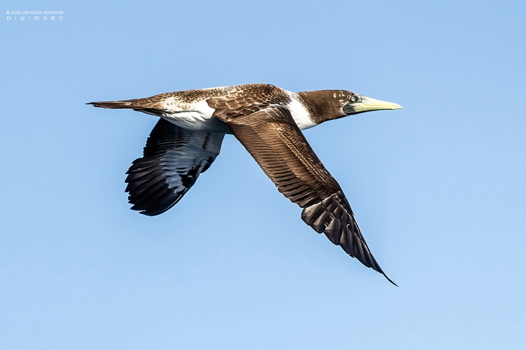
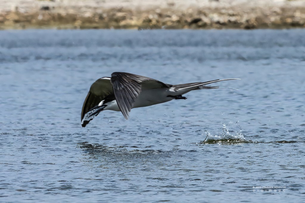
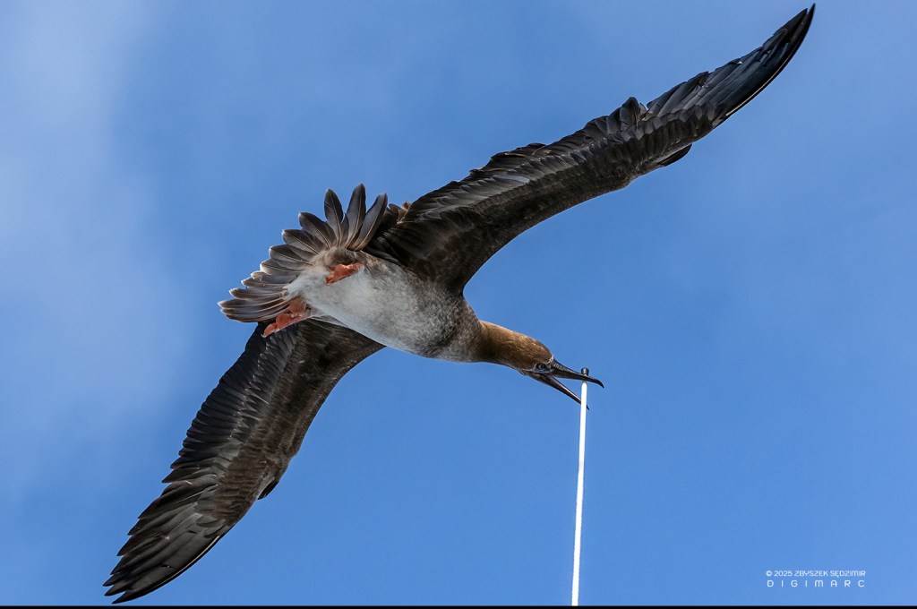
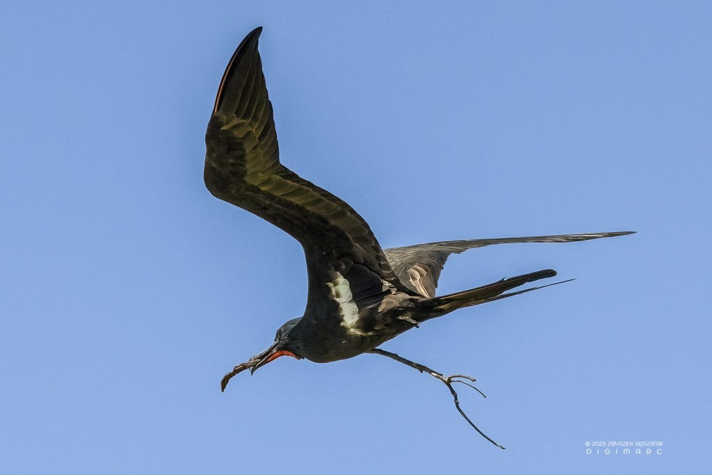
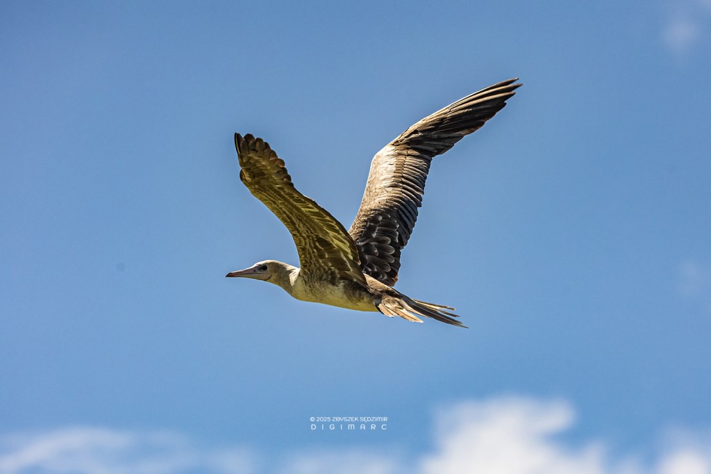
Brown Booby (Sula leucogaster). They are are commonly spotted around Mauritius, particularly near offshore islands like Gunner’s Quoin and further north toward Saint Brandon. Skilled hunters, they often follow ships, diving for flying fish stirred up by the vessel’s wake. I’ve placed this and the next photo at the beginning of my Saint Brandon Gallery because I captured them from the deck of the “Fregata”, a fishing boat that transported us from Mauritius to Saint Brandon after we embarked on our journey from Port Louis. It’s a bit surreal that, just about 5 km off the coast of Mauritius, we encountered the very birds we expected to find in the Saint Brandon archipelago!
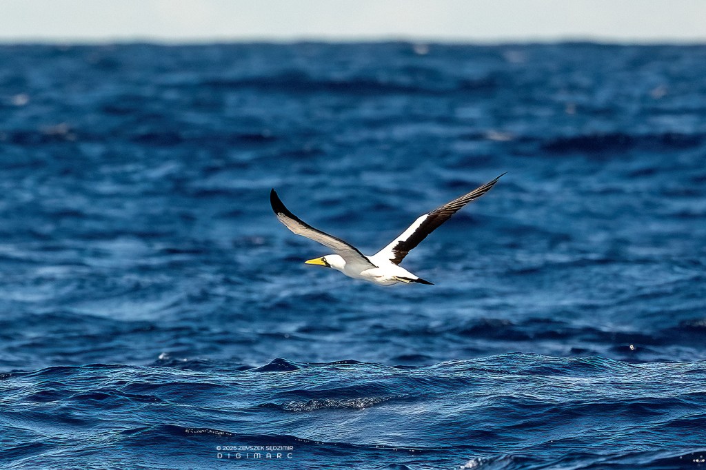
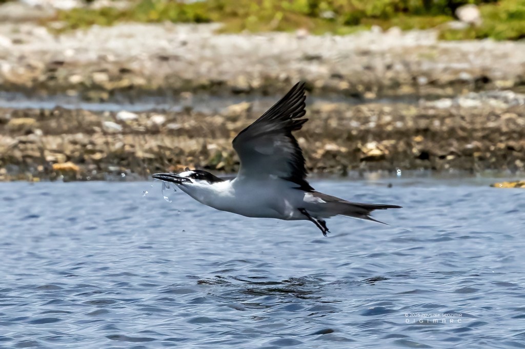
Masked Booby (Sula dactylatra). Less commonly spotted than their Brown Booby cousins, Masked Boobies occasionally appear in these waters, particularly around remote outposts like Saint Brandon. Ironically, once we arrived in the archipelago, Masked Boobies were nowhere to be seen. The only boobies we encountered were Red-footed Boobies and Brown Boobies.
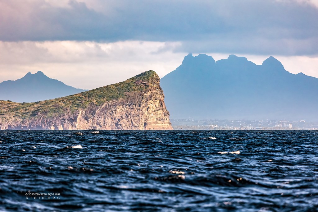
An unusual perspective of Gunner’s Quoin Island. In the background, the Moka Range mountains are visible, with the peak of Peter Both standing prominently. Now, the journey to Raphaël Island is no small feat. With a solid 30 hours of sailing ahead and the restless sea to contend with, it demands more than just stamina—and a touch of acrobatics—to avoid tumbling overboard while trying to move about the deck.
The North
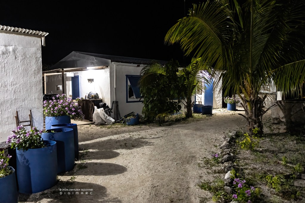
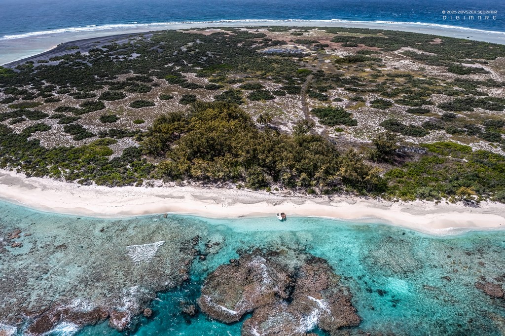
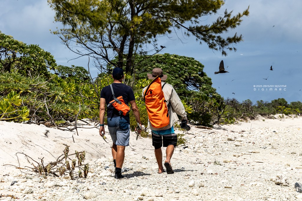
We start our journey through the archipelago at its northernmost edge. The fishing boats of Raphaël Fishing, ferrying fishermen, guests, and supplies from Mauritius, typically make their first stop at Raphael Island. Here, a small fishing base and two bungalows offer a temporary foothold for those venturing into these remote waters.
Scattered across the northern reaches of Saint Brandon are several other islands, each with its own character: Petit Raphaël, Swati Island, Sirene Island, Turtle Island, Poulailler Island, Puits à Eau Island, North Island, and the largest of them all—Albatros Island.
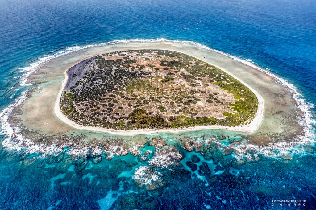
Raphaël Island

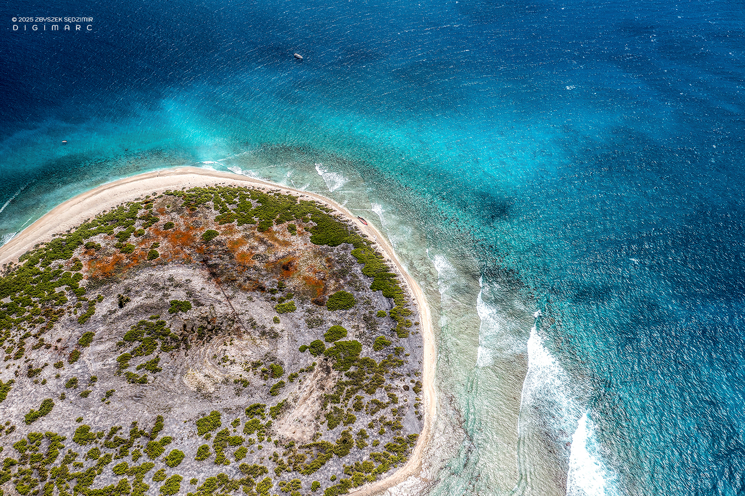
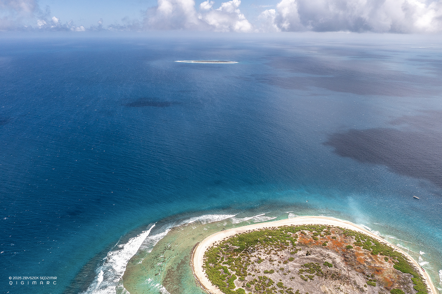
Here we have the northern tip of the Saint Brandon archipelago, sitting a little closer to the equator than its southern counterpart. In the foreground lies Raphaël Island, home to a small fishing base. In the background, Poulailler Island appears on the left, while Puits à Eau Island rests on the right. This photo was taken early in the morning—just the right time to catch the world as it wakes up.
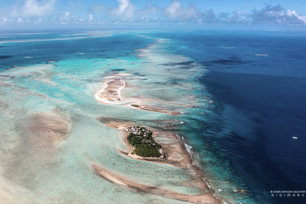
The archipelago, viewed facing south. In the foreground lies Raphaël Island, followed by the tiny Petit Raphaël and the larger Swati Island. On the right side of the image, the fishing boat “Fregate”, which brought us from Mauritius, is anchored. The waters here are too shallow for “Fregate” to venture any closer.
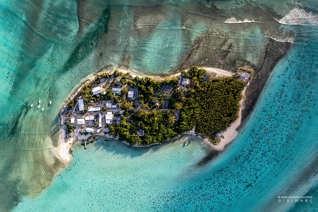
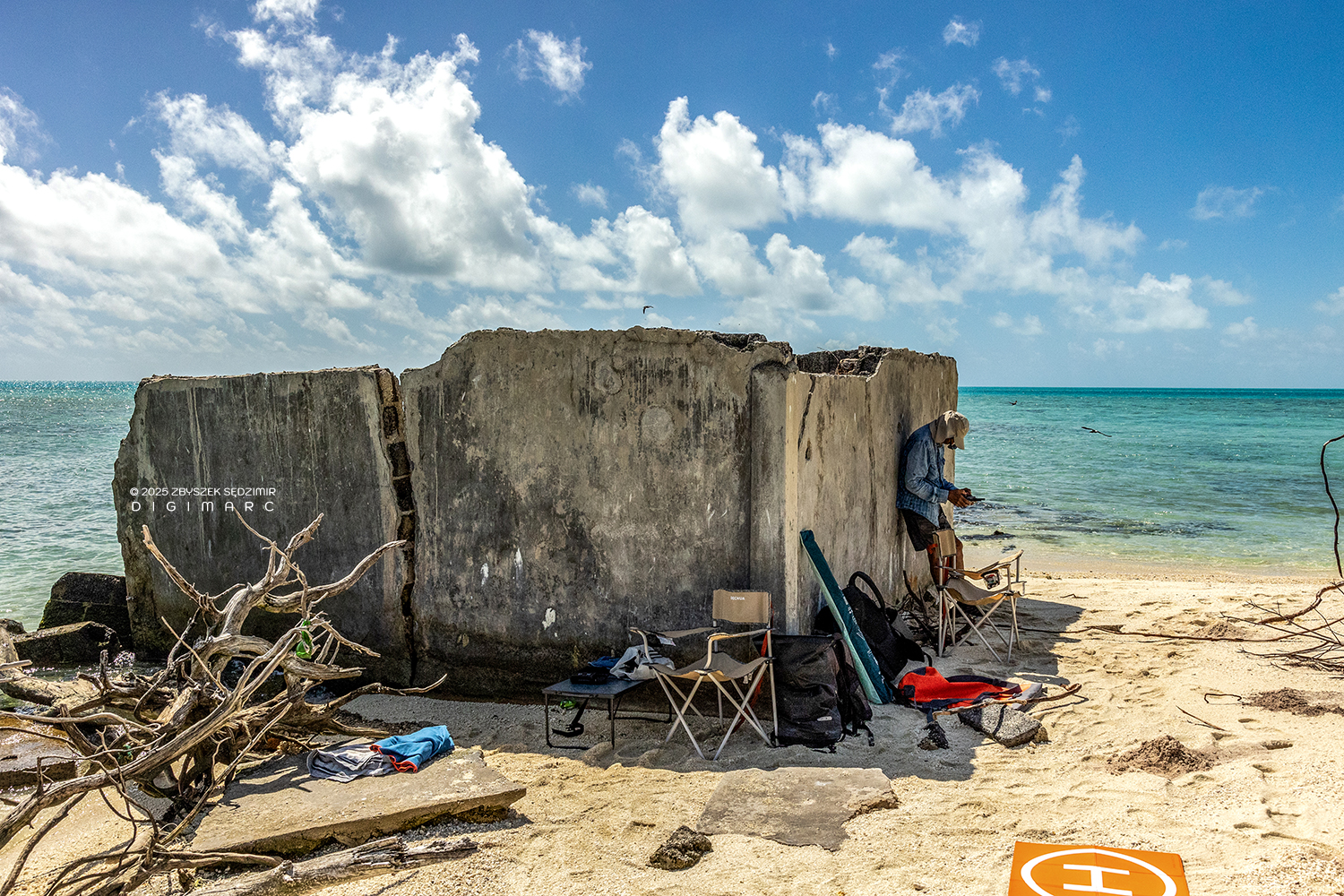
This photo of Raphaël Island was taken just half an hour before sunset, as the golden light cast its final glow over the landscape. On the left side of the island, farm buildings and living quarters stand quietly—sheltering fishermen and the occasional visitors who arrive on various missions to the archipelago.
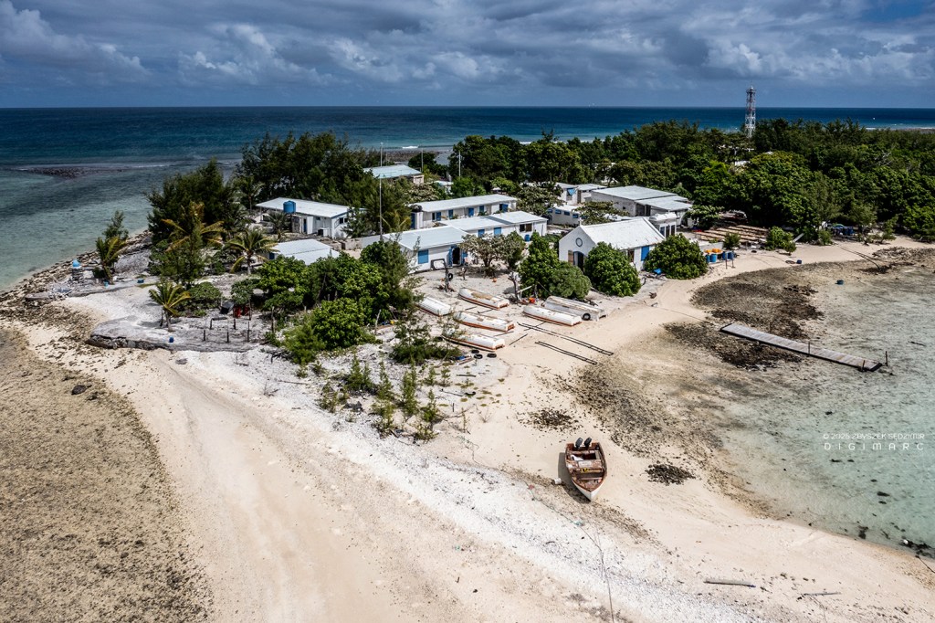
The humble buildings of the fishing base on Raphaël Island. In the foreground, slightly to the right, you can spot the chapel of Saint Louis.
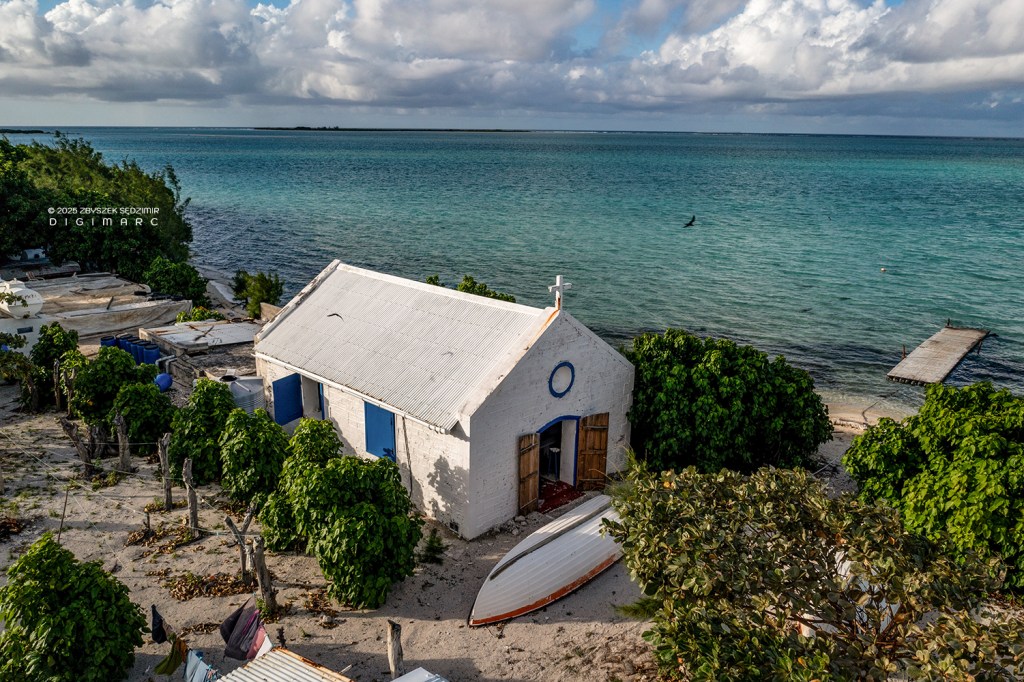
The chapel of Saint Louis.
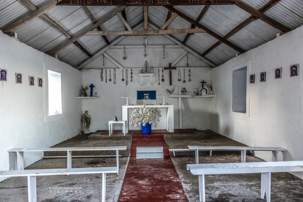
The modest interior of the chapel of Saint Louis.
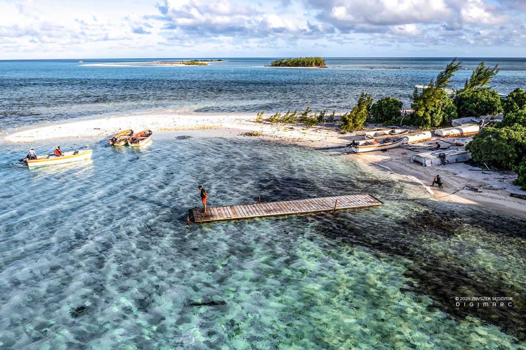
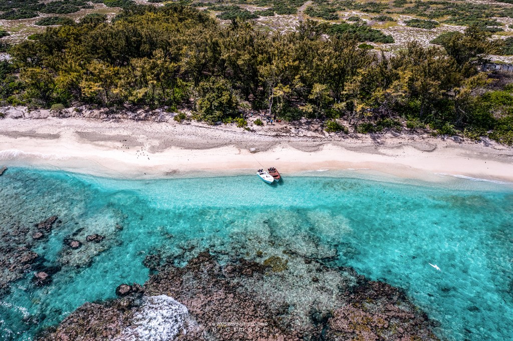
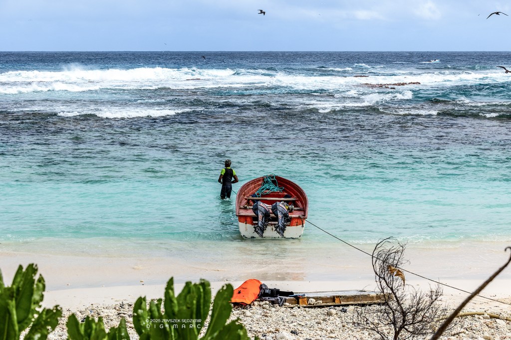
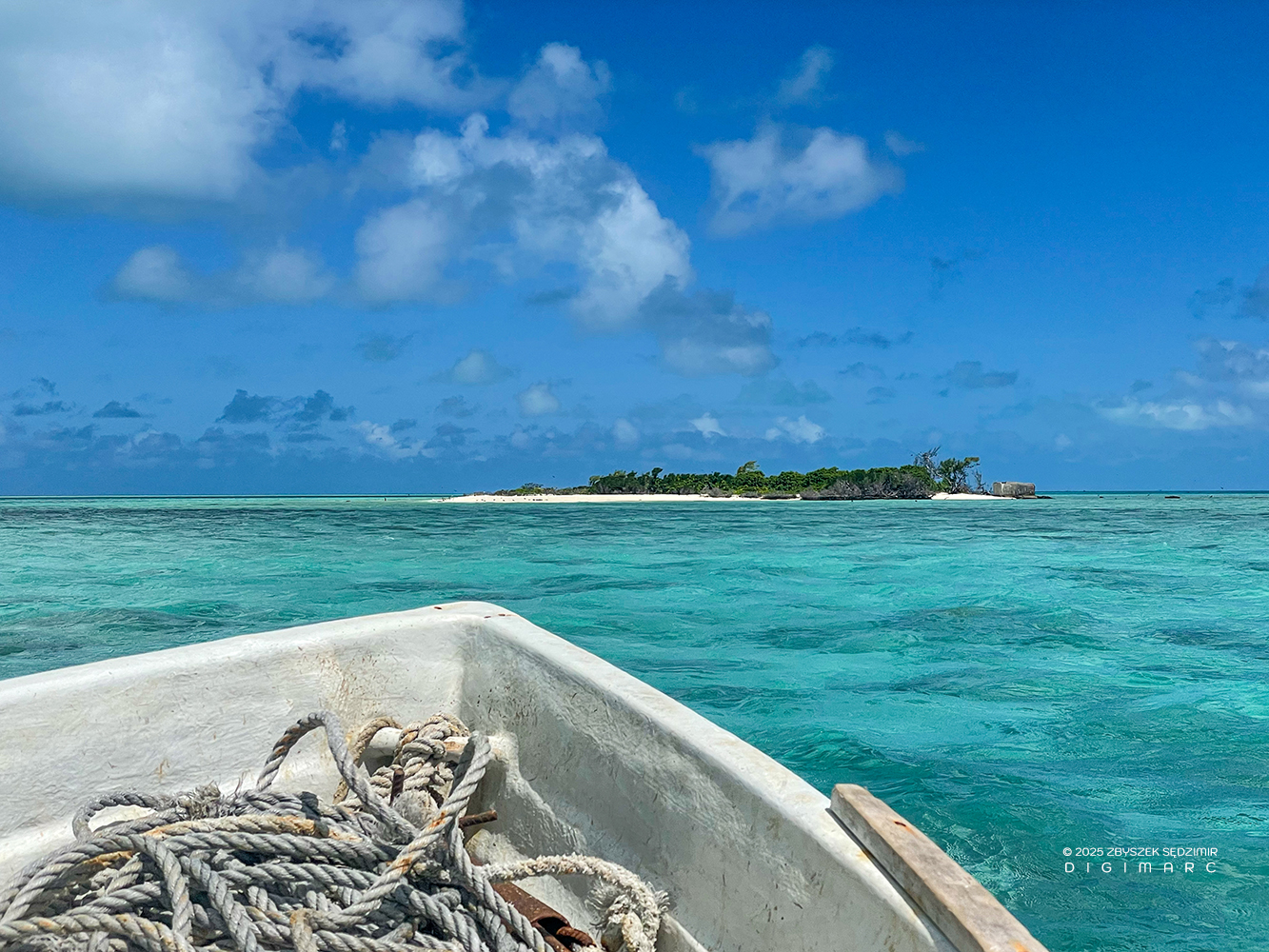
The same pirogues that carried the fishermen out to sea in search of their catch became our means of transport between the scattered islands of the archipelago. Some days, we spent over five hours in them, making the long haul from Raphaël Island to Dagorne Island and back….
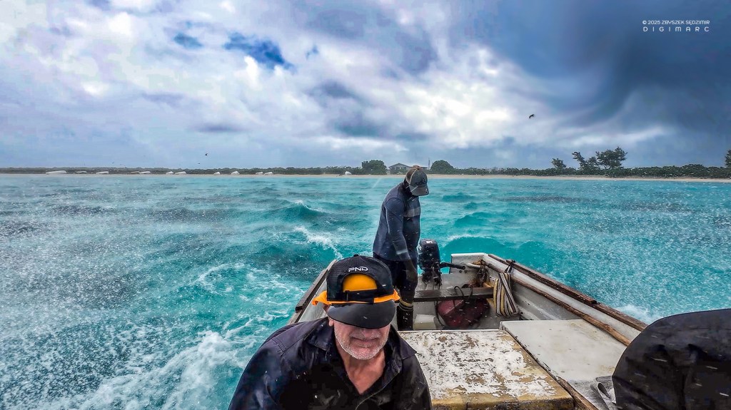
… When the wind kicked up and the short, sharp waves came slapping over the bow, the ocean drenched us with spray. The wooden bench beneath us was hard as iron, jolting our bones with every rise and fall. It wasn’t just a voyage—it was a real test of endurance.
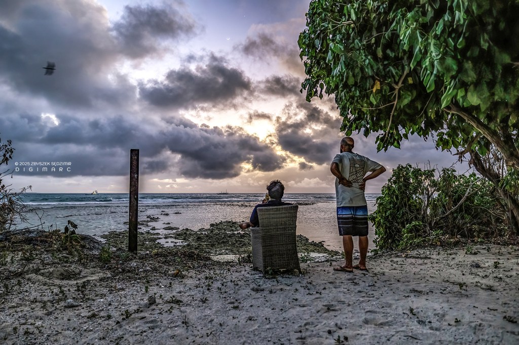
Watching the sunset after a busy day, a moment of peace to end it all.
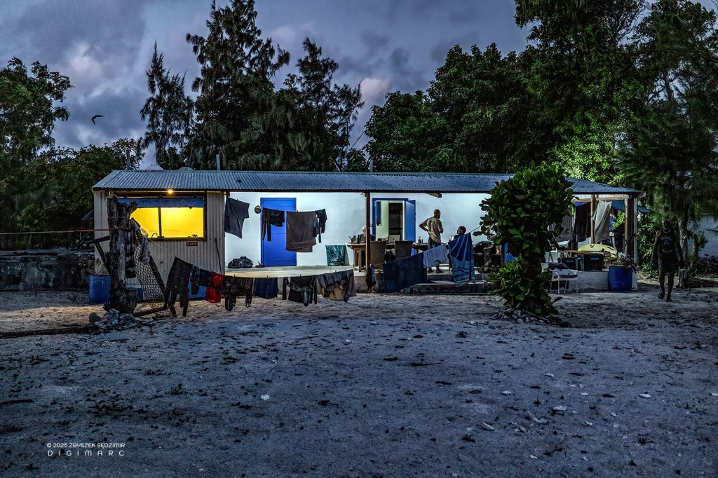
After a long day of diving and bouncing over the waves in pirogues, we tried to dry our clothes. It didn’t go too well—there’s no sun at night.
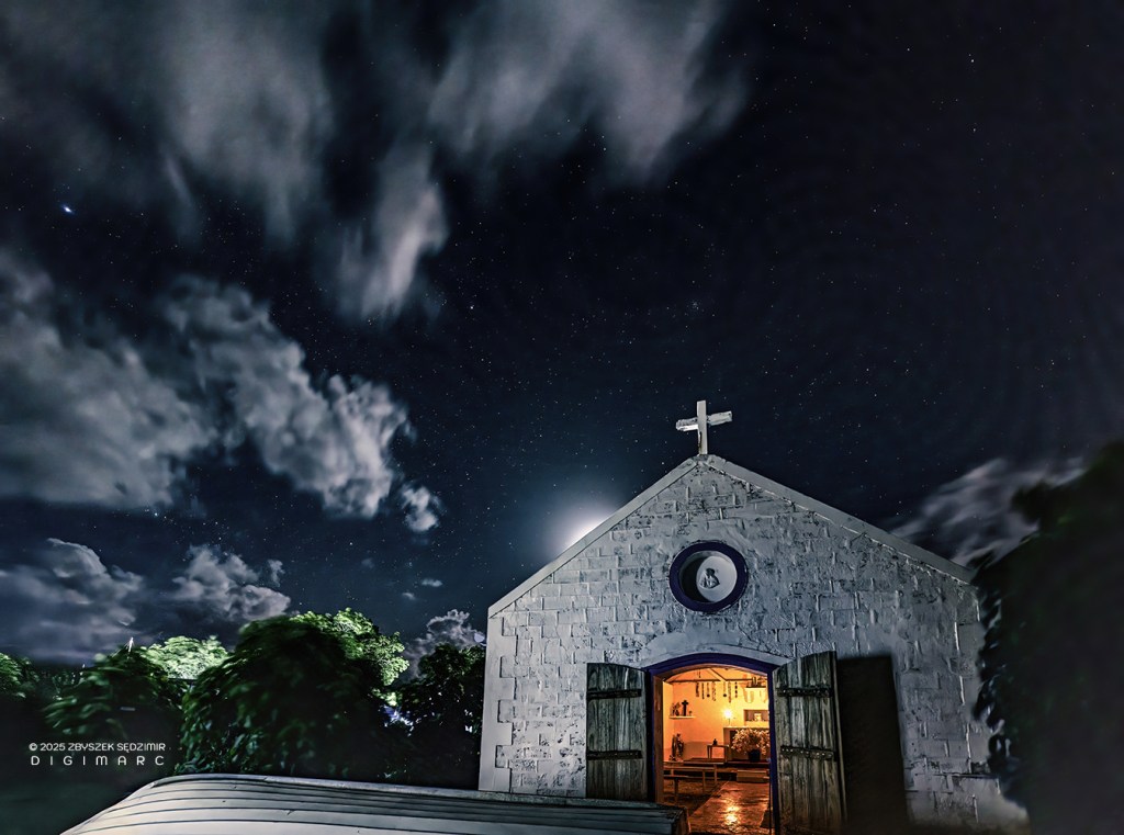
The chapel of Saint Louis by night, standing quietly under the starry sky.
The fishing base doesn’t fall into total darkness after sunset, thanks to the generators churning out electricity—they do a fine job of keeping the place lit…
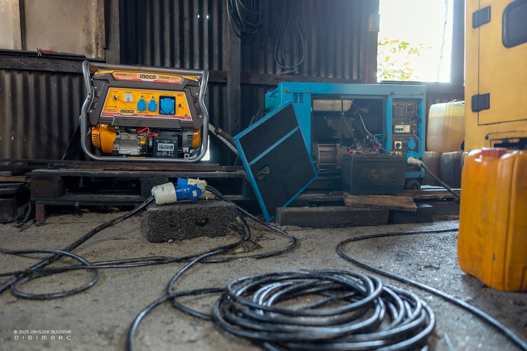
…though not exactly glowing with charm (and rather noisy).
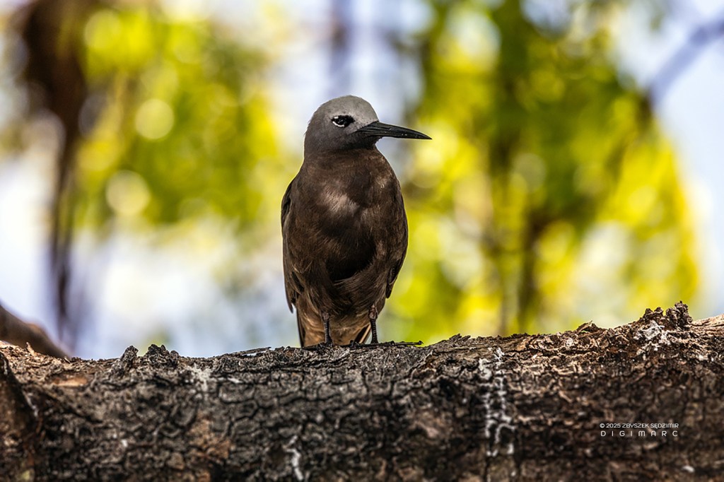
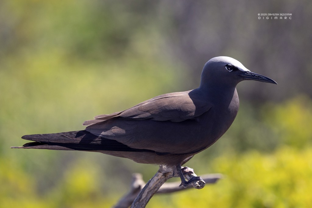
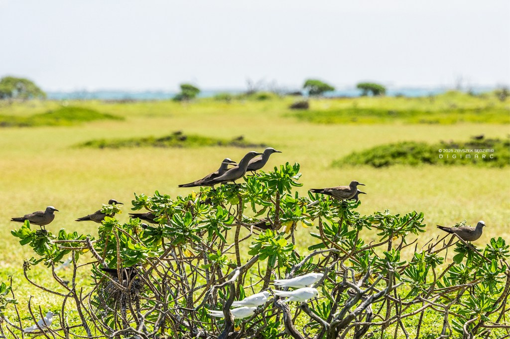
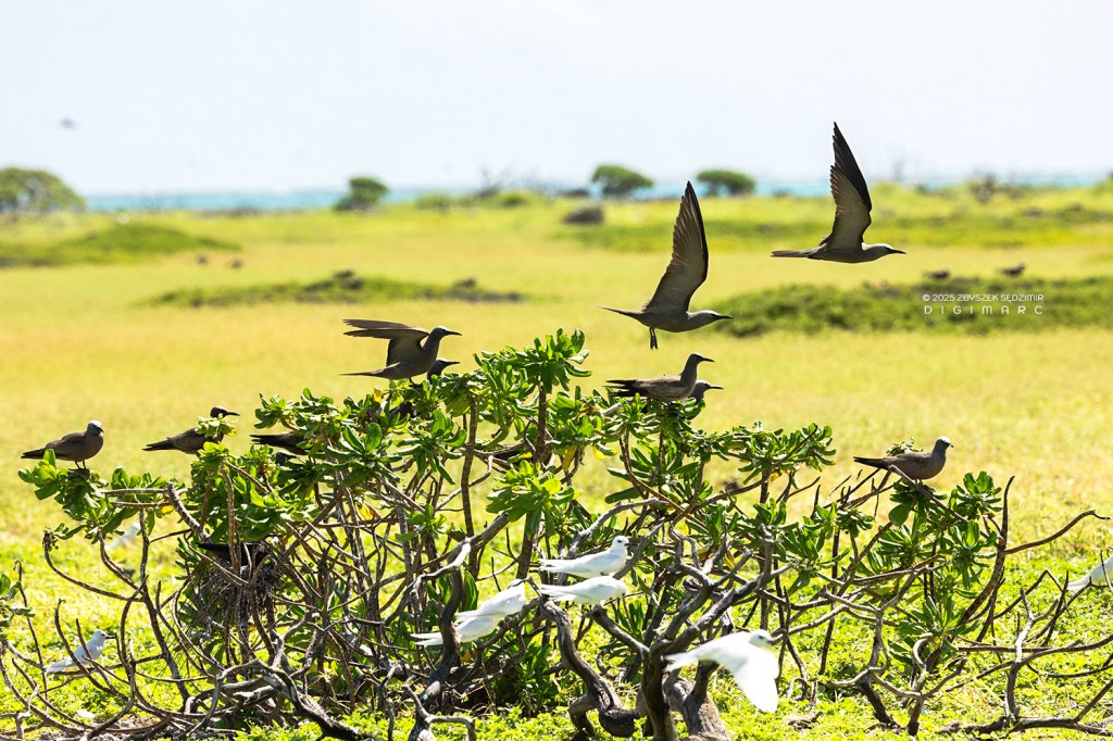
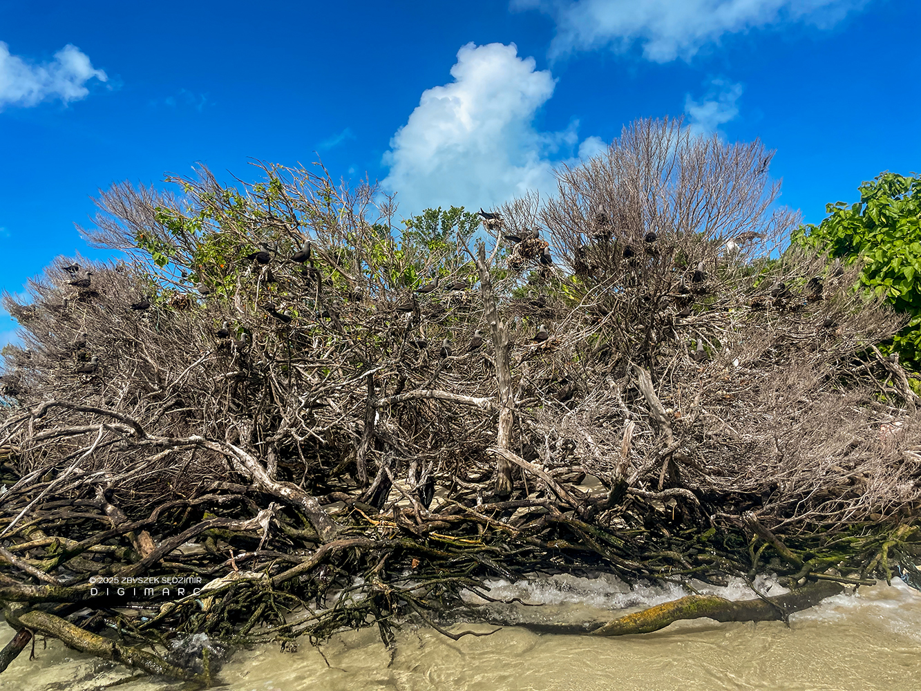
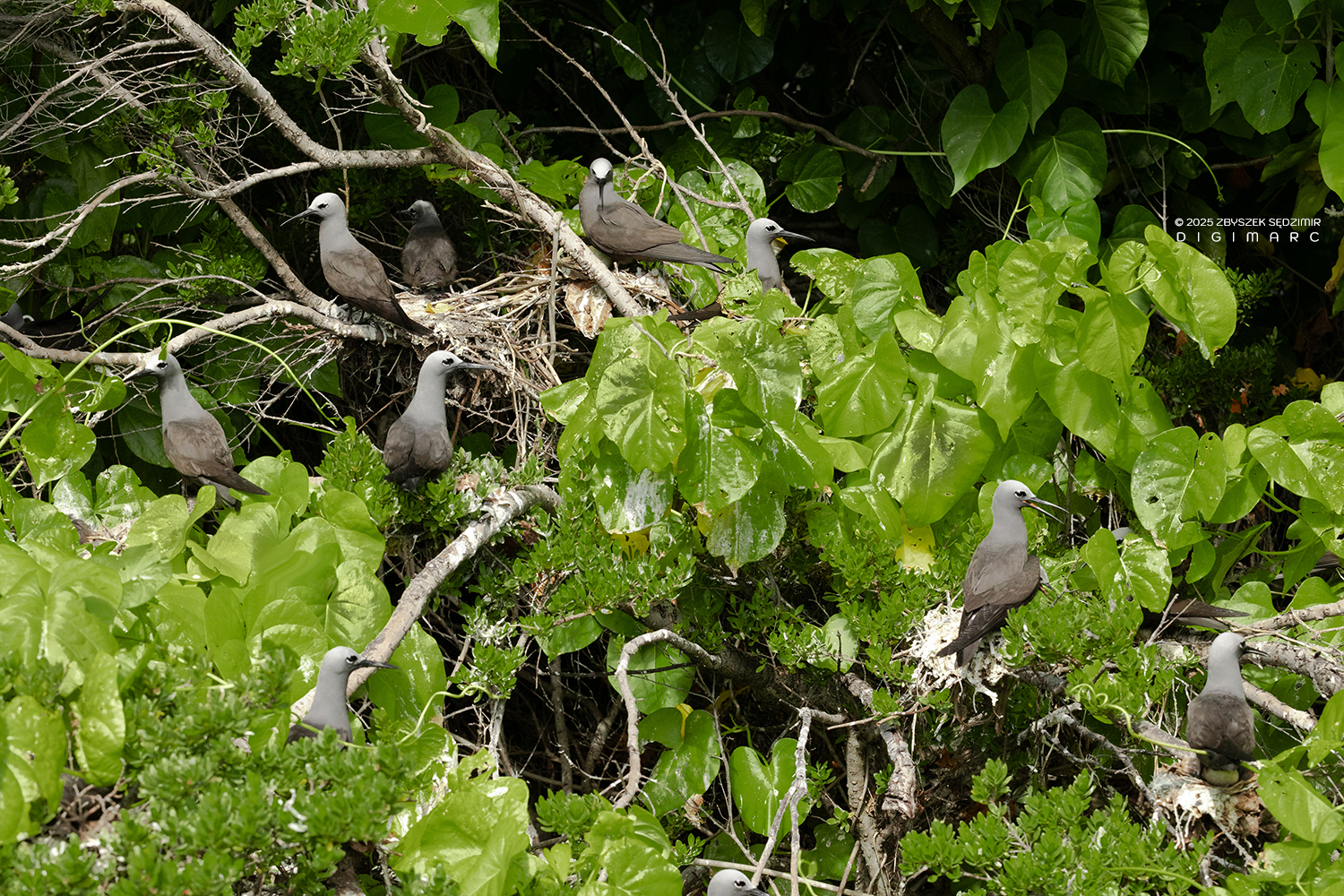
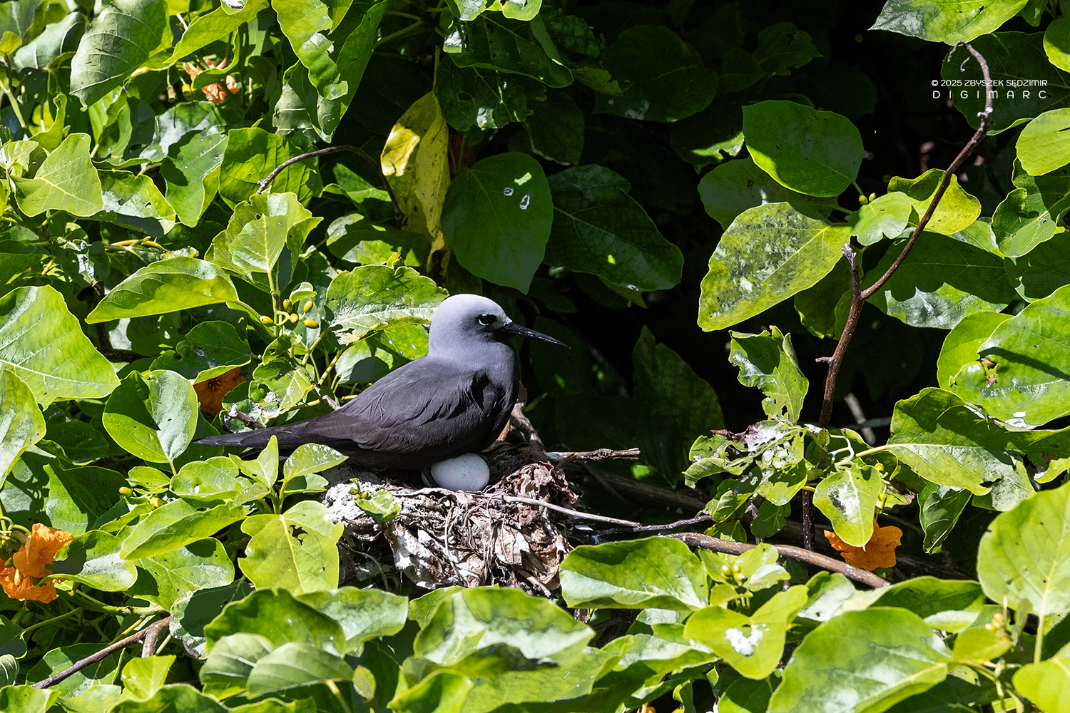
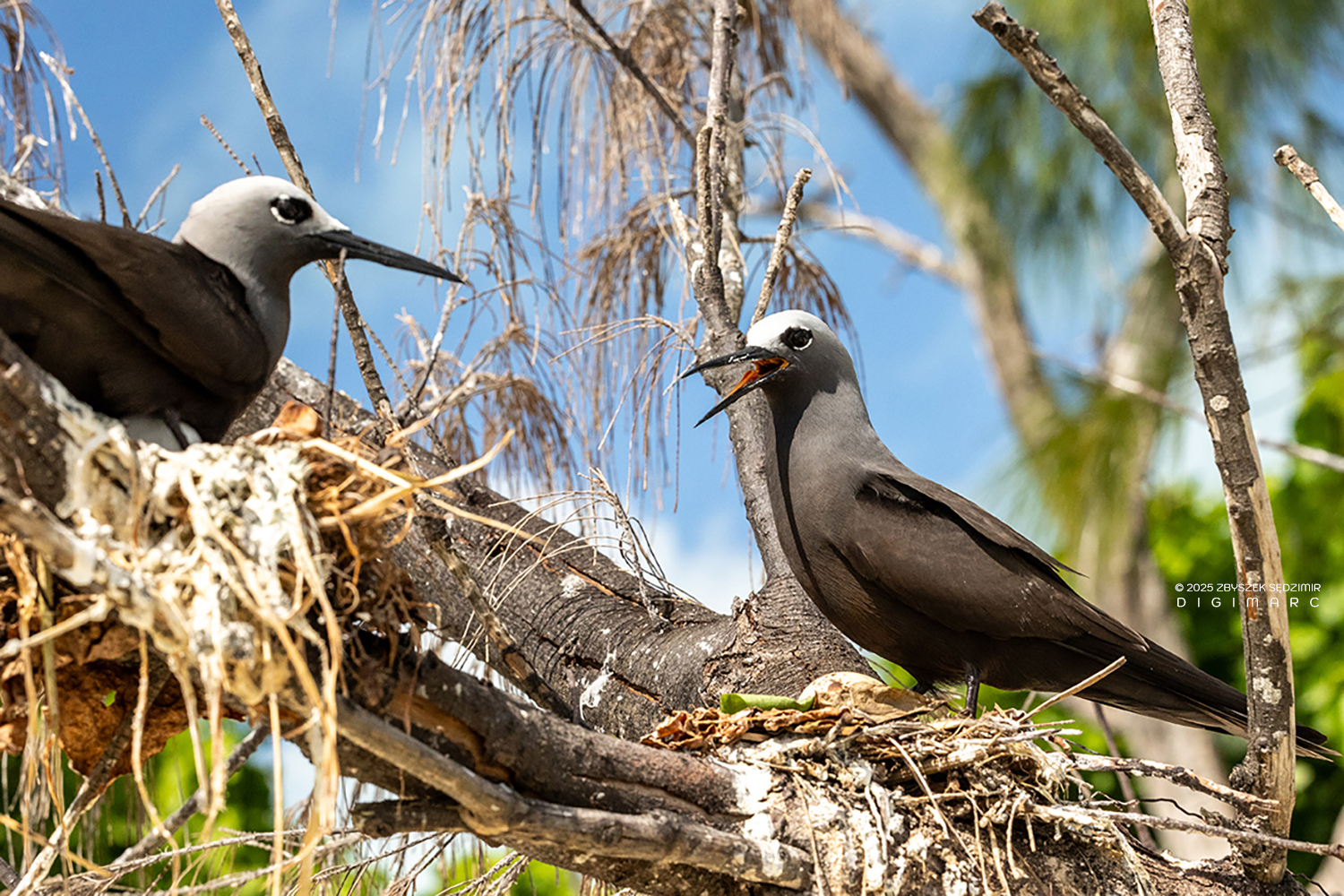
A fine-looking Brown Noddy. Raphaël Island is predominantly inhabited by Brown Noddies, Lesser Noddies, and Fairy Terns—though the real troublemakers are the rats. These little scoundrels have taken over the ground, forcing the birds to build their nests high in the tree branches. Rats pose a significant threat to the birds on many islands throughout Saint Brandon.
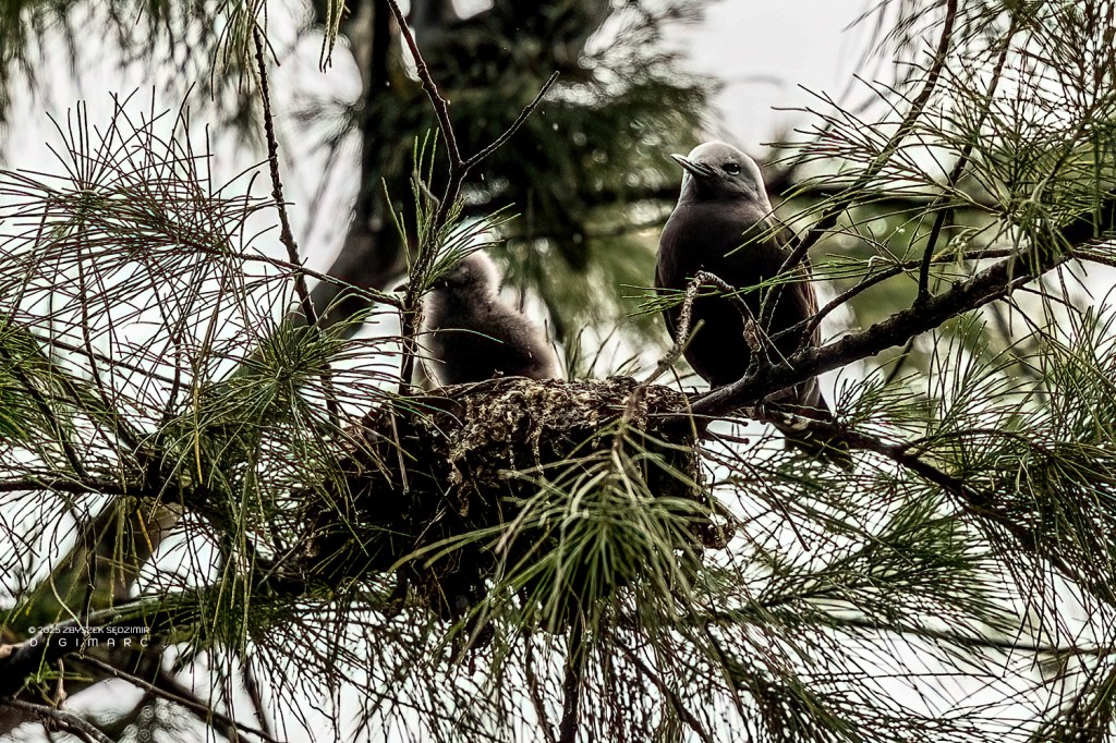
The Noddy family on Rafaela Island: a mother with her chick. Sleeping high above the ground means resting stress-free, safely out of reach of rats.
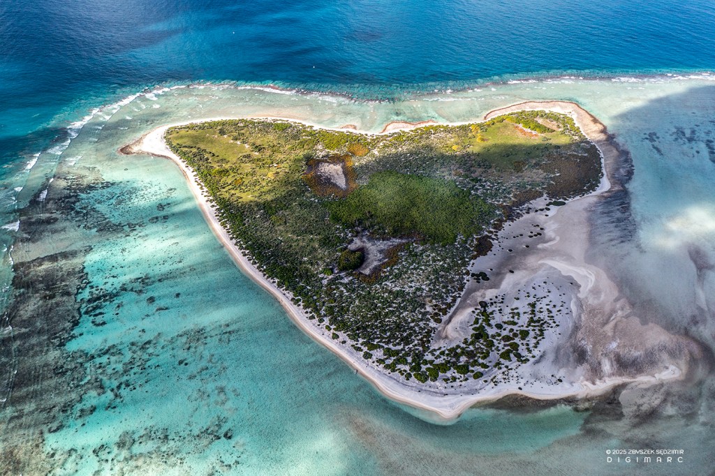
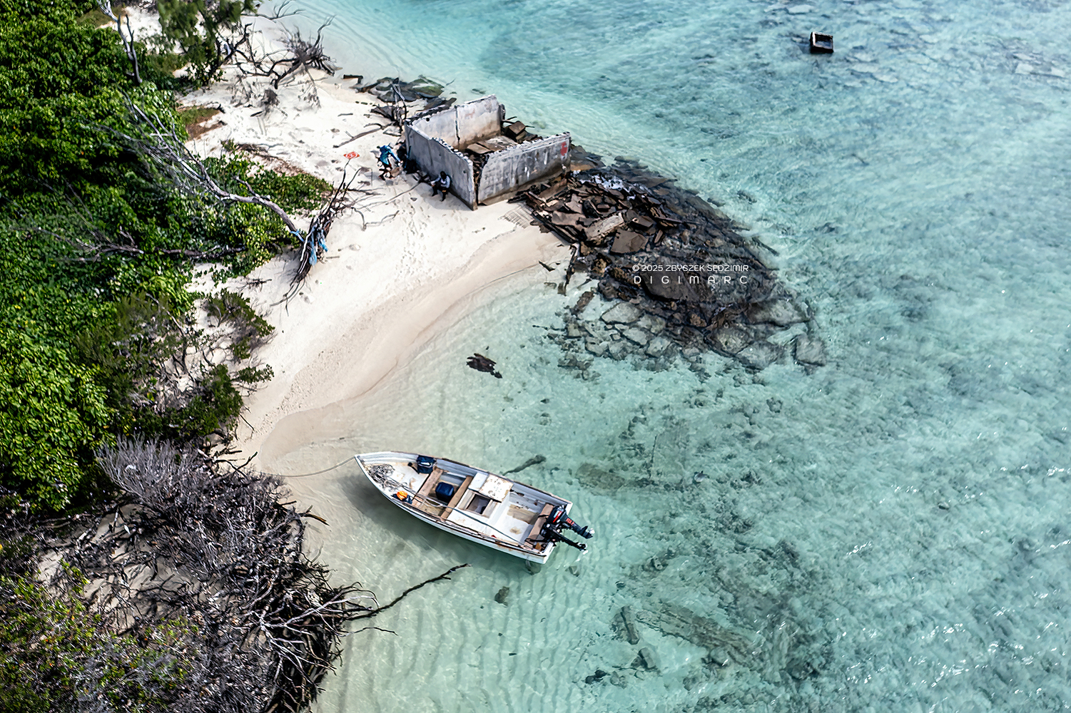
Swati Island
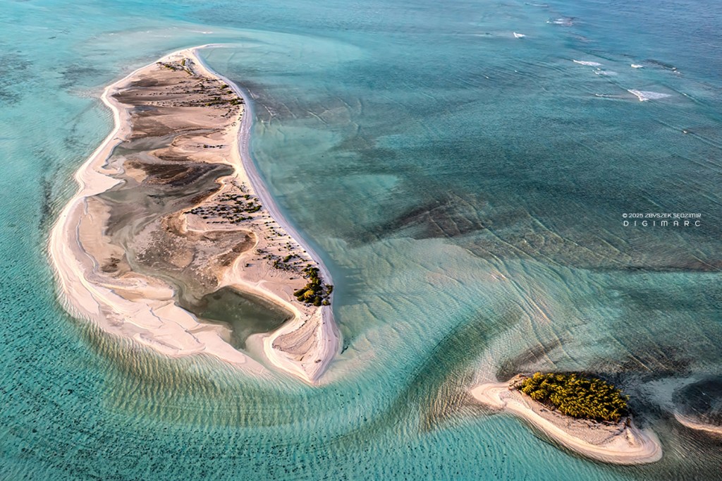
Swati Island and Petit Raphaël Island, catching the first golden light of the rising sun. Swati Island doesn’t have much in the way of vegetation—just enough to remind you it’s not entirely bare. As for birds, well, if they ever landed there, they must’ve thought better of it and moved on.
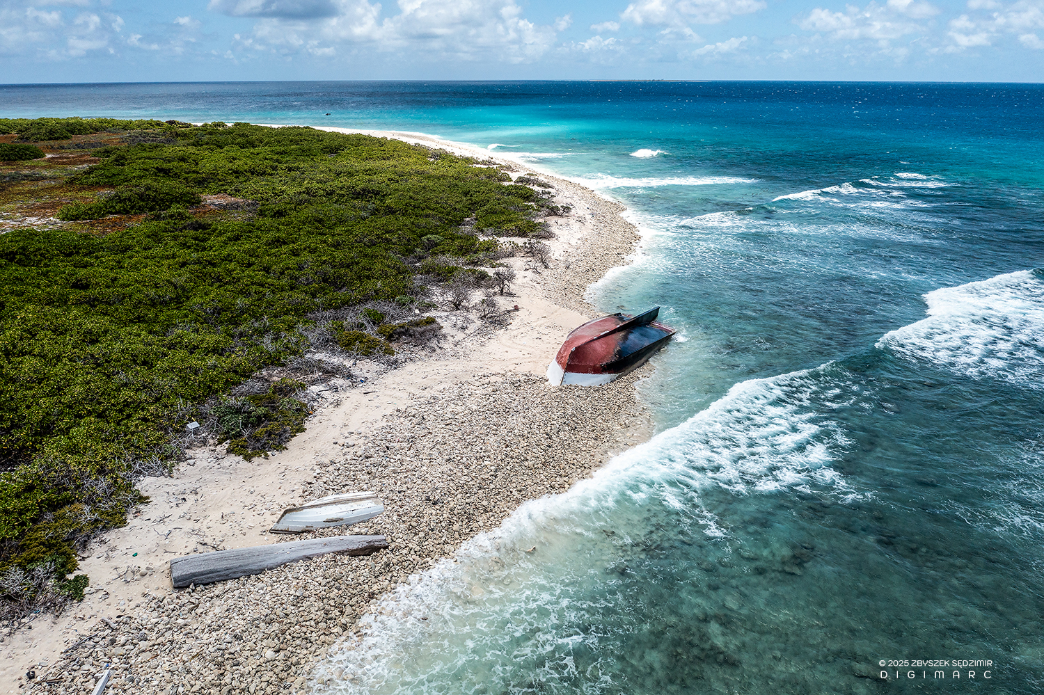
From above, you might spot a small boat resting off the right side of Swati Island, along the eastern shore. But don’t be fooled—it’s not waiting for passengers. That ship has long abandoned the seafaring life and settled into its final resting place, stranded on the reef and moved by cyclones into the shallows, where it now rots, threatening the marine life in the surrounding waters.
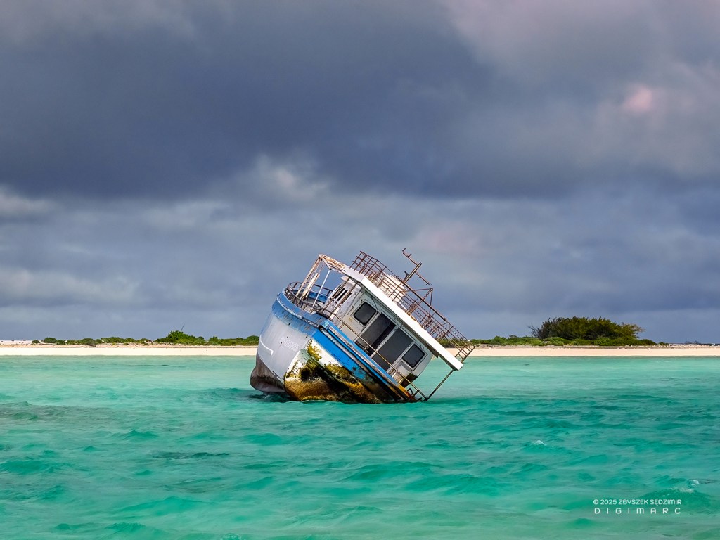
Shipwrecks are one of the archipelago’s more stubborn troubles. Aside from being an eyesore—and they certainly are—they spend years slowly rusting away, leaking all sorts of pollutants and toxins into the lagoon, with harmful consequences for marine life.
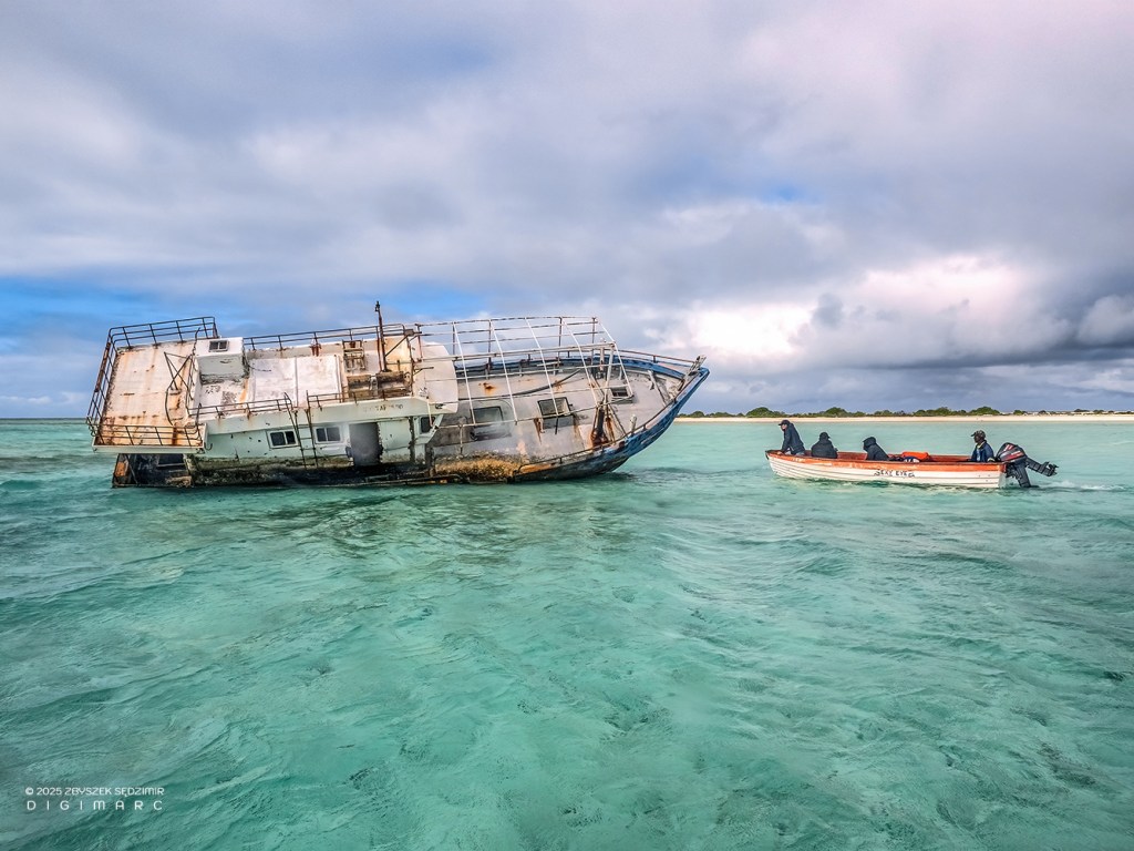
When the weather cooperated, we’d sail closer to these maritime ruins to get a better look at the mess they were making—corroding plastic foam, oils, greases, and all sorts of nasty liquids oozing from the ship’s machinery. The point of this wreck tally? To figure out just how much destructive potential they have for the delicate balance of life on Saint Brandon. And let me tell you, we’ll stumble across plenty more wrecks around the other islands, each one adding its own brand of chaos.
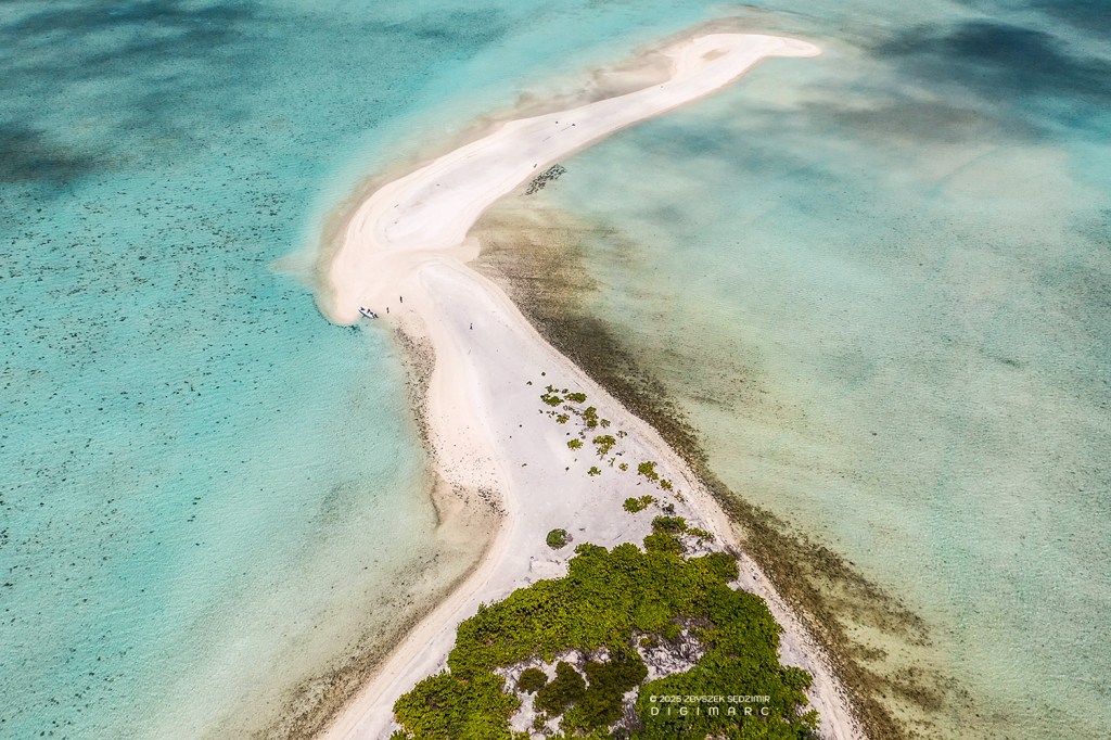
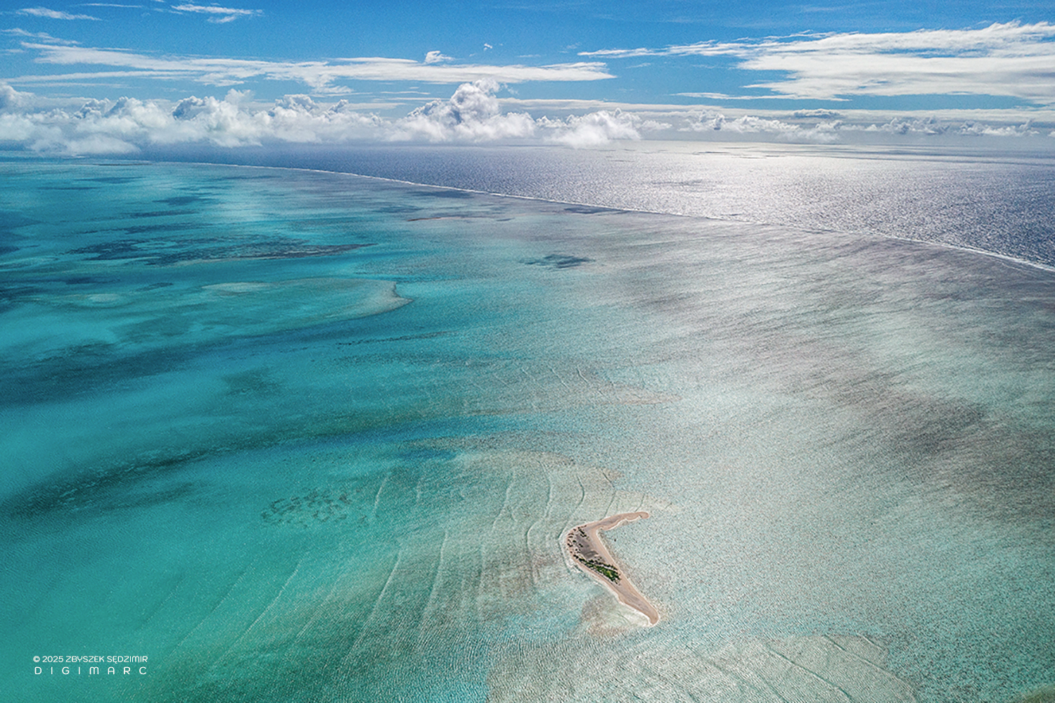
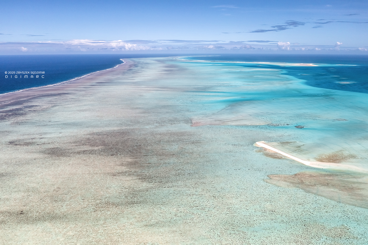
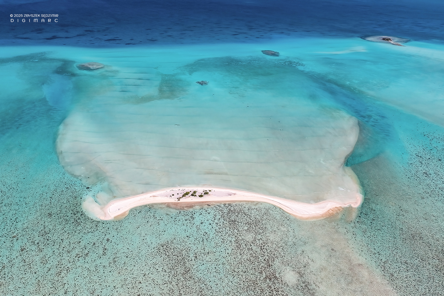
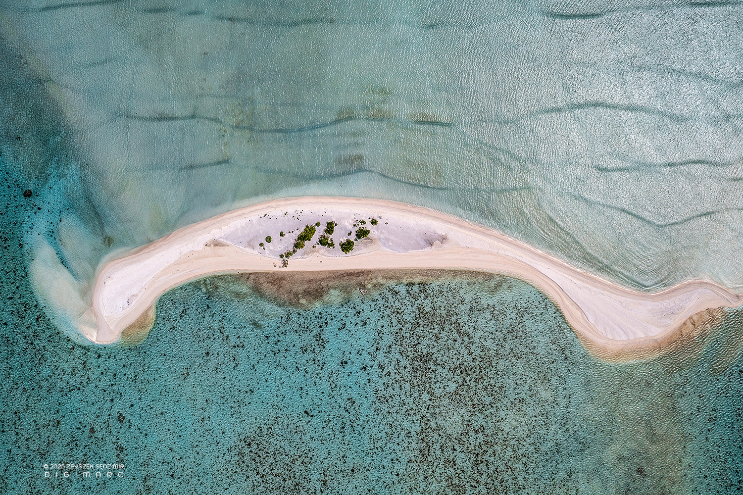
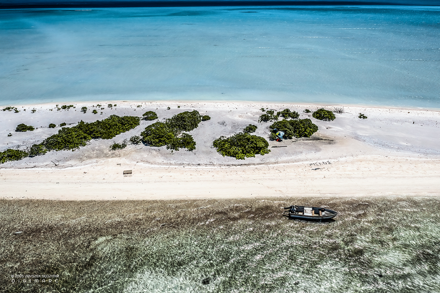
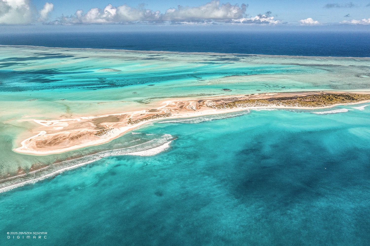
Turtle Island
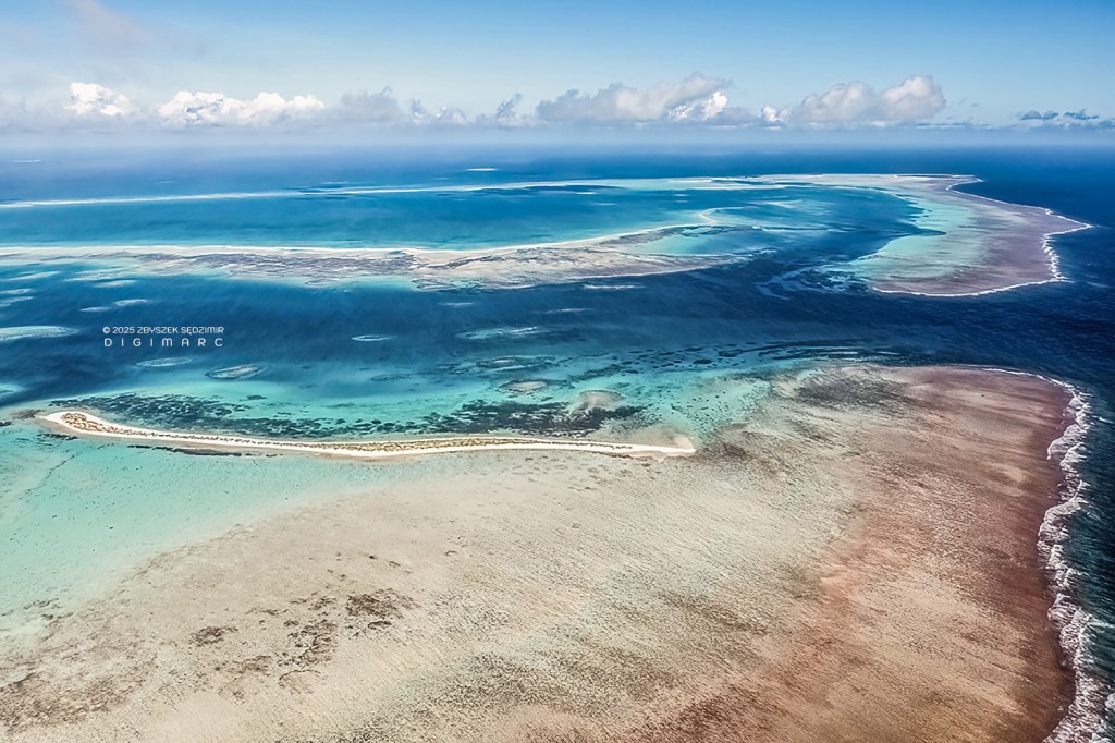
Turtle Island—long as a snake and thin as a rail. To the right, the eastern coral barrier stretches out, split by the Grande Passe. At the top of the image, the northern edge of the archipelago fades into the horizon. Farther to the right, the faint outline of Puits à Eau Island emerges, while in the middle, beyond the reef, the distant silhouette of Sirène Island drifts like a ghost upon the water. Below, the reef’s shallows shimmer in hues of yellow and brown—beautiful, but treacherous, ready to rip the keel off any boat that dares venture too close.

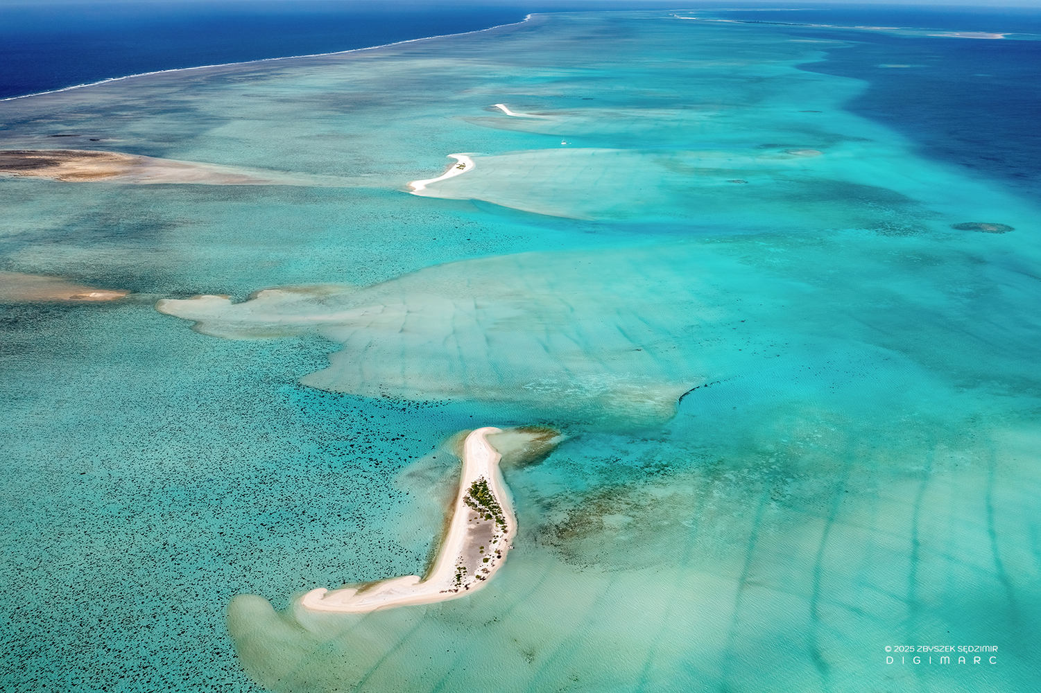
Turtle Island, laid out in all its glory, stretching near two kilometers from end to end. I pieced this image together from 15 separate shots—stitched ‘em up nice and tight—till it turned into a whopper of a picture, boasting a resolution of 11,660 x 12,264 pixels. Mighty big, if you ask me.
One of the 15 shots that make up the previous photo.
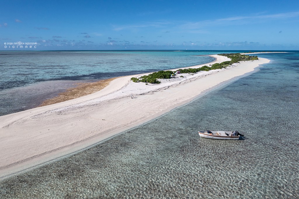
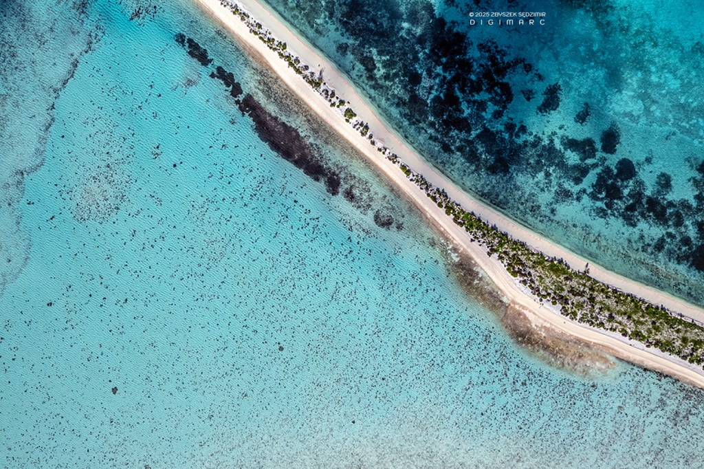
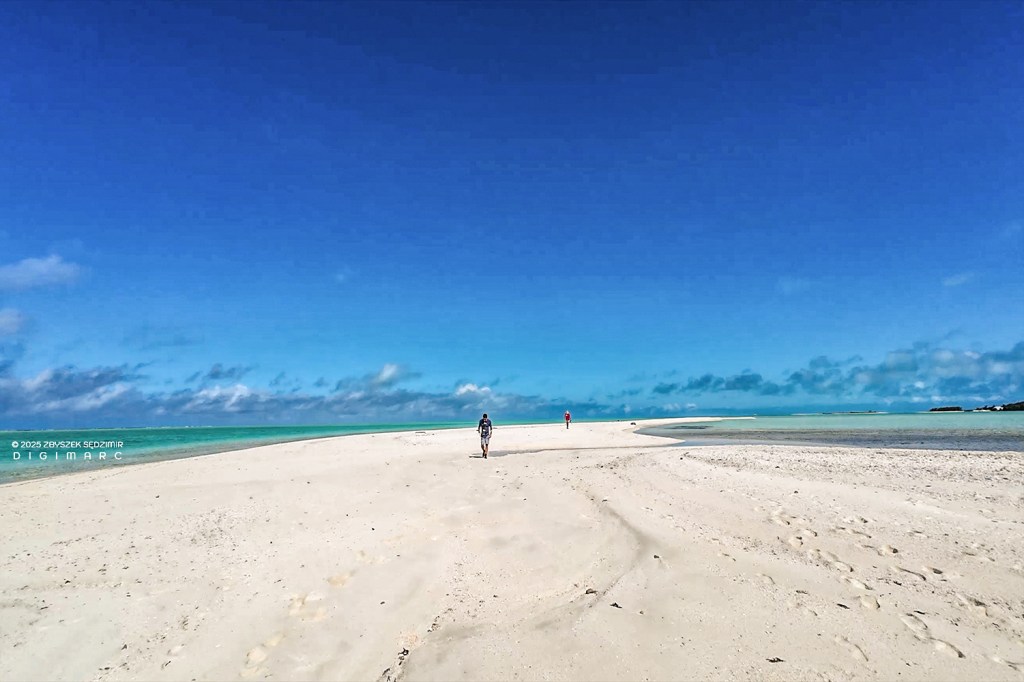
Turtle Island – A place where the beaches stretch on forever, right to the very edge of the world. The island, so narrow, makes it seem as though the water and the vegetation are shaking hands. It’s the kind of spot you’d imagine turtles choosing to bury their eggs in the sand, undisturbed. And that, my friends, is how the island earned its name.
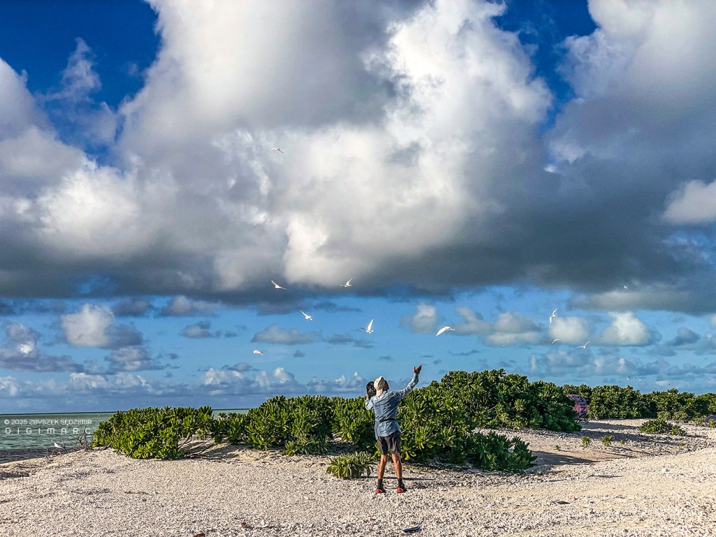
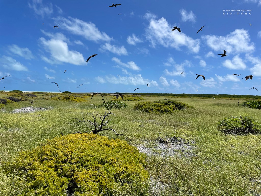
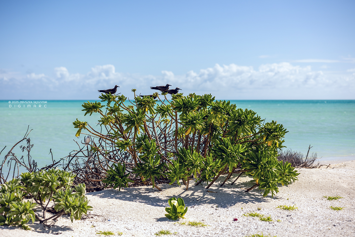
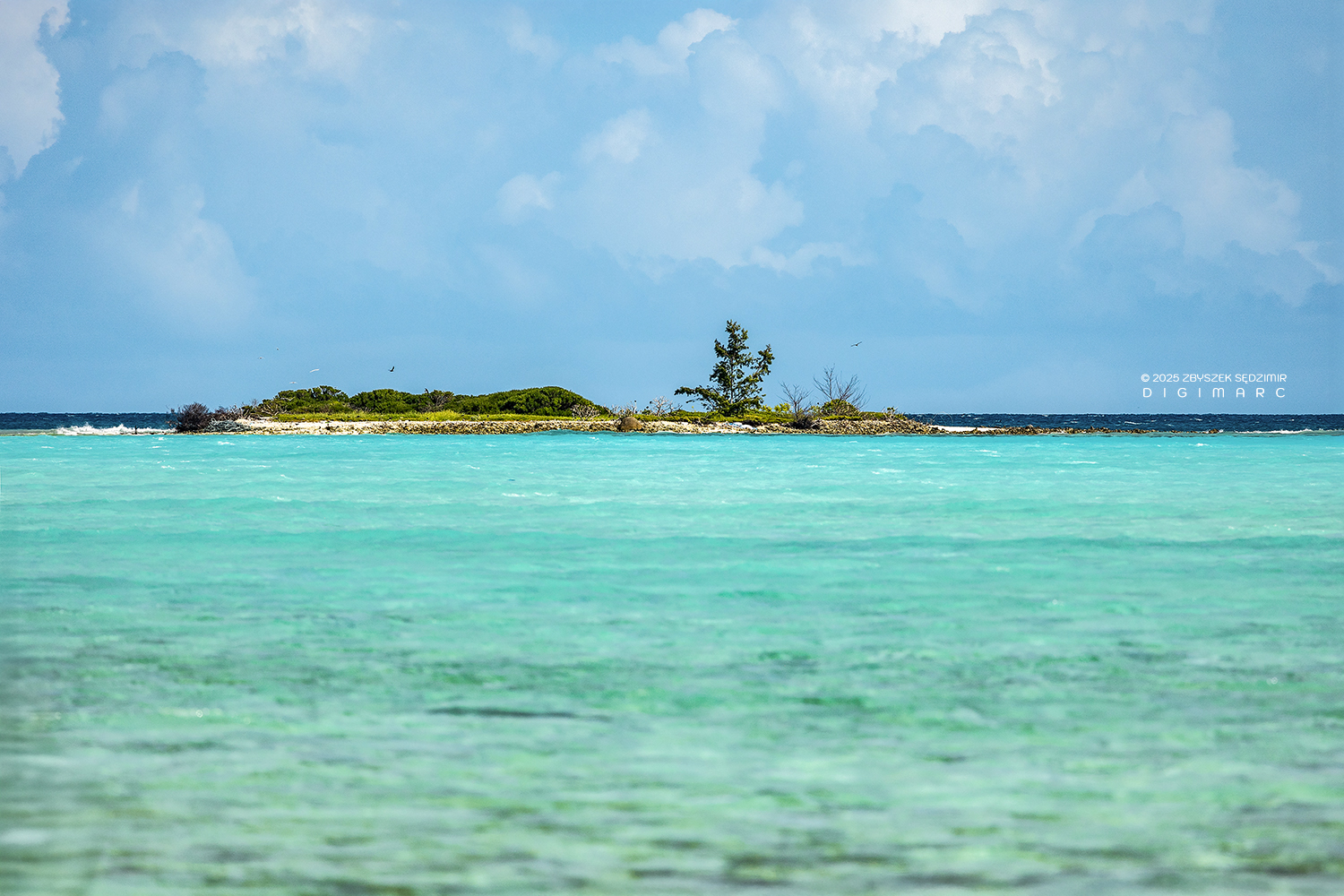
Seabirds make themselves at home on just about every island in the archipelago. Not being used to human folk, they tend to eye visitors with a mix of curiosity and suspicion—curiosity because they’ve never seen the likes of you before, and suspicion because they’ve got their own piece of the world to defend. But these birds aren’t just idle spectators; they play a mighty important role in keeping the place alive. Their droppings—nature’s own brand of fertilizer—feed the coral reefs, making them grow nearly half again as fast and stand up better to the warming seas.
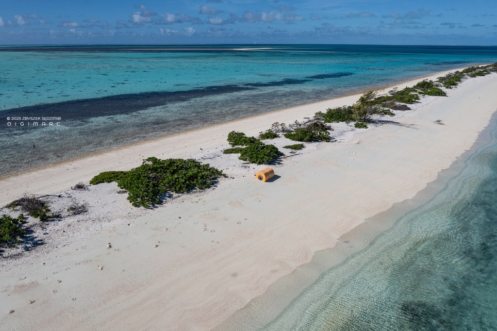
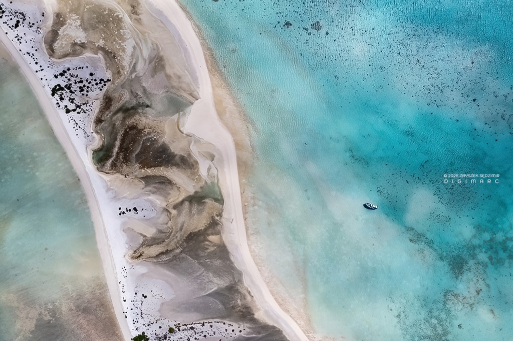
Even in the most remote places, far from civilization, humanity leaves its mark—pollution and the environmental destruction that comes with it. On Saint Brandon, the evidence is clear: plastic waste and shipwrecks. In this photo, you can see a buoy, lost by someone somewhere out on the ocean. Carried by the currents, such “strays” eventually reach the atoll, where, once washed ashore, they remain as unwanted decorations for decades to come.
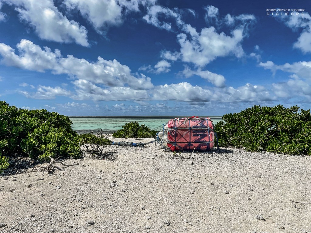
Turtle Island. Another one of the ocean’s castaways, left to the sun and the salt, waiting for whatever comes next.
Albatros Island
Albatross Island is the largest and northernmost of Saint Brandon’s islands. It lies beyond the coral barrier that shields the archipelago, 18 kilometers from Raphaël Island. Out there, the sea is ruled only by the winds and the currents.
Albatross Island is wrapped in its own coral fortress, with just one narrow passage where a boat might squeeze through—provided the sea is in a charitable mood.
Our pirogues, resting on the beach, are clear proof that our captains know their trade, even in the treacherous waters beyond the shallow flats of Saint Brandon. This is no small feat—places like Albatross Island, beyond the coral barrier, are rarely visited. Only large boats like the “Fregata” or “Albatross” can make the journey. The pirogues that fishermen use daily are well suited for the calm waters of the lagoon, but they stand no chance against the harsh conditions of the open ocean.
Our pirogues, resting on the beach, are clear proof that our captains know their trade, even in the treacherous waters beyond the shallow flats of Saint Brandon. This is no small feat—places like Albatross Island, beyond the coral barrier, are rarely visited. Only large boats like the “FrI’m changing the perspective so you can truly grasp just how tricky it is to land on Albatross Island. This is the same stretch of beach and sea as in the last picture—but instead of looking down from above like a bird, you’re now seeing it from the seat of a pirogue. All those rocks and narrow passages lurking beneath the water? They might as well be ghosts, because you won’t spot them until it’s too late. Anyone who doesn’t know these waters like the back of their hand is liable to turn their pirogue into kindling.egata” or “Albatross” can make the journey. The pirogues that fishermen use daily are well suited for the calm waters of the lagoon, but they stand no chance against the harsh conditions of the open ocean.
The same ocean, which appears all peaceful and calm from a bird’s-eye view, doesn’t feel quite so serene when you’re perched in a pirogue, doing your best not to be tossed around like a cork in a tempest!
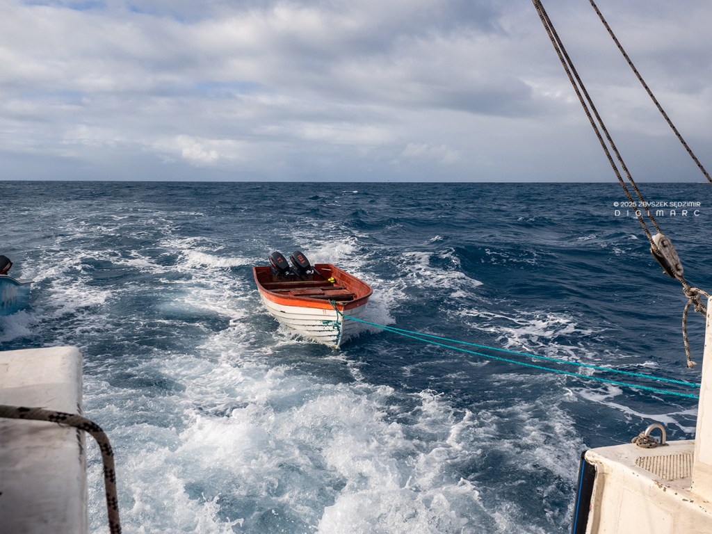
I can almost hear someone hollerin’, “Wait a minute now, you said pirogues can’t make the crossing from Raphaël Island to Albatross Island over open water. So how in tarnation did they end up here?” Well done, sharp-eyed reader, I see you’re paying attention! Of course, we didn’t make the journey in pirogues. We came aboard the “Albatross”, which kindly towed both pirogues behind it. We then used them to cover the short distance between the anchored “Albatross” and the shores of Albatross Island.
In the crystal-clear waters between the reefs on the side of Albatross where we landed, we encountered groups of turtles. But what truly captivated us were the sharks—though, much to our disappointment, none of them were kind enough to swim close enough for a proper portrait!
After crawling out of the water, we ventured off to explore the island on foot…
…with the sun beating down on us like a hot iron—no mercy, no shade and filling like the chicken on the roast.

After battling through some stubborn, thick underbrush—an experience that swiftly taught us that wearing shorts on such an expedition was about as wise as trying to fish with a rake—we finally emerged into a broad clearing, “inhabited” by thousands of chicks. Now, if you consider that each of these little ones has two parents, it’s easy to see why the Sooty Tern, with nearly half a million individuals, reigns as the most plentiful bird species in Saint Brandon, despite their “one-egg policy”!
Unlike Fairy Terns, which lay their eggs on tree branches, Sooty Terns nest directly on the ground, usually on sandy or rocky areas with little vegetation. They do not build elaborate nests—instead, they create simple scrapes or shallow depressions in the ground. Each female lays a single egg per breeding season, and both parents take turns incubating it for about 27–31 days.

We spent a good while observing how the adults, returning with food, managed to pick out their own chicks from the crowd. It’s like trying to find your car in a packed parking lot—except with a lot more flapping and a whole lot more noise!
A young Sooty Tern patiently waiting to be fed by its parents… Looks like the service is a bit slow today.
And just like that, the parent comes barreling out of the sky like a paratrooper on a mission, landing right beside its chick—having somehow picked it out from the sea of fluff long before touching down.
Parents carry food for their chick in their stomachs, and once on solid ground, they deliver the meal in a beak-to-beak transfer—regurgitating freshly caught fish and squid with the precision of a well-practiced ritual.
There’s no room for impostors here—any chick daring to beg from the wrong parent will be swiftly exiled. Sooty Terns are fiercely territorial and downright ruthless during the breeding season. They defend their nests with relentless aggression, launching into loud, frantic calls, sharp pecks, and even mid-air assaults against any intruder—be it another bird, a wandering crab, or an unlucky human who strayed too close. Their colonies are nothing short of overwhelming, sometimes numbering in the tens or even hundreds of thousands. The result? A deafening, chaotic symphony of screeches, flaps, and fury, a true assault on the senses.
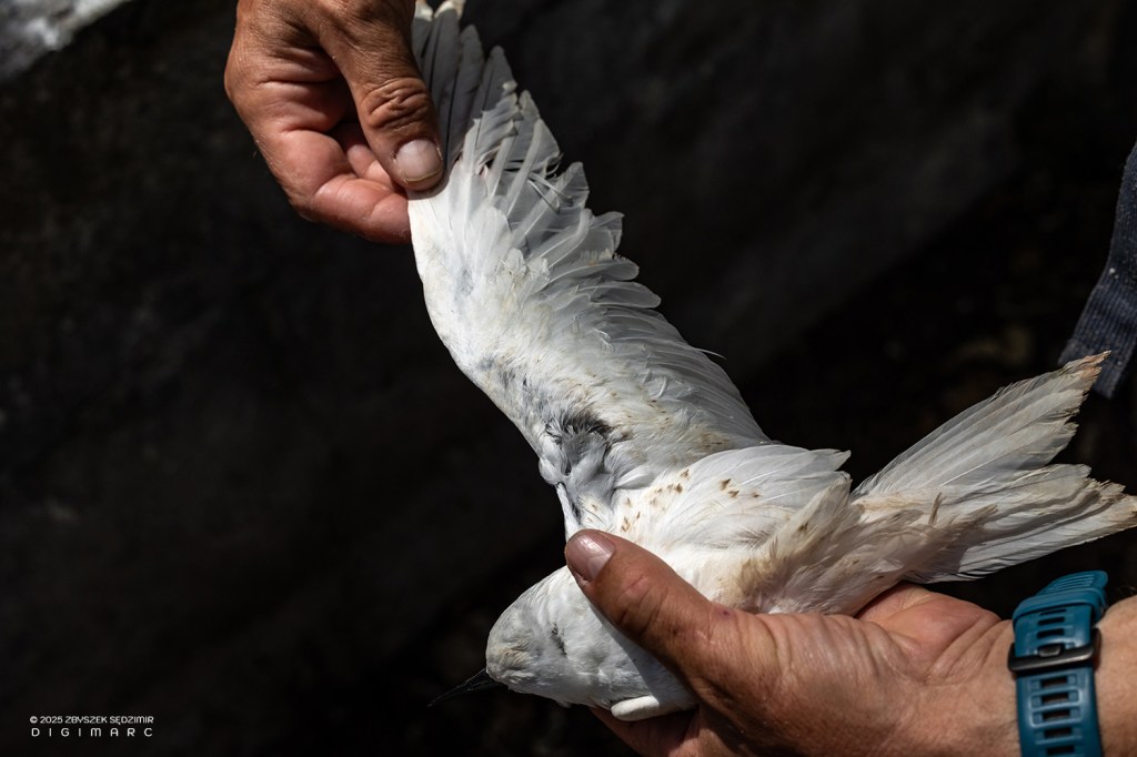
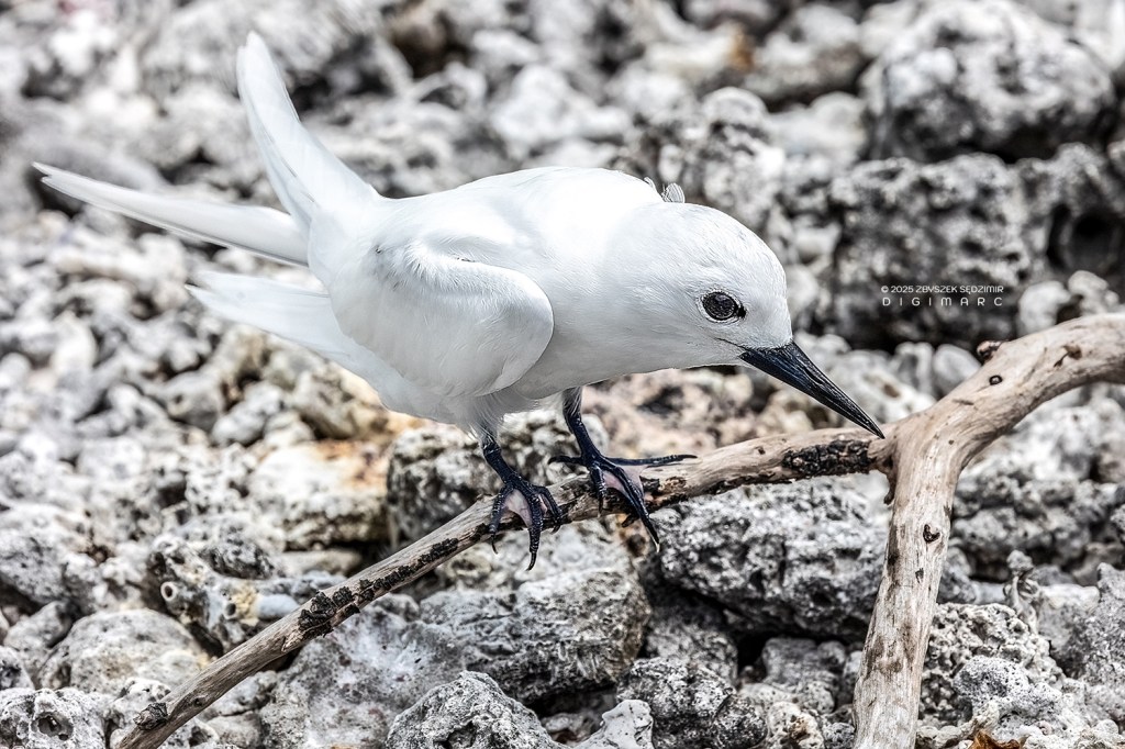
As we went further, we came across a white tern with a damaged wing. We couldn’t determine exactly how it had happened, but it might have been the work of a rat. Unable to fly, the bird has little chance of survival.

After a while we came upon a small freshwater pool.
Well, now, that was a sight to behold! It couldn’t have been rainwater—no, my friend, it hadn’t rained in what felt like an eternity. And as for an underground spring? That seemed a stretch as well, considering Albatross Island is nothing but coral, and corals, as we all know, are about as porous as an old sieve.
Skimming just above the water’s surface, seabirds—noddies and terns—swooped gracefully, dipping their beaks into the water just as they do when hunting fish out at sea. Whether they were catching tiny fish or simply stopping for a drink, we couldn’t say for sure. Sequence 1/3
Sequence 2/3
Sequence 3/3.
Our little expedition pressed on, surrounded by the island’s winged residents, who seemed more than a little surprised by their uninvited guests. Less than fifteen minutes later, we made yet another “discovery.”
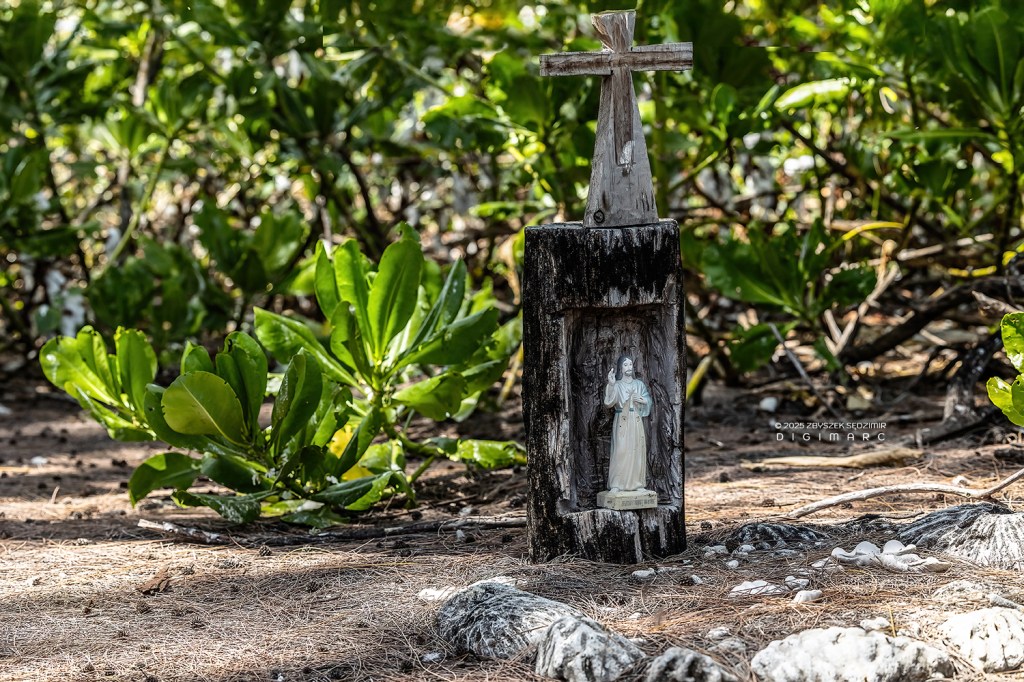
Tucked away in a grove of “filaos” trees, stood an old wooden grave, worn and weathered by over 150 years of wind, salt, and time. At some point, someone—perhaps much later—had placed a statue of Christ upon it, maybe as a comfort for the departed soul… or for their own. Who lay there? That remains a mystery.
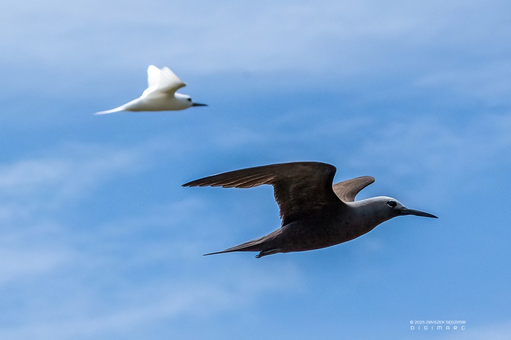
Before we left the island, I managed to snap a picture of a Noddy and a White Tern, flying side by side in what could only be described as a display of synchronized acrobatics—almost as if they’d been rehearsing for it.
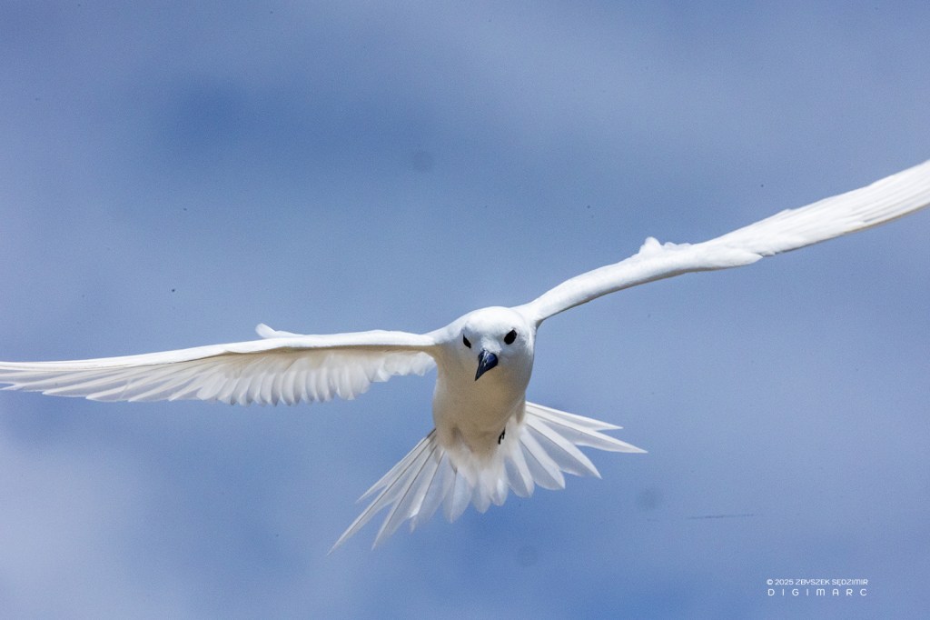
The White Tern, giving us a polite “Goodbye,” as we made our departure from Albatross Island—probably glad to see the back of us, as any sensible bird would be.
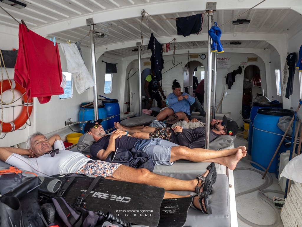
All the members of our expedition to Albatross Island (including my friend from National Geographic, who, like me, is missing from this picture) are lying on the deck of the fishing boat “Albatross”, a bit weary from the adventure. The return trip to Raphaël Island took just under two hours, though the time seemed to stretch out like a lazy afternoon nap.
Our entertainment came courtesy of a Booby, who, for reasons unknown to anyone, seemed to have an intense dislike for the “Albatross” radio antenna. With all the grace of an acrobat, it performed a series of aerial contortions, determined to defeat the poor antenna once and for all.
Puits à Eau Island
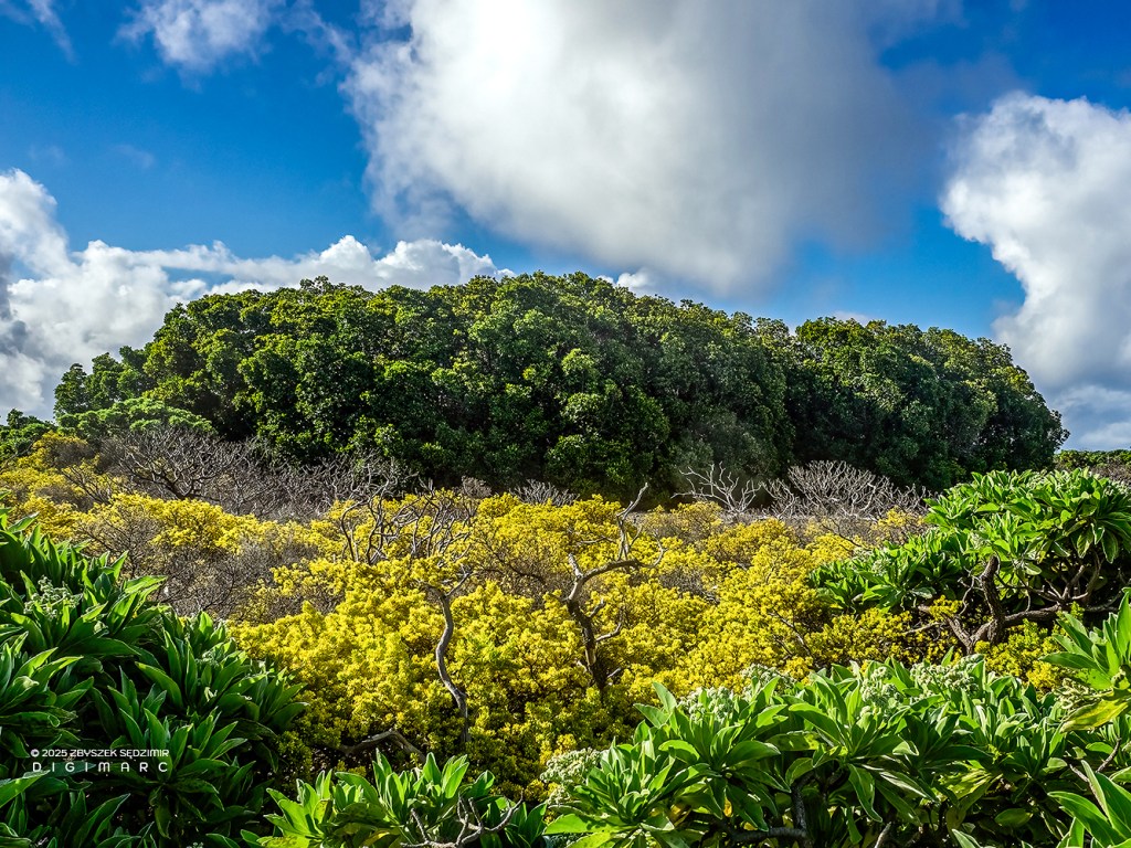
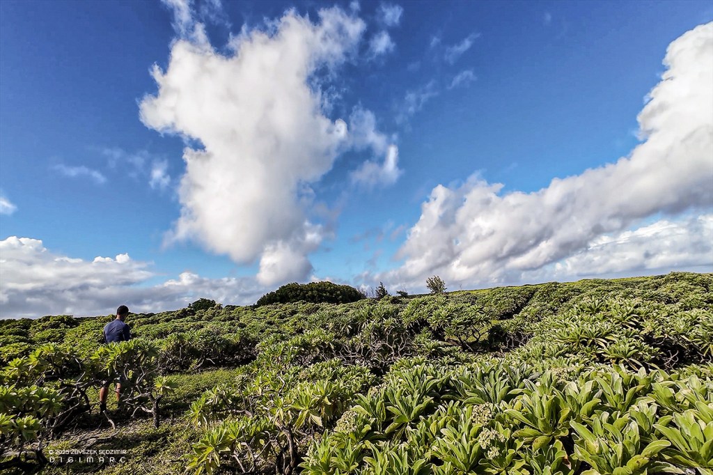
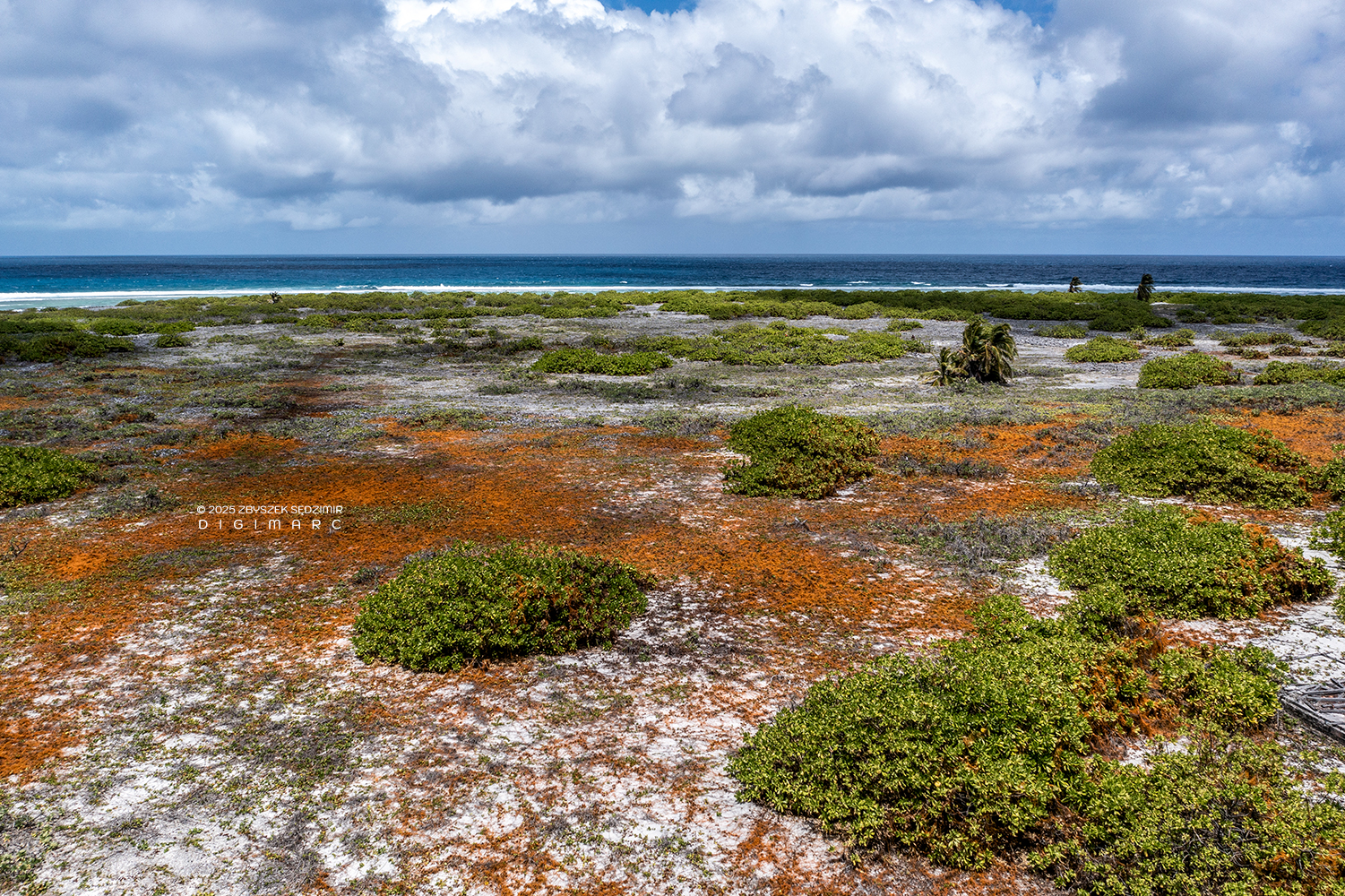
From way up in the sky, Puits à Eau Island looks like one of the biggest patches of land in all of Saint Brandon. It sits just a stone’s throw from Raphaël Island—though that throw better be a mighty good one. The place is thick with vegetation, mostly “voloutiers”, which seem to have taken it upon themselves to make sure no visitor gets through without a proper scratching.

We landed on the western side of the island, setting out to find ourselves a patch of mangroves. Now, as any halfway educated soul knows, mangroves usually take root in shallow coastal waters, holding the shoreline together and giving young sea critters a safe haven against predators. But according to the fishermen who’d been to Puits à Eau Island, the mangroves here had taken a notion to grow inland instead. Sounded peculiar enough that we figured it was worth a look.
And sure enough, after a short march, we stumbled upon a mangrove forest. Towering over 20 meters high and bursting with lush green foliage, it was a sight to behold. But there was just one problem—these mangroves weren’t where they were supposed to be. Instead of clinging to the coast like respectable mangroves do, they had taken root deep inland!
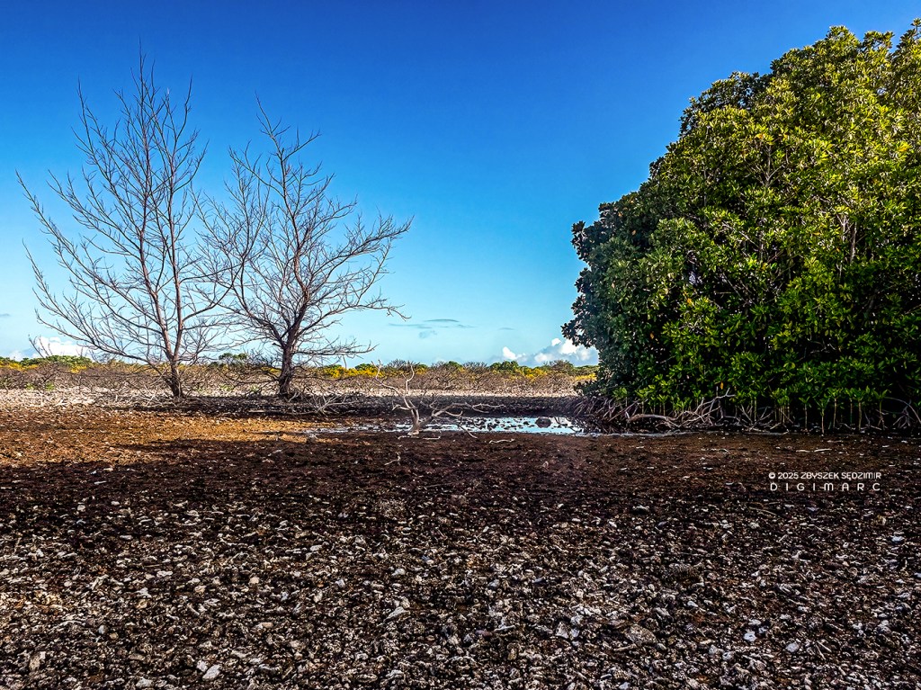
When we reached the mangroves, it became clear that the ground beneath and all around them was thoroughly soaked with salt water. A fine arrangement for the mangroves, no doubt—but not so much for the other trees and plants, which had withered away, unable to survive in an environment that played favorites.
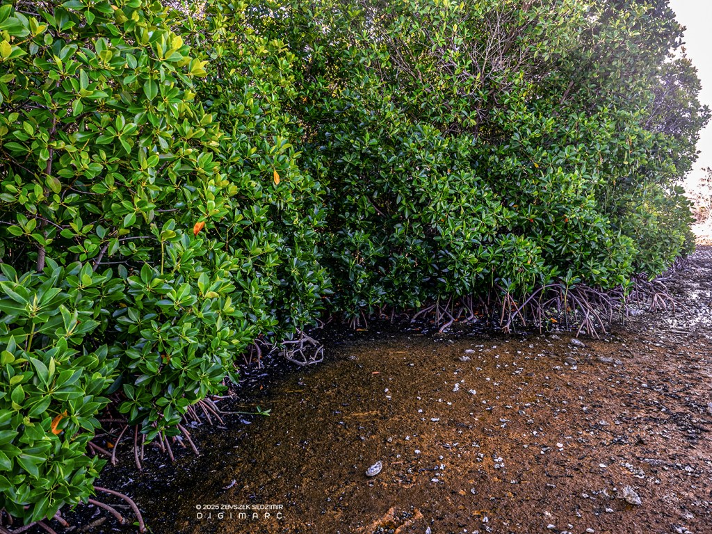
We had our answer as to why the mangroves were growing inland, but a new question cropped up: where was all that salt water coming from? The best guess was an underground tunnel, allowing seawater to seep up to the surface whenever the tide came rolling in.
One more thing struck us as odd: not a single bird to be seen, not a feather in sight, and all despite the island’s thick, flourishing vegetation and the towering mangroves that should have offered shelter from such predators as rats. It was a curious silence, like a well-kept secret, and we couldn’t help but wonder what in tarnation had driven the birds off this otherwise inviting spot.
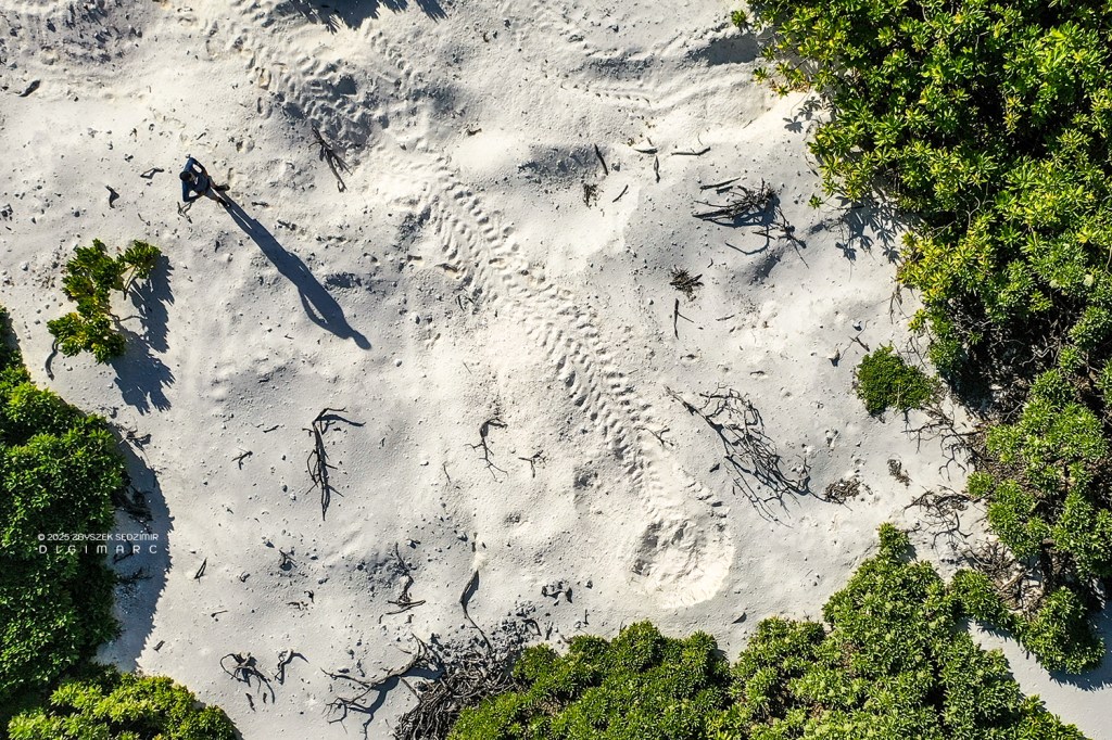
To wrap things up on a cheerful note: near the spot where our dinghy had come ashore, we stumbled upon the unmistakable tracks of a female turtle that had come to lay her eggs. The marks in the sand were clear as day—and not from just one turtle, but several. Yet another proof of how vital this archipelago is for the thousands of turtles that call it home.
Poulailler Island
Three islands in a single shot: Poulailler Island, Puits à Eau Island, and beyond the coral reef and lagoon, North Island. Poulailler Island is slightly smaller than Puits à Eau and has a bit less vegetation. And just like on Puits à Eau, we didn’t spot a single bird.
A defining feature of Poulailler Island is its sandy “tail,” which stretches out to form nearly half the island’s entire length.
Trying to reach the end of the “tail” across the scorching sand felt about as exhausting as trekking through the Sahara.
Our efforts were soon rewarded with a spectacle that held us spellbound—an extraordinary drama unfolding just beneath the water’s surface. In barely 50 centimeters of depth, a shimmering school of tiny fish—each no more than two centimeters long—twisted and pulsed in a frantic ballet. Weaving among them, baby sharks, no longer than 40 centimeters, moved like shadows—sleek, silent, relentless. It was a ruthless game of pursuit. With each strike, the school erupted in a dazzling burst of silver, only to swirl back into formation just beyond the predator’s jaws. Instinct dictated the only rule: stay together, or vanish.
The vegetation on Poulailler Island—mostly “Veloutier”—forms a dense ring around a sandy clearing. Naturally, curiosity got the better of us, and we decided to push our way through this leafy barricade to see what lay beyond.
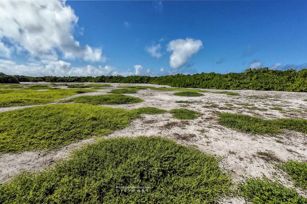
The clearing we reached was dotted with patches of greenery, giving the illusion of a neatly kept lawn. Yet, the complete absence of birds was a mystery not easily explained.
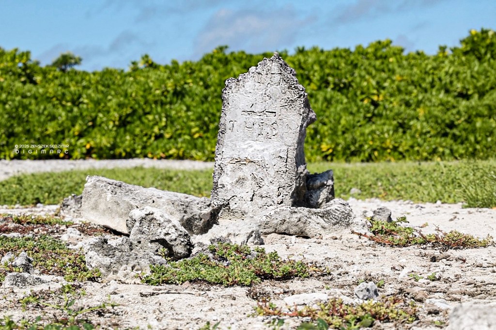
And then, we made a discovery—a lone grave marked by a weathered stone headstone, its inscriptions long erased by time. Who had been laid to rest here, and when? That was a mystery we couldn’t unravel.
The Middle
The islands located in the central part of the archipelago include Paul Island, Fregate Island, Avocaire, the Tectec Islands, Coral Island, and Perle Island. Of them all, Perle Island was the only one I didn’t get the chance to see.
Paul Island
From the air, Paul Island looks for all the world like a stingray making a leisurely glide to the southeast. Just beyond the island, plain as day, you can see a great yawning gap in the eastern coral reef. That there is Passe Cayenne, and if you were looking for a way through, well, that’d be your door.
Paul Island’s “tail” is mostly covered in veloutier argenté (Tournefortia argentea) and veloutier vert (Scaevola taccada). The bigger birds—Boobies and Frigates—stake their claim on the sturdier argenté bushes, building their nests among the branches. Meanwhile, the Noddies and Terns seem content to perch on the veloutier vert, laying their eggs right on the bare ground, as if trusting fate to keep them safe.
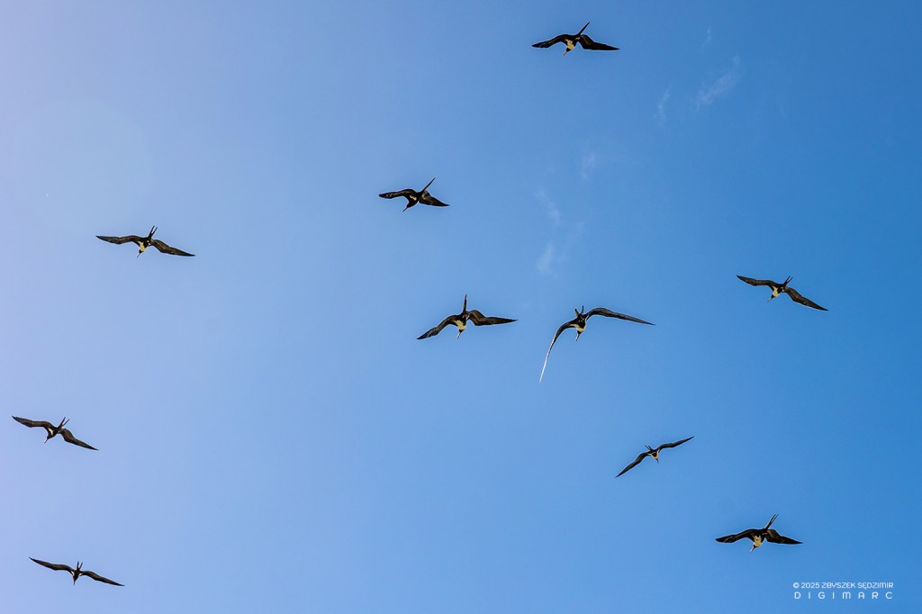
In April, Paul Island was teeming with Frigatebirds—hundreds of them. These birds are the aerial aristocrats of the seabird world—built for life on the wing, masters of the sky, and hopelessly inept at anything involving land or water. Belonging to the genus Fregata, they roam tropical and subtropical oceans, spending most of their lives riding thermals, barely flapping their wings and almost never touching the sea.
Unlike most seabirds, frigatebirds lack the waterproofing that allows others—like gulls or albatrosses—to rest on the water. Instead, they remain airborne for weeks on end, riding warm air currents and even sleeping in flight. Scientists tracking them have recorded frigatebirds covering thousands of miles without landing, soaring to astonishing heights of over 4,000 meters (13,000 feet).
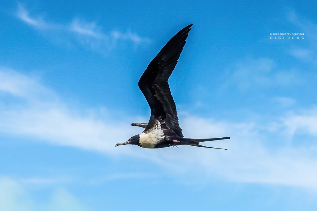
One of their most notorious traits is kleptoparasitism—stealing food from other seabirds in mid-air. Armed with long, hooked beaks and an impressive wingspan (up to 2.3 meters / 7.5 feet in Fregata magnificens), frigatebirds relentlessly harass boobies, terns, and other unsuspecting victims until they drop their hard-earned catch. With the precision of a skyborne bandit, a frigatebird swoops in, snatching the falling fish before it ever touches the water. In this photo, a frigatebird perches on its nest, gazing up at the photographer—its mischievous nature written all over its face.
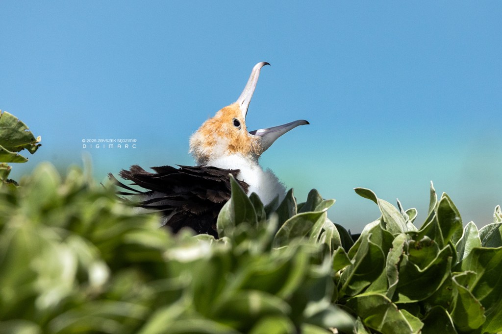
Frigatebird chicks are slow to mature and depend on their parents for food for over a year—one of the longest dependency periods of any seabird. Nesting on low shrubs or rocky outcrops, the young are often left alone as the parents venture out to find fish.
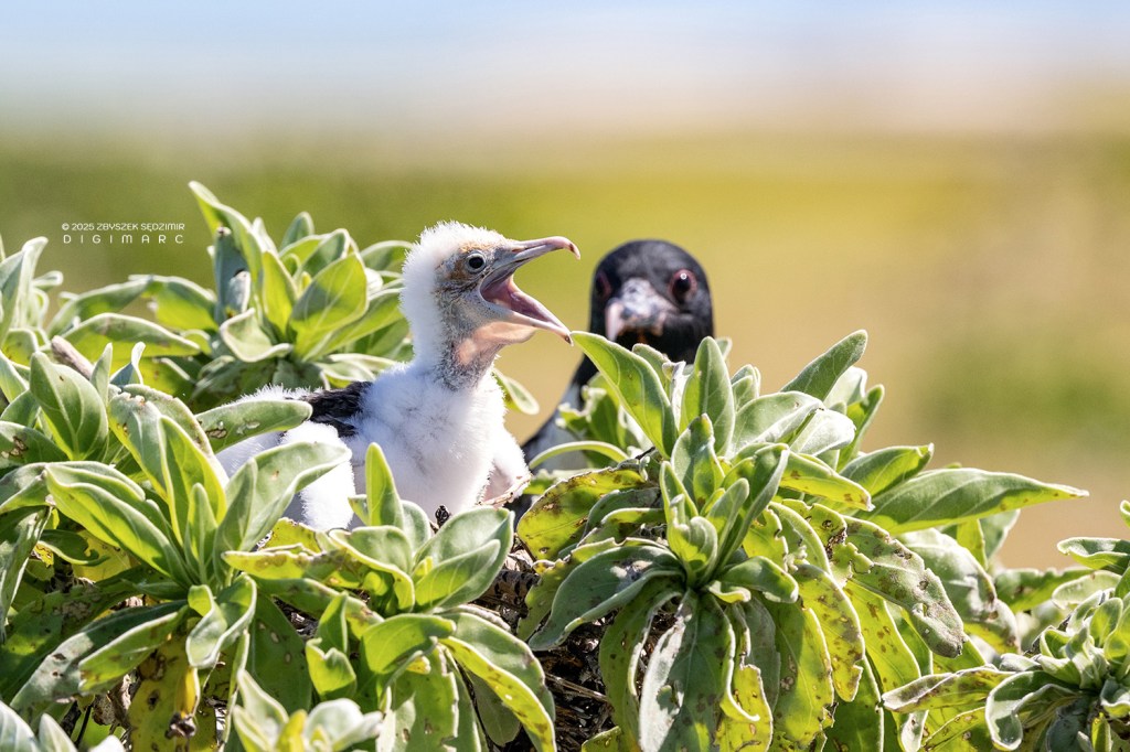
And when a frigatebird chick is hungry (which is always), it begs with such persistence that you’d swear it hadn’t been fed in weeks, even if it had a full meal just that morning.
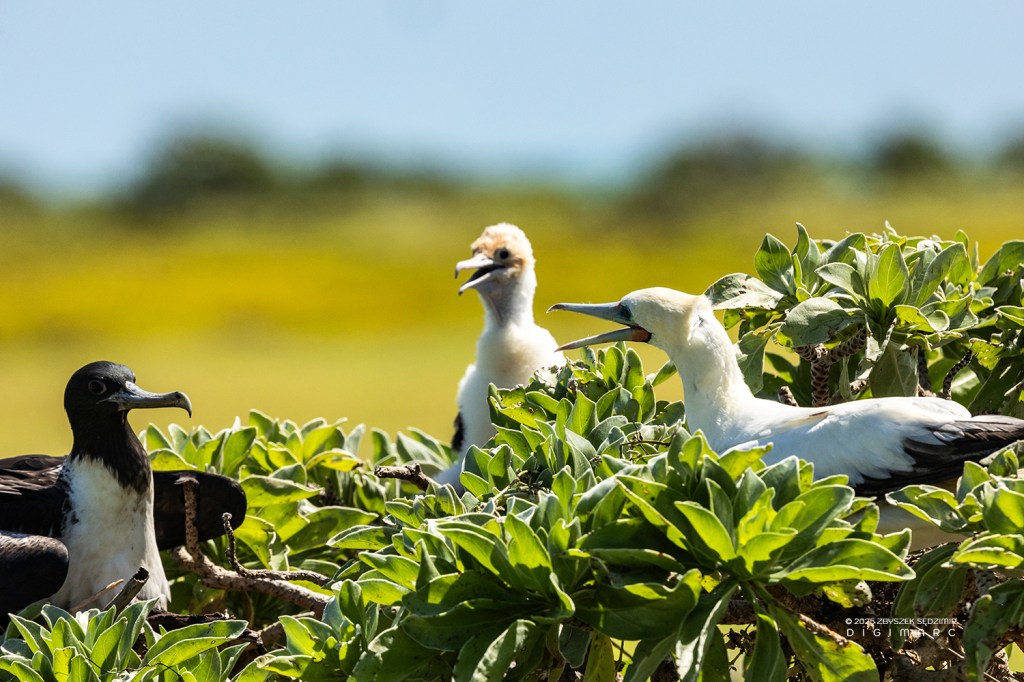
Sometimes, you could spot a curious mix of neighbors: on a single veloutier shrub, both Frigatebirds and Boobies had made their nests. In this picture, they’re having a neighborly chat, as if discussing the weather or the latest gossip.
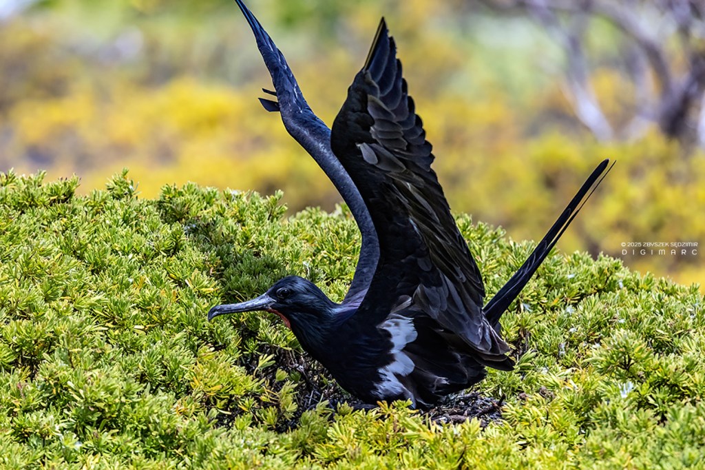
A Frigatebird, captured at the very moment of landing in its nest, proudly showcases its magnificent plumage. Notice the perfect synchronization of its wings and tail, allowing for an almost vertical descent—graceful, precise, and utterly effortless.
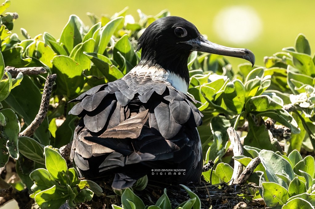
Frigatebirds are low-reproduction seabirds, producing just one egg per breeding season. This single egg is laid in a loosely built nest on low shrubs or rocky ground, and both parents take turns incubating it for about 50 days. Once the chick hatches, it has one of the longest dependency periods of any seabird. The parents feed it for up to a year, and in some species, even longer! In Magnificent Frigatebirds (Fregata magnificens), for example, chicks may receive parental care for over 18 months, meaning that these birds usually breed only once every two years. This extremely slow reproductive rate makes frigatebird populations vulnerable to disturbances and environmental changes.
A Frigatebird on a mission—sailing through the sky with a beak full of nesting material.
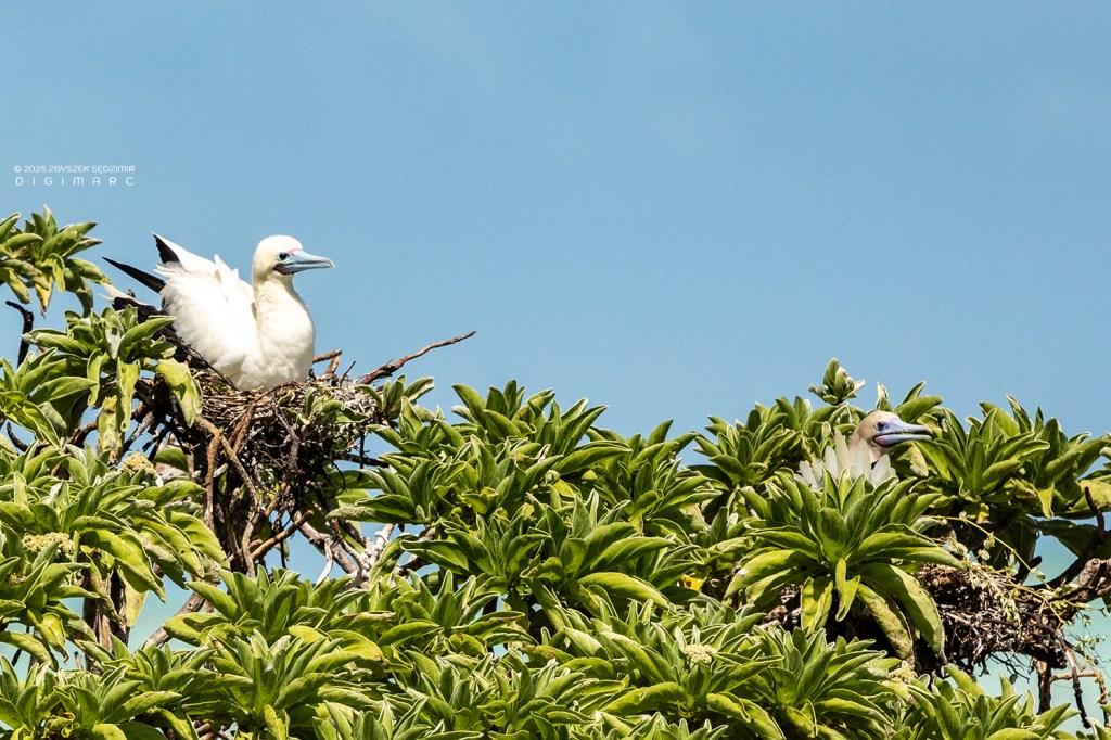
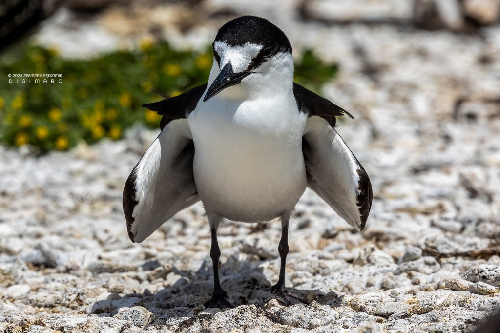
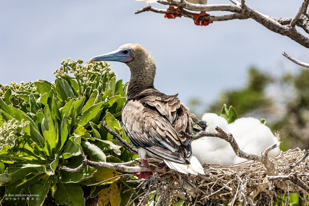
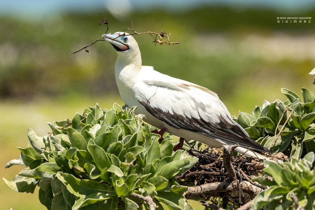
The second group of large seabirds found in the Saint Brandon archipelago are the red-footed boobies. Unlike their ground- or cliff-nesting relatives, these remarkable birds prefer the branches of coastal trees on remote tropical islands. Using twigs, leaves, and whatever else they can find, they build their nests high above the ground. The female lays a single egg, and both parents share the duty of incubation. Year after year, they return to the same nesting sites, displaying remarkable fidelity to their chosen home.
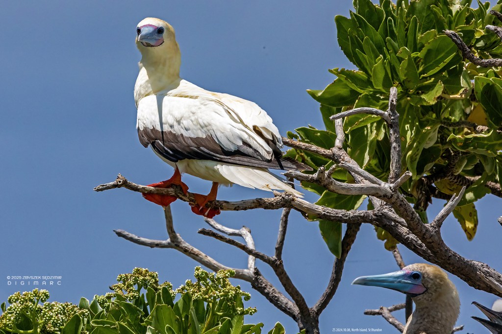
Red-footed boobies (Sula sula) are unique among boobies because they exhibit color polymorphism, meaning individuals can have different plumage variations within the same population. There are three main color morphs: (a) White morph – Completely white body with black flight feathers on the wings….
…. (b) Brown morph – Overall brownish-grey plumage. (c) Intermediate morph – A mix of white and brown, sometimes with a white head and brown body. The exact reason is not entirely understood. This fascinating polymorphism makes the red-footed booby one of the most visually diverse seabirds!
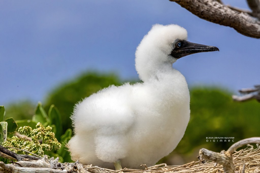
The little chicks are decked out in a fluffy white coat, and on their heads, that down sits like some powdered wig straight out of a baroque court—only with a bit more charm and a lot less formality.
Red-footed boobies are masterful fliers, renowned for their agility and grace in the air. Like frigatebirds, they employ a technique known as dynamic soaring, allowing them to cover vast distances by effortlessly riding air currents. Unlike many seabirds, they have relatively short wings, but these are perfectly suited for quick, maneuverable flight. When it’s time to dive for prey, they tuck in their wings and plummet into the water with remarkable precision, showcasing their hunting prowess.
Red-Footed Booby pausing mid-nest construction – possibly wondering where to put that last twig.
Paul Island is also home to populations of smaller seabirds found throughout the archipelago. In this photo, you can see noddies circling overhead, displaying distinctly aggressive behavior—an unmistakable sign that we had wandered into their breeding grounds.
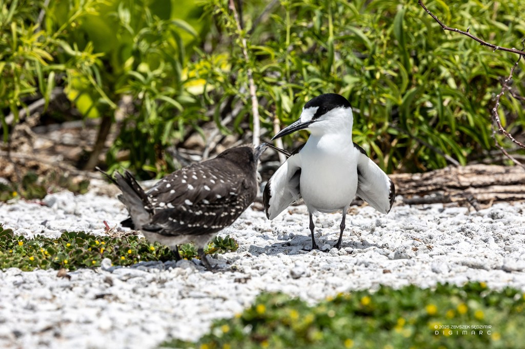
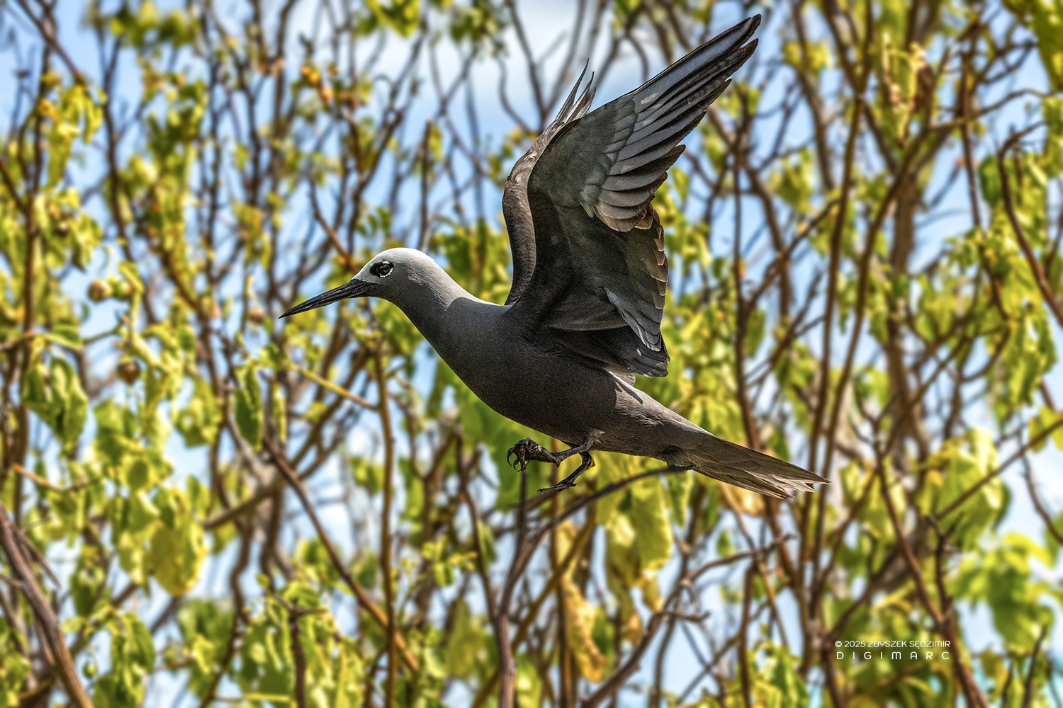
Here, I think it’s worth taking a closer look at the Brown Noddy. These seabirds are colonial nesters, gathering in large, noisy groups to breed—often alongside Black Noddies and various terns. The female lays a single egg per season, with both parents taking turns incubating it for about 33-36 days. Fiercely protective of their nests, Brown Noddies engage in loud, aggressive vocal displays to ward off intruders. If warnings fail, they won’t hesitate to dive-bomb or deliver sharp pecks to trespassers. Their vigilance is essential, as they often nest near frigatebirds—infamous aerial pirates always on the lookout for an easy meal. In short, Brown Noddies are highly social, devoted parents, and fearless defenders of their nesting sites, playing a vital role in the island ecosystems they inhabit.
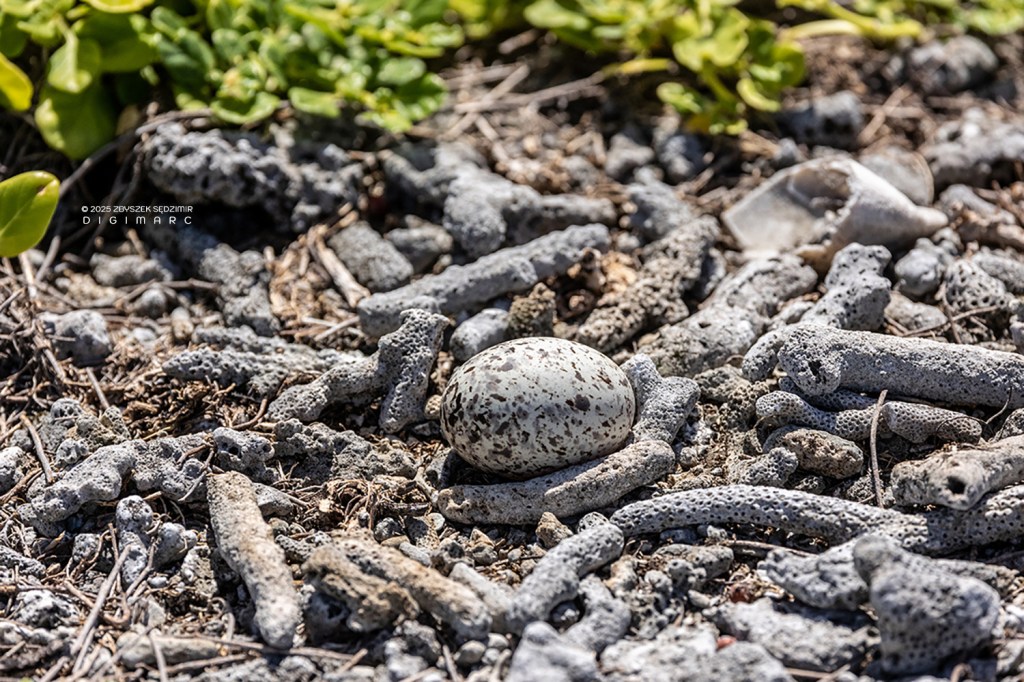
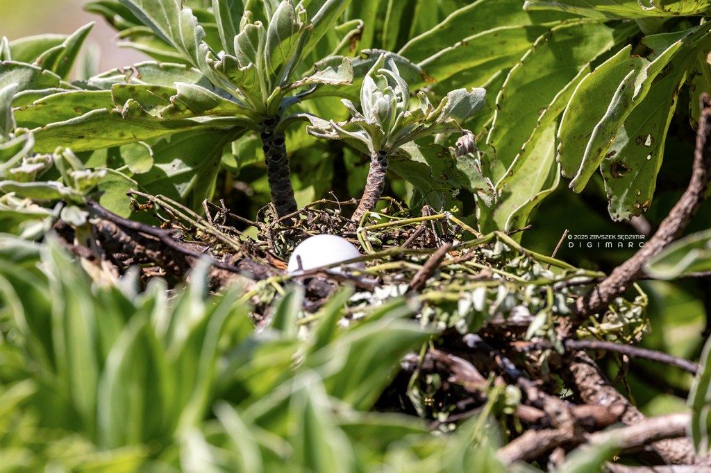
During our journey across Paul Island, we experienced all of this firsthand. Eggs lay exposed on the bare ground, vulnerable and unattended. We had to watch our step—one careless move, and we’d risk an unfortunate omelet. The one in this photo, for instance, was laid by a White Tern, which had only temporarily left its spot. Fairy Terns almost never lay their eggs on the ground, but there are rare exceptions.
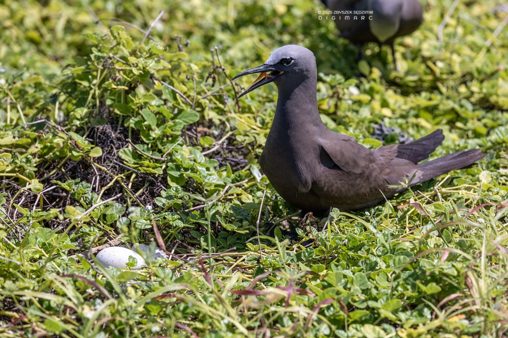
But when a parent—like the Brown Noddy in the photo—stood guard, any attempt to get closer was met with an immediate and unmistakable message: we were not welcome. Hissing and squawking like an angry tomcat with a score to settle, it made sure we got the point. And just like that, we found ourselves altering course—no questions asked.
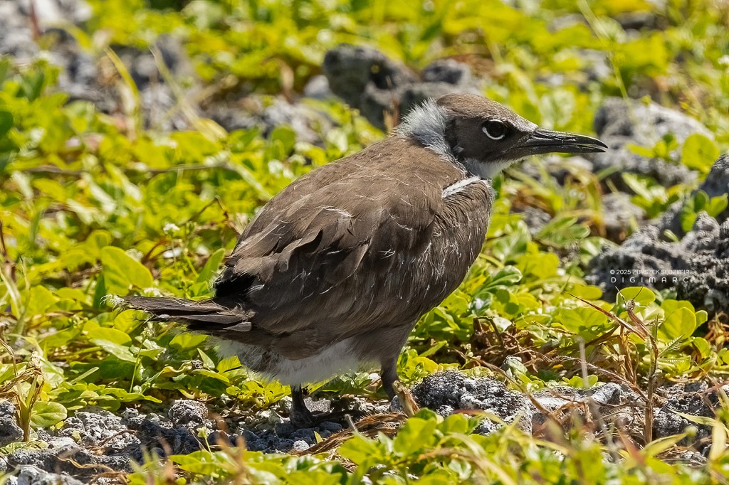
Every now and then, a little brown noddy chick would dart across our path. Lacking the wings to lift itself, it waddled along on foot, looking like a tiny, trembling creature trying to seek refuge among the thick bushes.
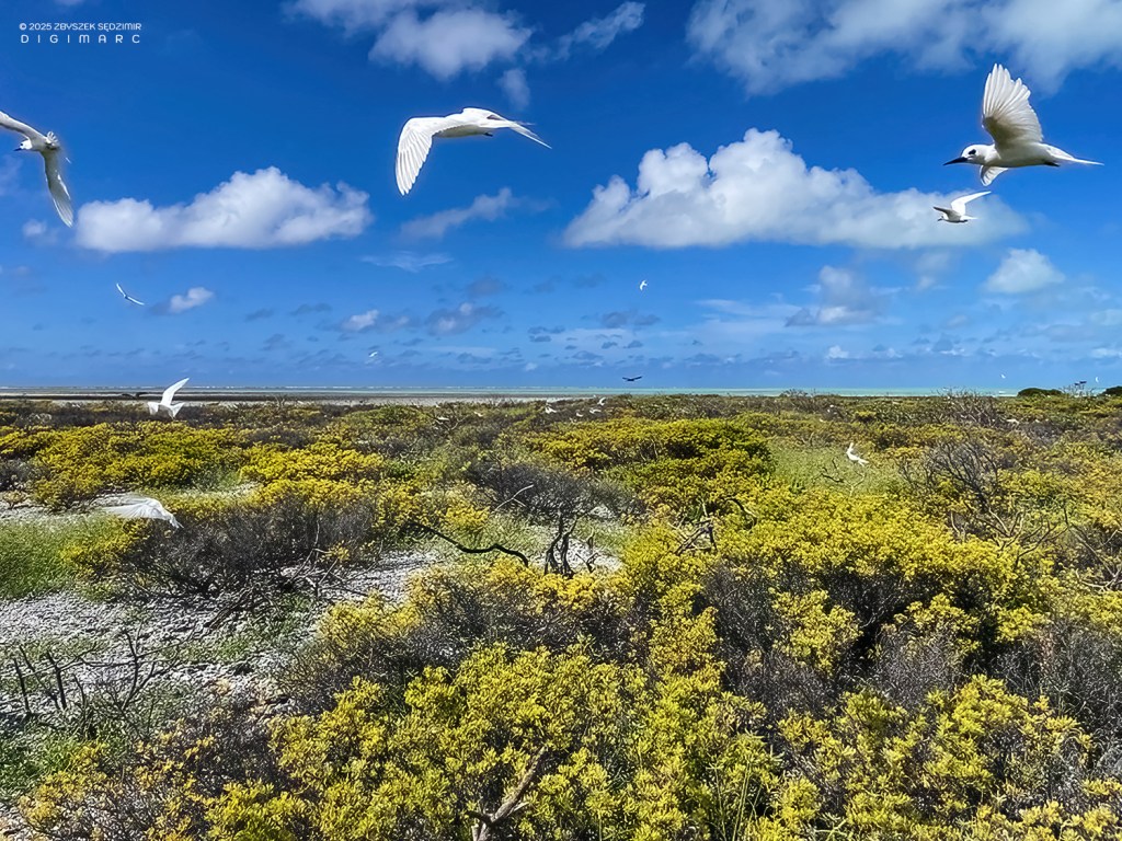
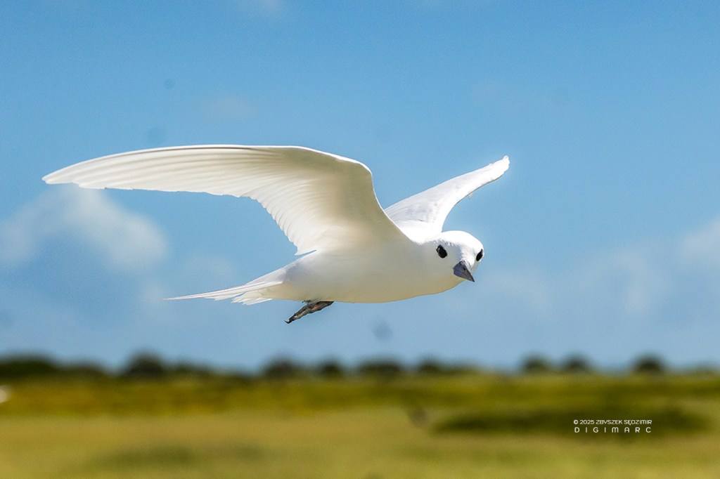
As we continued our journey, we arrived at a White Tern (Gygis alba) breeding site. The Saint Brandon population of these elegant seabirds is estimated to be around 20,000 individuals. One of the most remarkable traits of Fairy Terns is their choice of a nesting site—or rather, their lack of one. Instead of building a traditional nest, they simply lay a single egg on a bare branch, tree fork, or even a man-made structure, relying on the egg’s slightly adhesive texture and the chick’s strong feet to keep it from falling.
A Fairy Tern, turning the tables and making me feel like the one under observation 😉 Fairy Terns are masterful fishers, skillfully catching small fish and squid to feed their chicks. Unlike many seabirds that swallow their catch and later regurgitate it (remember the Sooty Terns?), Fairy Terns return from their foraging trips with prey neatly held crosswise in their beaks. This unique method allows them to deliver fresh, whole meals directly to their young—ensuring a protein-rich diet for rapid growth.
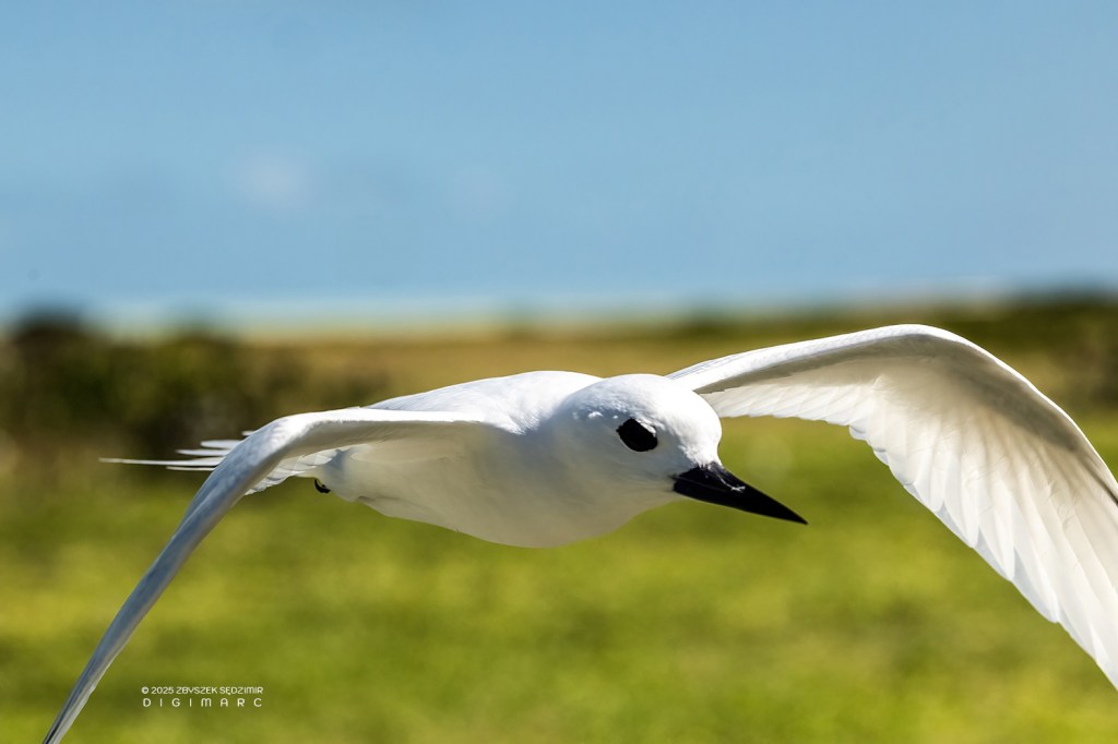
A Fairy Tern swooped in so close that I had to take a step back to avoid a mid-air collision.
Seeing the Fairy Tern, with its feathers as white as fresh snow, one could easily see why the folks around here call it “Zwazo Lavierze” — the “virgin bird.” It’s as if the very purity of its plumage has earned it such a name, untouched and unspoiled, like a maiden in her finest dress.
It’s always puzzled me why the Noddies and Terns perched on Veloutier shrubs seem to hold some sort of silent agreement—every last one of them facing the same direction. I’ve observed this phenomenon on other islands as well, at different times of the day—even at night.
Not having the faintest idea who might give me a straight answer, I did the next best thing—I asked ChatGPT. And wouldn’t you know it, the contraption actually had a reply: “While it may look like a fine bit of bird ballet, this peculiar habit is all about practicality—helping them stay steady, waste less energy, and keep their feathers unruffled in the never-ending coastal winds.”
I’ve already said plenty about the birds of Paul Island, but nothing about the surrounding lagoon waters. Let’s start with the shallow coastal waters.
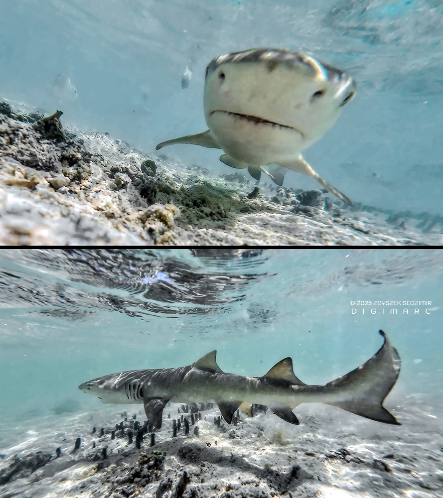
The shallows were teeming with baby sharks, darting through the water in hot pursuit of tiny fish—much like the scene over on Poulailler Island. It was a fine spectacle, provided you weren’t one of the fish.
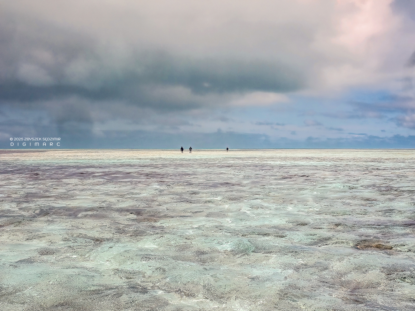
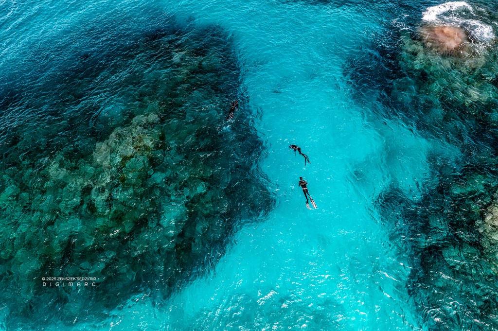
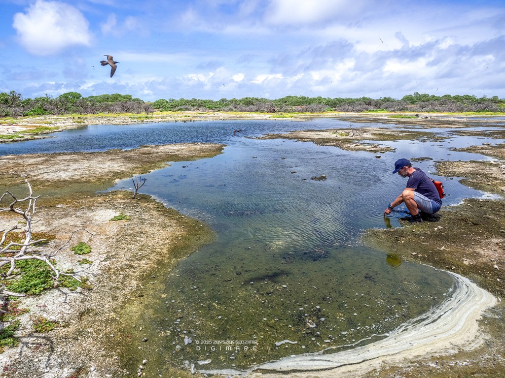
There are also vast shoals stretching from Raphaël Island to Paul Island—an ideal place for an ocean walk. Saint Brandon offers a rare opportunity for this, with its extensive shoals spanning dozens of square kilometers. The water is only knee-deep, but sturdy shoes are essential, as the coral beneath can be razor-sharp. In this photo, scientists are seen collecting algae.
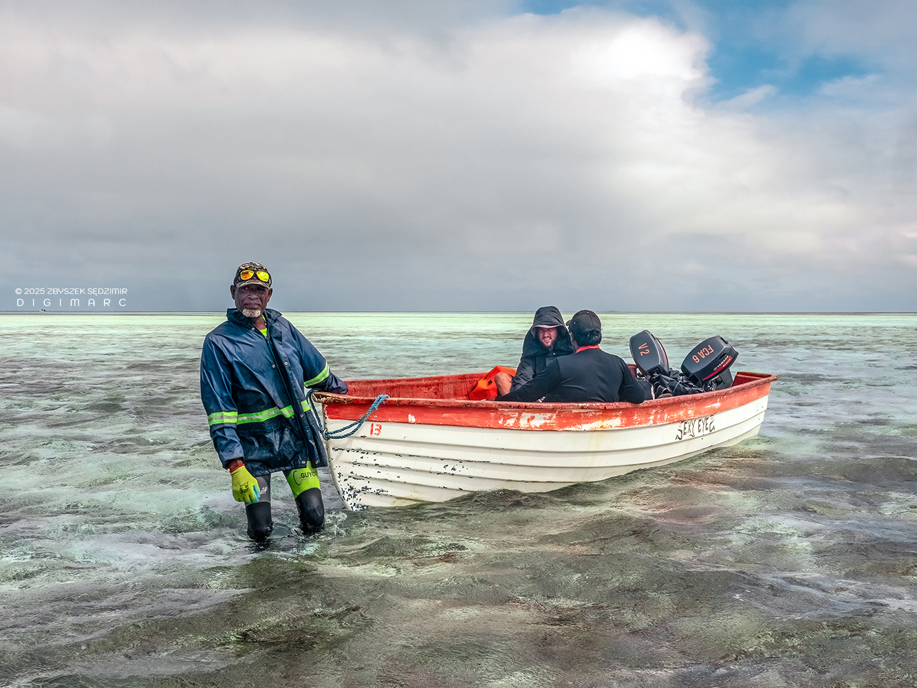
Sometimes the water is so shallow that starting the pirogue’s engine is impossible, leaving manual towing as the only option.
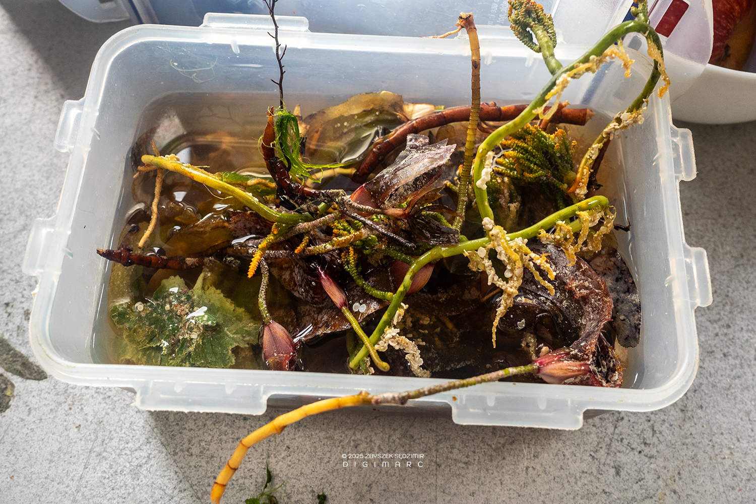
Back on Raphaël Island, there’s plenty of work left to do—sorting through the day’s haul of data and artifacts. And no, that’s not a seaweed salad being prepped for dinner, though at a glance, you’d be forgiven for thinking so.
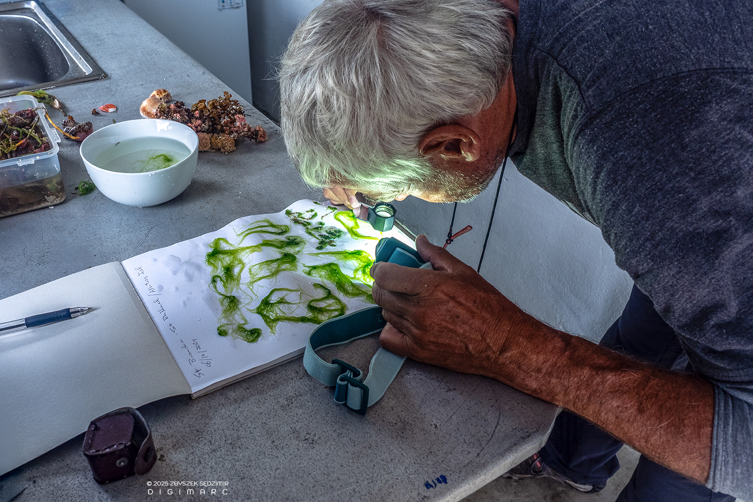
All the findings must be identified, sorted, analyzed, documented, and properly stored. Only then is it time to eat! 😉
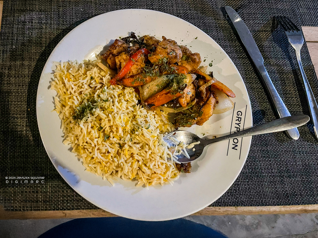
Like this delicious ”vindaye poisson” 😋, for example.
Avocaire Island
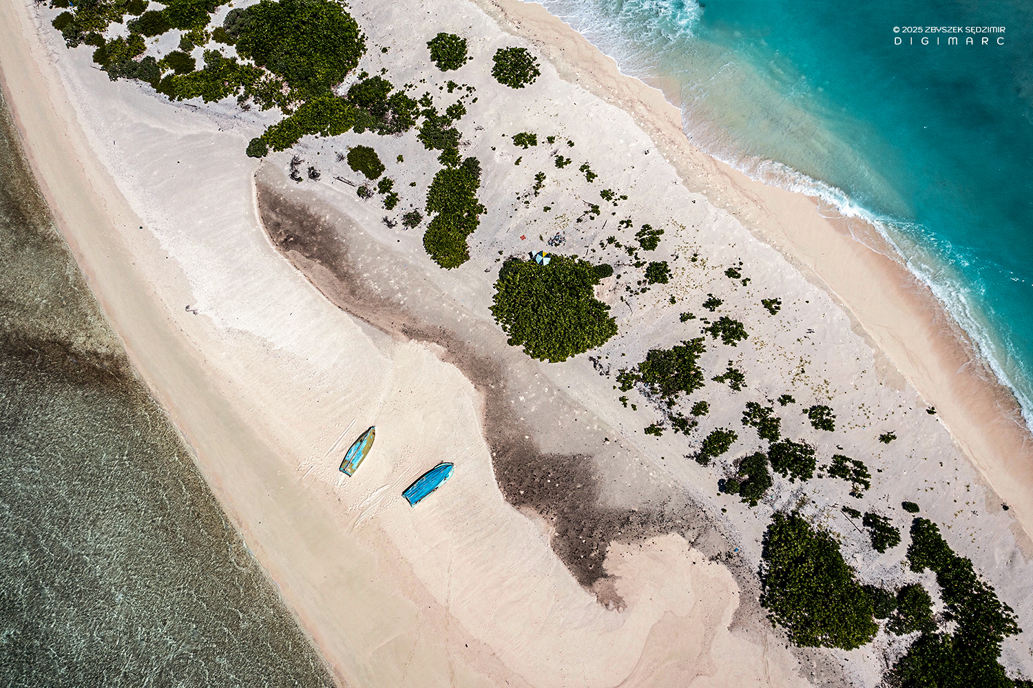
As our boat approached the Avocaire Island, its lush and dense vegetation immediately caught our eye.
On the shore, we were welcomed by a vast colony of Noddies that had completely overtaken the island.
From above, Avocaire Island vaguely resembles the foundation of New York’s Flatiron Building—though a bit more weather-beaten and worse for wear. Not too long ago, it was more than twice its current size, home to workshops where fishermen repaired their boats.
But the sea, as always, had other plans. Bit by bit, the waves gnawed away at the land, swallowing buildings and leaving behind little more than a memory and a lesson: when the ocean decides to reclaim something, there’s not much arguing with it.
The ruins proved to be useful in their own way, offering a much-needed patch of shade. Anyone who has ever tried piloting a drone under a blinding sun knows that without it, you might as well be flying blind.
I decided to take a closer look at what was hiding in the dense shrubs covering the island. Sure enough, I stumbled upon colonies of Noddies and the occasional White Tern. As long as I didn’t get closer than a meter, they showed no sign of distress, going about their usual business—busy, noisy, and full of feathered drama.
A little to the side, Noddy was sitting on an egg (I couldn’t say whether it was Noddy’s mom or dad). Not wanting to cause any distress to the bird, I squeezed myself even further into the bushes.
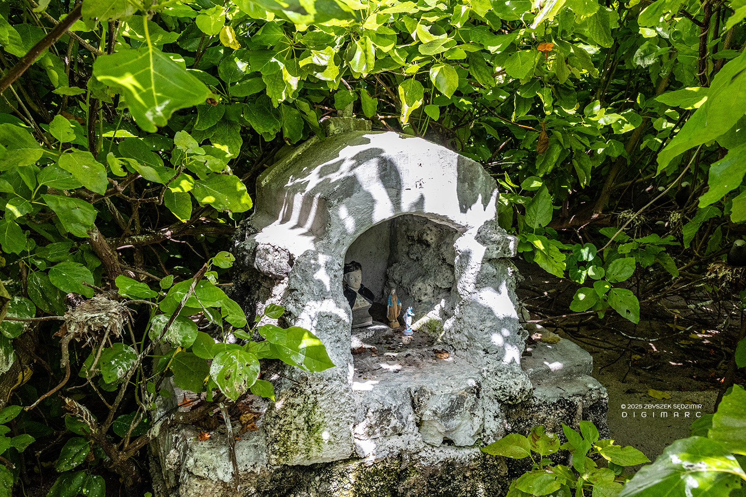
And here’s what I came upon—a so-called “grotto,” one of those little makeshift shrines the faithful put up wherever their hearts tell them to. In this one, tucked inside, was a tiny statue of Mary and, right next to her, a bust of Father Laval. He was a Catholic priest who landed in Mauritius back in 1841 and gave himself over to the poorest folks around—Creoles and former slaves, who’d only just been freed three years earlier when the British Empire finally put an end to slavery.
On my way back to the coast and our pirogue, I found myself witness to a heated debate between two Noddies. Perhaps it was sparked by an unequal division of marital duties?
To wrap up our visit to Avocaire Island, a bit of humor: a Noddy, having just “touched down” on a branch so thin it hardly seemed real, was now perfecting the fine art of staying upright. And, by some miracle, it succeeded!
Frigate Island
Fregate Island lies 14 km northwest of Avocaire Island, just beyond the western coral barrier. Getting there is no small feat—unless you happen to be a fish. The surrounding reef is as unwelcoming as a locked door with no key.
In the upper part of the photo, you can see “Albatros”, the ship that brought us from IDS. A little lower on the left, there’s a white pirogue, which we used to get closer to the reef. Not wanting to risk smashing it to pieces, we swam to the island.
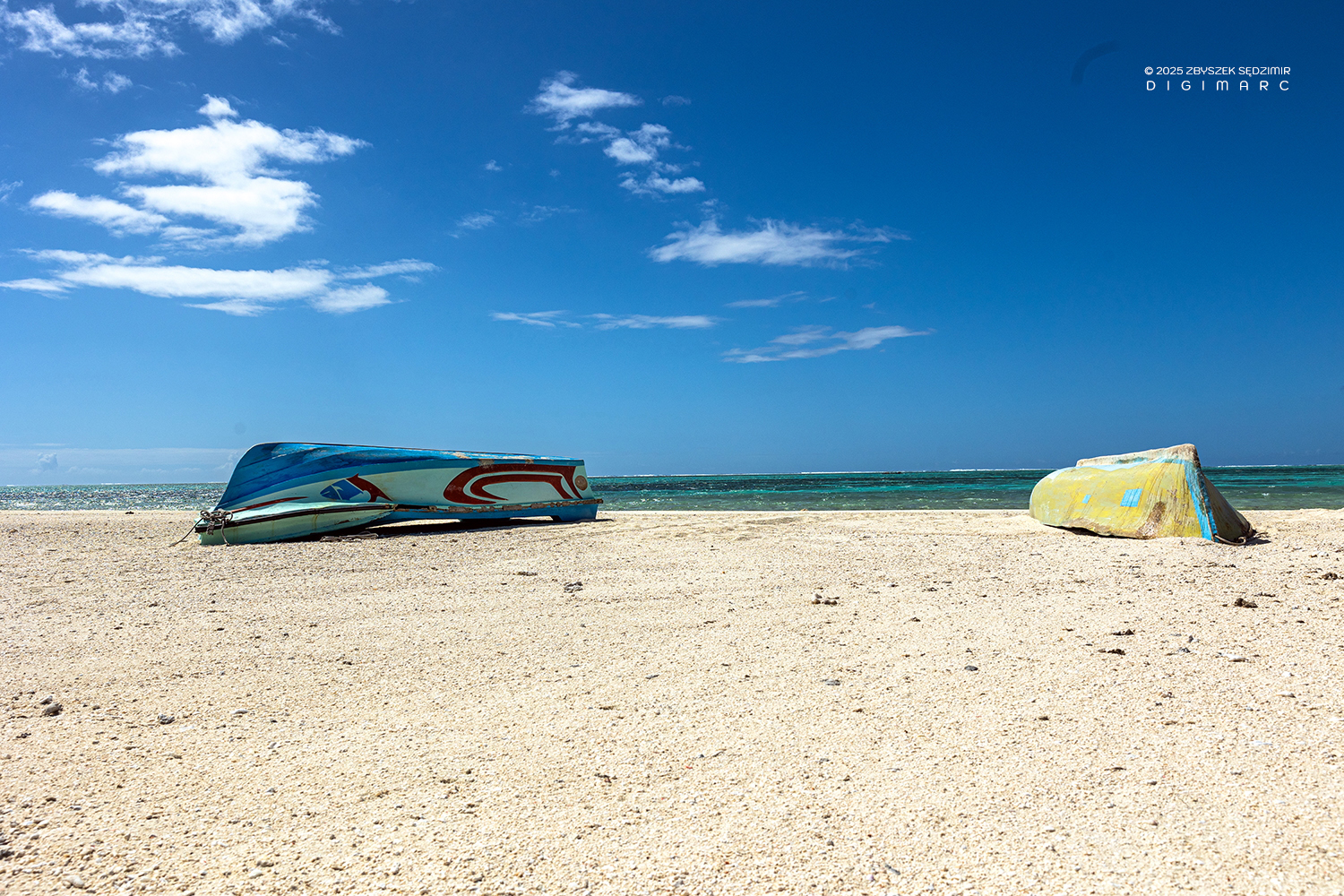
On the island’s beach lie the remains of two pirogues that once dared to challenge the barrier.
Rising even higher above Fregate Island, one can spot Perle Island, resting 6 km to the north.
A rather surprising fact is that we didn’t see a single bird on Fregate Island. The red vine sprawled across the ground and tangled in the veloutier bushes is most likely the parasitic “Cassytha filiformis”.
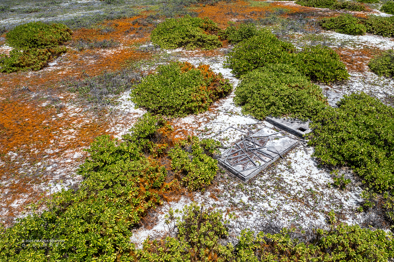
Unfortunately, much like on several other islets in the archipelago, Frigate Island bears the ruins of abandoned structures—silent witnesses to a former economic activity that was ultimately forsaken. The reasons can only be speculated: the island’s difficult access, cyclones leveling everything in their path, and so on. Such remnants scar the archipelago much like shipwrecks, though they pose less of a threat to the environment.

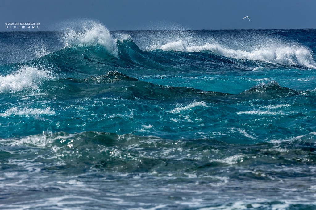
To conclude our visit to Frigate, here’s a photo of one of the elements that shaped the natural wonder of the Saint Brandon archipelago: the Indian Ocean—or more precisely, its waves. They can unleash destructive power, tossing ships onto coral reefs, or offer the perfect energy for an unforgettable ride on a surfboard.
Coral Island
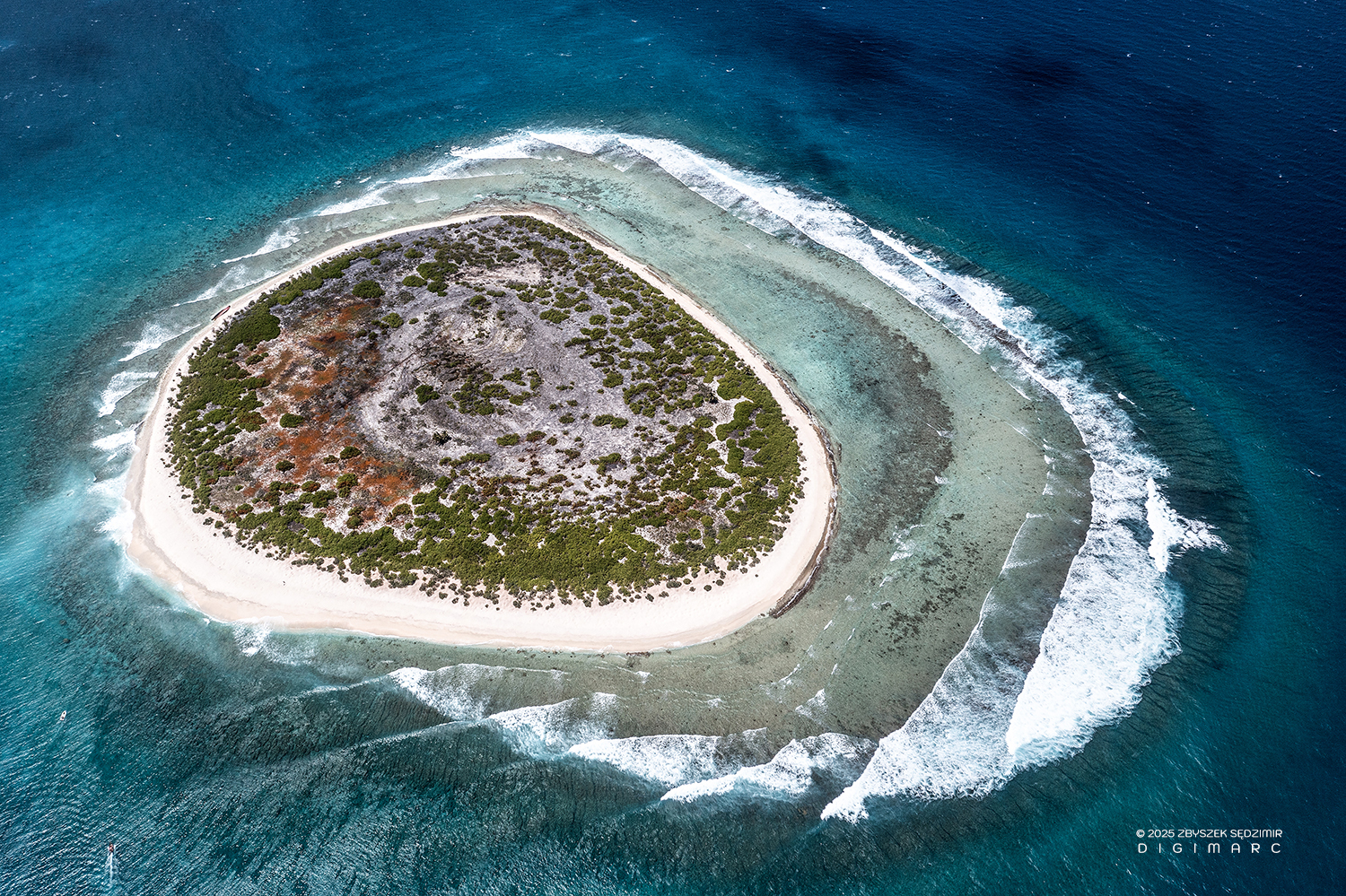
A tiny island almost without vegetation. In the shallow water around it are Hawksbill turtles.
From up here, it looks a bit like some strange critter wearing a diving mask. And if you glance over near what you’d call its left ear, there’s our pirogue.
The water around the island is so shallow that sometimes you have no choice but to walk to reach it. The vegetation is sparse, with a single larger Veloutier bush and a few tiny ones doing their best to hold on.
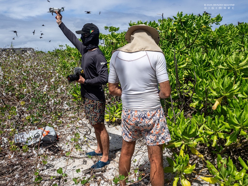
You might wonder what the hell we were doing in such an ordinary place. The truth is, Coral Island was the perfect base for launching drones and capturing aerial photos of the lagoon.
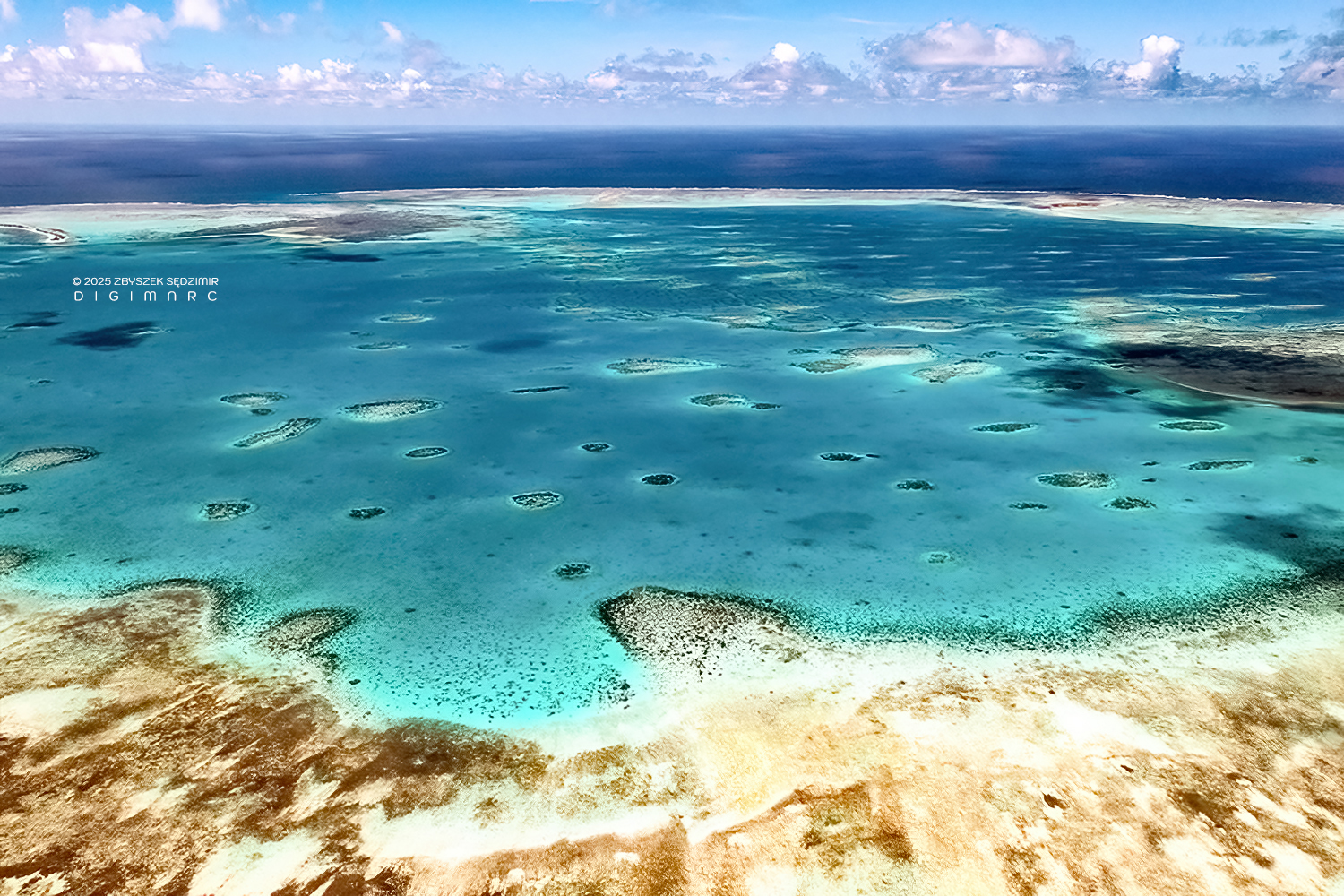
The coral in the lagoon here forms underwater formations that extend all the way to the western reef. The water shimmers with strange, almost unreal combinations of colors, best admired from the sky.
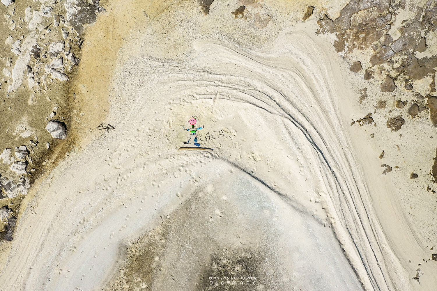
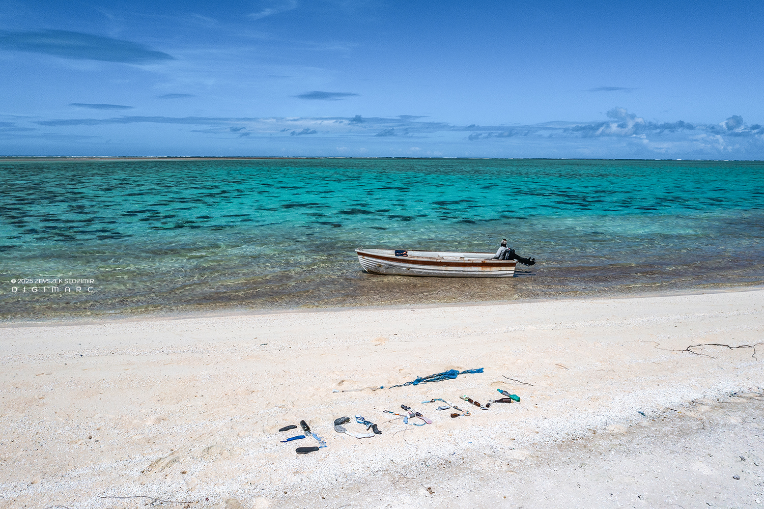
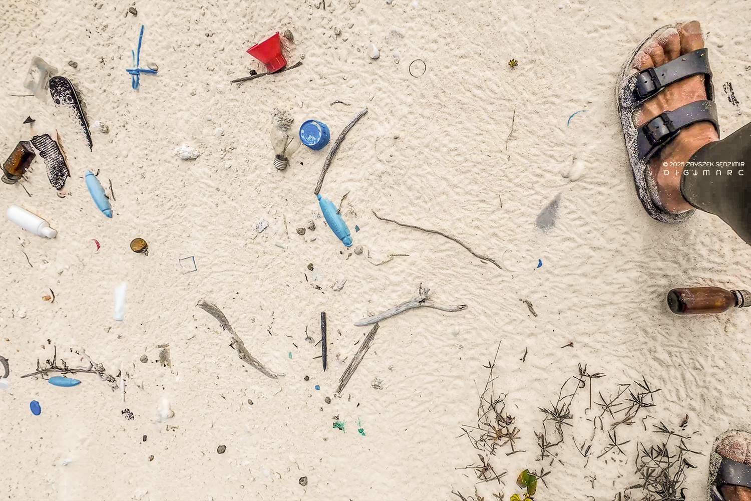
A completely different color palette comes into view up close on Coral Island: plastic waste, carried by ocean currents for thousands of kilometers, only to meet its final resting place on Saint Brandon. I decided to turn it into an artistic performance.
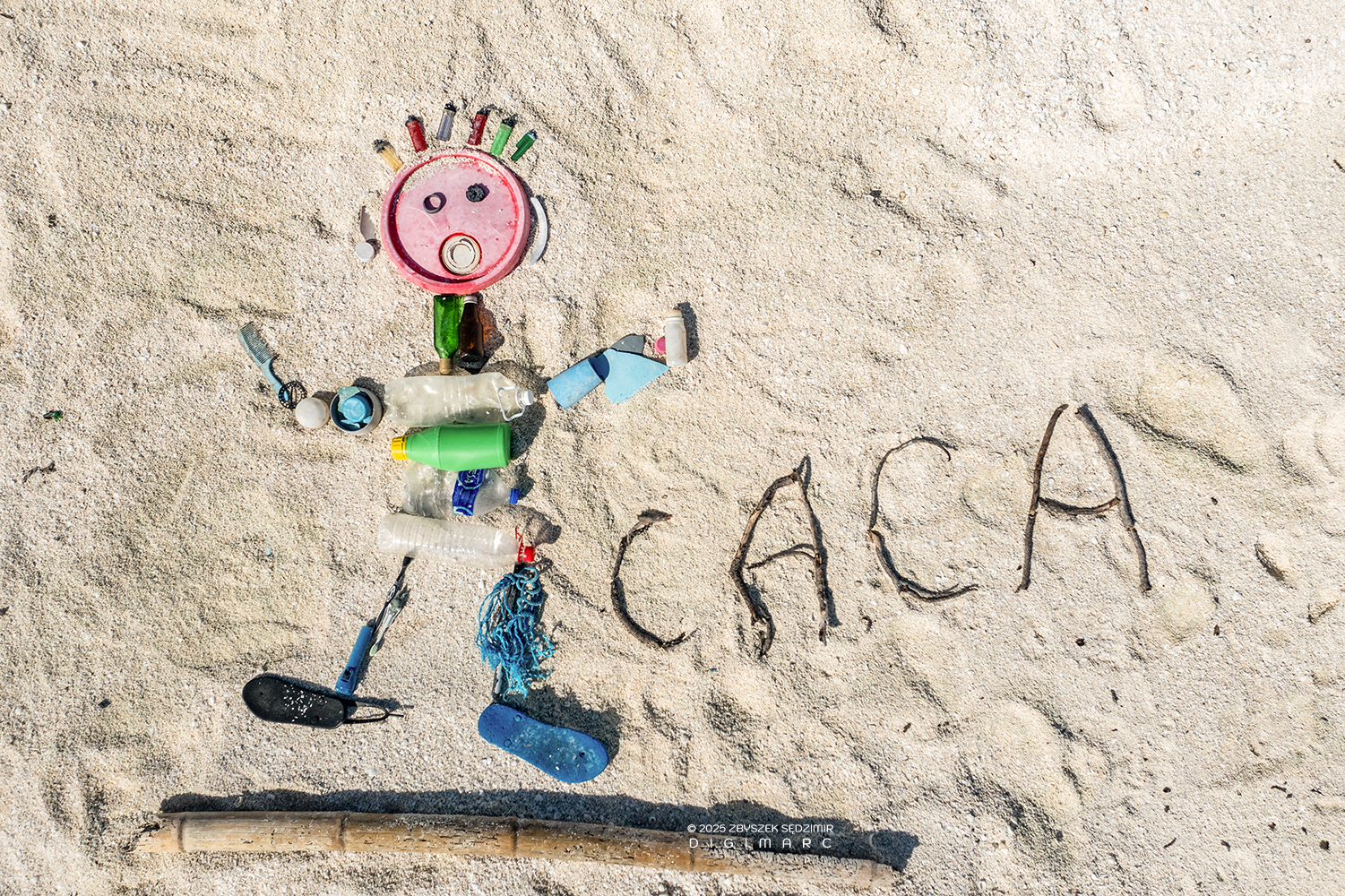
And as a farewell gesture, here’s a close-up of my “masterpiece,” so you can admire its fine ingredients—flip-flops, lighters, plastic bottles, glass vials, a toothbrush, and whatever else the ocean saw fit to throw in.
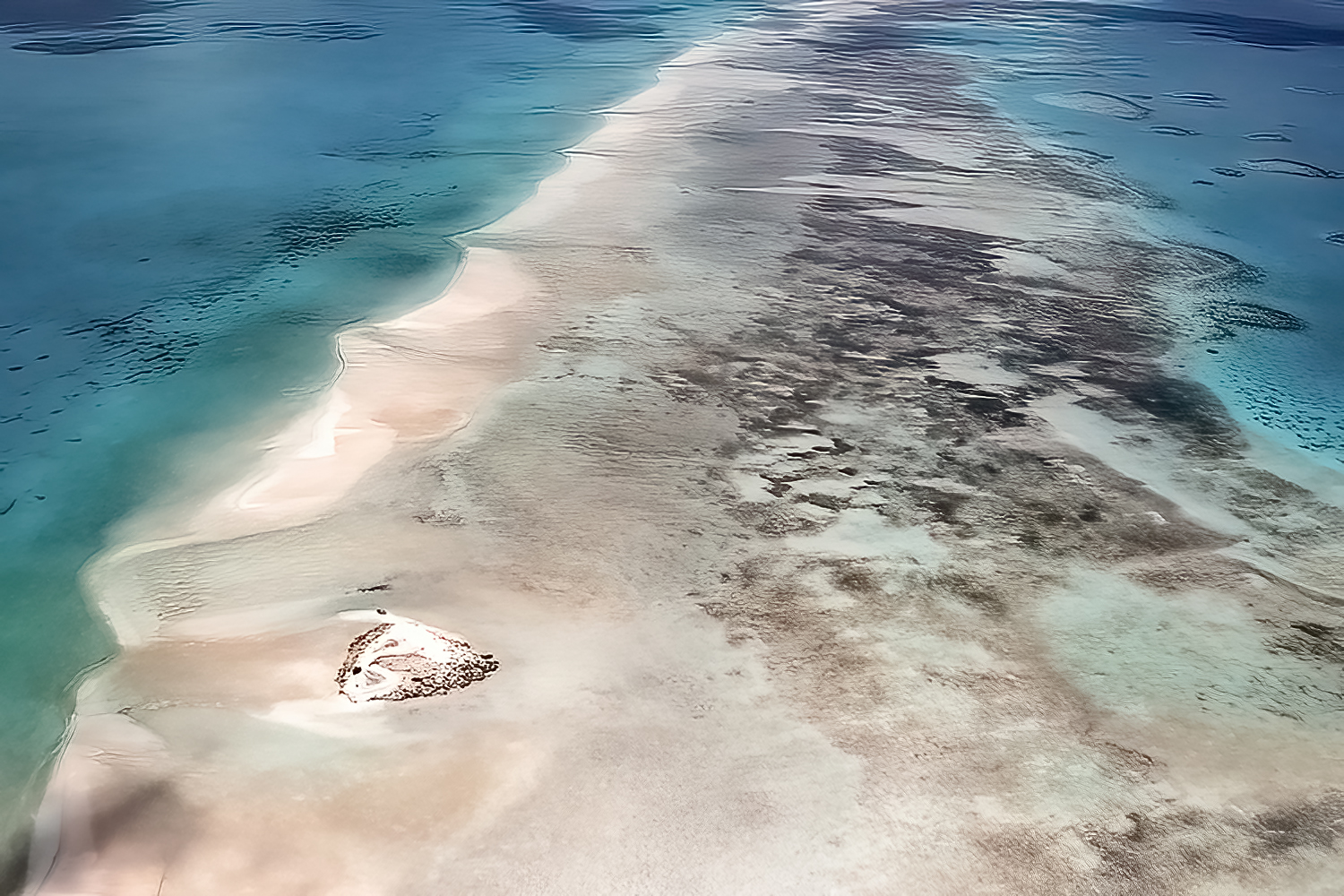
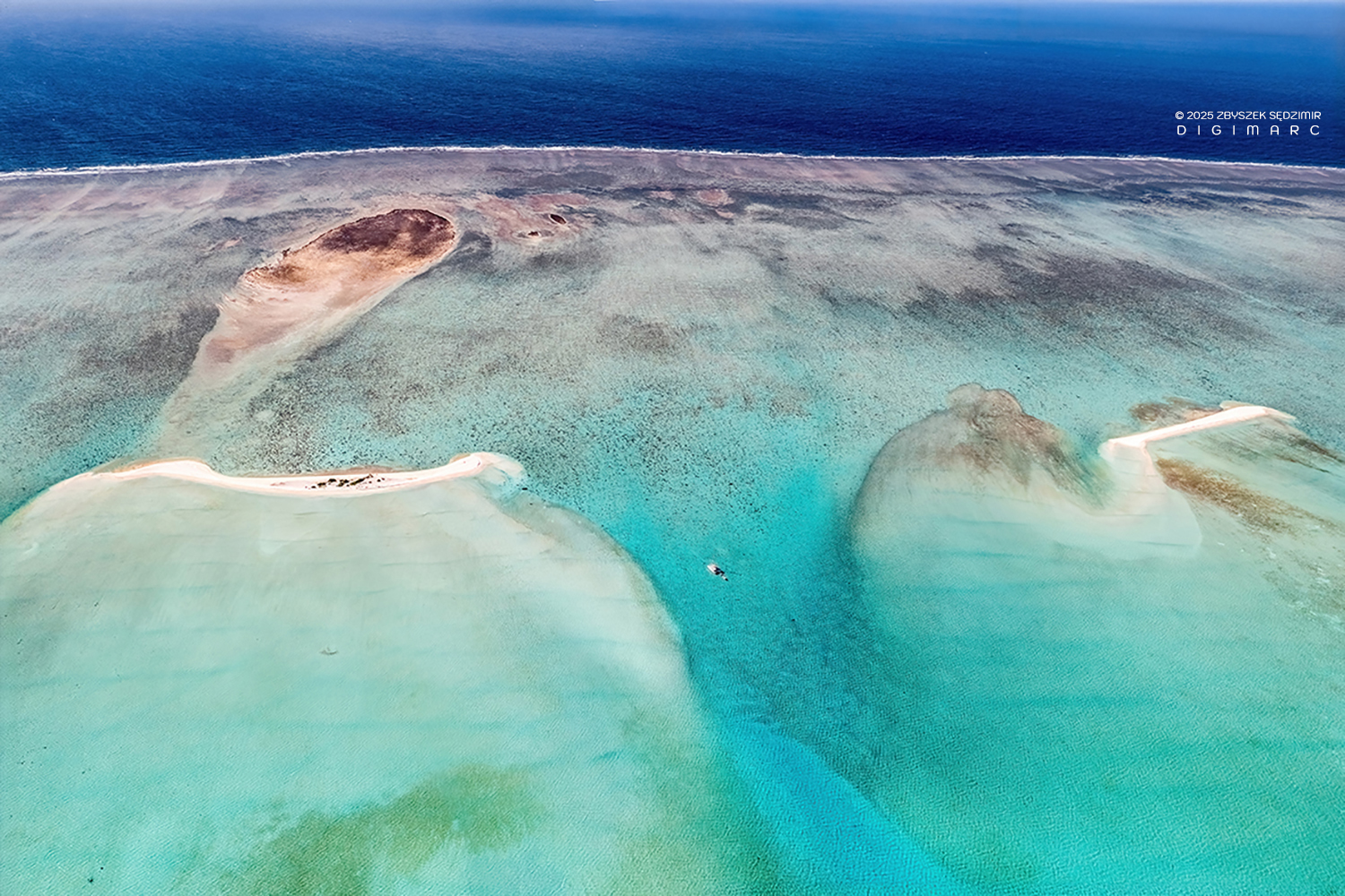
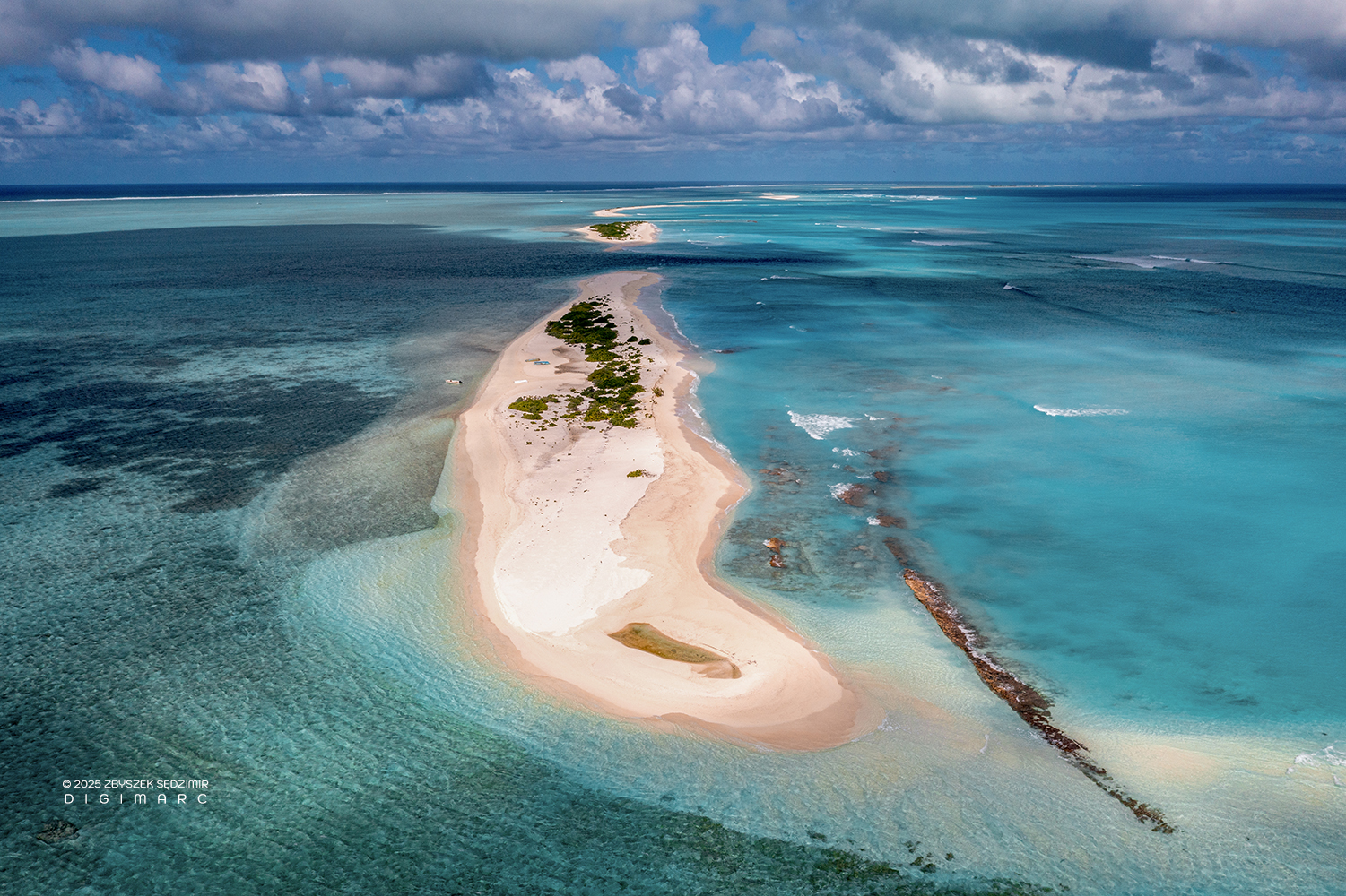
Tectec Islands
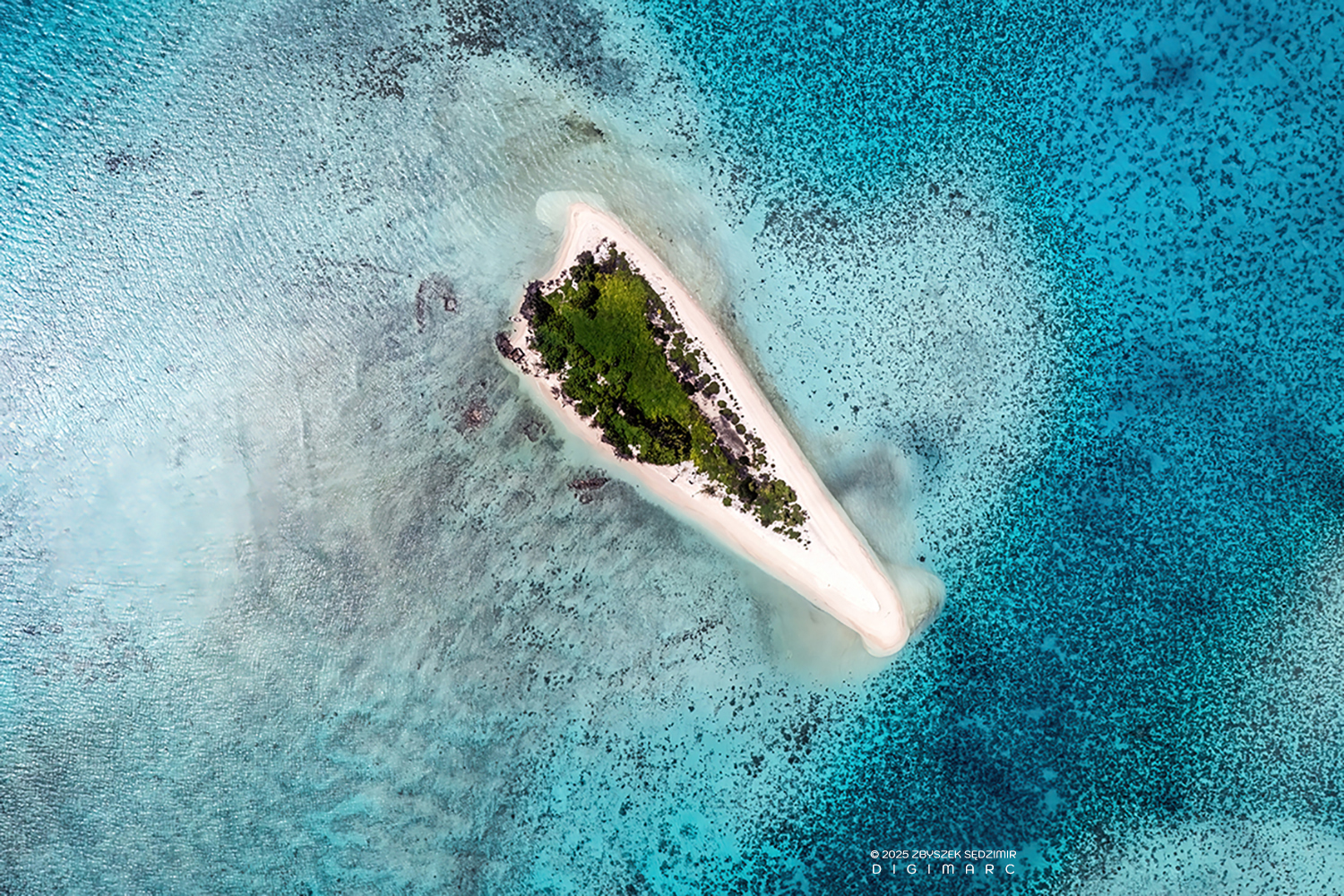
The Tectec Islands ain’t much more than a handful of sandy bumps, dressed up in a coat of seashells the folks around here call “tectec”. Seen from above, they look utterly lost in the vastness of the ocean.
In this picture, you’ll see not one, but three of the Tectec Islands — one shaped like a boomerang, and the other two curled up like a set of parentheses.
The vegetation on the Tectec Islands isn’t much — just enough to tempt the smaller birds like Noddies and Terns to drop by. And sure enough, just like on Paul Island and a dozen other places, there they sit, all neatly lined up and facing the same way, as if they knew something we didn’t.
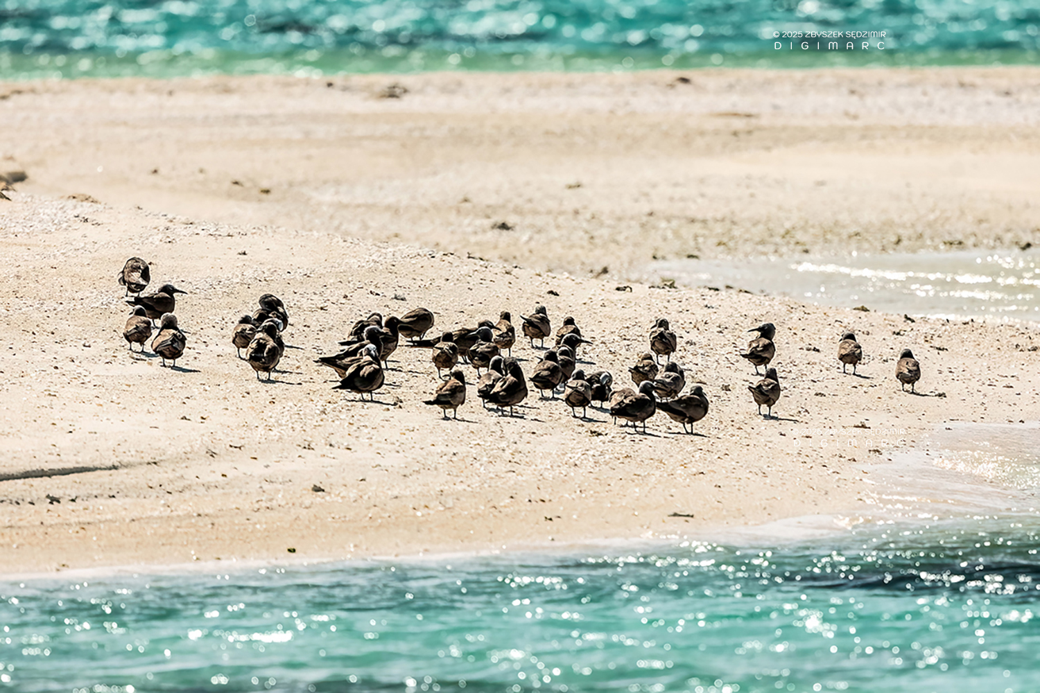
A group of Noddies strolling along the beach, looking like a bunch of holidaymakers .
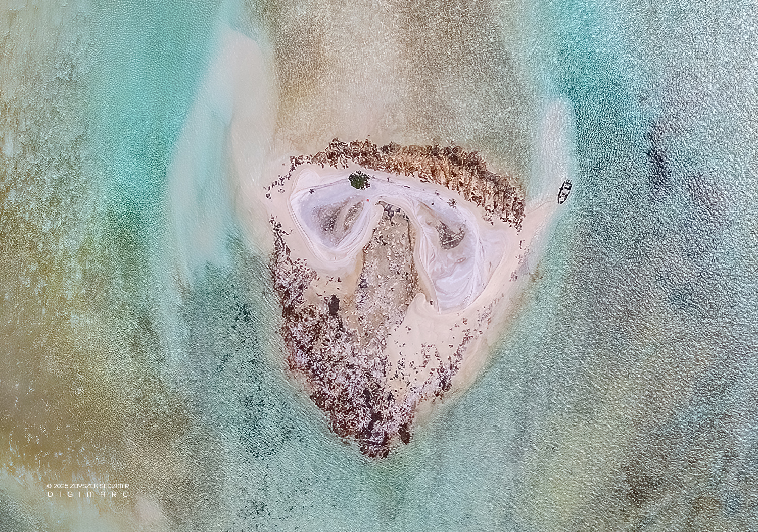
Much like Coral Island, the Tectec islets we stopped on were little more than drone runways—nothing fancy, just a patch of land to launch from and land on, all for the sake of capturing a breathtaking view of the archipelago. In this south-facing photo, you can spot one of those bracket-shaped Tectec islets on the right, and far off near the horizon, Chaloupe Island, with the long, lazy sprawl of Coco Island stretching out to its left.
Another Tectec islet, briefly visited and seen from above. Below, the lagoon reveals a mesmerizing display of colors, shifting with the tides and changing light. In the upper right, Courson Island stands resilient against the vast ocean, its distinctive “tail” stretching into the water like a natural breakwater.
Courson Island, as spied from Tectec Island through a 500mm telescope. The place boasts thicker greenery and a whole lot more birds, all of them looking like they own the place.
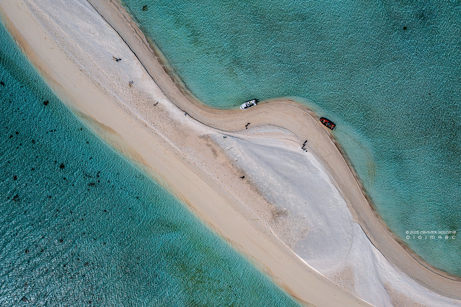
Drop down a little lower, and you’ll start noticing that the lagoon’s seabed isn’t the same on both sides—the western side (up top) and the eastern side (down below) each tell a different tale. And if you’ve got a keen eye, you might catch how the ends of Tectec look a little blurred—the southern tip to the left, the northern to the right—like a sketch an artist smudged with his thumb. That’s the handiwork of the wind, which blows mostly from the east or southeast in this part of the Indian Ocean, stirring up currents that, in turn, shift the sand as they please.
From this height, you can start picking out details on the surface of our Tectec islet. In the foreground, there’s the pirogue that brought us here. A little farther up, on the island itself, you can spot the umbrella we huddled under for shelter from the merciless sun. And then, of course, there’s something you could find on every single island in the archipelago, no matter how small—trash. To the left, a large wooden pallet lies on the beach—not exactly picturesque, but at least not an immediate threat to the environment. On the right, however, just above our pirogue, is something else entirely—the result of my growing frustration with the ever-present plastic pollution.
Collecting materials—mostly flip-flops—for my “work of art” took me less than ten minutes. Gathering whole objects is relatively easy, though tedious. But picking up shattered plastic from broken items is nearly impossible—not to mention microplastics, which are beyond reach and everywhere.
To conclude our visit to the Tectec islets, here’s one last aerial view toward the east. Seeing the mesmerizing beauty of the lagoon, with its abstract color combinations that could easily pass for a piece of modern art, it’s hard to understand why the Portuguese sailors of the early 16th century named the atoll “Cargados Carajos Baixos” (Cursed Shoals). However, reading the accounts of those who survived a major storm or a cyclone passage on the atoll quickly makes it clear. In January 1948, during the cyclone, Avocaire Island was submerged under two meters of water. Of the four fishermen who were there at the time, only one survived. Another reason for the name was undoubtedly the fact that the archipelago, devoid of any elevations or landmarks, was a perfect trap into which ships still fall to this day.
The South
Zwazo Posé Island

Our journey to Zwazo Posé Island began from South Island, where we set off in two pirogues heading north. Along the route, we passed several sizable islands, each striking in its own way. We noted them for exploration on the return leg, but our immediate destination remained Zwazo Posé. What does the name “Zwazo Posé” mean? In Mauritian Creole, zwazo means “bird” (a phonetic form of the French oiseau), while posé translates to “resting” or “settled.” So, “Zwazo Posé” can be understood as “resting bird.”
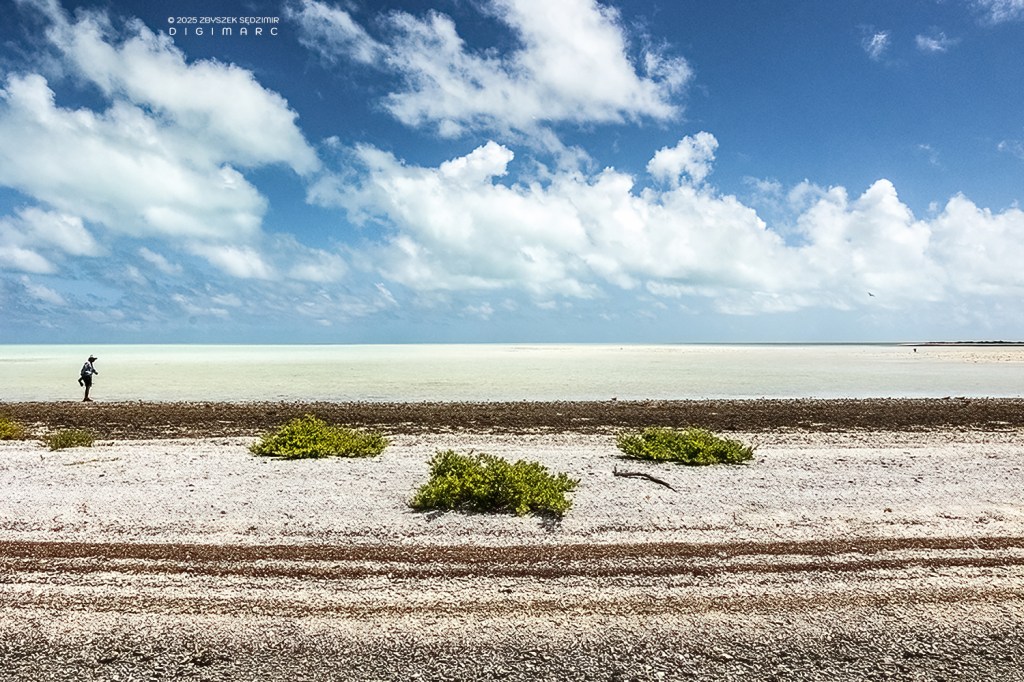
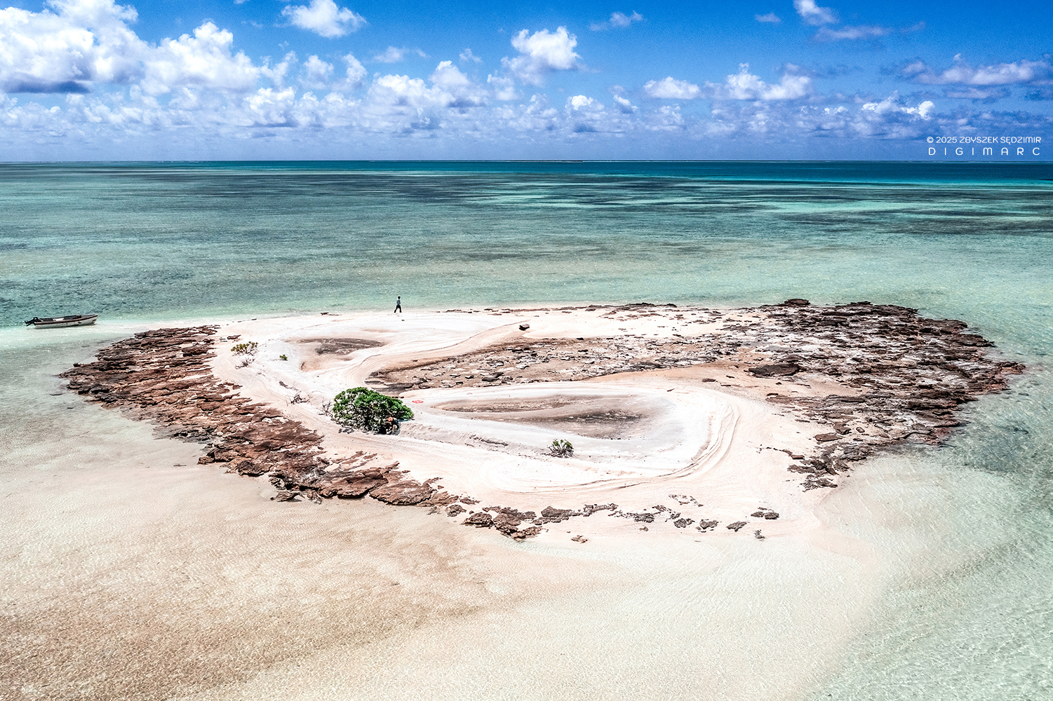
The island is almost entirely barren, with virtually no vegetation. It’s made up of fine sand the color of cantaloupe melon, creating a stunning contrast against the turquoise waters of the lagoon.
As on many other islands in the archipelago, the shift in perspective—from aerial to ground level—comes as a shock. Beneath our feet, the beautiful cantaloupe-colored sand is riddled with plastic, or more precisely, plastic debris.
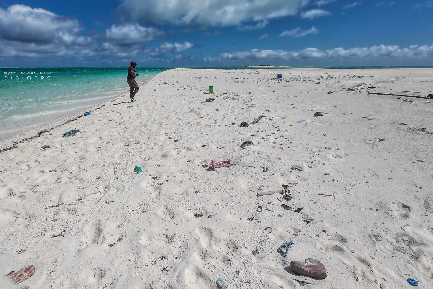
What truly terrifies me is the thought that Saint Brandon is not an exception, but the rule: on our blue planet, plastic is everywhere—and there’s more of it every day.
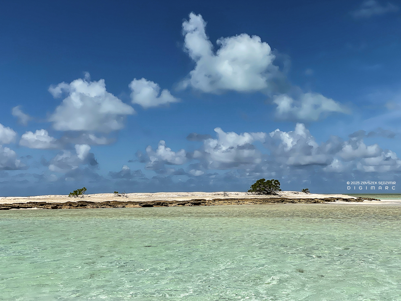
Chaloupe Island
Between Zwazo Posé Island and Coco Island lies one of the largest islands in the area: Chaloupe Island. It is completely barren, with nothing but sand stretching in every direction. Its color is similar to the cantaloupe-hued sand of Zwazo Posé, but even finer—like powder. Just south of Chaloupe Island, Coco Island comes into view.
From above, Chaloupe Island unfolds like a bleached sandscape beneath the western sky—vast, silent, and untouched. As we sailed from Zwazo Posé to Coco Island, we didn’t stop. The island drifted past our side, its powder-fine shores glowing in the sun.
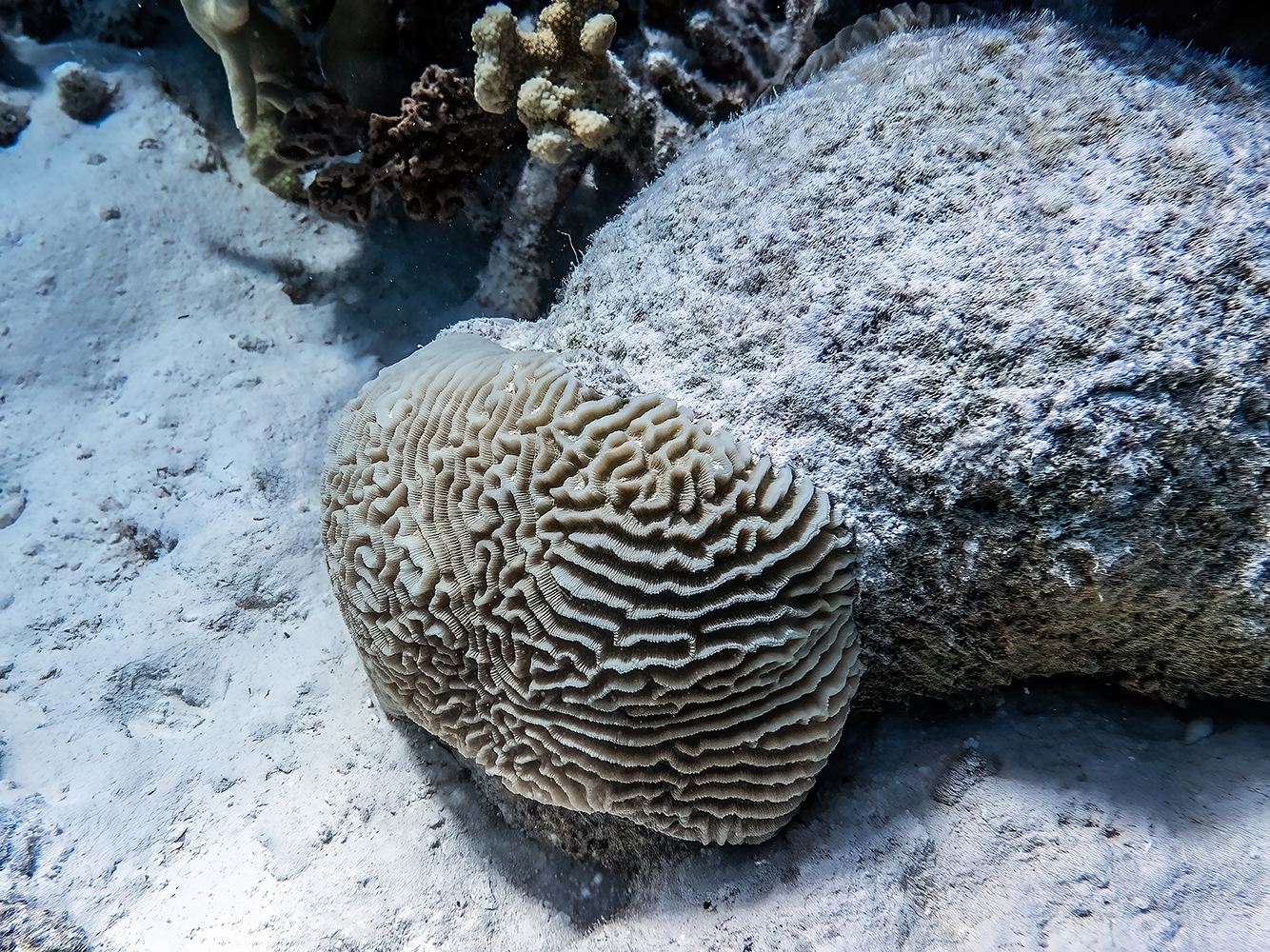
A massive brain coral, likely from the genus Platygyra, resting on the sandy reef between Chaloupe Island and Coco Island, its maze-like structure shaped by decades of slow growth.
Coco Island
In this shot, the northern tip of Coco Island is visible. Coco Island holds the record for length—stretching nearly 5 kilometers from its southern to northern end. It’s no surprise that it once hosted numerous utility buildings, including mechanical workshops and a dried fish production facility.
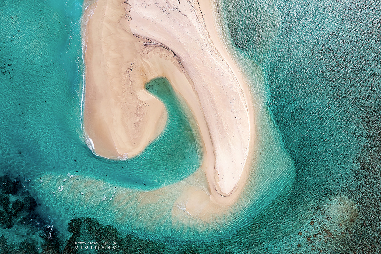
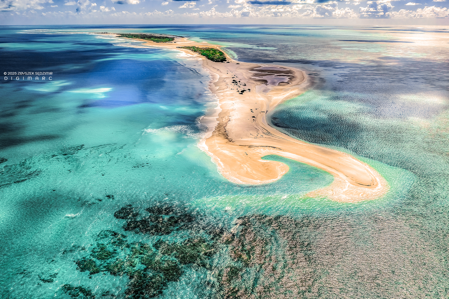
Souths end of CoCo Island. The interplay between reef, beach, and sea creates fluid lines and gradients — a natural abstraction shaped by currents and tides in one of Mauritius’ most isolated coral island groups.
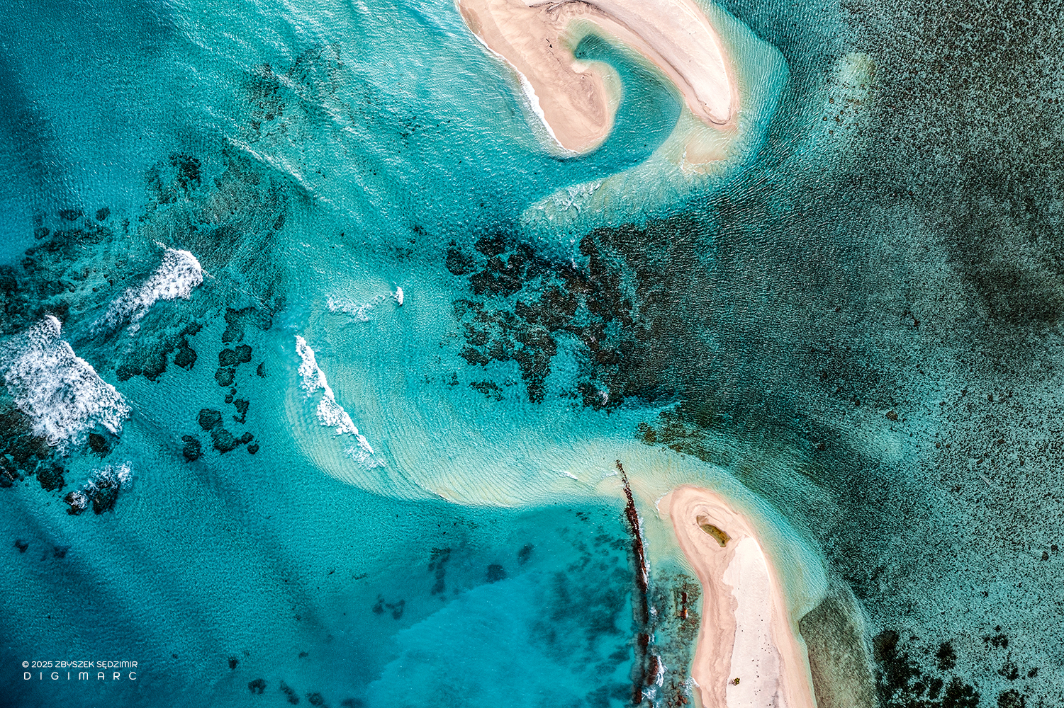
The southern end of Coco Island meets the northern tip of Little Dagorne Island – a mesmerising dialogue of sand, water, colours, and textures.

Sections of Coco Island are densely vegetated, within which survive the remains of old utility structures and a small altar, partially hidden and gradually overtaken by the natural environment.
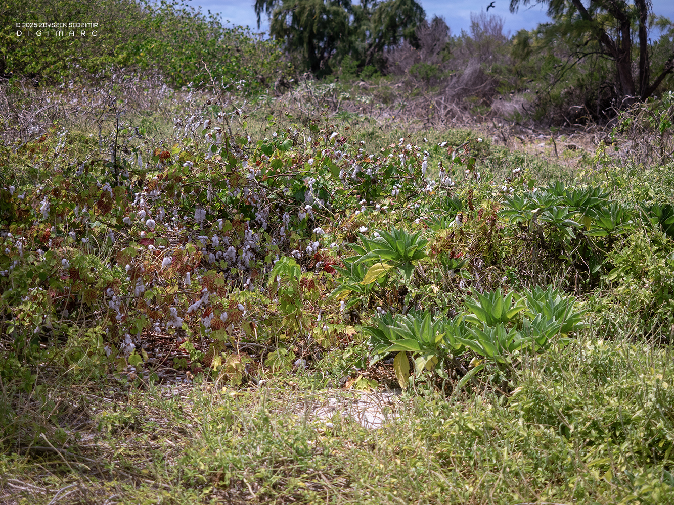
Cotton plants on Coco Island.
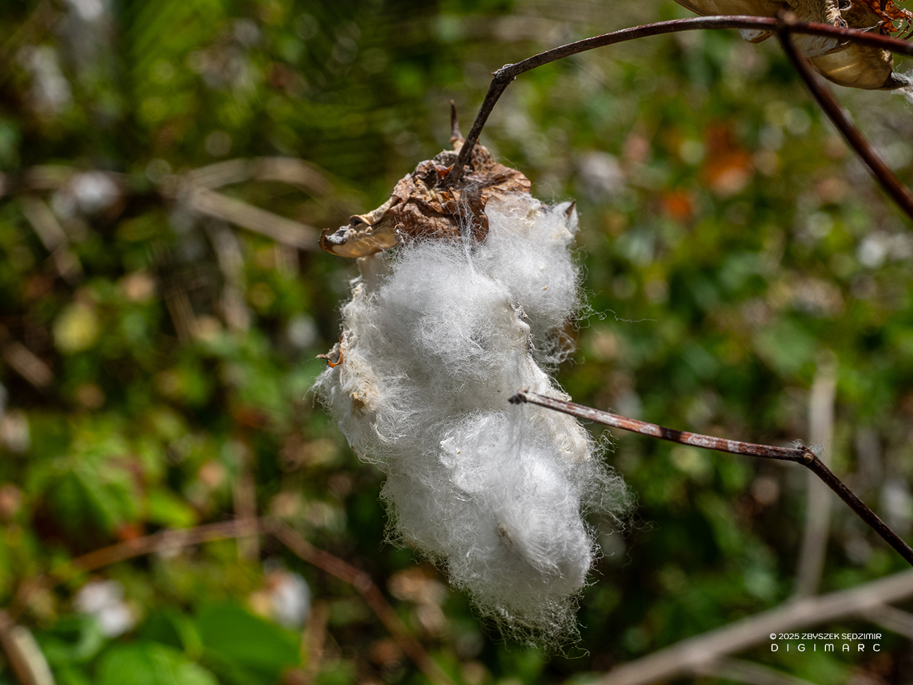
Cotton plants.
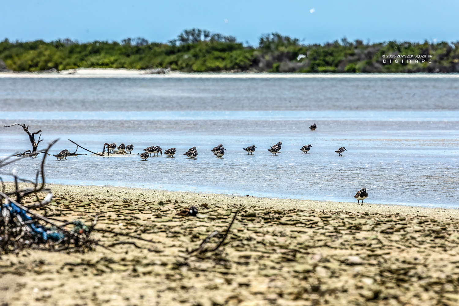
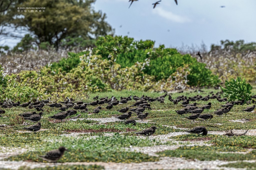
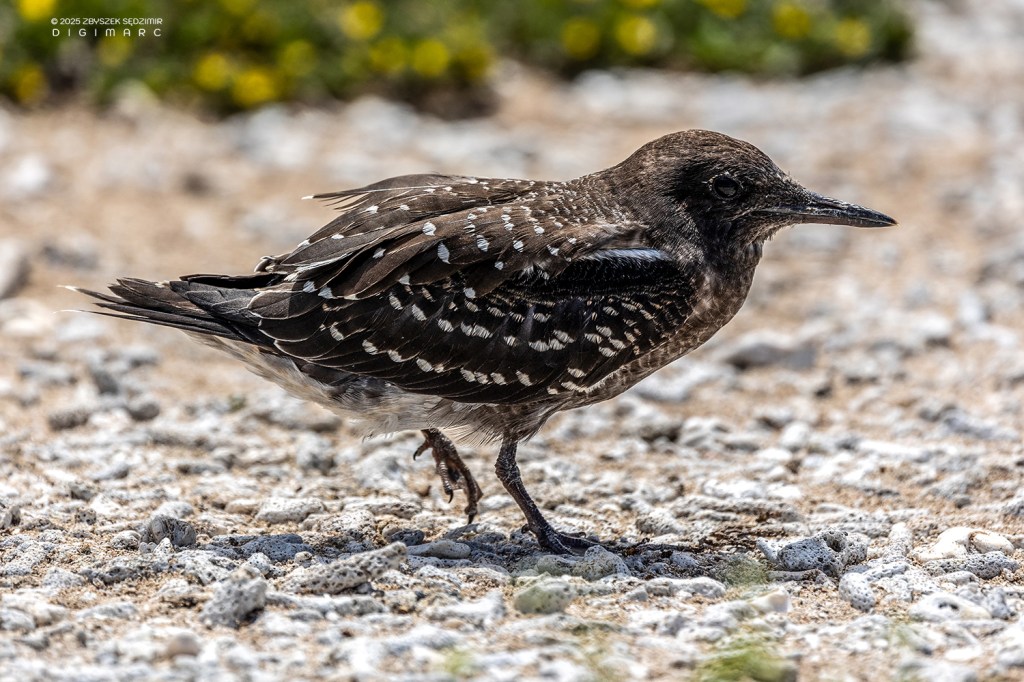
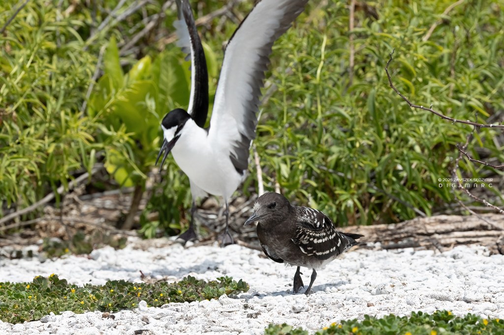
Coco Island is visited by many migratory shorebirds, such as the turnstones seen in this shot.
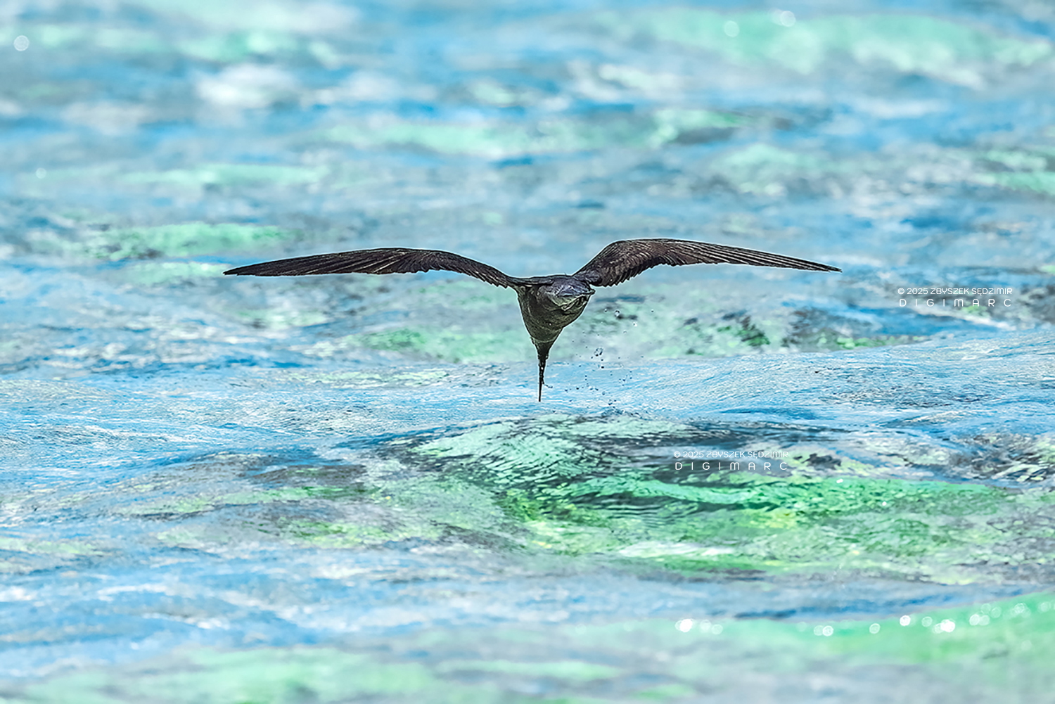
I spent some time photographing a noddy while it was hunting. I was struck by its absolute concentration — and then, in a split second, it struck, dipping its beak into the water. One can only hope the effort was not in vain.
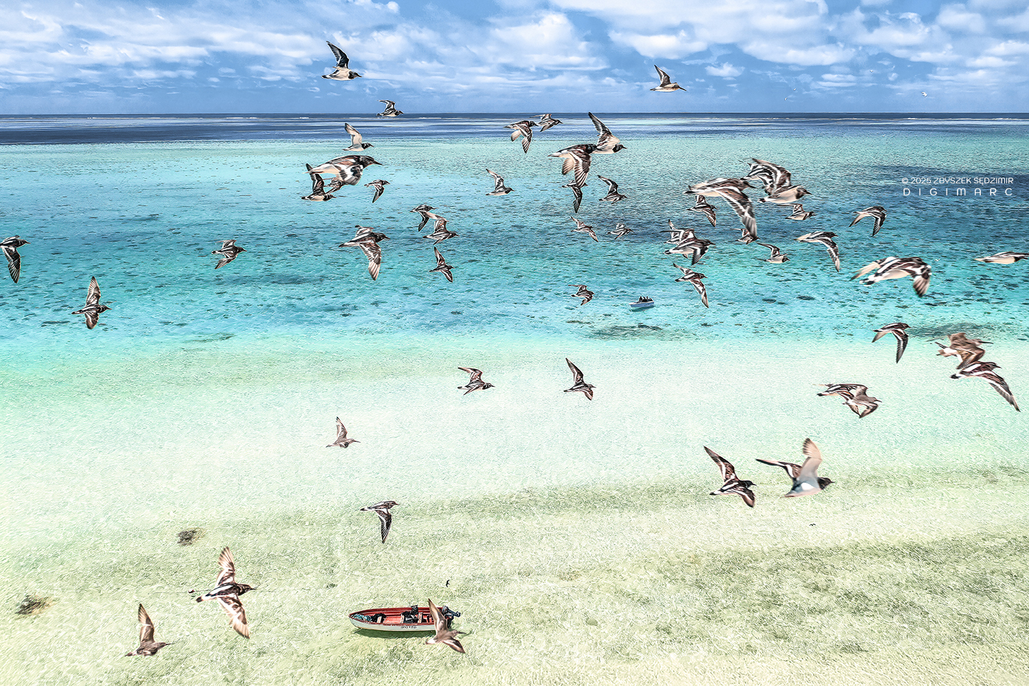
By sheer luck, a group of birds crossed the frame just as my drone was in position.

Surveying the shallow waters along Coco Island’s eastern beach in search of sea turtles, navigating above coral patches in the crystal-clear lagoon.
North end of CoCo Island.
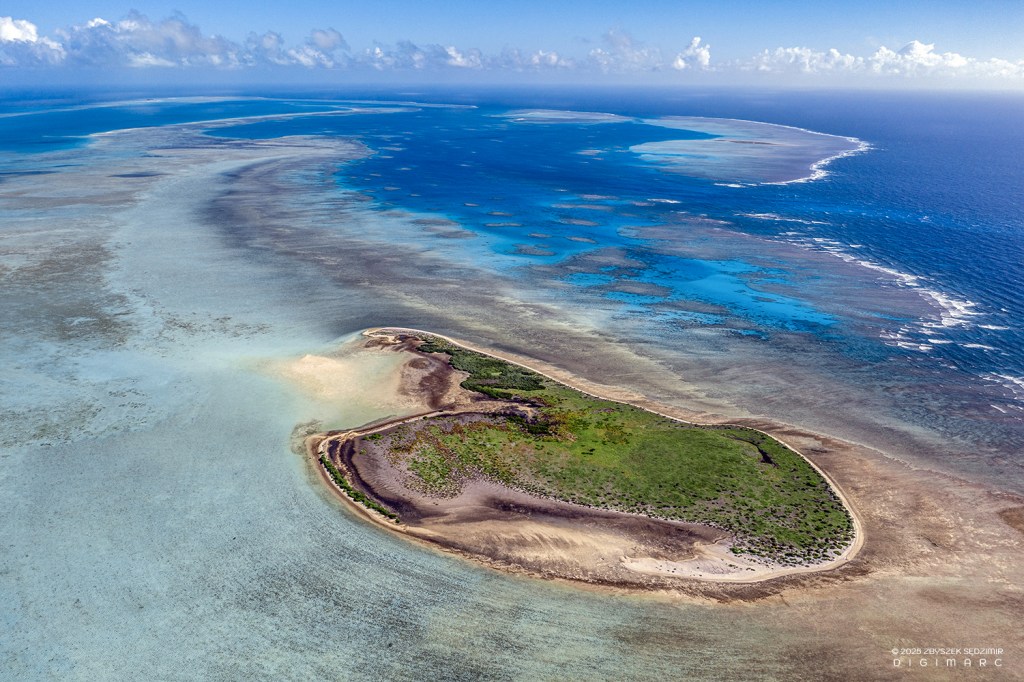
Petit Dagorne Island
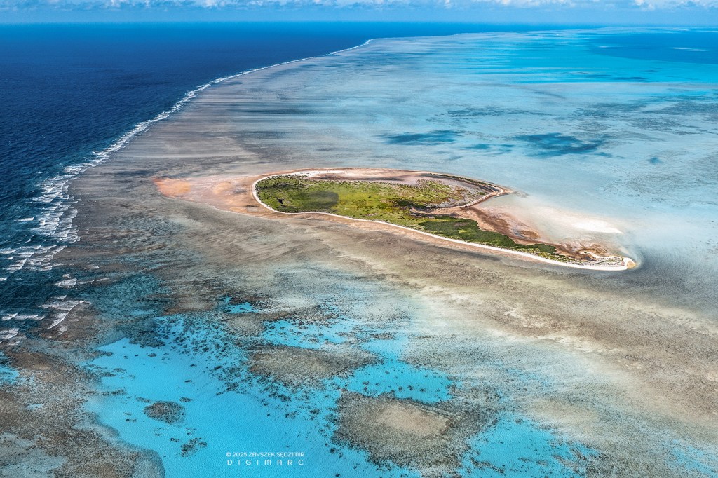
Petit Dagorne Island is a delicate sandbank of fine, pale sand, composed of crushed corals and shells and dotted with sparse vegetation. The view is directed toward the southern end of the archipelago; our pirogue appears on the left side of the image.
Fishermen from South Island use the island as a natural parking area for their boats. At the centre of the photograph stands an improvised “drone command centre”.
Another perspective of the “parking lot”. The guys put a lot of effort into decorating the pirogue.
Copyright © 2026 Zbyszek SĘDZIMIR, All rights reserved.
To be continued
