First Expedition
My good friend, Pierre Argo, painter and photographer, published a photo album in 2001 entitled “Mauritius from a bird’s eye view”. To create the album, he took about 1700 analogue pictures from helicopters and light aircraft with his analogue Nikon. Unfortunately, he was not able to take many pictures of the islands that belong to Mauritius but are further away (so-called “Outer Islands”). Last year (2023) he decided to create a similar album, this time with drones, which is cheaper and logistically easier than with helicopters and planes. The Outer Islands will be shown in much more detail in the album.
Pierre chose Saint Brandon as the first group of islands. I was delighted when Pierre offered me a part in the photo work. It was important to him to offer other perspectives in addition to aerial photography, such as underwater photography. I took responsibility for these.
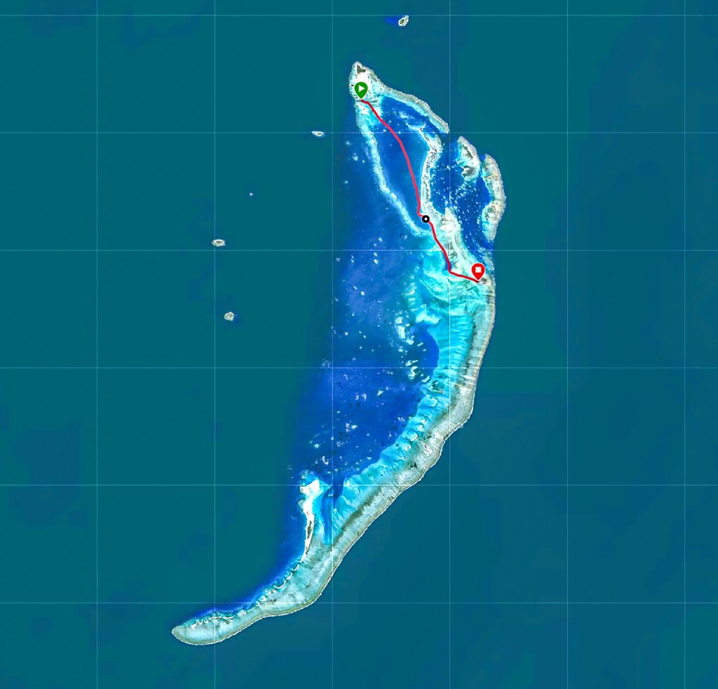
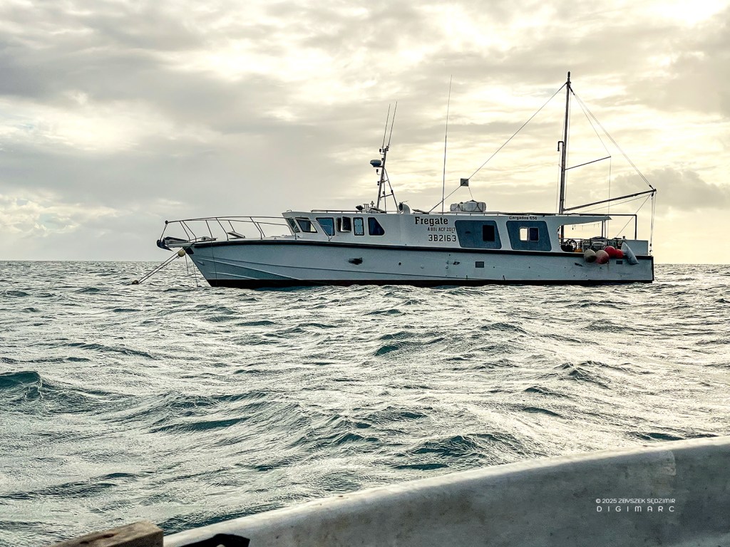
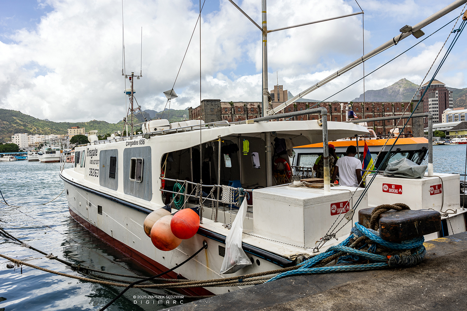
Our expedition lasted 11 days, with 30 hours spent traveling one way and 27 hours on the return journey. We sailed on the fishing cutter “Fregate” belonging to the Raphaël Fishing Company. We spent the night on the island of Raphaël, where the base of Raphaël Fishing Company is. The company provided us with a motor launch with a skipper who knew the entire archipelago very well. The skipper, Monsieur Boulon, took us every day to other islands, inhabited only by animals. These were: Tortue Island, Paul Island, Corail Island, Avocaire Island, Tet Tec Islands, Dagorne Island, Coco Island. The penultimate night was spent on the South Island.
Day 1
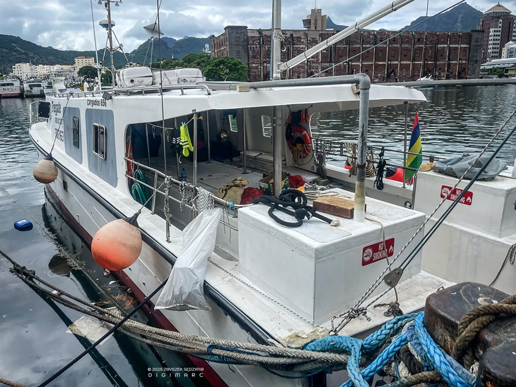
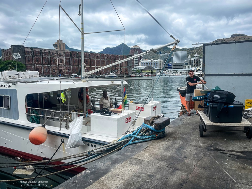
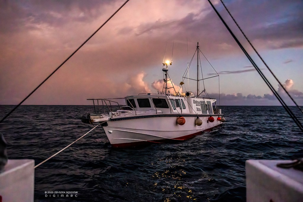
09.04.2024, 10:30 – The fishing boat “Fregate” on which we will spend the next 30 hours is waiting for us at the harbor in Port Louis.
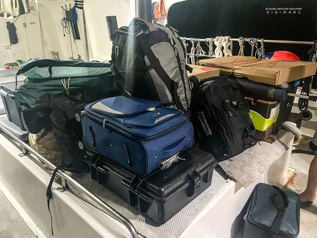
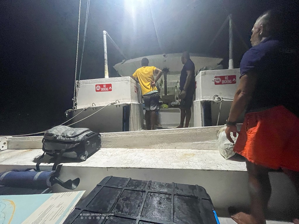
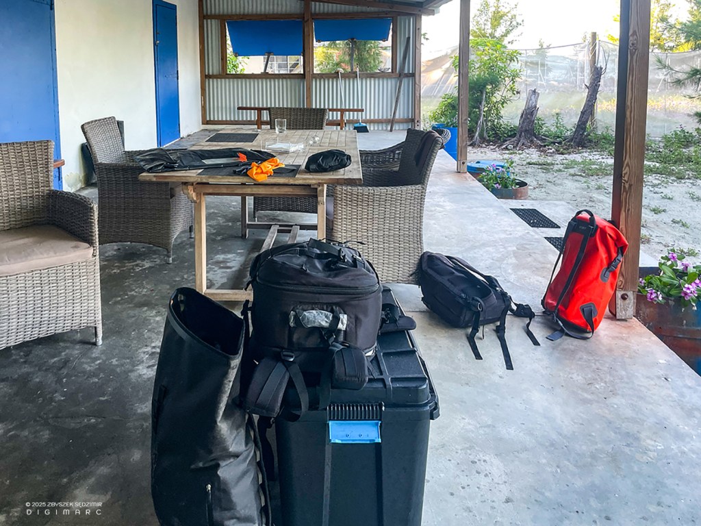
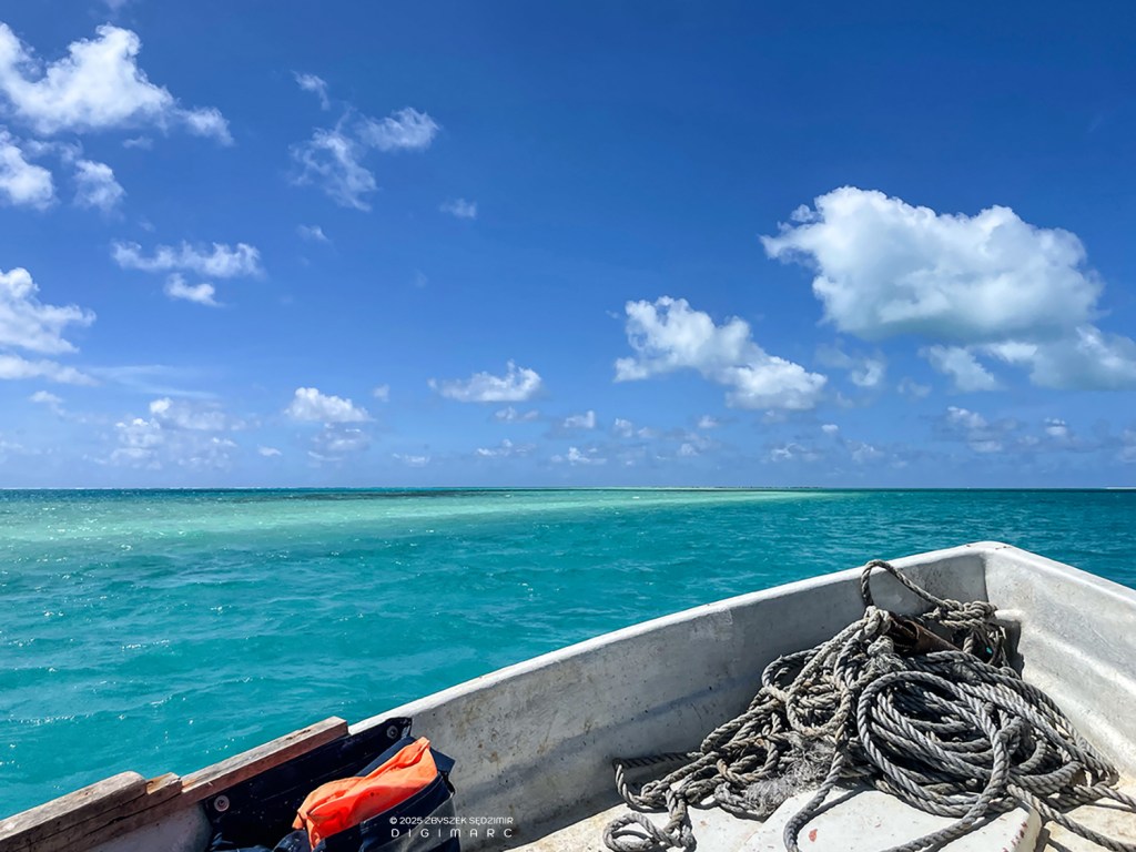
These boxes contain our equipment: drones, photo equipment, snorkeling equipment, power banks, solar panels, etc.
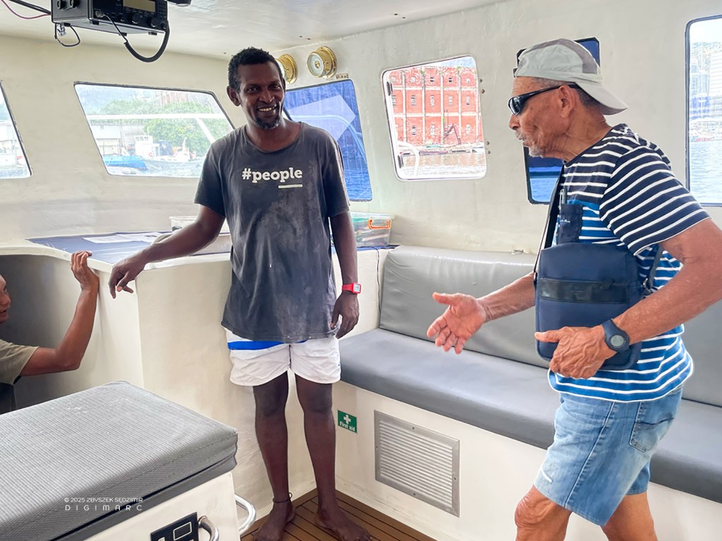
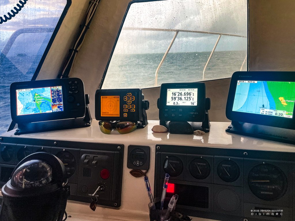
After our equipment is loaded and safely stowed, we visit the captain in the cockpit.
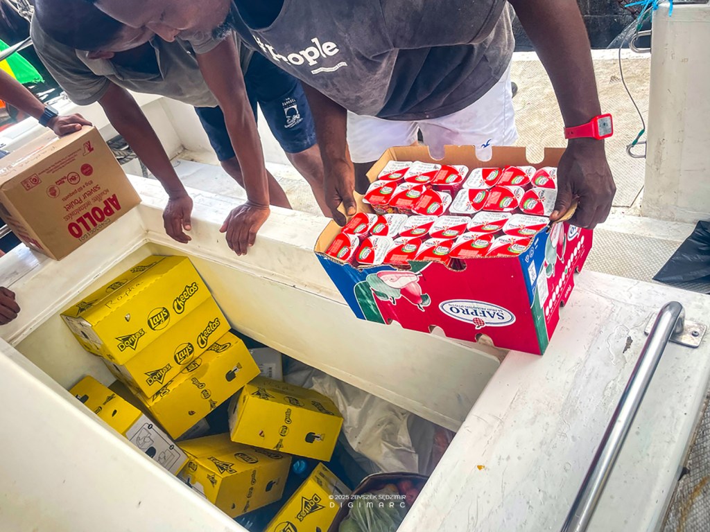
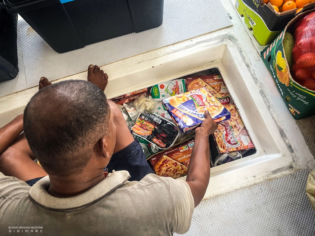
The fishing boat is transporting supplies for the entire crew and for fishermen working on Saint Brandon.
On the way back to Mauritius, up to 4 tons of fish are transported in four cold storage rooms.
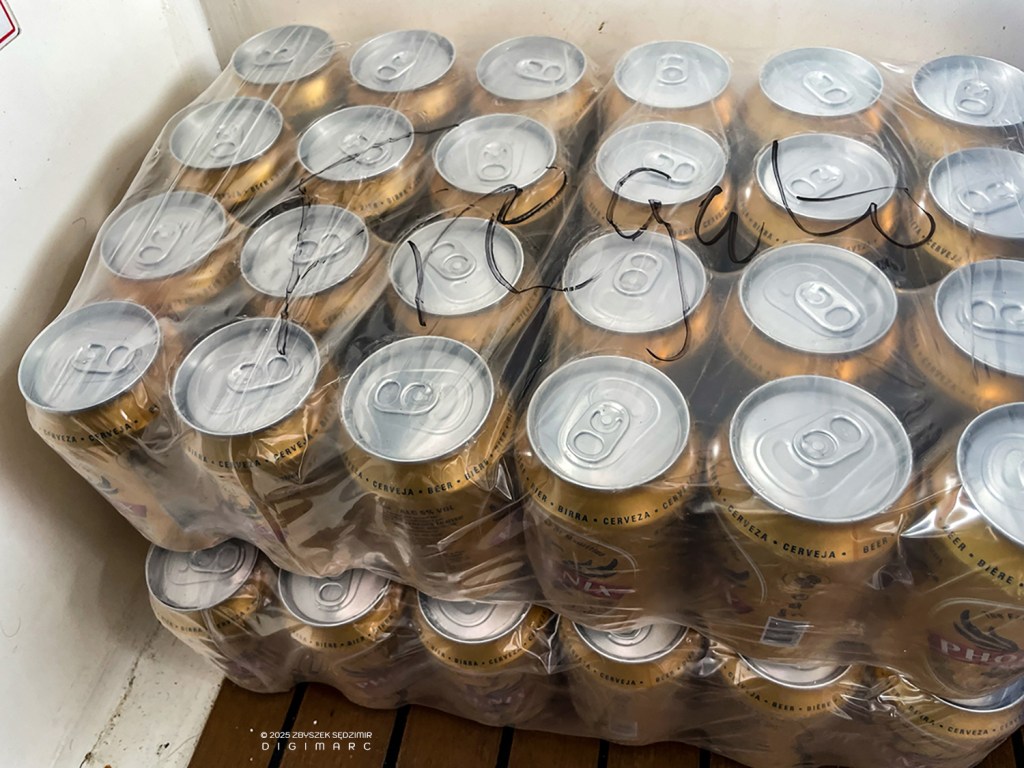
There will be no shortage of drinks 😉
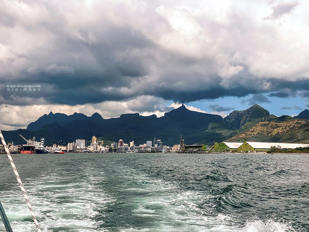
14.23 – The loading of the cutter is complete, it has been fully refueled (diesel for the crossing and gasoline for the dinghies and generators on site), and the floating border control post has checked our passports. We can set off, and soon we will leave Port Louis and Mauritius behind us.
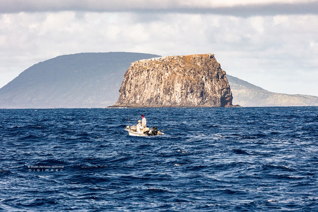
15 kilometers away from Mauritius rises Pigeon Rock. In the background is Round Island, which is a nature reserve.
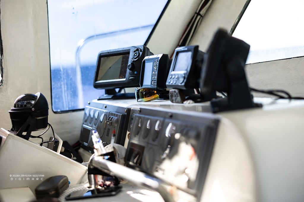
The navigation instruments in the cockpit of the “Fregate” allow for safe travel even in challenging weather conditions and at night.
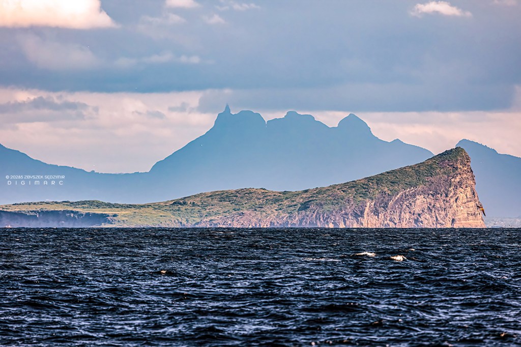
An unusual perspective of Gunner’s Quoin Island. In the background, the Moka Range mountains can be seen with the peak of Peter Both.
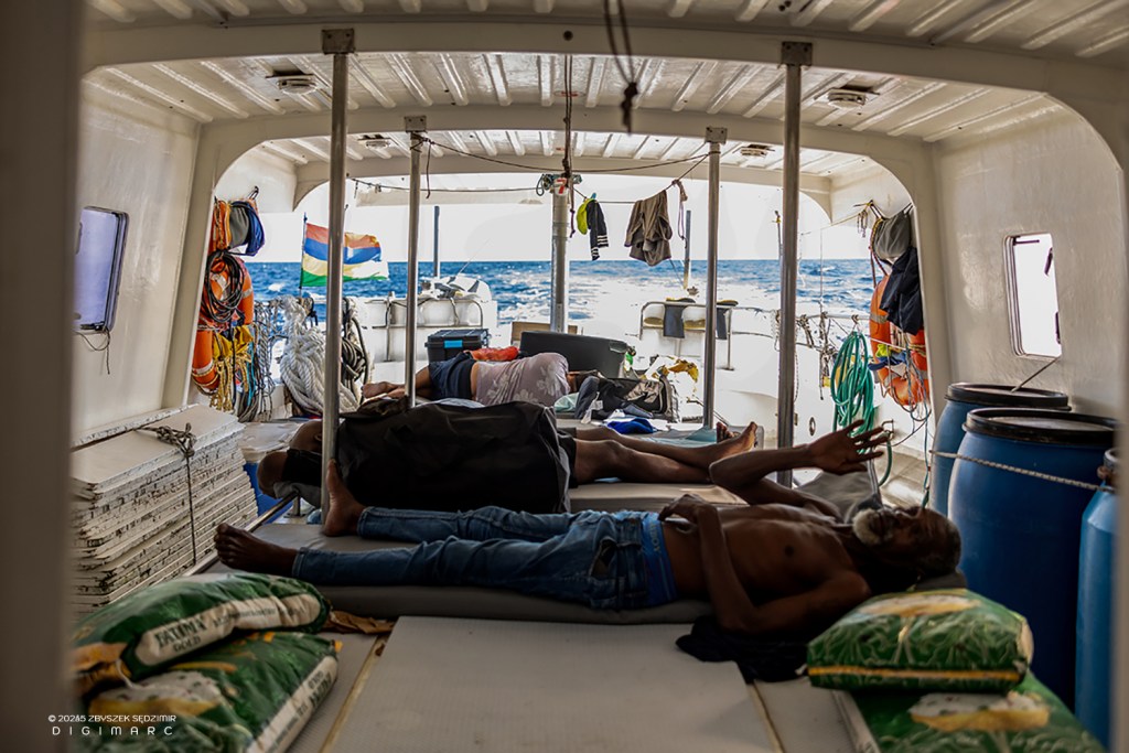
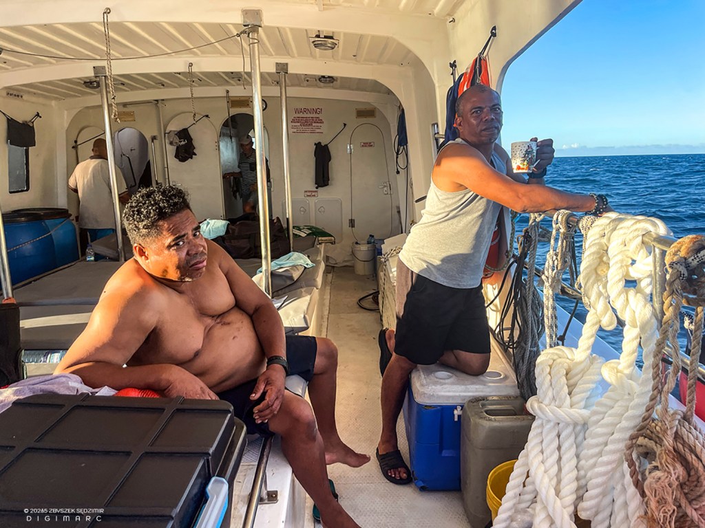
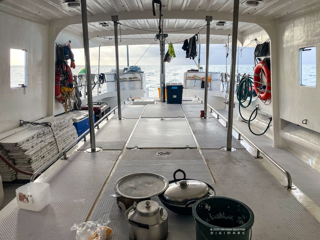
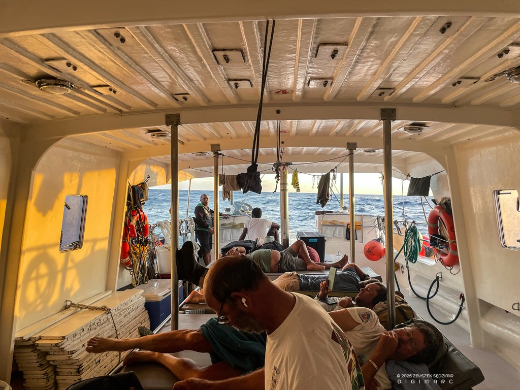
For sleeping, there are 3 cabins for 11 people. In warm weather, many prefer to sleep on the deck.
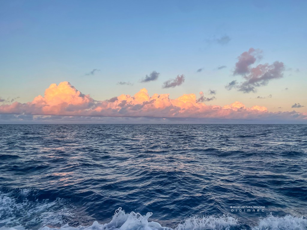
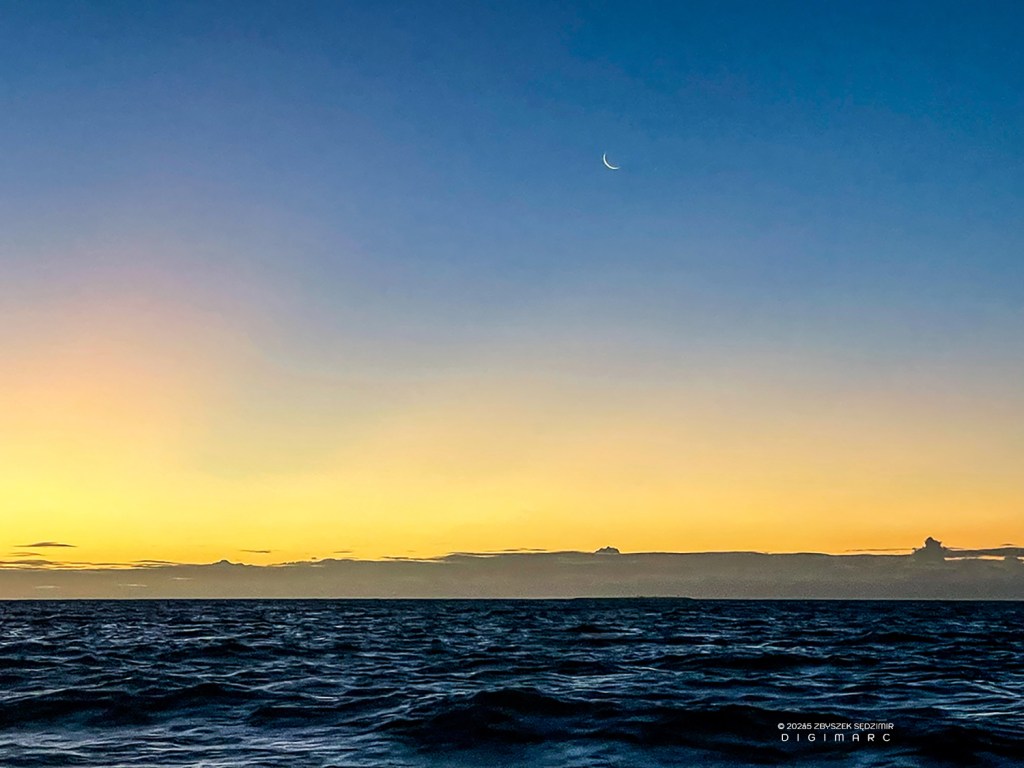
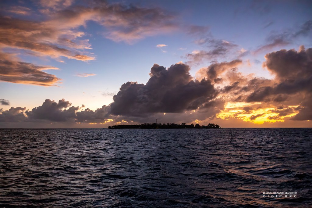
17.56 – The sun will set soon.
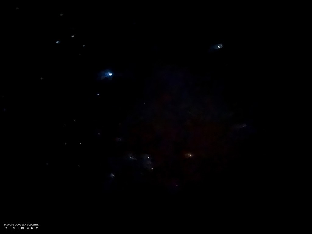
21.34 – The night is so clear and the light pollution so low that I managed to take a photo of Orion and Sirius with my iPhone.
Day 2

10.04.2024, 06.18 – A new day is dawning. Sunrise in the middle of the ocean.
16.49 – After ten and a half hours of travel without any significant incidents, we arrived at the southern end of the archipelago: South Island. We are not stopping, just continuing our journey towards Raphaël Island.
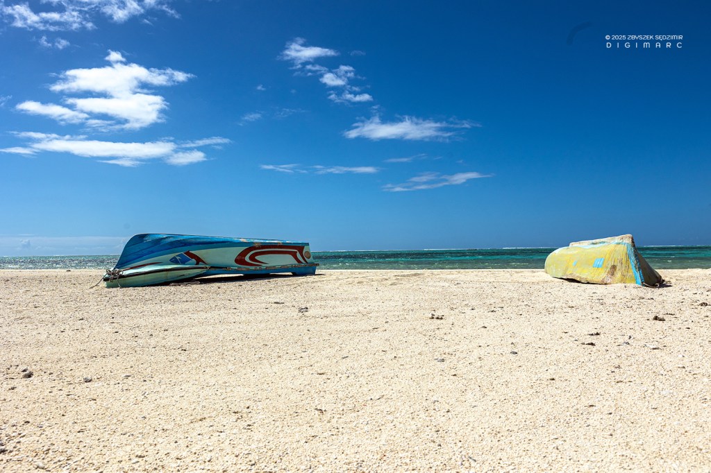
Not good for the environment: ships that have run aground on the southern coral reef.
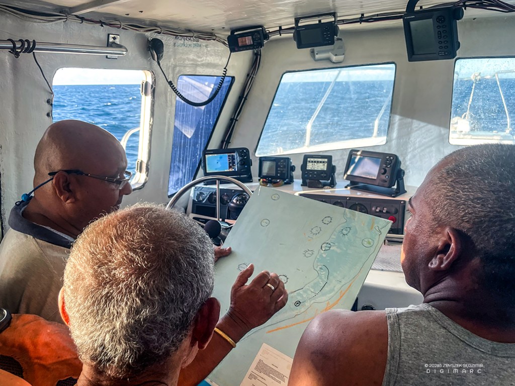
Short meeting in the cockpit. The captain tells us which of the archipelago’s islands, in his opinion, must be seen.
17.21 – We still have almost two hours of travel until we reach our destination. Not all of our travel companions have endured the journey well.
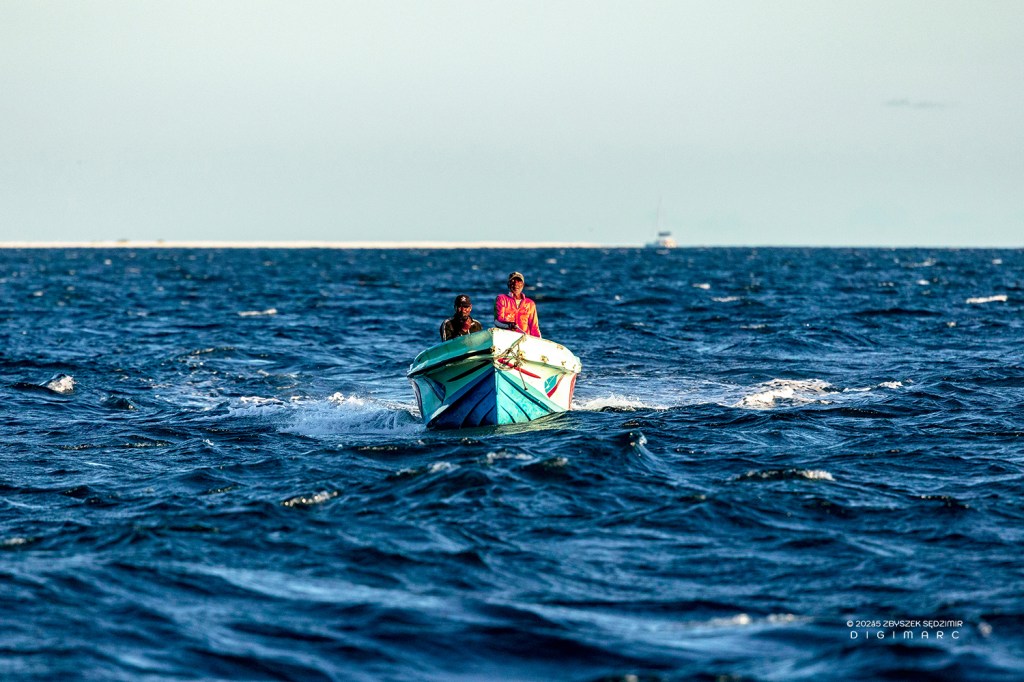
Encounter on the open sea: two fishermen catch up with us in a boat.
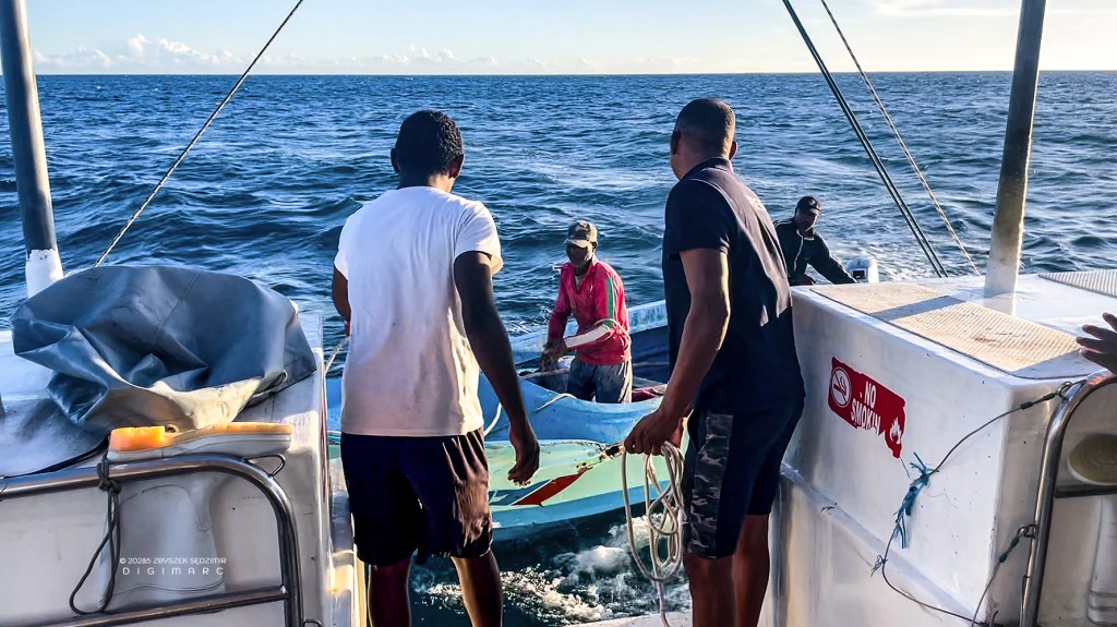
They moor to the “Fregate”.
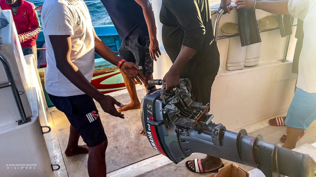
It turns out they came to pick up a boat engine that we are carrying for them.
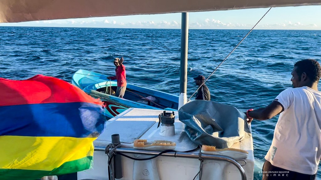
As quickly as they arrived, they sail back to the South Island.
18.20 – Just before arrival. A beautiful sunset.
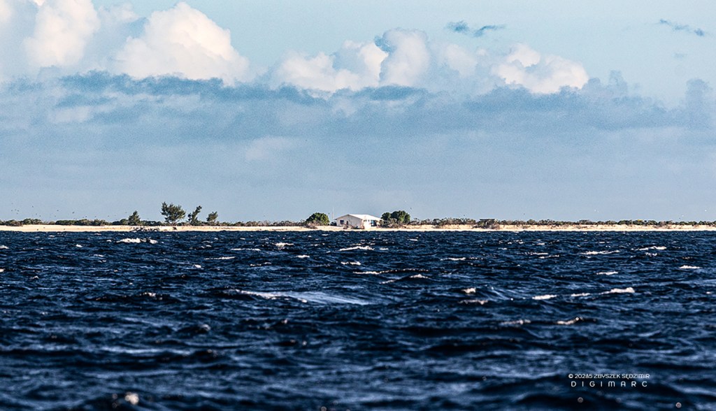
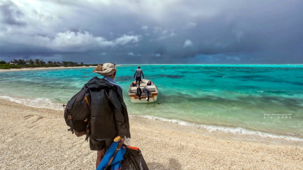
19.27 – Finally we arrived at Raphael Island. Our equipment is being brought up onto the deck first…
…and then loaded onto a dinghy. This is necessary because the water around the island is too shallow for the cutter to get closer.
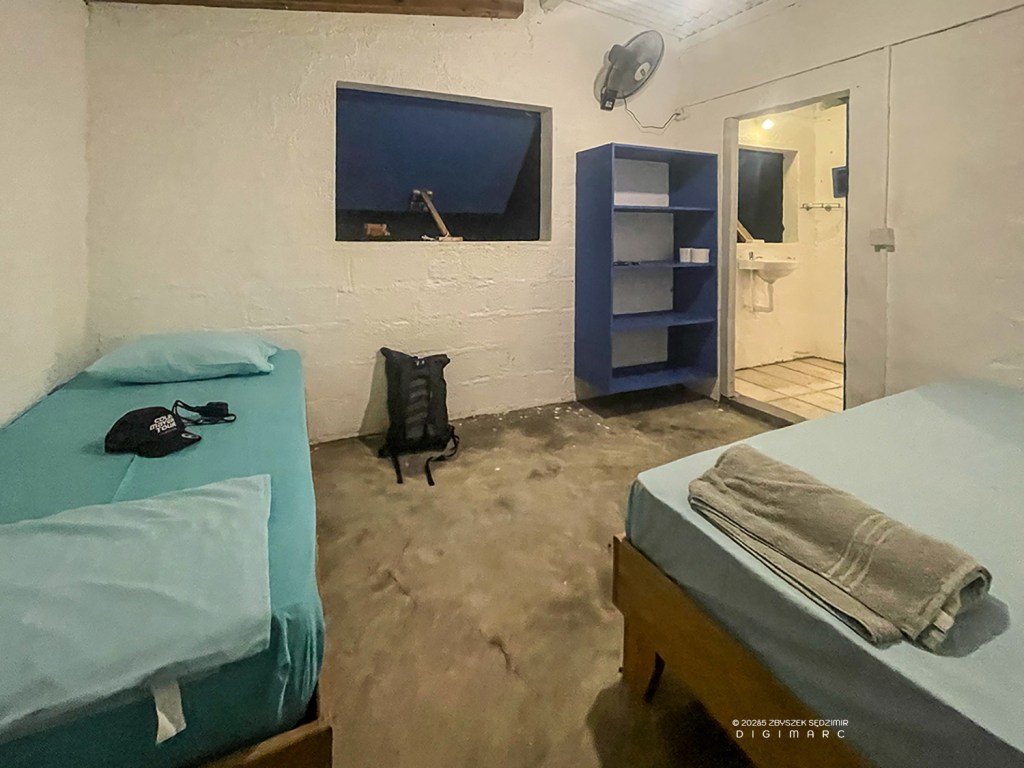
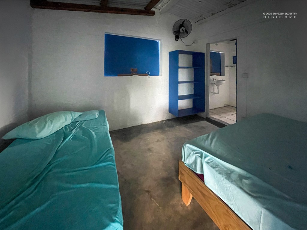
That is our simple accommodation…
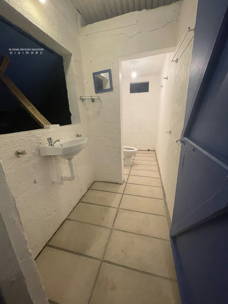
…even with a bathroom..
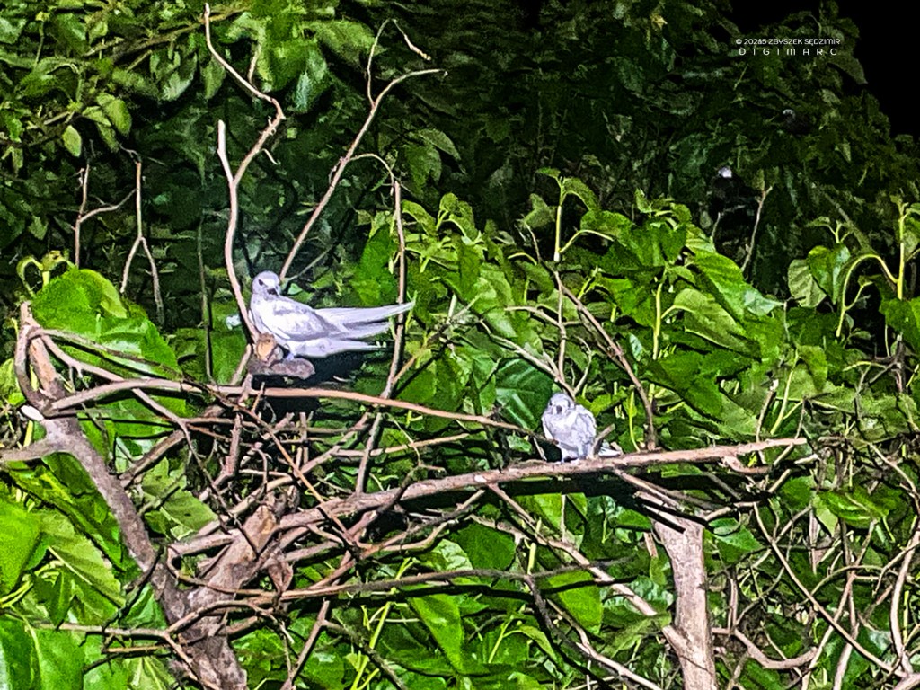
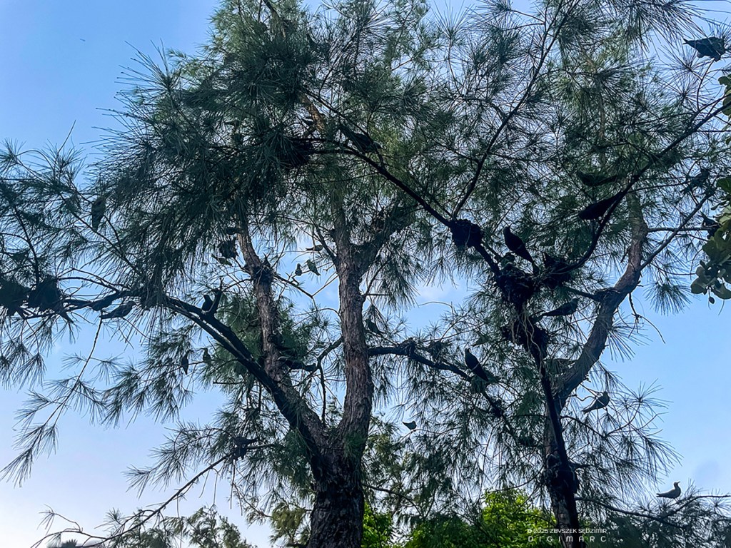
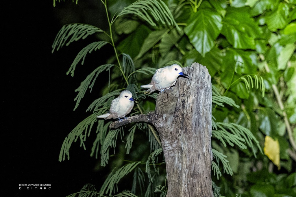
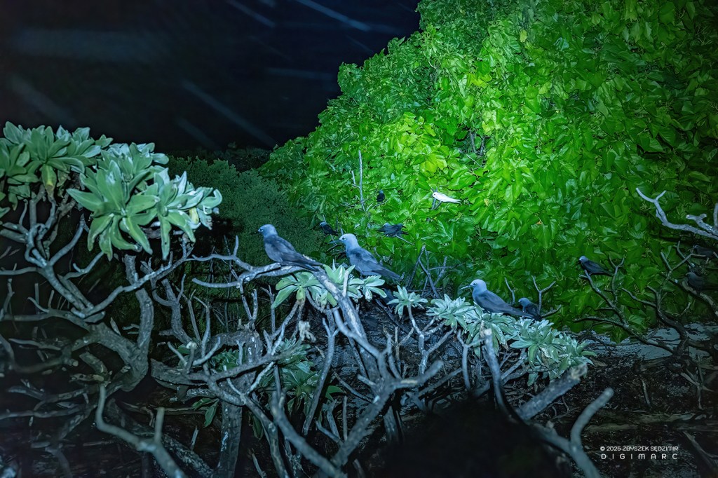
21.12 – Curious, I went outside with my flashlight and saw birds everywhere in the trees that weren’t afraid of me.
Day 3
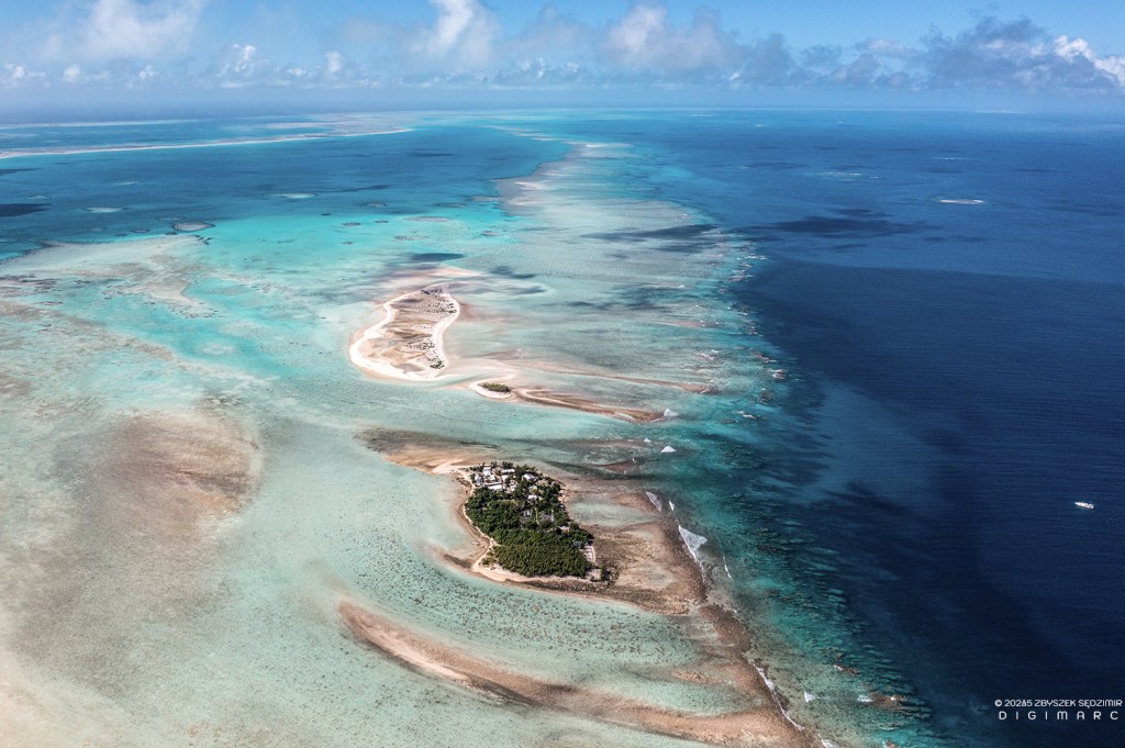
11.04.2024, 09.26 – The third day of our trip. Raphael Island, seen from the air, seems to be completely lost. On the far right you can see the fishing boat we arrived on the previous evening.
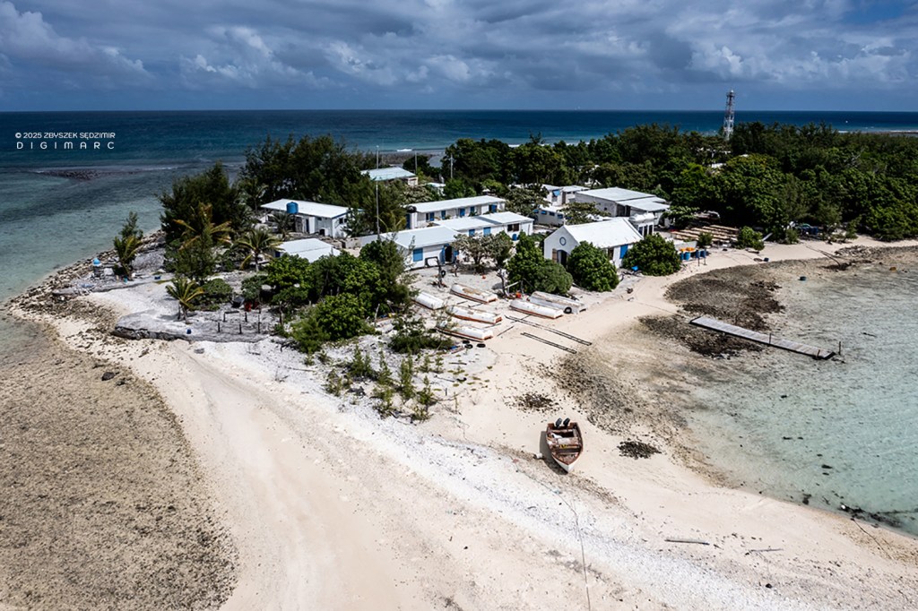
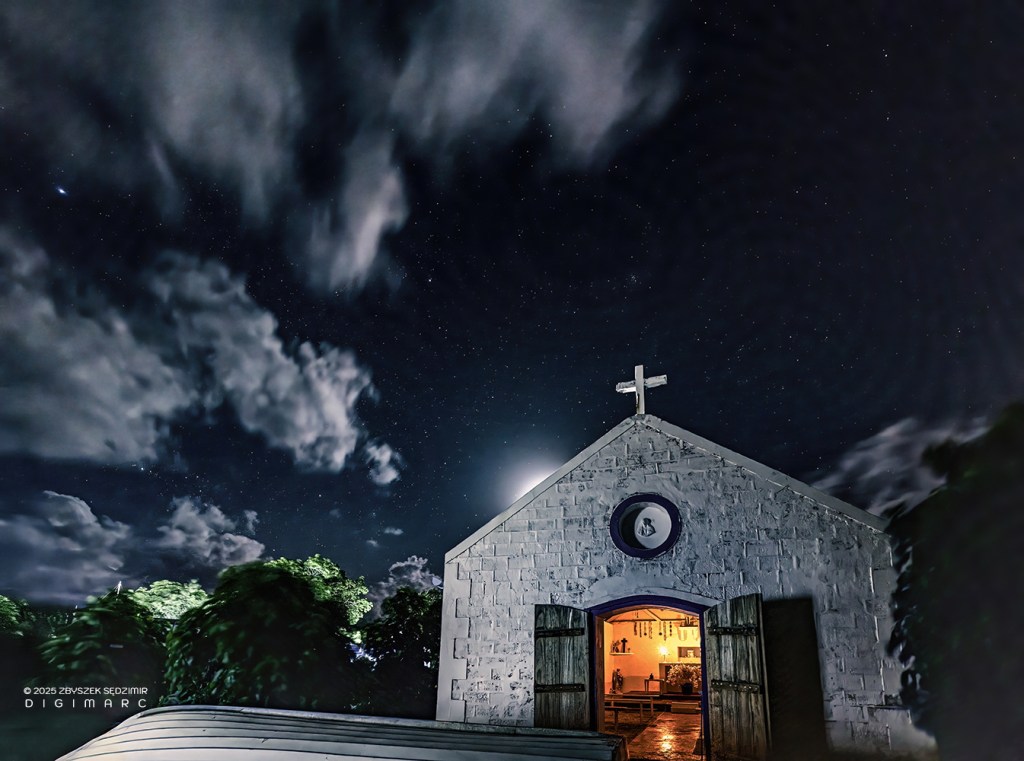
The island seen from a different perspective. In the first row you can see the St. Louis Chapel.
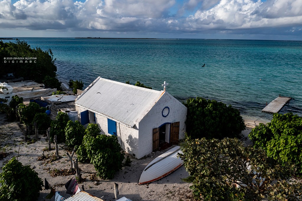
The Saint Louis Chapel seen from outside…
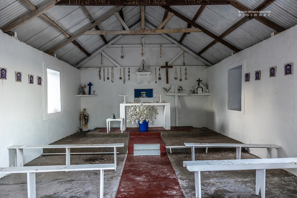
…and from the inside.
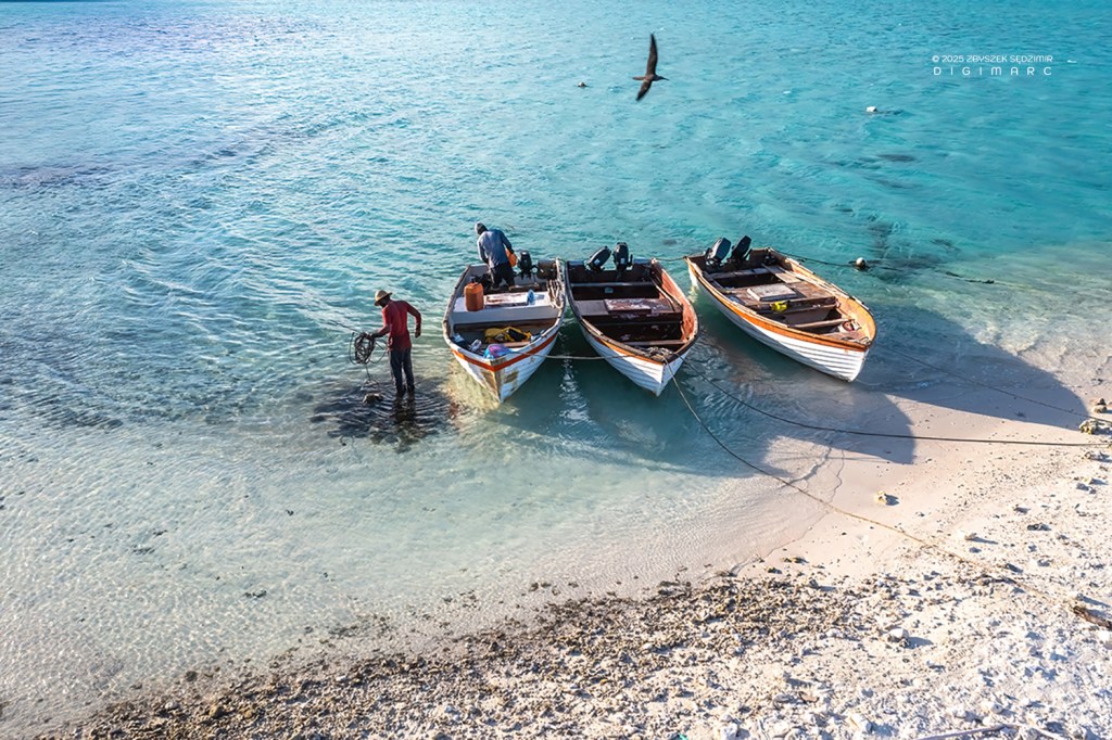
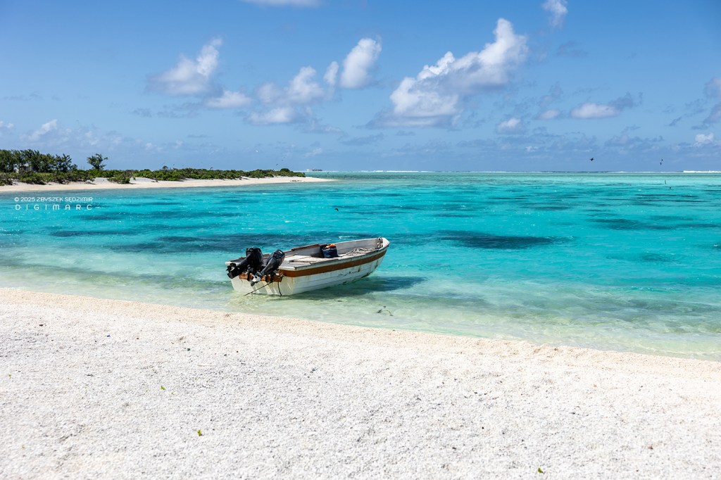
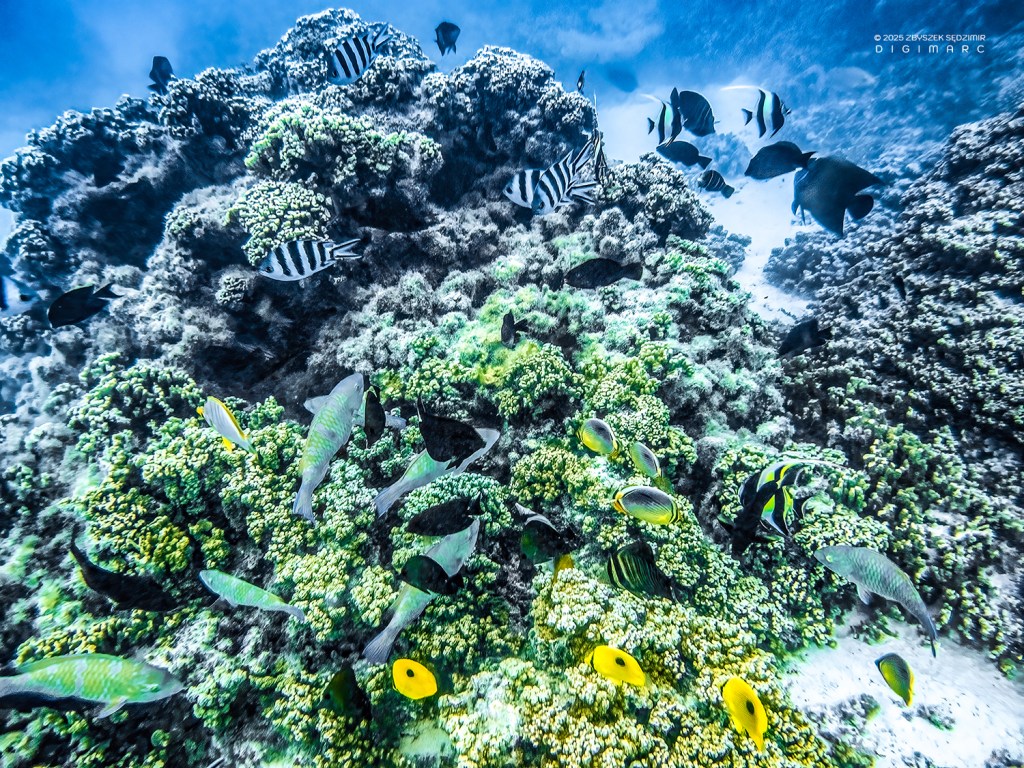
Fishermen use these sloops to go out to sea in pairs every day to catch fish. On Saint Brandon, only angling is allowed in order not to damage the coral reef.
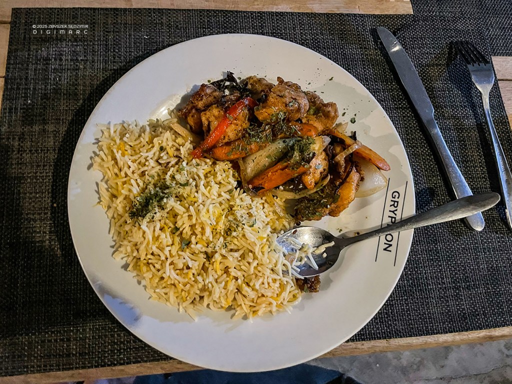
19.11 -The day ends with a delicious dinner: vinday de poisson.
Day 4
12.04.2024, 06.50 – Fourth day on the archipelago. We are going to the Turtle Island. It’s a half hour ride.
Our equipment is waiting to be loaded onto the boat.
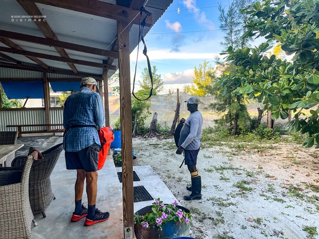
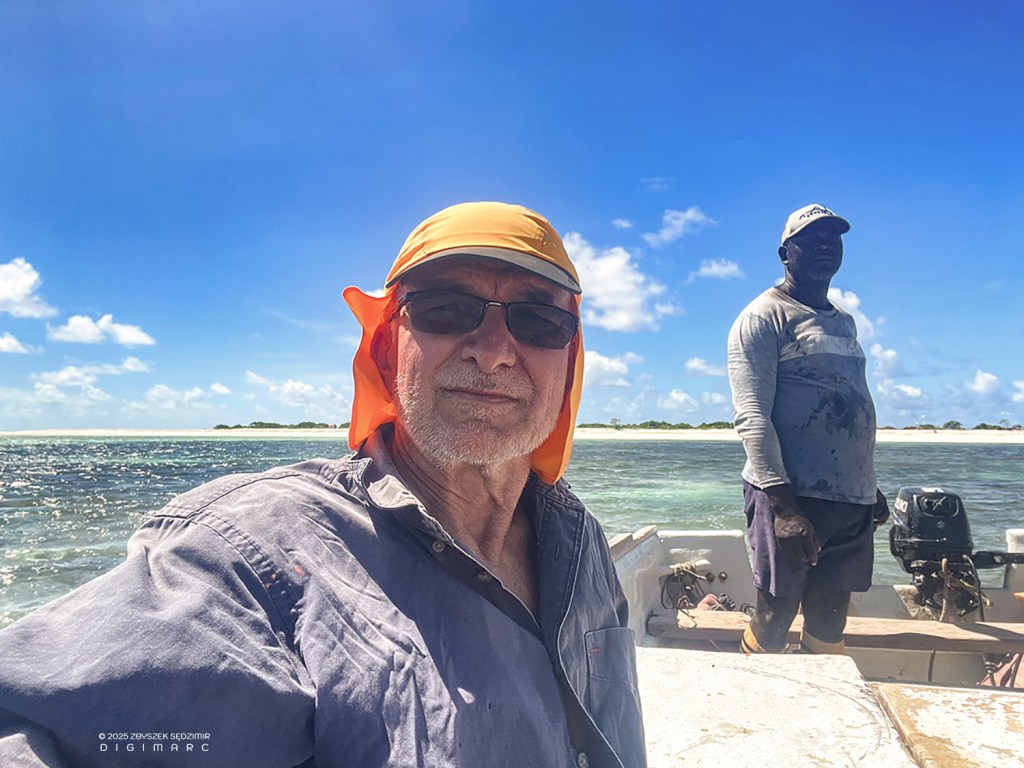
Our guide, Mr. Boulon, is coming to help us with the loading.

The sloop is waiting for us.
06:55 – The sun is already well above the horizon.
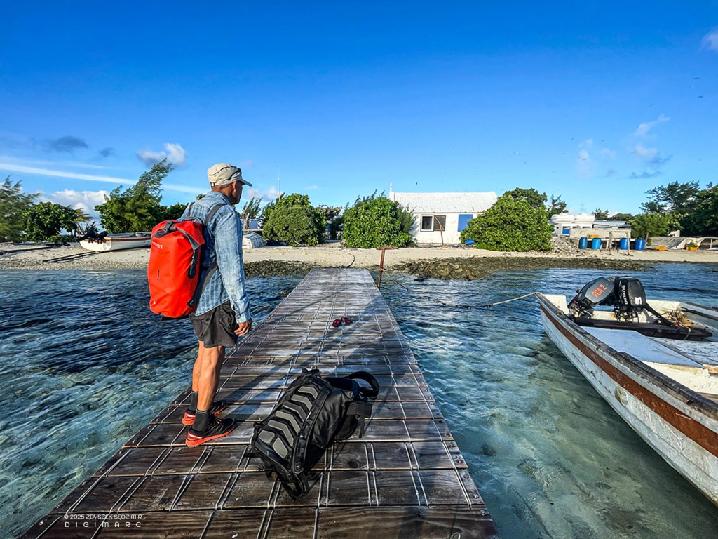
Pierre is ready to board.
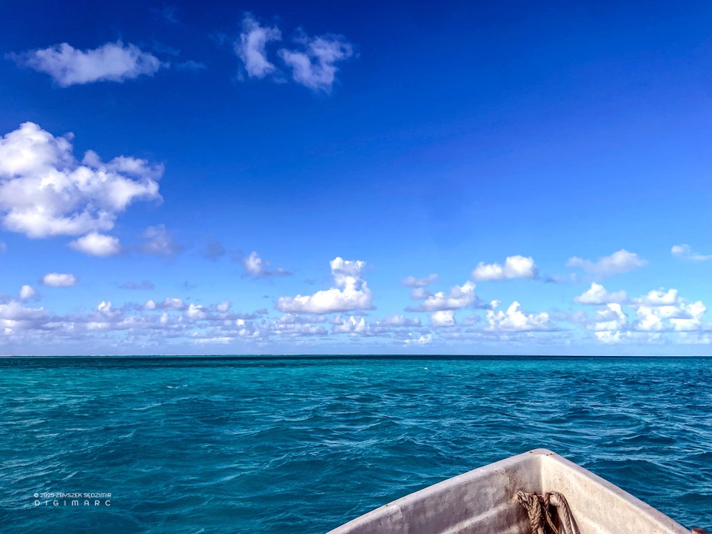
We are on the water heading southeast.
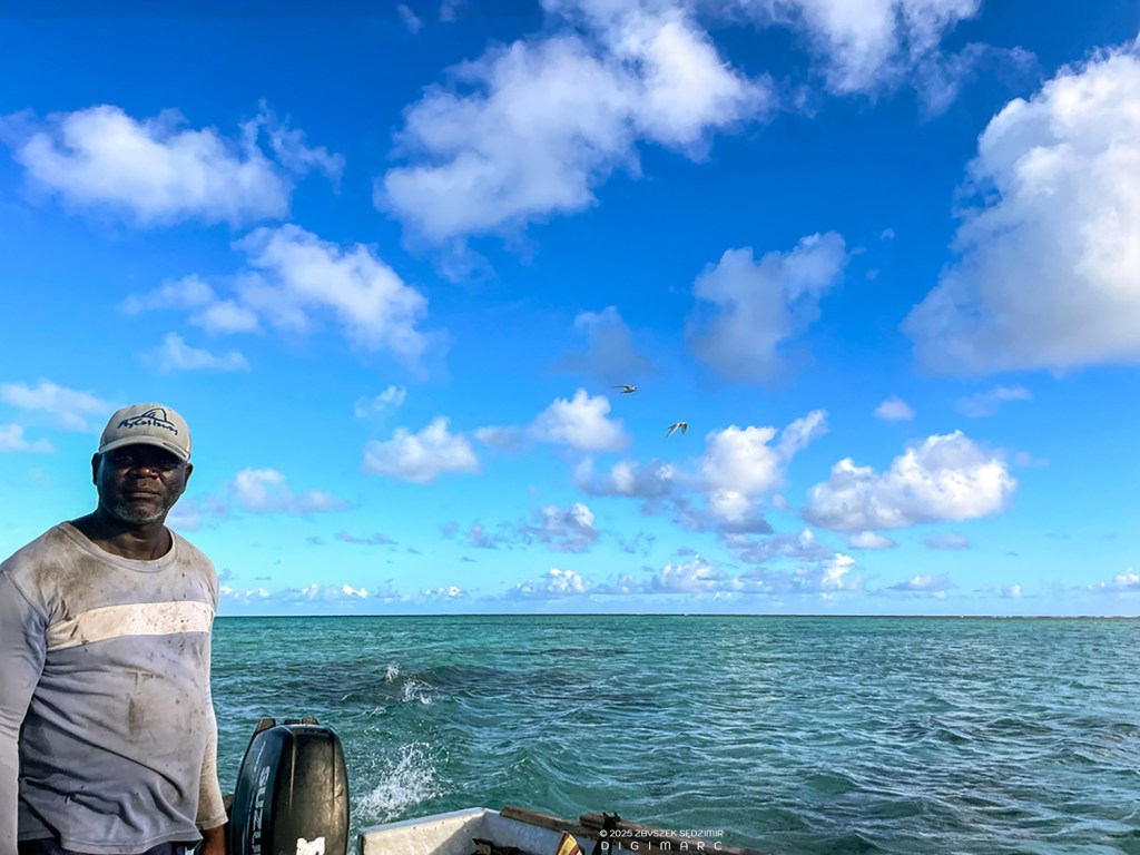
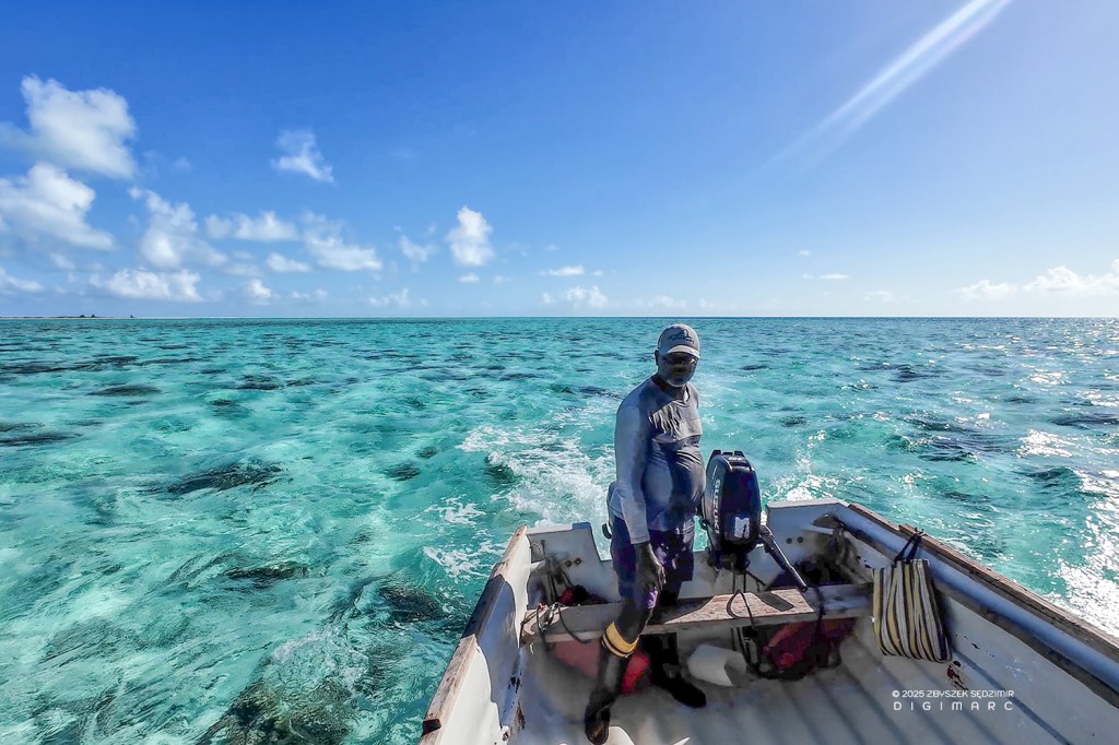
As always, Mr. Boulon steers in a standing position to have a better overview of the route.

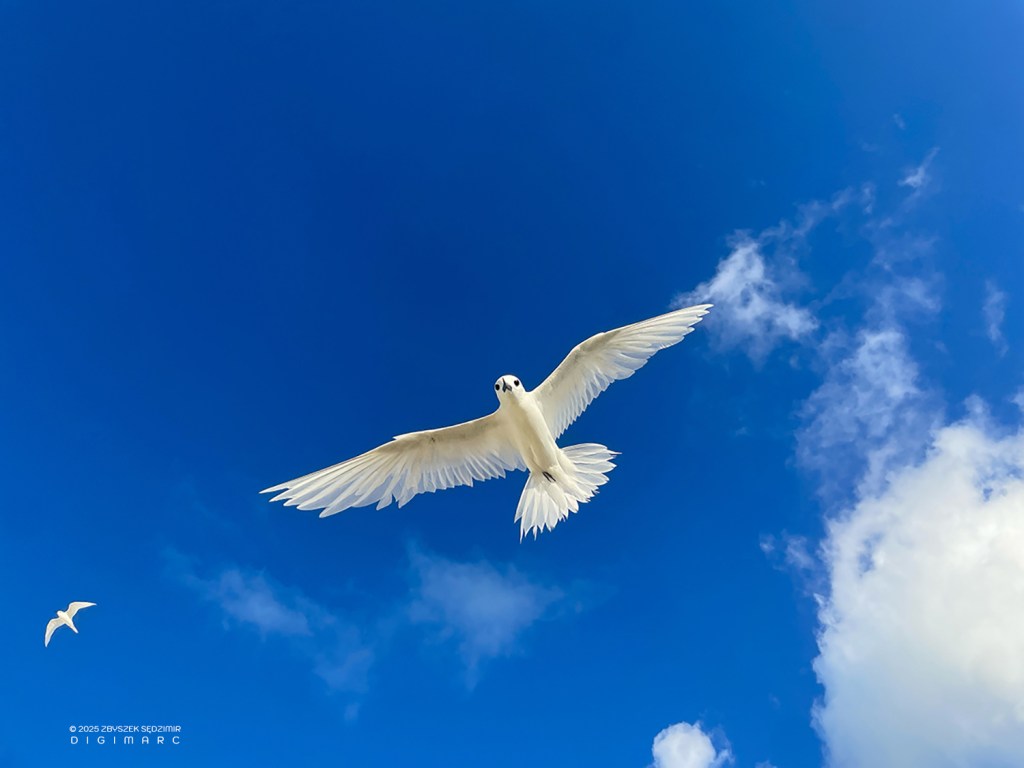
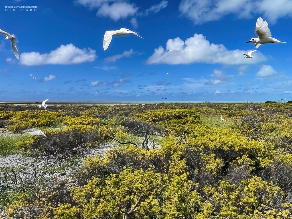
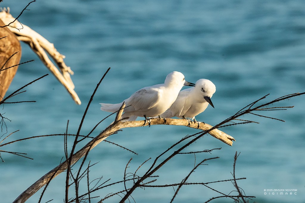
Every day there are seabirds accompanying us a while. Here is a white tern.
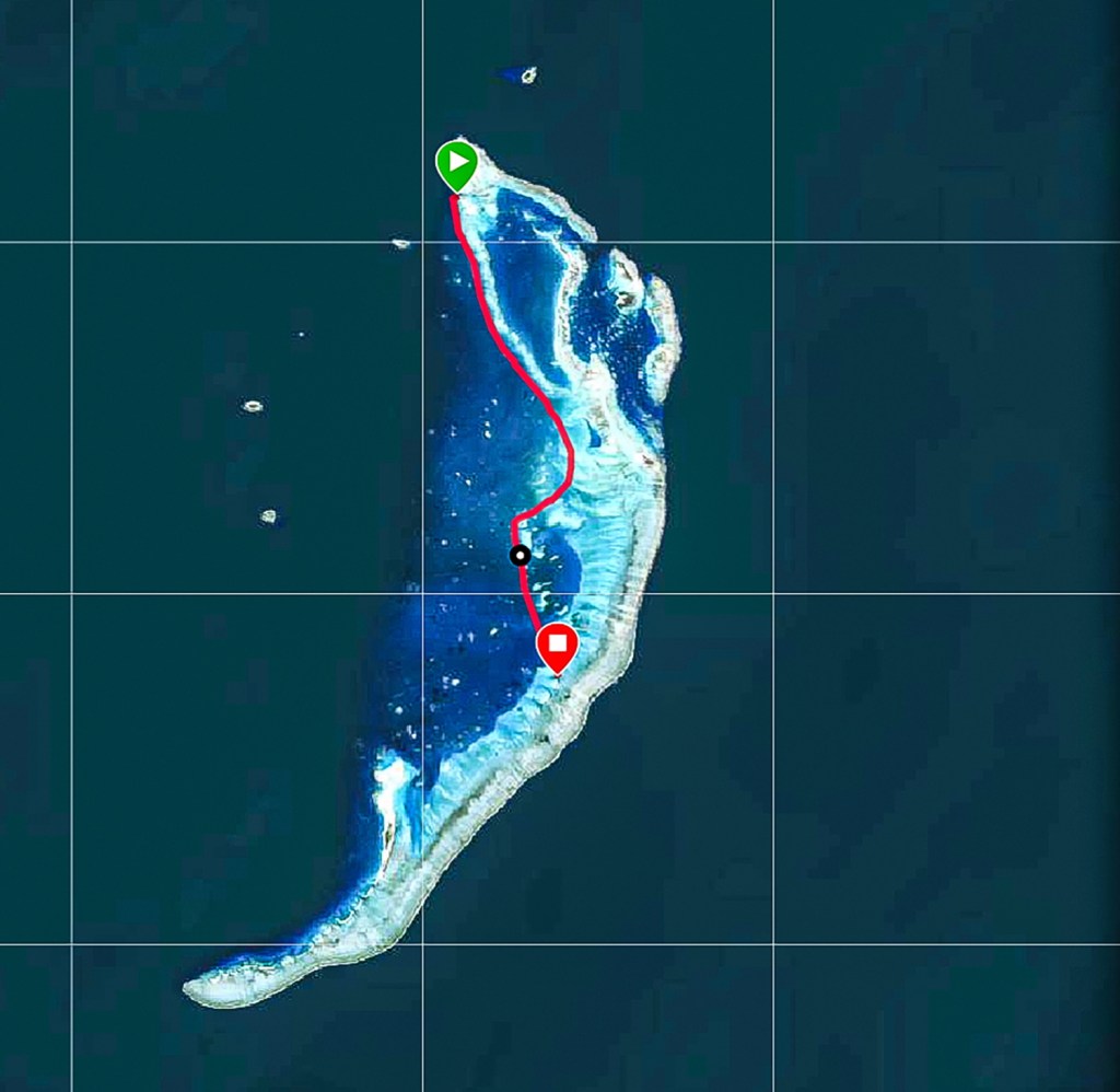
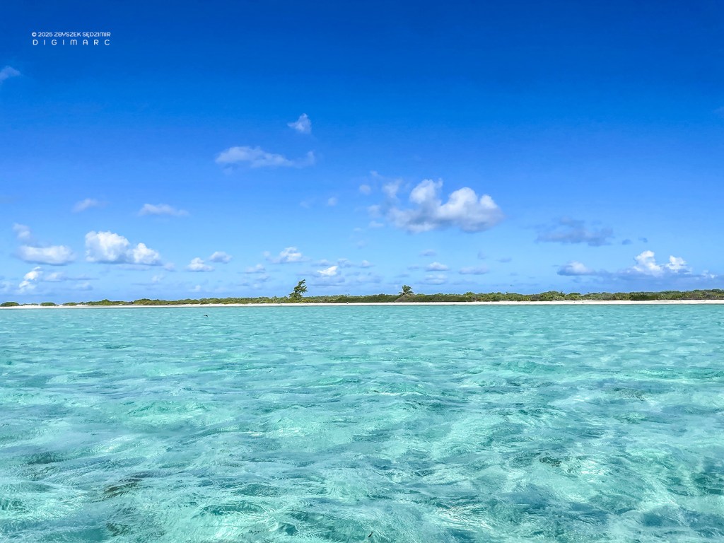
07.39 – After about 40 minutes of travel, we reached the northeastern end of Turtle Island.
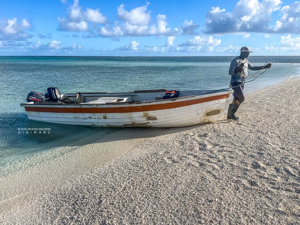
Mr. Boulon is parking the boat…
… and helps us to unload our equipment
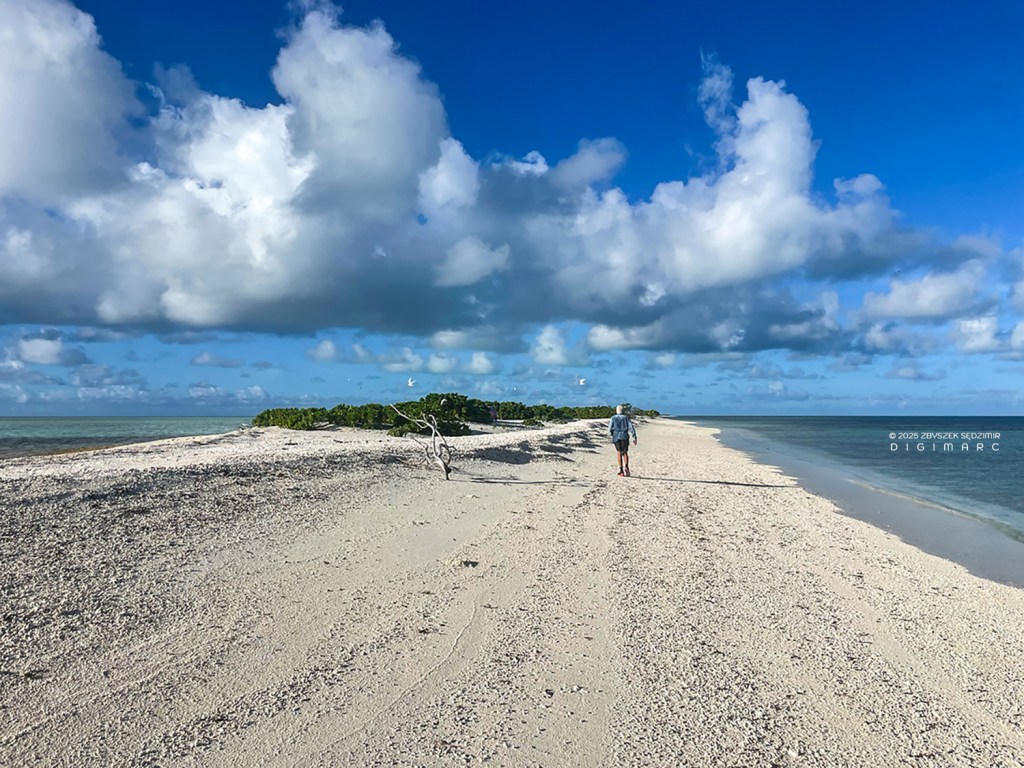
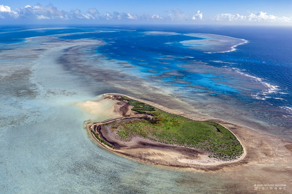
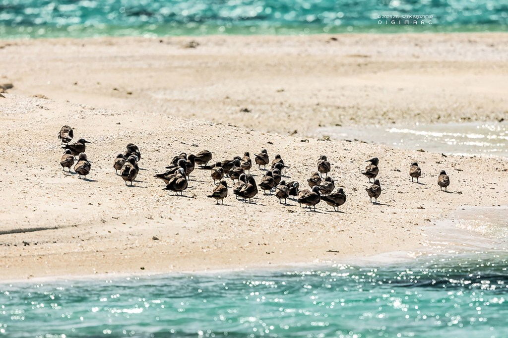
Turtle Island – a seemingly endless beach, which rarely shows any traces of people. There are birds everywhere that seem to be very curious.
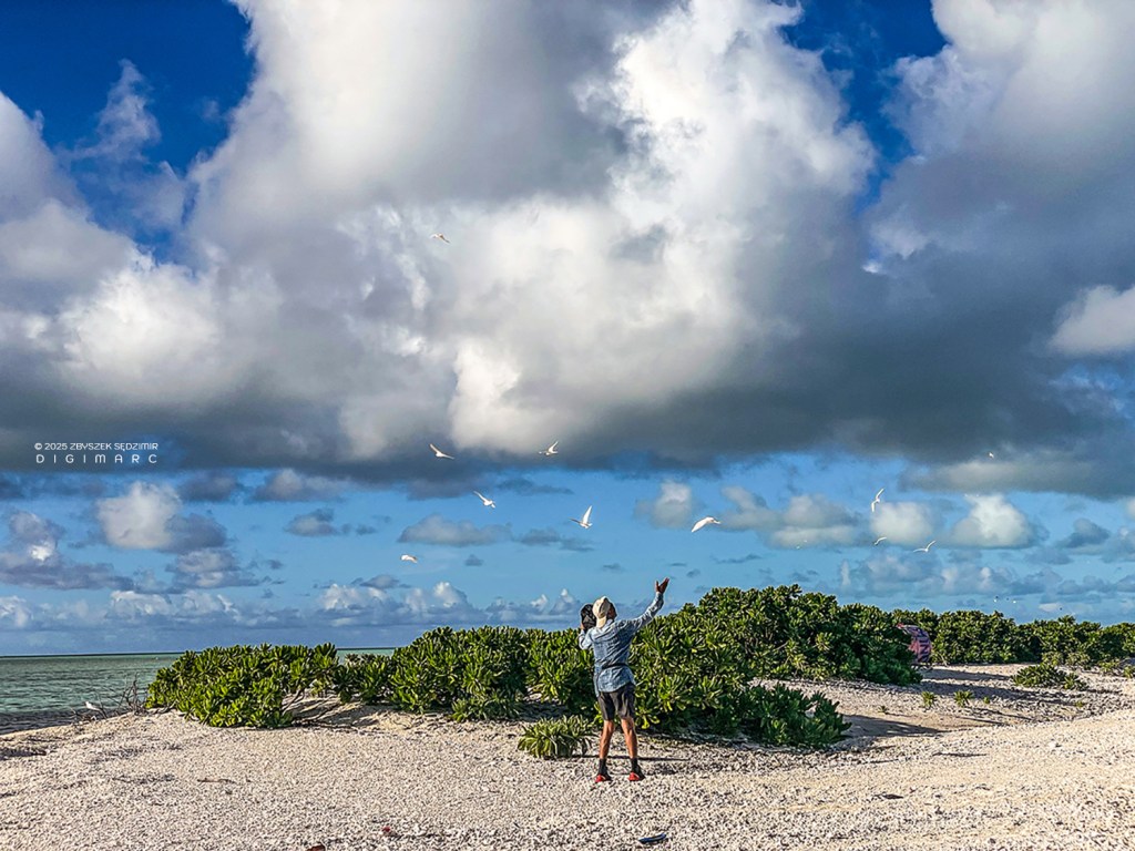
Pierre tries to lure them.
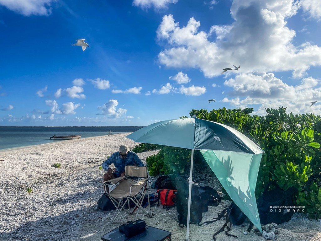
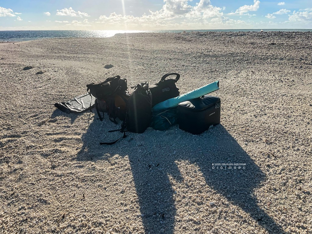
Our “command center”, as far as possible in the shade to protect the equipment and us from the blazing sun.
The name of the island comes from sea turtles that come here during the breeding season to bury their eggs in the sand. Since we were not there during the breeding season, we only saw these animals in the water.

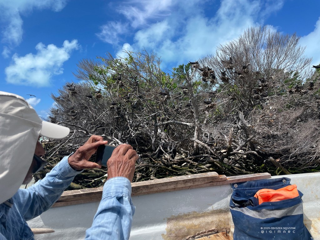
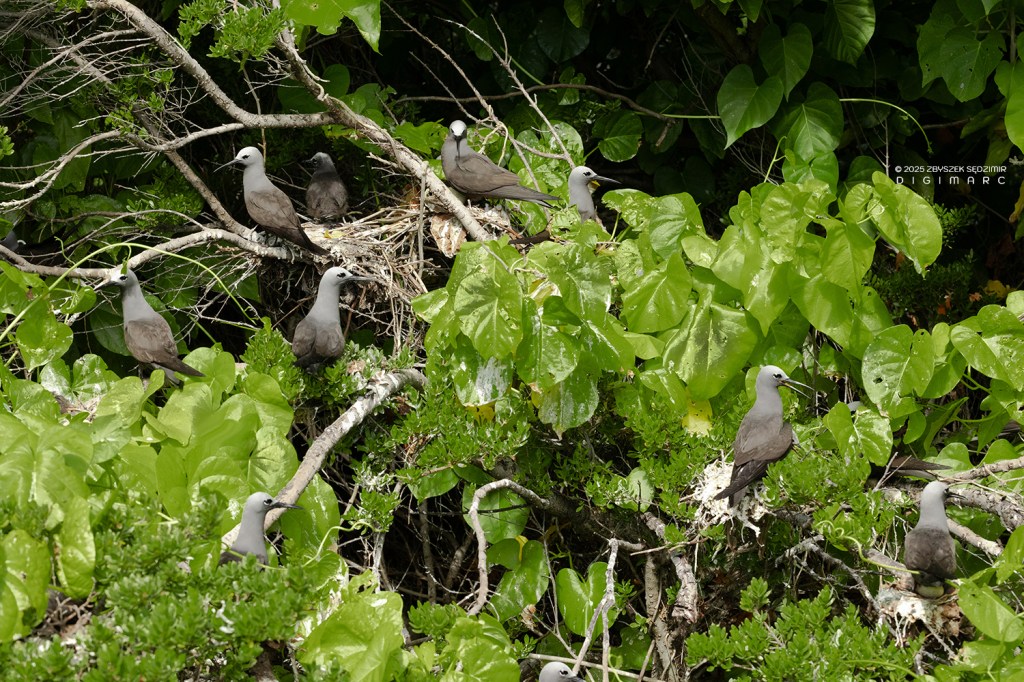
In fact, birds can be seen everywhere. It is estimated that there are almost 600,000 birds on the archipelago. The majority are sooty terns, followed by the lesser noddy and brown noddy.
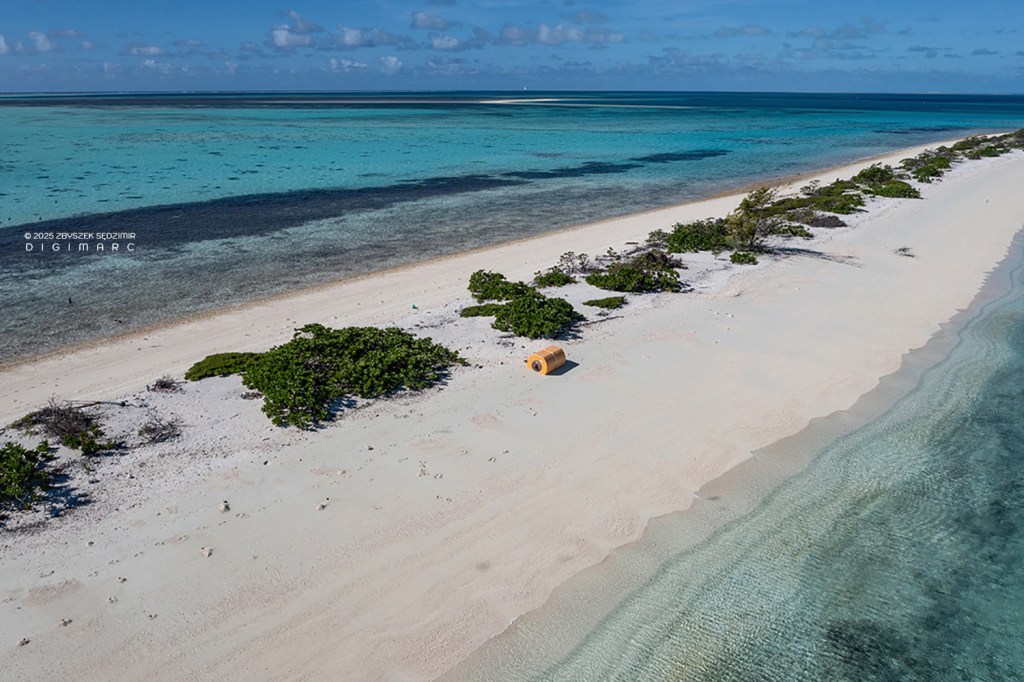
Although people rarely come to this (and the other) island, garbage is omnipresent. Here you can see the particularly large specimens…
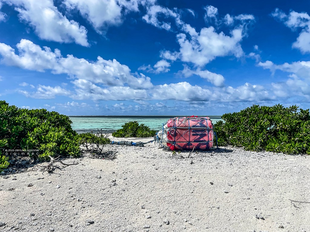
…buoys that have been lost somewhere in the ocean. There are also countless other plastic objects that come ashore: Flip-flops, flasks, lighters, toothbrushes, etc. We will see this in photos from other islands.
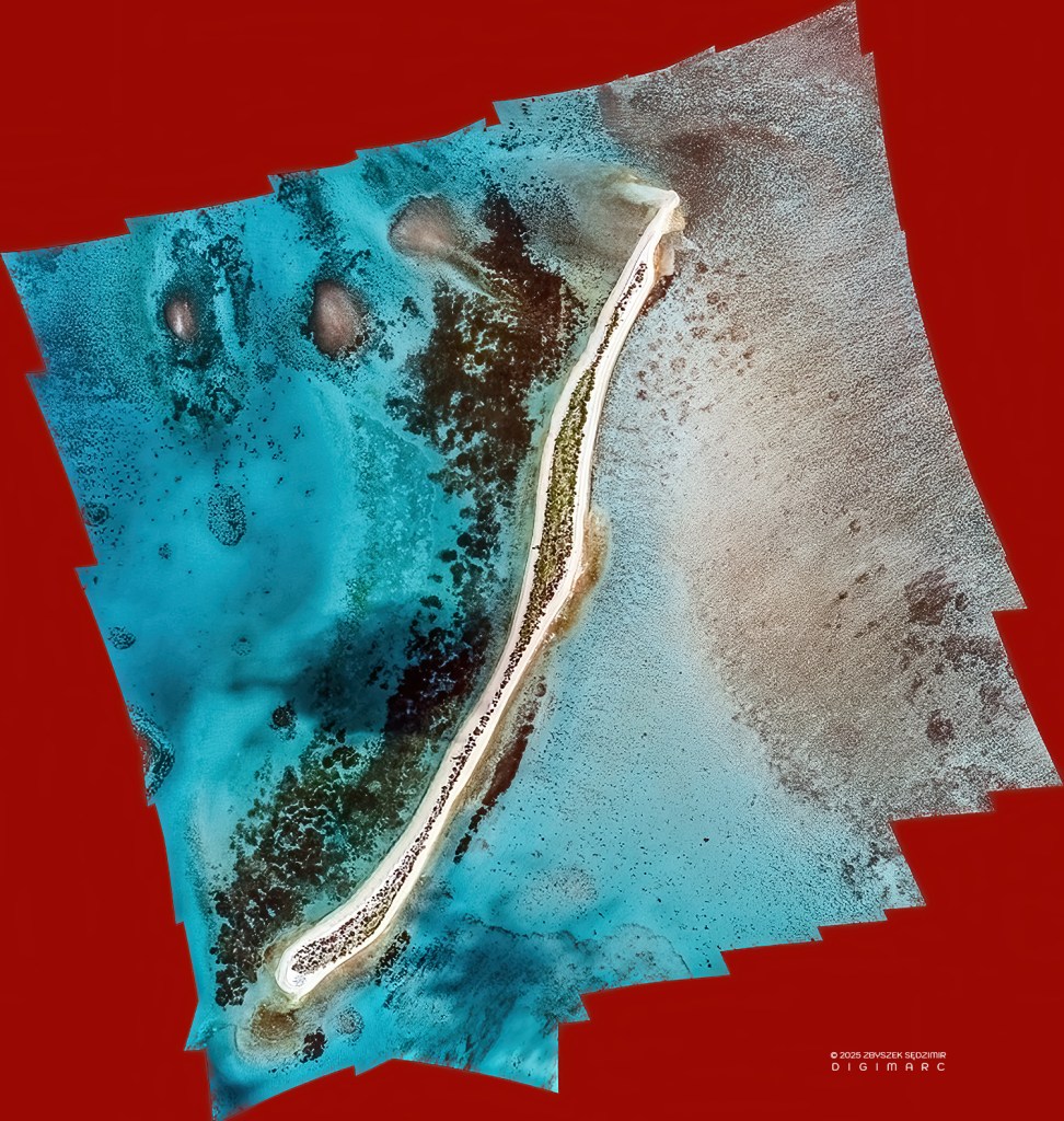
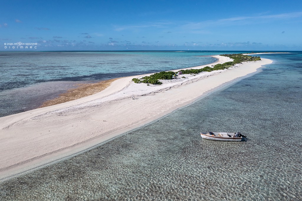
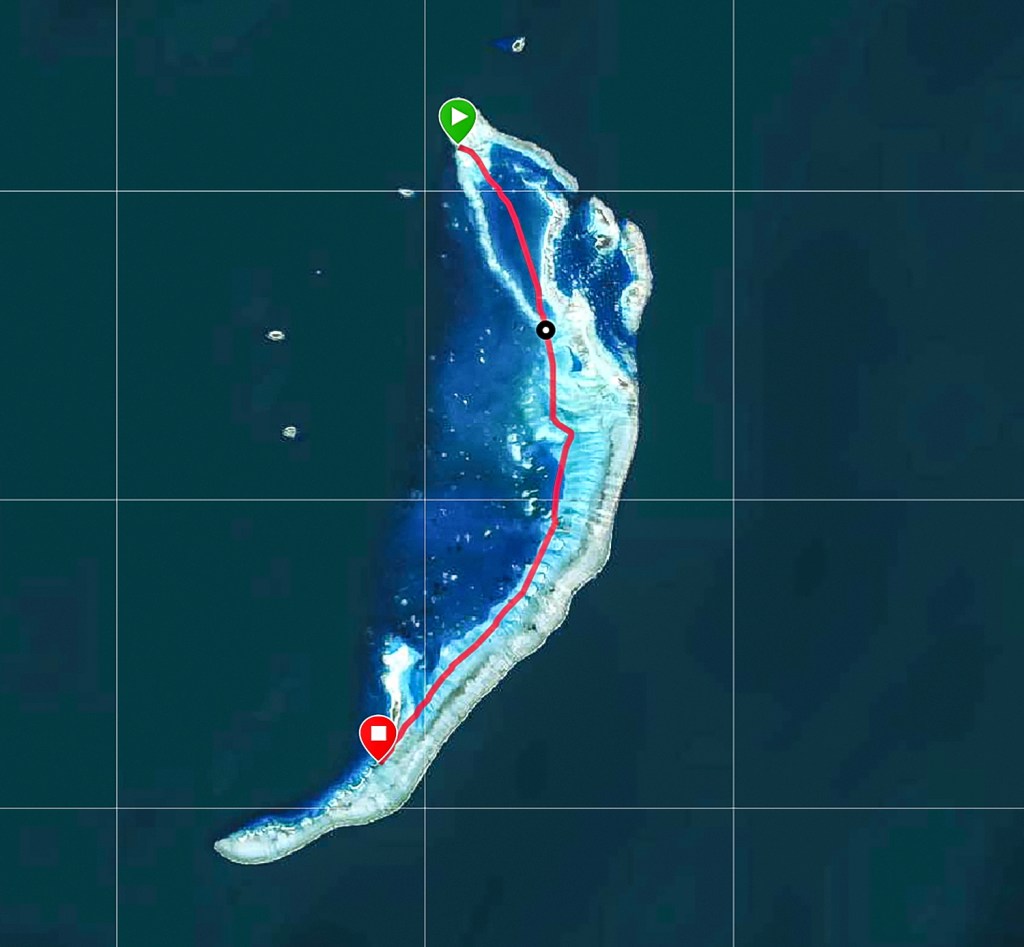
The Turtle Island in full size. It is almost 2 km long. I put the photo together from 15 individual shots. Its resolution is 11660 x 12264 pixels.
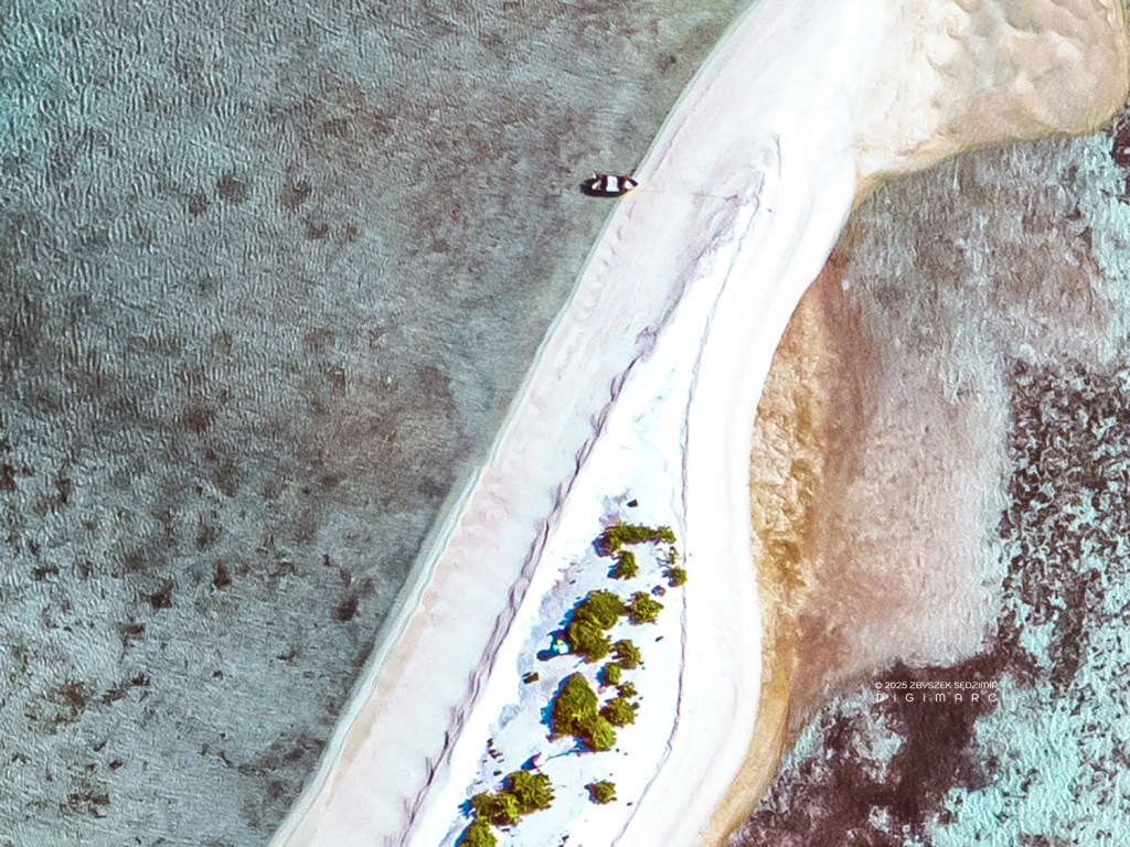
A detail from the large photo showing our sloop and command center.
10.46 – We leave Turtle Island and head towards Coral Island.
We don’t feel too hot because the wind stays nice and fresh. But the sun is merciless and you have to cover your skin as much as possible.

On the way we see fishermen fishing in knee-deep water.
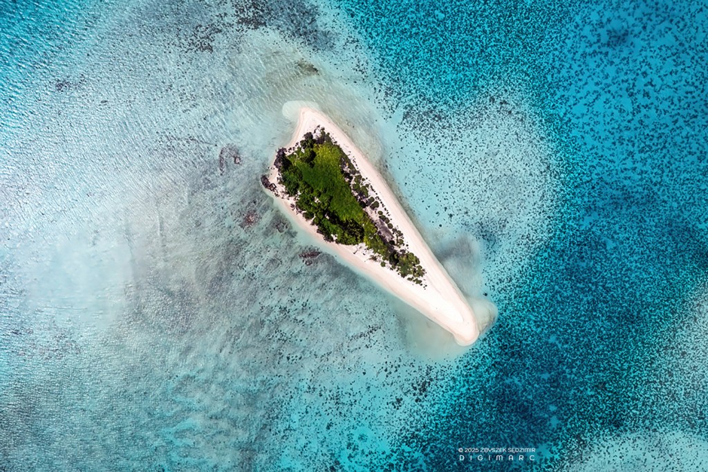
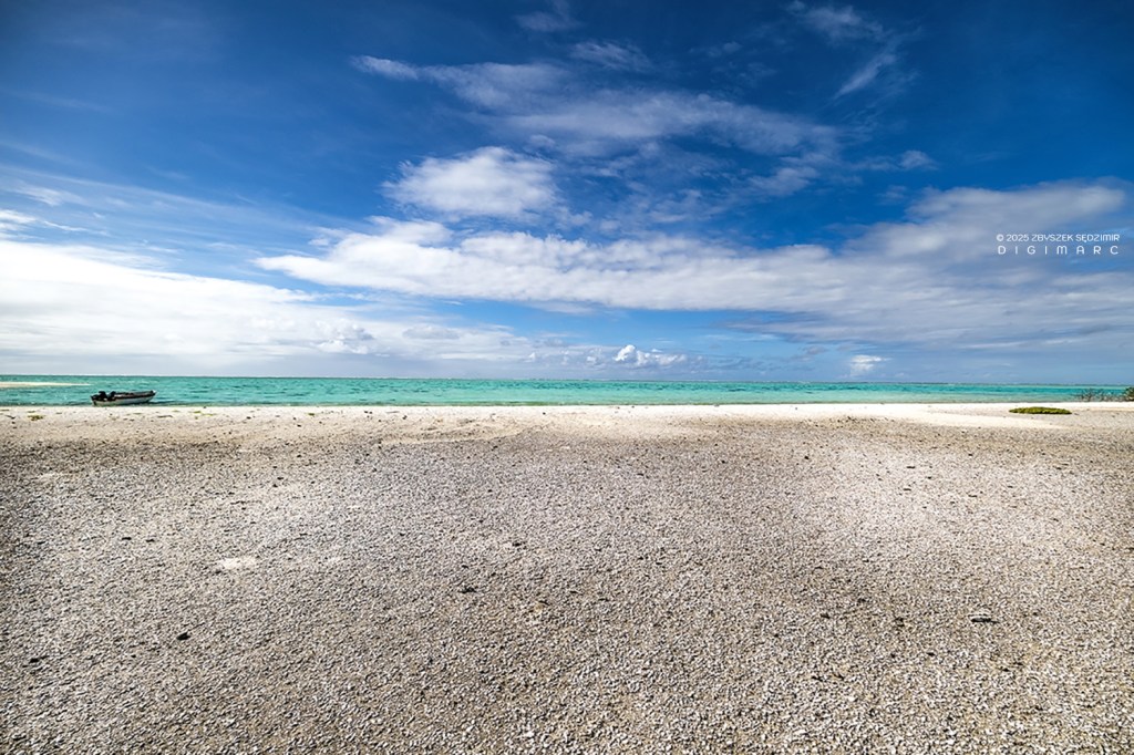
11.20 – Coral Island is very small and is formed entirely from the coral reef. The vegetation is very, very sparse.
We use our drones to take many aerial photographs of the archipelago from here.
18.00 – Back on Raphael Island, we are greeted by the birds.
Day 5
13.04.2024 07.00 – The next day, the journey continues towards Paul Island. This island is quite large and inhabited by various species of seabirds. That will be more than one hour’s drive.
As always, we set off at 7 a.m. with Mr. Boulon…
……and as always, we have company.
After more than an hour’s drive we arrive. Paul Island resembles a ray from the air. It is located near the eastern coral reef.
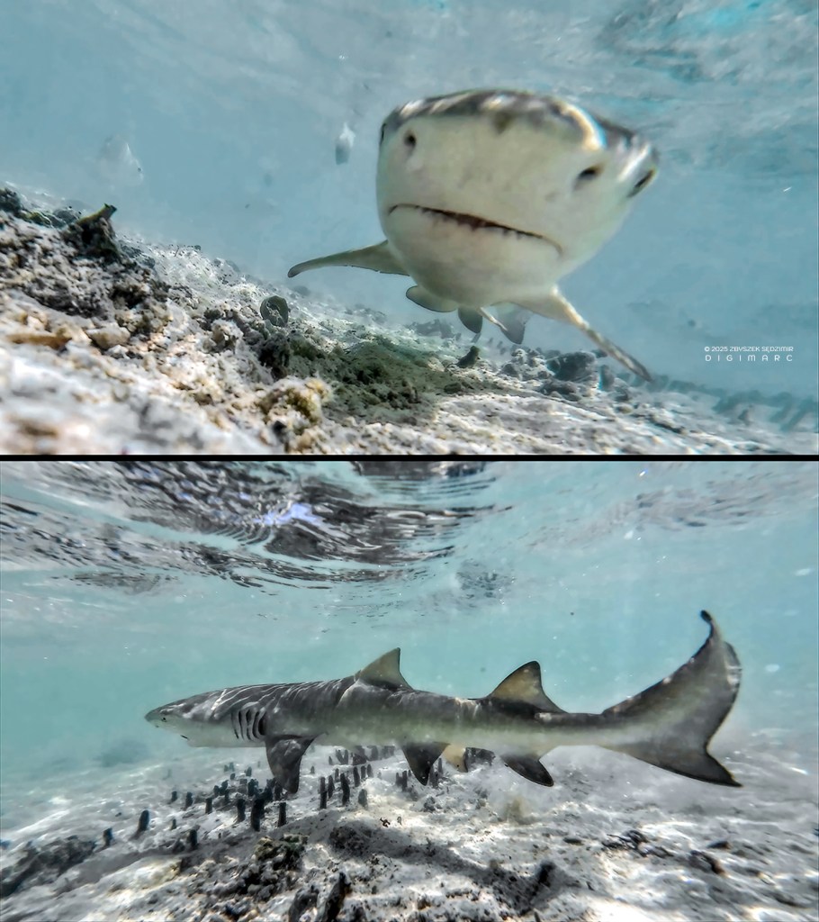
In the shallow water around the island there are lot of small sharks.
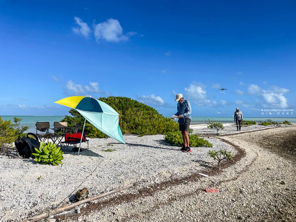
08.21 – Our drone command center on the beach. From here, we took small excursions on foot to photograph the birds up close.
The birds are everywhere: in the air, on the bushes and also on the ground.

You have to be very careful not to trample the eggs lying on the ground.
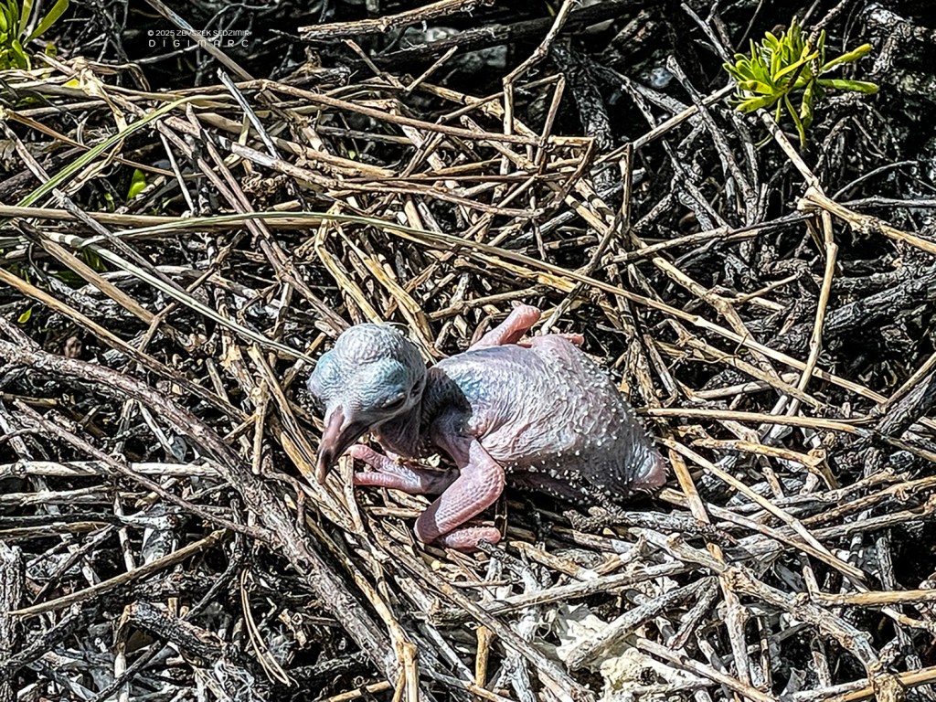
You can see newly hatched birds…
… and those who are already bigger but still can’t fly.
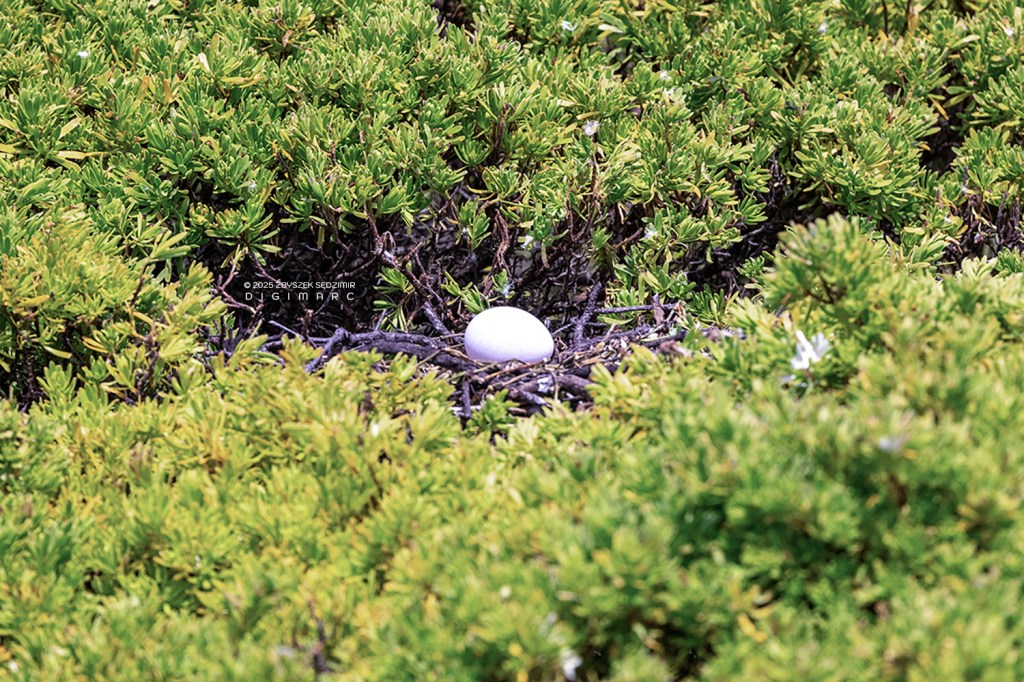
Sometimes the eggs are on the ground, sometimes in the nest…

…sometimes they are unguarded…

…sometimes a parent is there, ready to chase away the intruder.
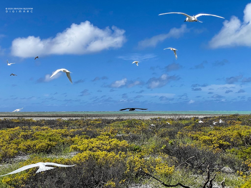
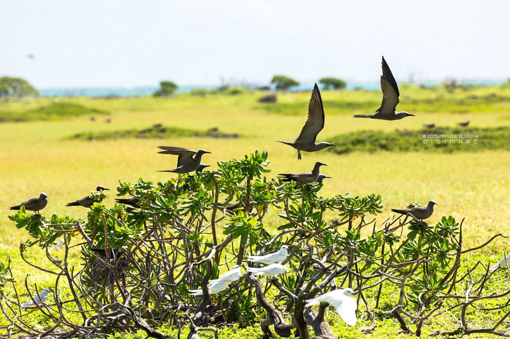
There are swarms of white sterns in the sky, which are usually very nosy…

One of them flew giggling so close that it almost caught the lens of my camera.

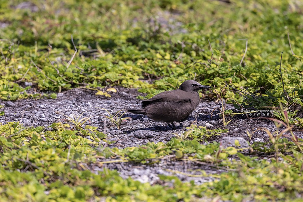
Equally numerous are the noodys, which can be aggressive towards uninvited guests.
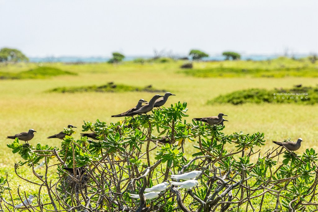
Noodys and terns perched on bushes (most often beach beach naupaka) always position themselves facing into the wind.
Perhaps this makes it easier for them to take off?
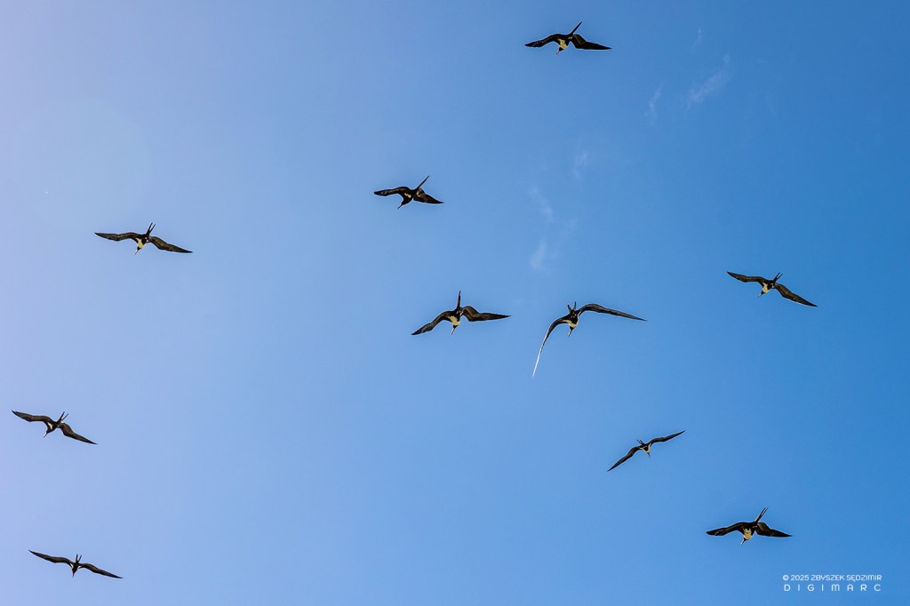
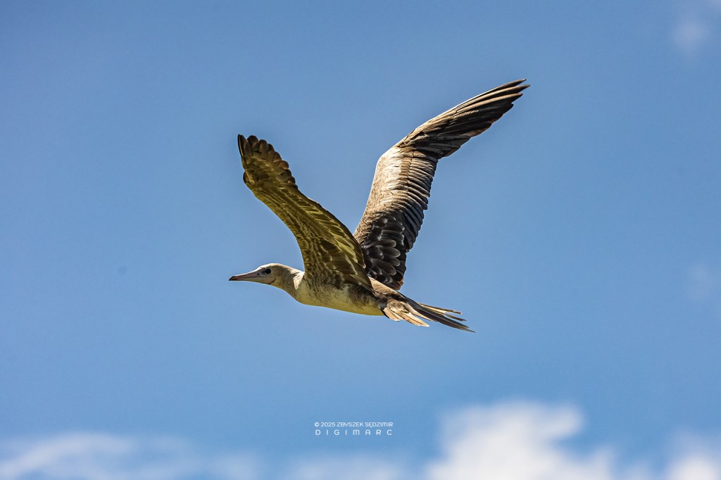
On Paul Island, there are also much larger birds such as frigatebirds. Whole squadrons of them glide across the sky, seemingly effortlessly, rarely flapping their wings.
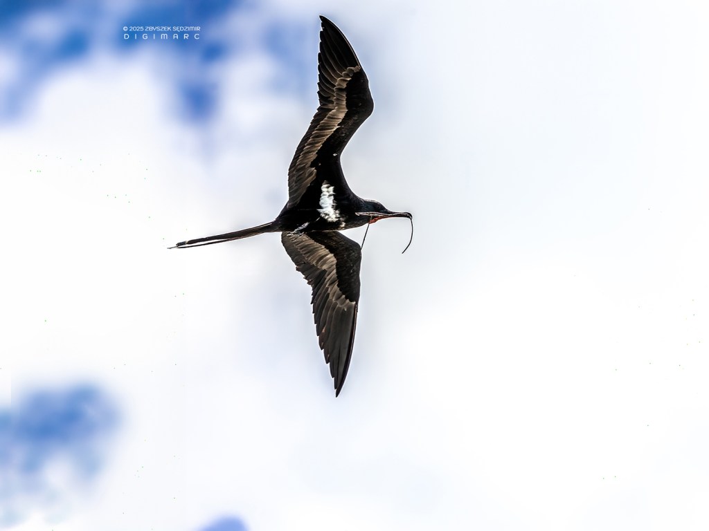
Some of them transport construction material.

And there is a hungry offspring waiting on the ground.
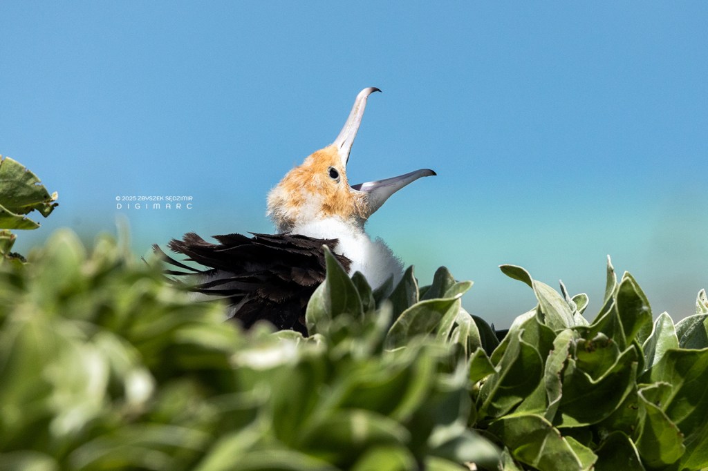
“Oh, I guess Dad’s coming back to the nest!”
The frigate’s beak, curved like a fishing hook, is an extremely effective weapon.
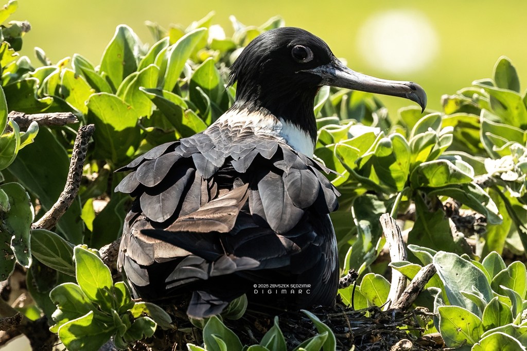
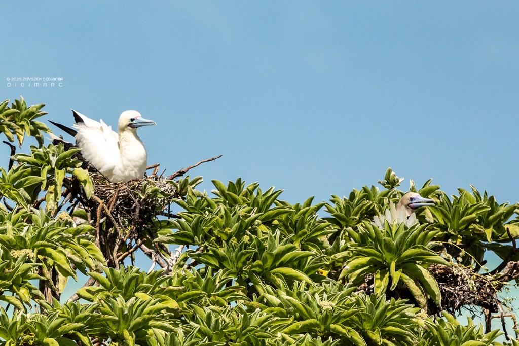
Among the large birds on Paul Island, Red-Footed Bobbys are also numerous.
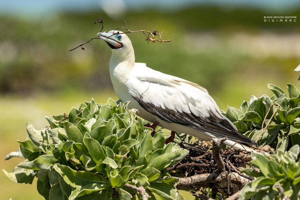
They often build nests in the immediate vicinity of frigatebirds…
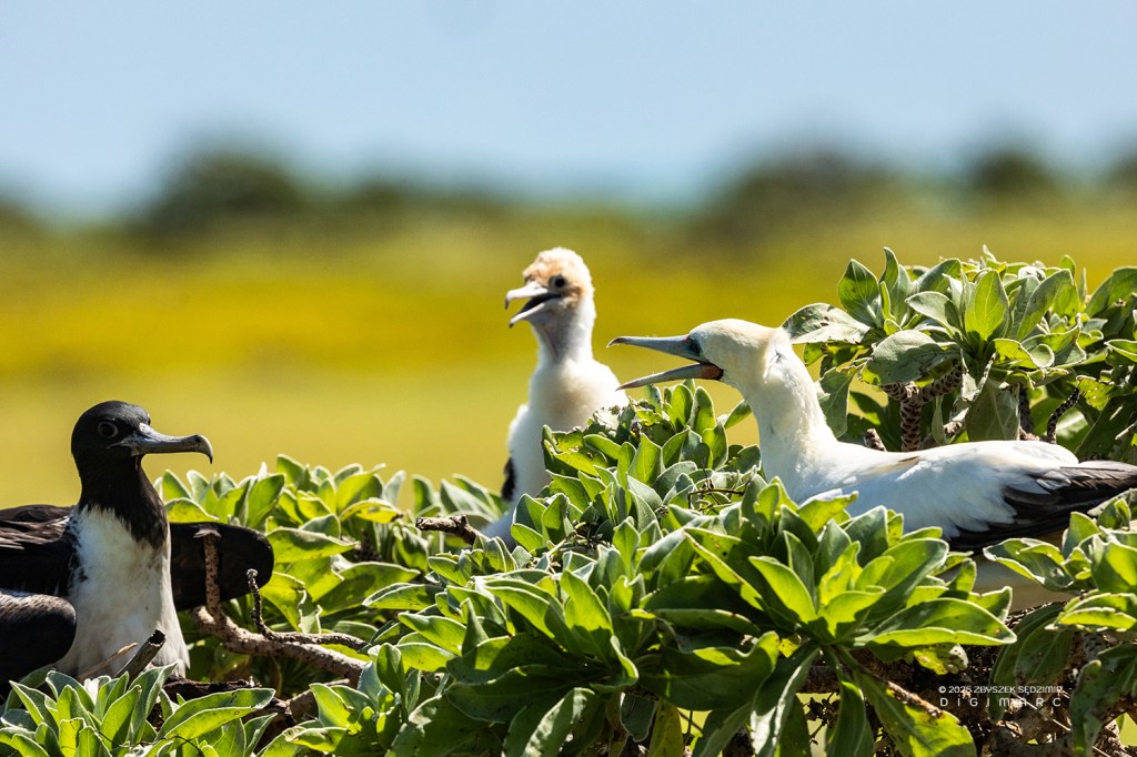
…with whom they have a smalltalk.
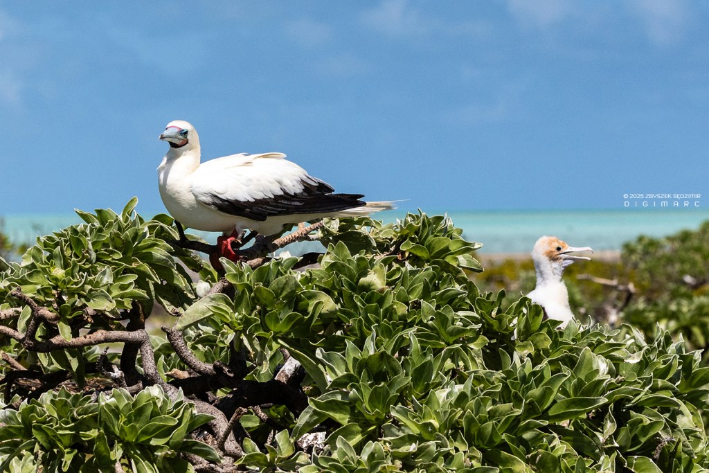
Booby, sitting on the highest branch, likes to observe what is happening around.
Neighbors

And here on this beautiful deserted island inhabited only by animals, GARBAGE is present like a plague that comes from afar, set in motion by the wind and sea currents. Today, no area on our planet can effectively protect itself against this plague.
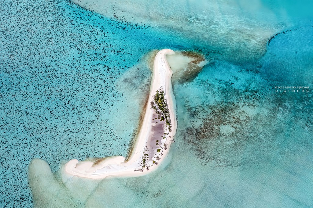
12.59 – We left Paul Island and after a half-hour journey we reach Avocaire Island.
The island itself, whose shape reminds me of the horizontal section of the “Flat Iron Building” in NYC, is small, but its vegetation is abundant.
Upon reaching the shore, we are greeted by a large colony of noodys. who don’t panic when they see unknown strangers, they just watch us with interest.
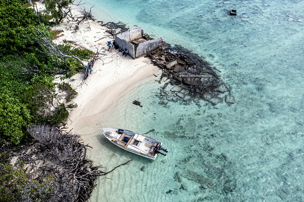
On Avocaire Island are the remains of a building belonging to the fishing base of Raphael Island, which once had a small workshop for minor boat repairs. The building was about 100 meters away from the water. Today its ruins lie in the water. It is difficult to defeat the forces of nature.
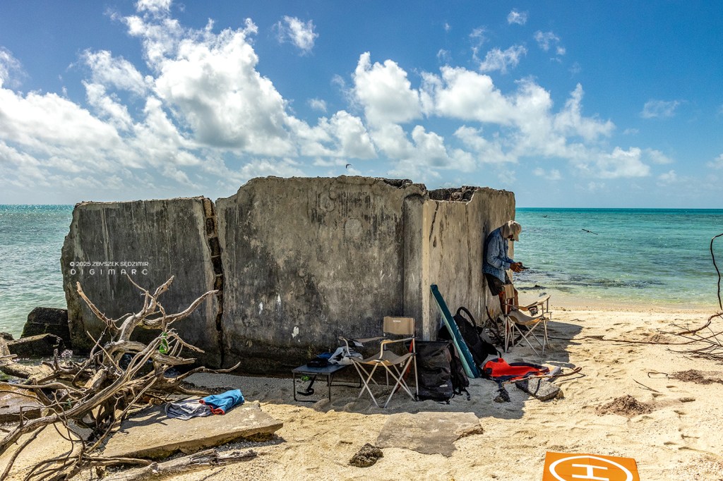
In the shadow of these ruins we installed our drone “command center”.
I decided to see what was hidden in the thick bushes covering the island. There were noodles almost everywhere. There were also a few white terns. As long as the distance between me and the birds was less than about one meter, they did not show any anxiety.
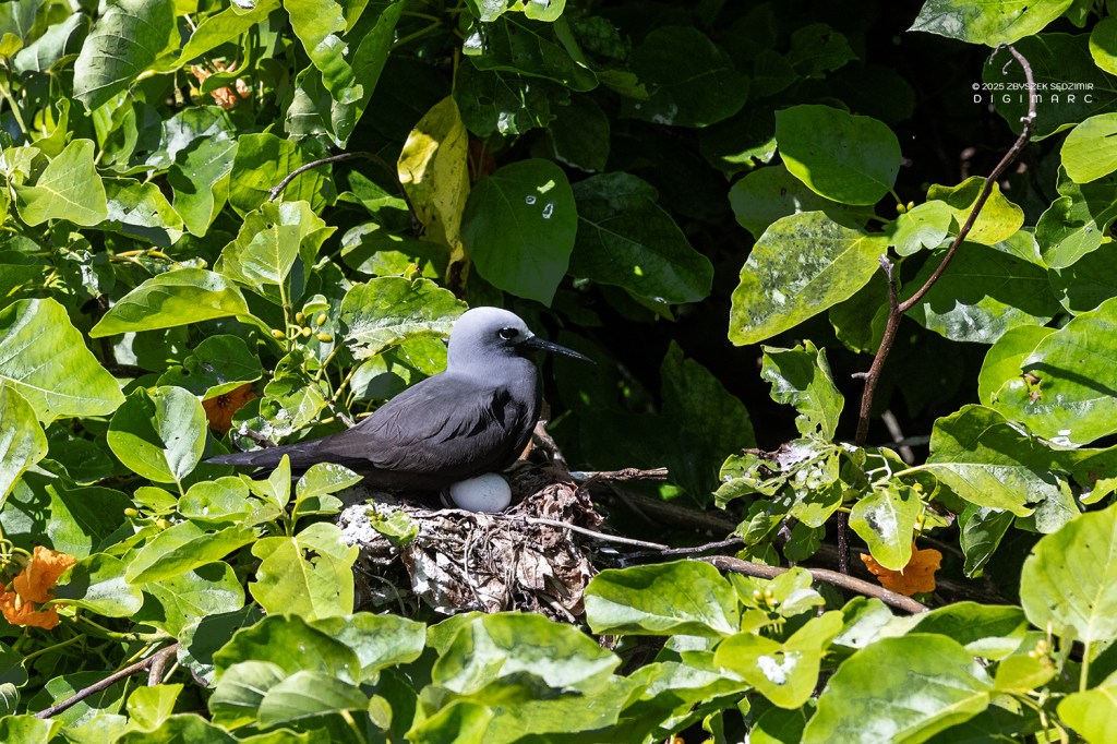
Going a little deeper, I made a discovery: first I saw a nest in which the female nooda was guarding an egg.
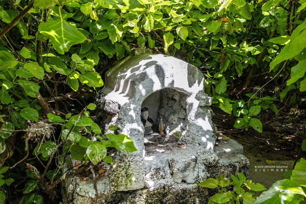
I passed her and went about two meters deeper and this is what I saw. This is the so-called a “grotto”, i.e. a small chapel built by the faithful “in the wild” without the involvement of the church. There are plenty of such “grottoes” in Mauritius: on the rocks on the coast, in fields and even in cities (this is a topic for a separate photo project). In this “grotto” there is a bust of Father Laval. Jacques-Désiré Laval arrived in Mauritius in 1841 and devoted his missionary activity to the Creole population and slaves who had regained their freedom only three years earlier thanks to the abolition of slavery in England. From Avocaire Island we returned to Raphael Island.
Day 6

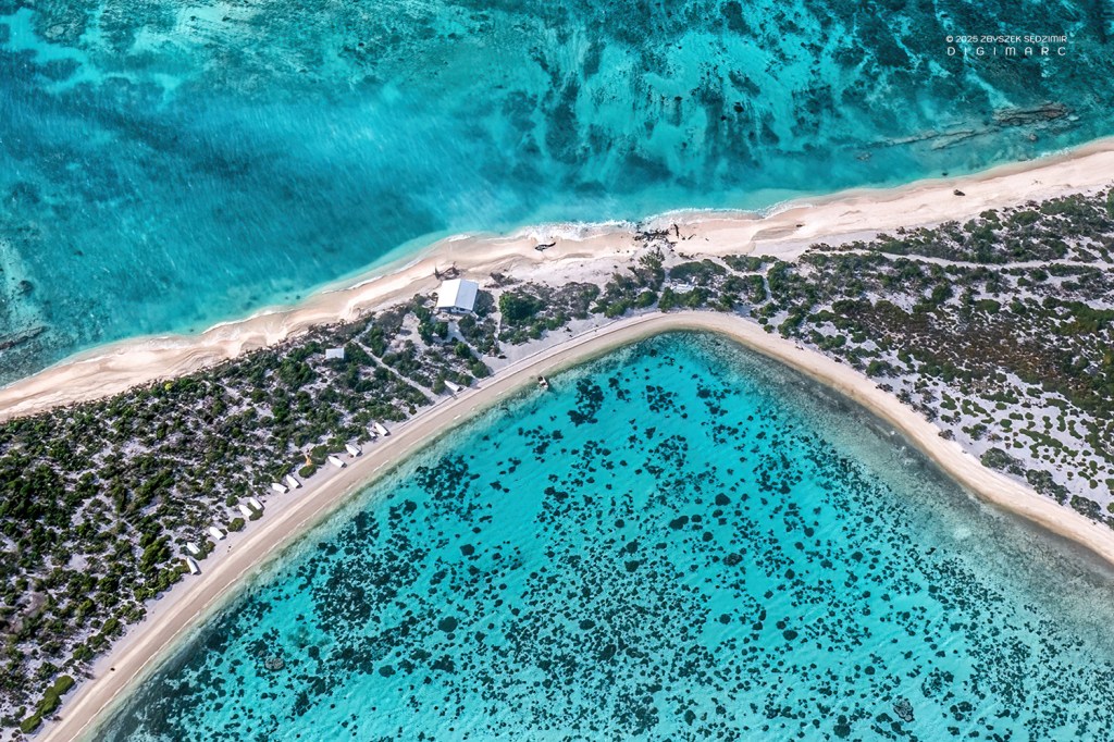
14.04.2024 06.28 – Day six. I got up a little earlier to take photos in the light of the rising sun. In the foreground is Raphael Island, further north is Poulaiier (Chicken coop) Island and further still one of the largest islands in the archipelago, Puits à Eau (Water Well) Island. This is the northern end of the atoll. The archipelago has two more islands north outside the atoll: North Island and Albatros Island.
Here there are two islands located towards the south, a stone’s throw from Raphael Island: tiny Petit Raphael and much larger Swati Island.
Today our goal is one of the Tectec islands. We leave, as usual, at 7 am. We sail there for over an hour and a half.

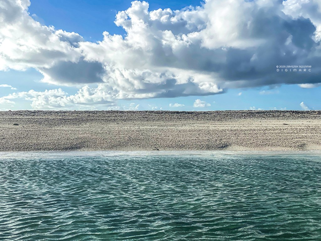
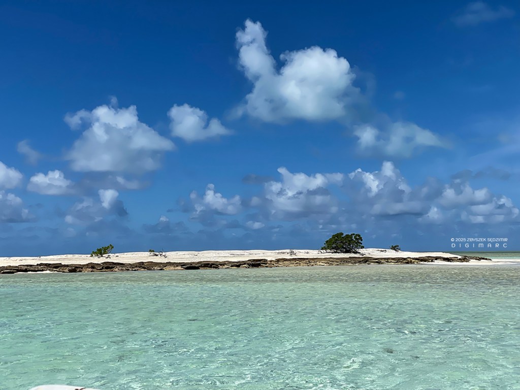
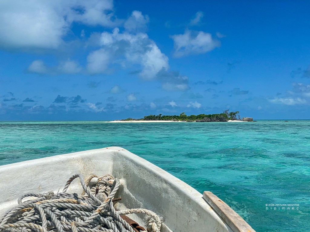
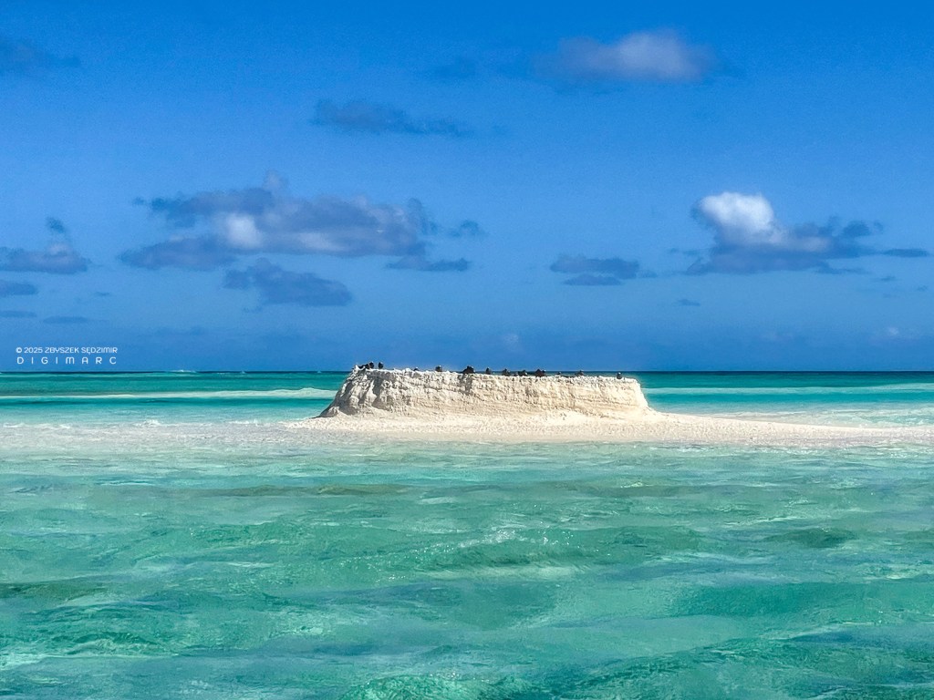
The name Tectec comes from the small shells that are the main “building material” of these islands. The one we are heading towards seems to be completely lost.
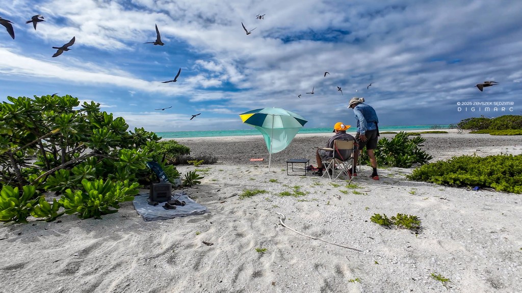
Our “drone command center” attracts enormous interest from birds.
Tectec are formed by sea currents and wind.
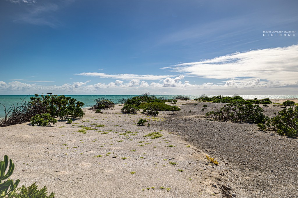
The vegetation there is very modest.
The birds appear to be vacationers on the beach.
These huge banks of shells might seem infinitely far from human civilization if it weren’t for…
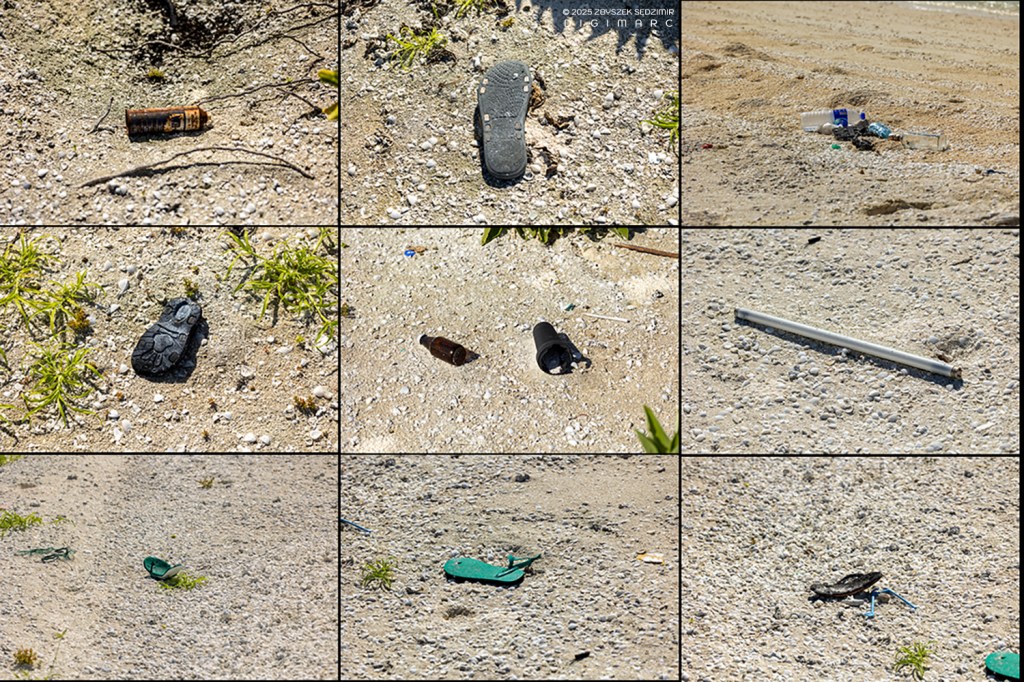
…GARBAGE 😣
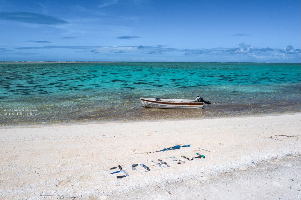
I was wondering what gigantic amounts of this crap must be floating in the ocean waters if so much waste lands in such a remote and small place as Saint Brandon. I let out my frustration by arranging obscene words on the beach with the flip-flops, toothbrushes, and other debris I found.
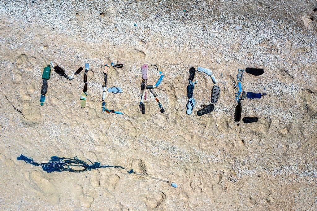
😳😡

I did the same on Coral Island, where we stopped briefly on our way back to Raphael Island.
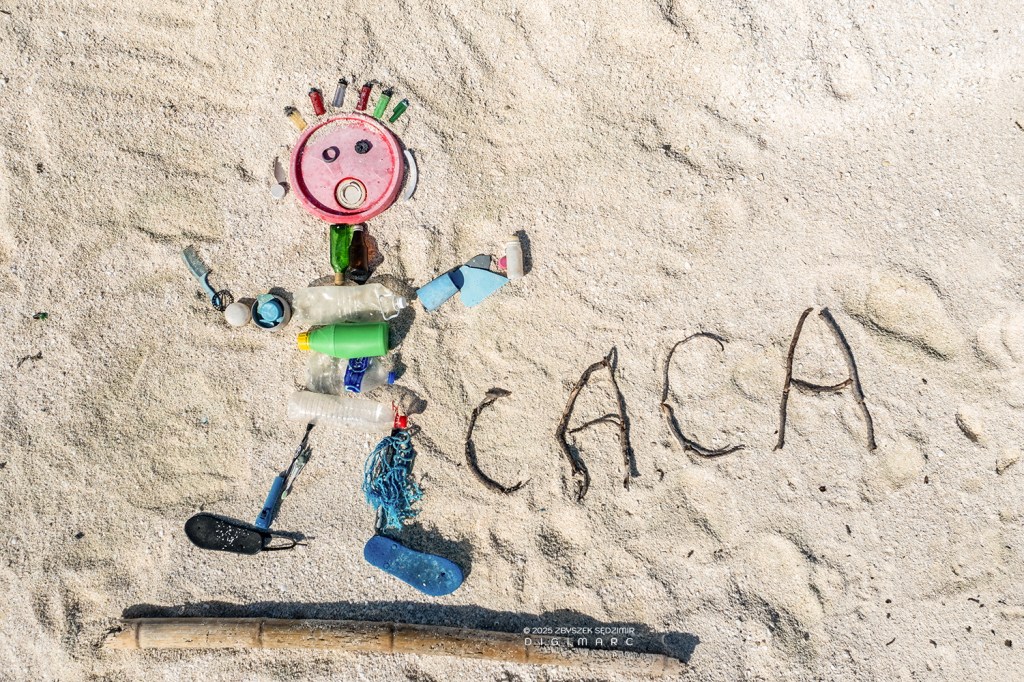
😳🥺🥺😡😡😡
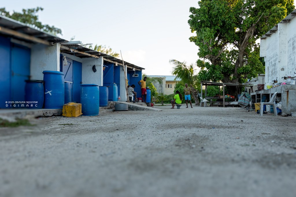
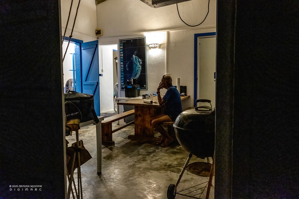
17:40 – Back on Raphael Island. The fishing base here is small. The fishermen stay on the island for anywhere from a few weeks to three months. Since there is neither internet nor a telephone network (except for a satellite phone), people spend their free time in two ways: playing games and…
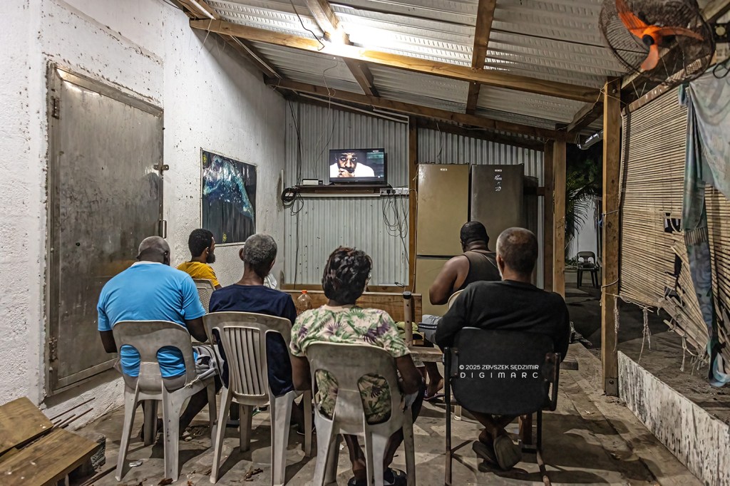
… satellite TV…
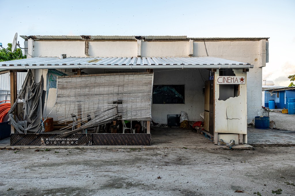
… at the local cinema 😉
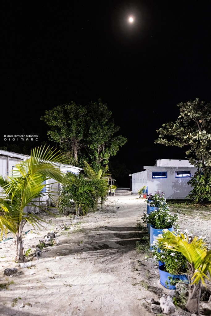
19.45 – The “streets” of the neighborhood are clean and lined with bins filled with flowers.
The Chapel of St. Louis is illuminated.
And birds are sitting everywhere…
Day 7
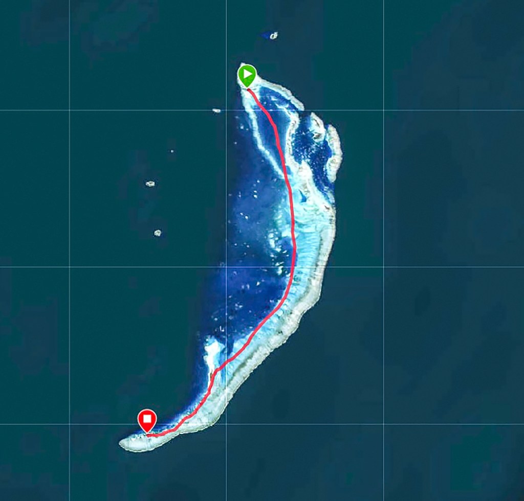
15.07.2024 – The seventh day of our trip. Today’s destination are the islands in the southern part of the archipelago. We start at 6.55am and arrive at Dagorne Island at 9.20am.
Two and a half hours of riding on a wooden bench in a nutshell, constantly jumping on the waves, is a hard exercise for the mind and body
😅
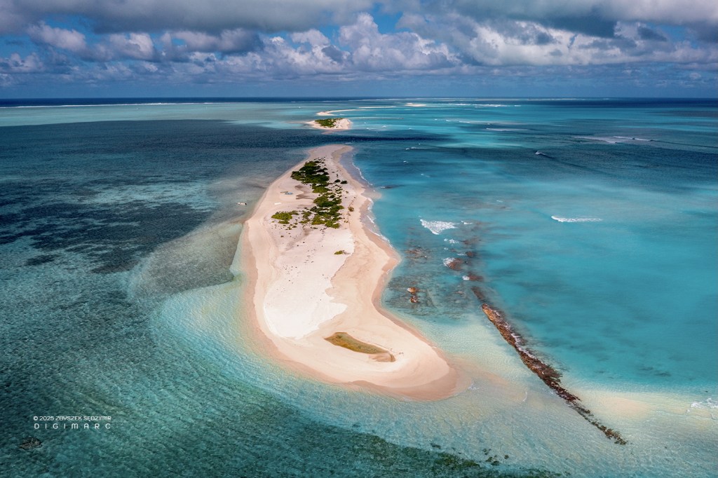
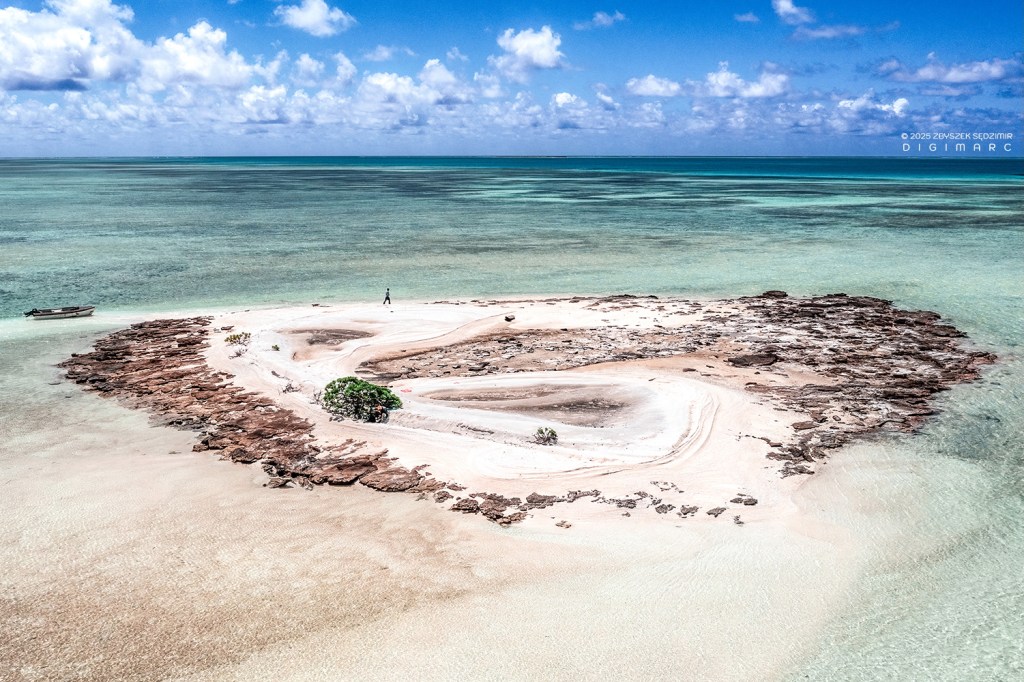
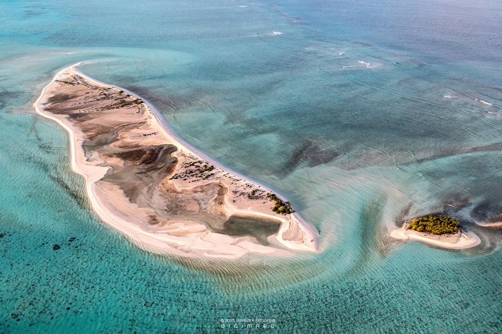
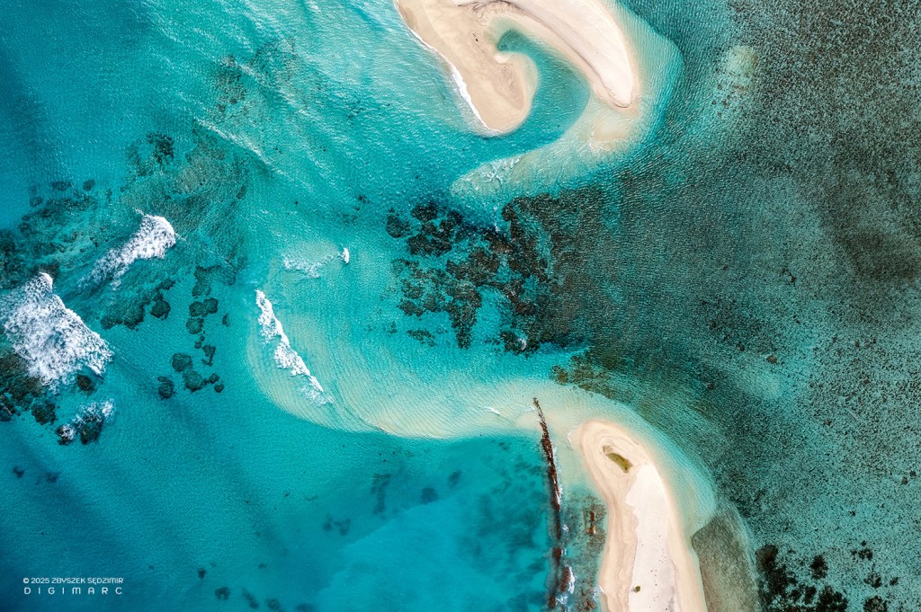
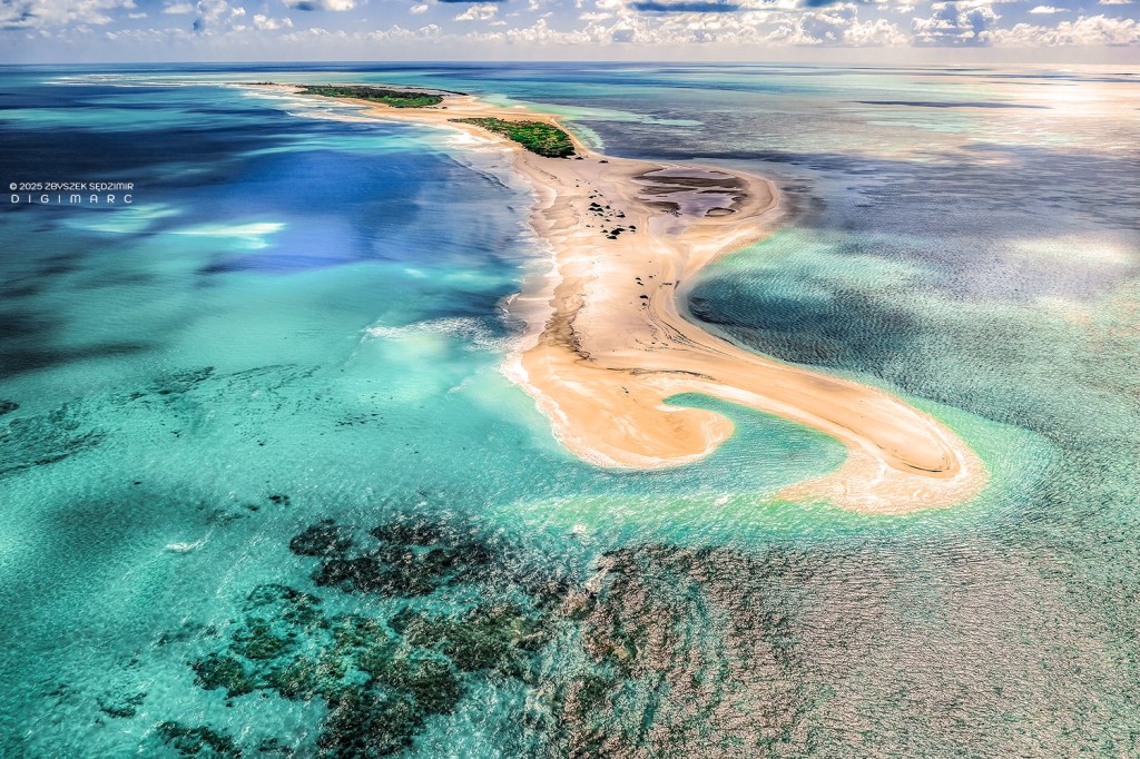
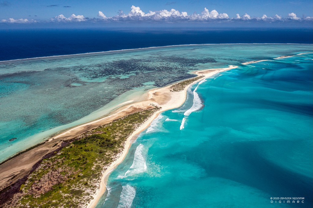
10.00 – The reward for these efforts is the view of Dagorne Island. It is a sandbank of fine sand made from crushed corals and shells, covered with sparse vegetation. This photo shows the view towards the southern end of the archipelago. Our boat can be seen on the left side of Dagorne Island.
The island is used by South Island fishermen as a “parking lot” for their boats. In the middle of this photo you can see our drone “command center”.
If the boat on the left side looks familiar, then you are attentive readers of my travel journal 👍😀. The same boat can be seen in my photo from the second day of our expedition. In it were two fishermen from South Island, for whom we brought a boat engine from Mauritius..
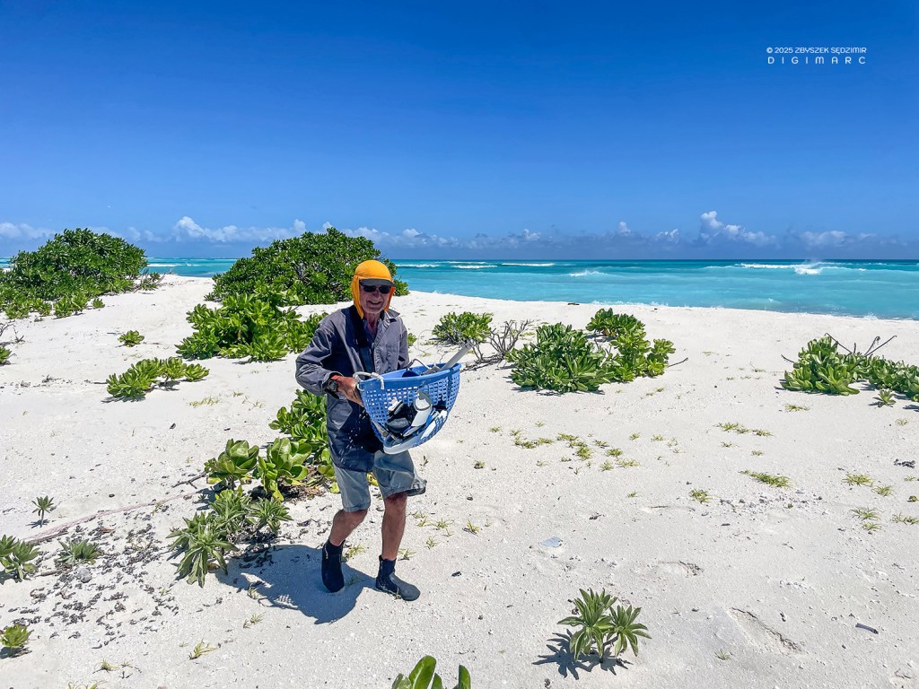
This island is also teeming with plastic waste. Finding something like a basket, I started collecting trash around our “command center.”

This is the result of about 15 minutes of collecting within a radius of about 15 meters!
Dagorne Island (at the bottom) is adjacent to Coco Island (at the top). They are separated by only a small strait.
Dagorne Island (at the bottom) is adjacent to Coco IslaCoco Island is one of the larger islands in the archipelago. It is almost 4 kilometers long. It used to have many coconut palms, but a cyclone that devastated the archipelago 40 years ago destroyed almost all of them. There are plans to replant the island with palms, but the obstacle is the wild rabbits, which prevent the young palms from surviving.nd (at the top). They are separated by only a small strait.
The crossing to Coco Island took longer than expected. The reason is the shallowness of the lagoon, through which it was necessary to sail at minimum speed with one engine.

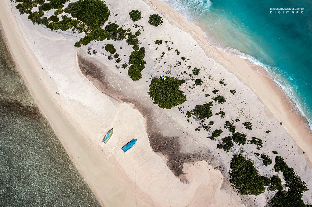
On Coco Island, we hid in the dense thickets right by the beach.
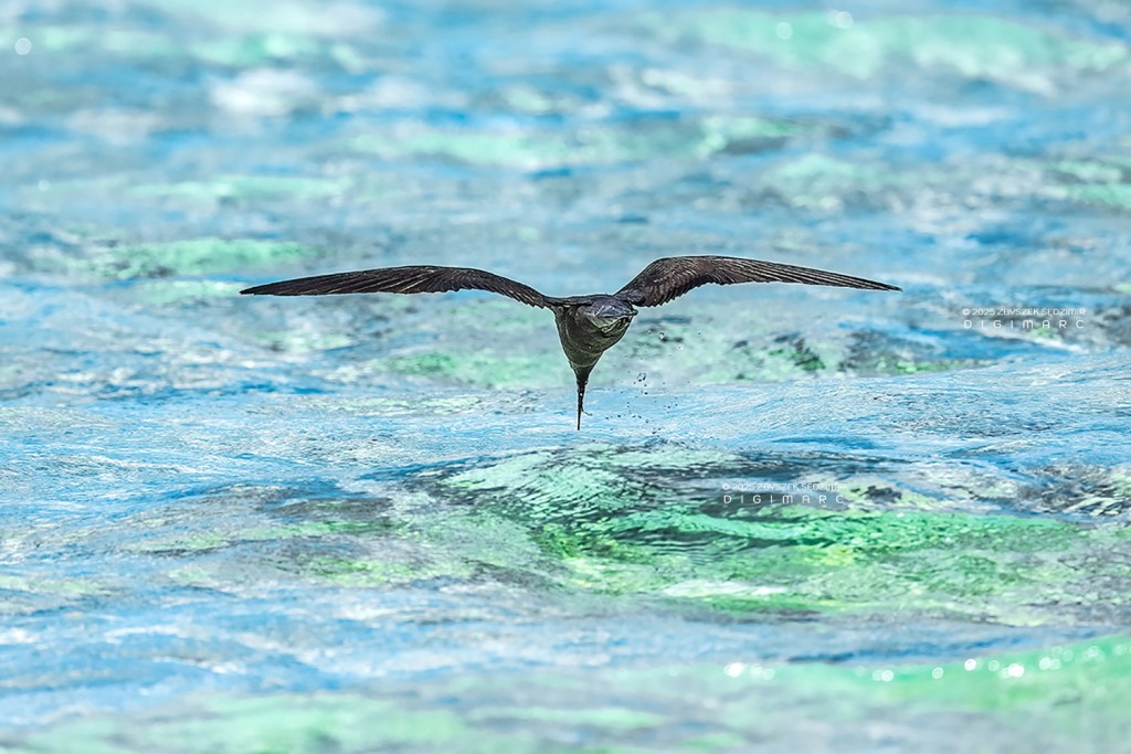
I focused on photographing birds hunting in the sea.
Coco Island viewed towards the southern end of the archipelago.
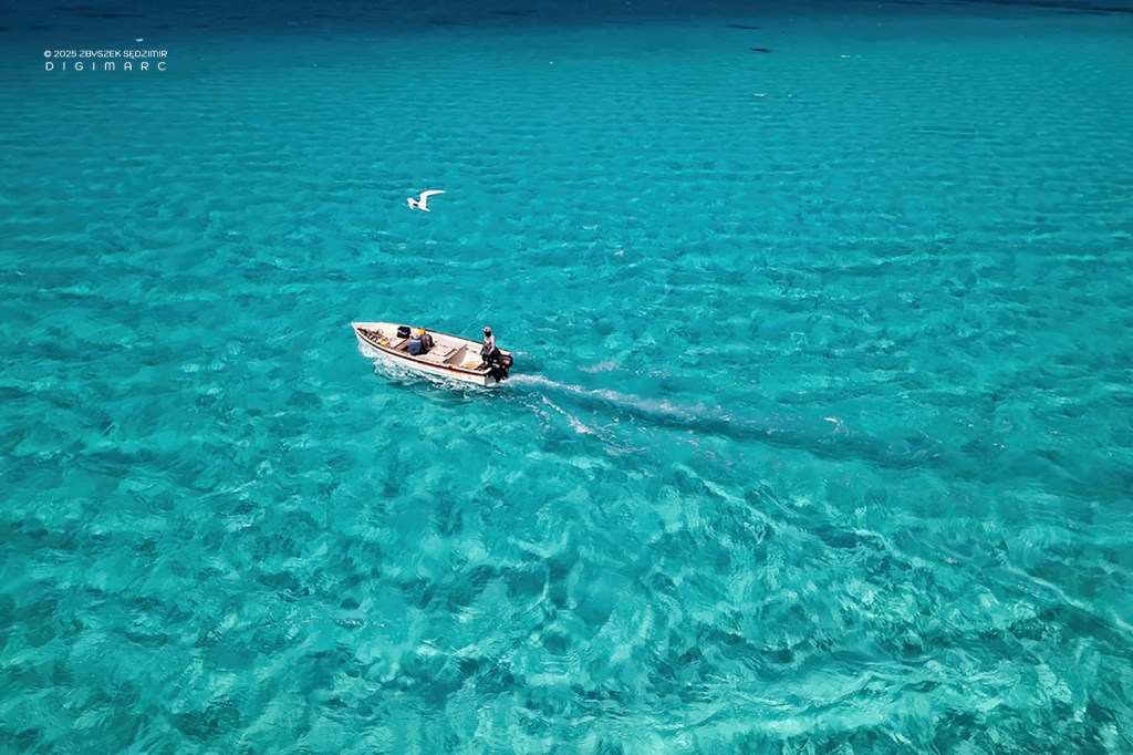
On the way home, as usual with an escort.
Day 8
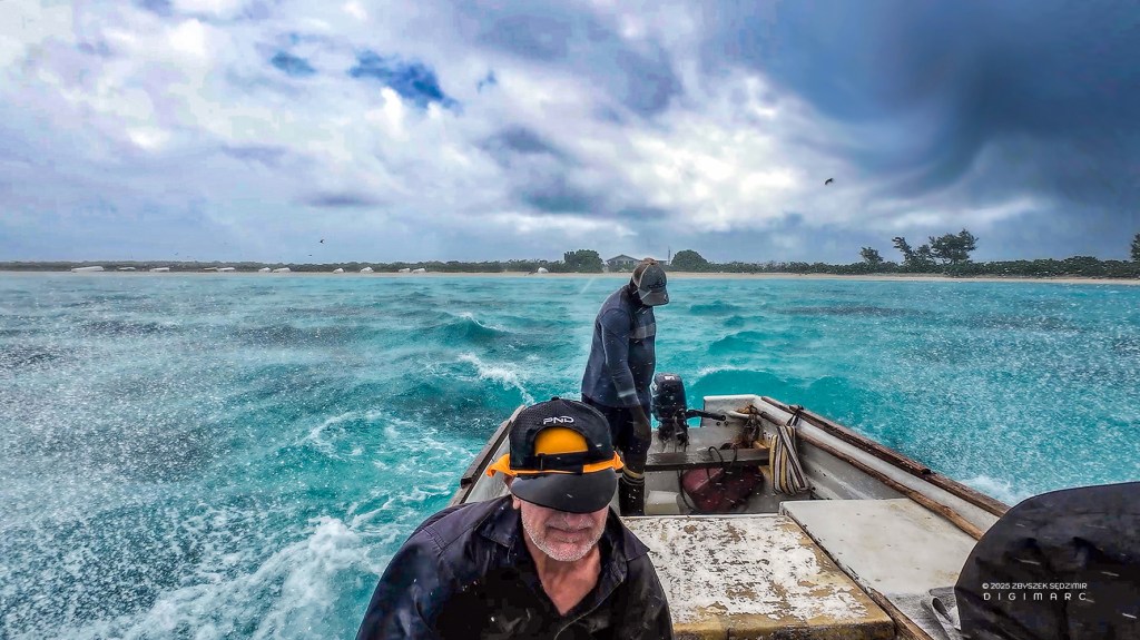
16.04.2024 – Eighth day of the expedition. The destination is South Island. It will be our longest journey and will take over three hours under conditions similar to the previous day: many waves and a lot of bouncing in the boat.
Before sailing, we clear out our accommodation on Raphael Island because the next night we will sleep on the South Island. In turn, after returning from South Island, we will spend the night on the Fregate, which will take us back to Port Louis.
08:01 – The first hour of the journey passes without significant changes in the landscape: ocean, sky, and our boat.
08:55 – We pass by Coco Island.
Further south, there are more and more sandbanks, barely protruding from the water but full of winged visitors.
10.15 – We finally reached our destination: the South Island!
The boat is anchored in the water.
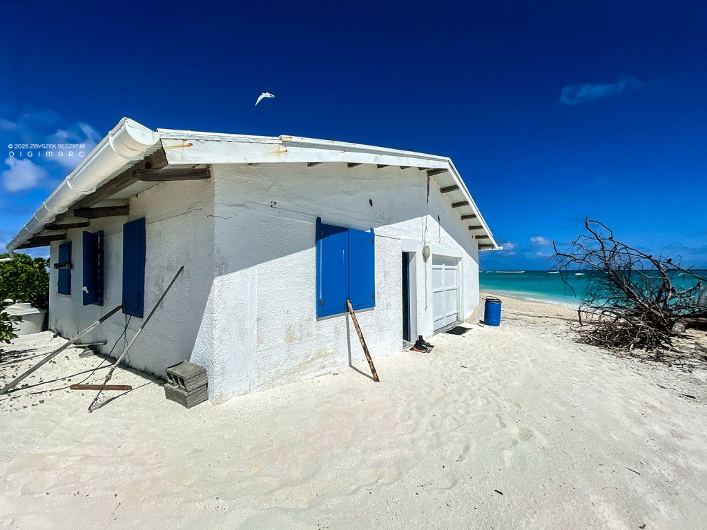
From the beach, a narrow path leads to the bungalow where we will spend the night.
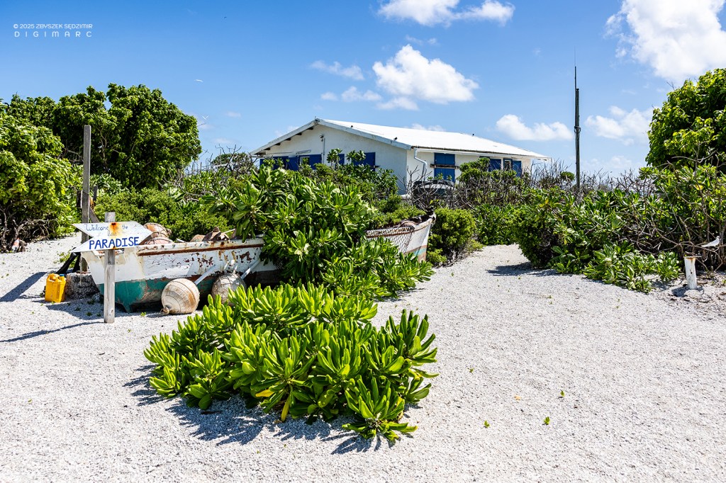
The welcome visible on the signpost on the left accurately reflects the character of this place.
Upon reaching the bungalow, it turns out that there is also a beach on the other side.
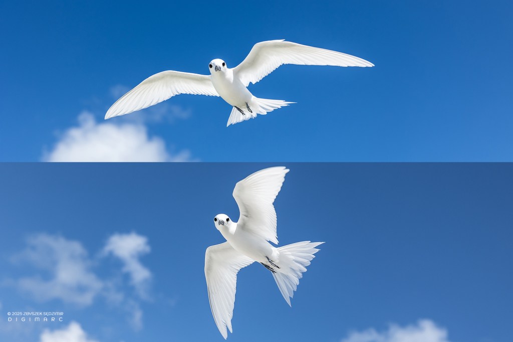
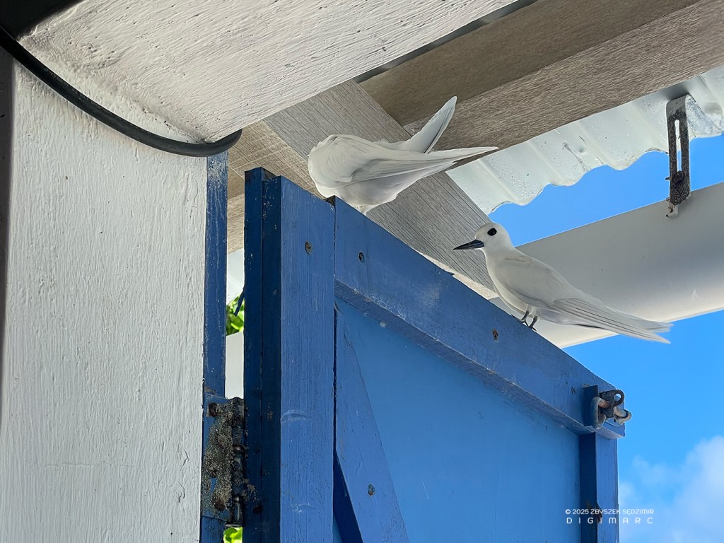
While I familiarize myself with the surroundings, a white tern accompanies me, as if trying to guess my intentions.
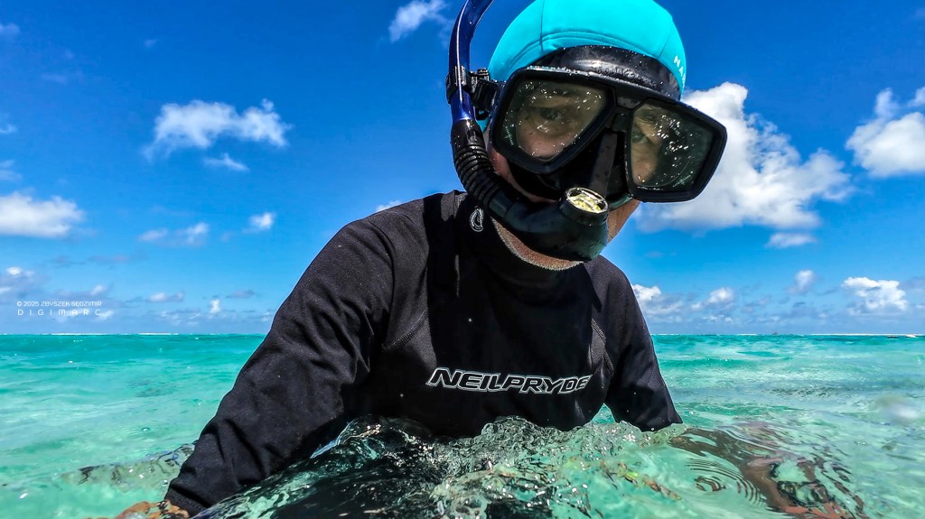
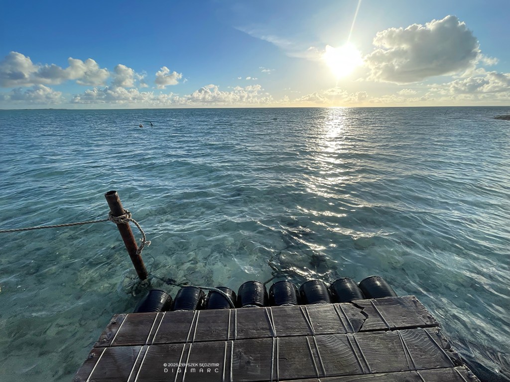
13:15 – In the afternoon, I decided to go into the water to take some photos. Due to the large number of sharks, I didn’t dare to do this in the northern part of the archipelago. Mr. Boulon assured me that in the eastern part of the lagoon near South Island, there is nothing to fear.
Underwater, I was breathless: at a distance of 10-15 meters from the shore and at a depth of 3 meters, I had views similar to those in Mauritius at a depth of 12 meters, one kilometer from the shore.
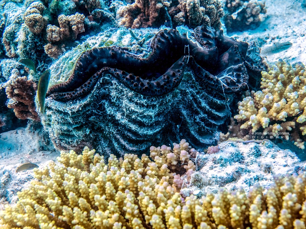
The beautiful bénitier quickly close their shells when they notice my shadow…
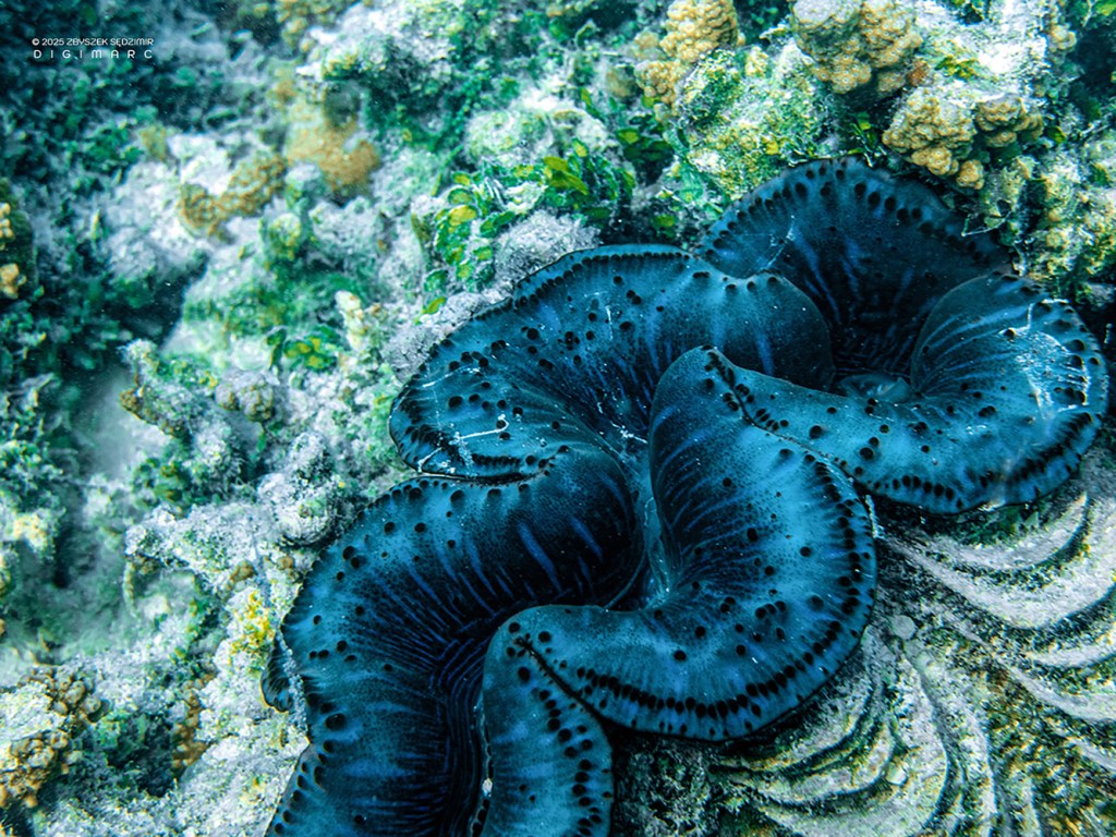
The beautiful bénitier quickly close their shells when they notice my shadow…
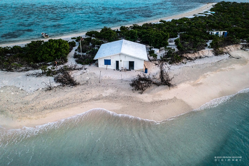
After the underwater photos, it’s time for aerial shots. In our bungalow, we will be lulled to sleep tonight by the sound of waves on both sides of the building.
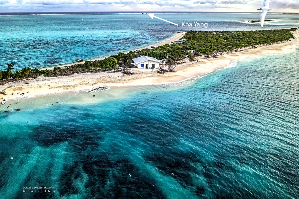
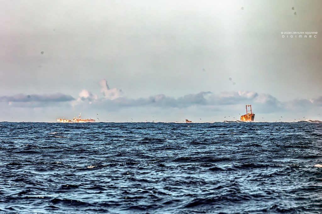
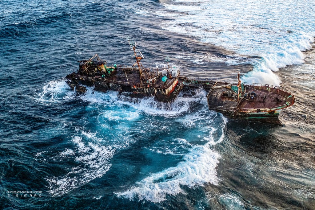
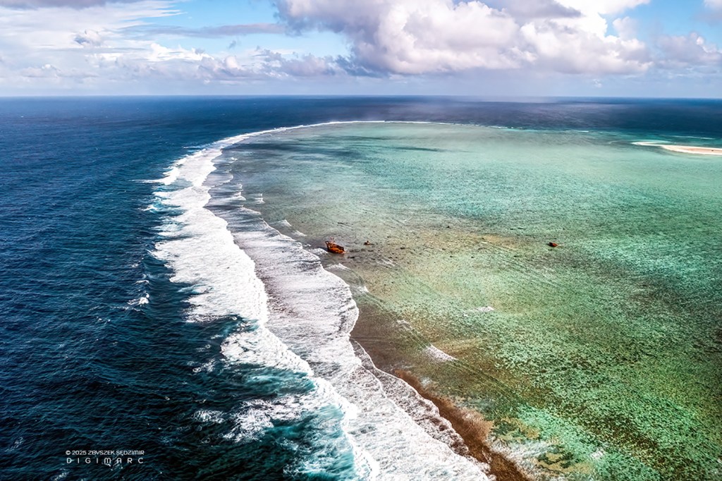
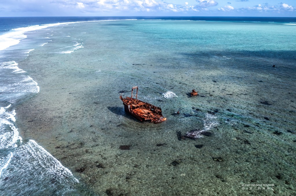
View towards the southeast: in the foreground is the South Island with our bungalow. In the background is the eastern coral reef, where two large fishing vessels are stranded. In this photo, you can see the “Khan Yang” from Malaysia, which ran aground on the reef in February 2015.
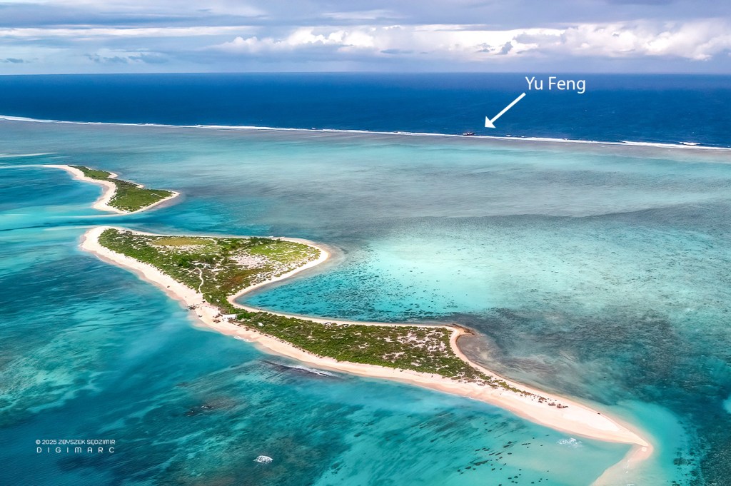
Changing perspective to the northeast: in the foreground is South Island, slightly higher is Grand Capitaine Island. In the background, the eastern coral reef with the wreck of “Yu Feng 67” from Taiwan, which ran aground on the reef in December 2022.
Its crew was rescued by fishermen who arrived at the accident site in fishing boats from Raphael Island. Fortunately, there was no oil spill.
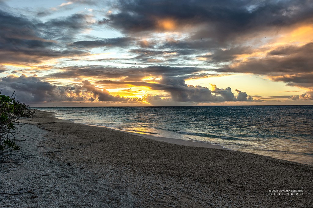
17:55 – Just after sunset. Suddenly, everything calms down. The birds grow quiet and prepare for the night.
Pierre is planning photos for the next day.
An unexpected visit from a native resident of South Island: leisurely exploring one room after another, and after about 20 minutes, returns to where he came from 🤓
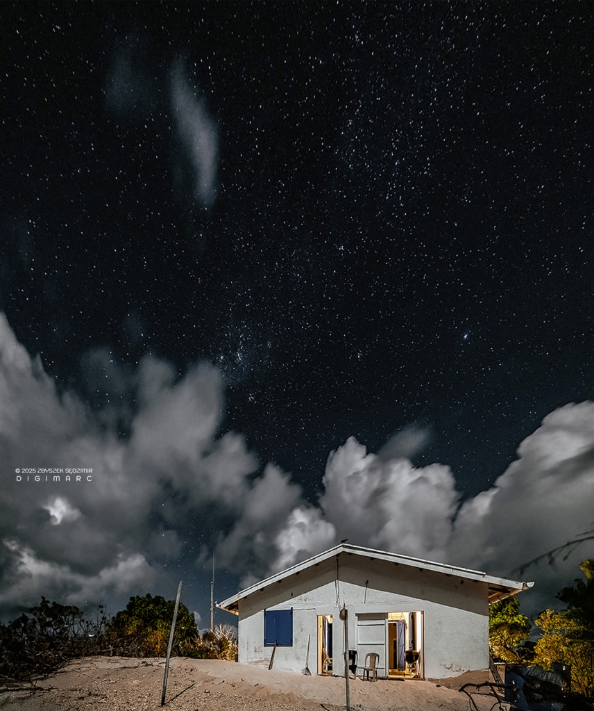
19:51 – A beautiful moonlit night. Outside, there is practically no artificial lighting. Ideal conditions for taking some night photos.
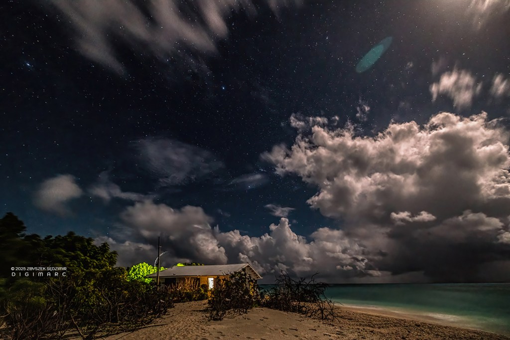
20:14 – The moonlight is so strong that it illuminates the beach like the sun.
20:30 – Even at night, the birds are all facing the same direction 😅
Day 9
17.04.2024 6:47 AM – A new day on South Island. Someone wants to sleep a bit longer, but someone else isn’t letting them 😉
During breakfast, someone is visiting us. Could it be the same pair I saw early in the morning?
After breakfast, I’m sending the drone towards the Malaysian wreck, “Khan Yang.”
It is in a state of advanced decay.
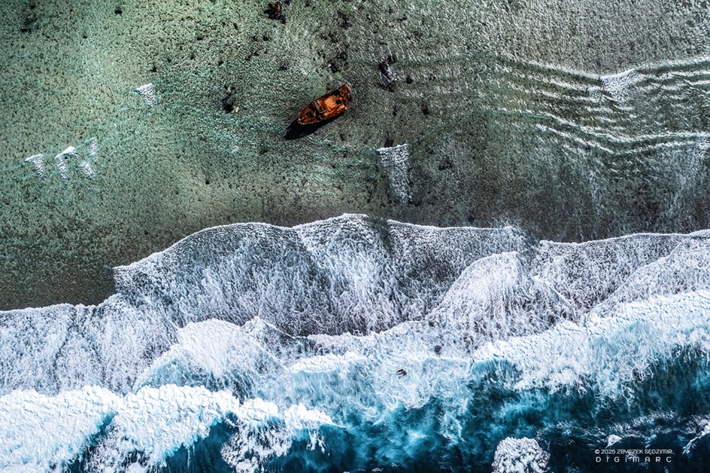
Additionally, a few years ago, a strong cyclone “threw” the wreck over the reef so that it is now located in the lagoon.
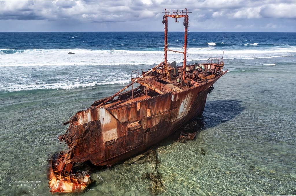
One more shot from up close.
Around 11 AM, we start preparing to return to Raphael Island. In the meantime, the weather has deteriorated significantly, with strong winds and heavy rain on the way.
We hurry to load our equipment.
As we push off from the shore, it starts pouring.
After 10 minutes, we have to return to South Island because Mr. Boulon, in the heavy rain, is unable to see unexpected obstacles and we risk getting stuck on the reef.
We wait out the rain in a bungalow used by fishermen.
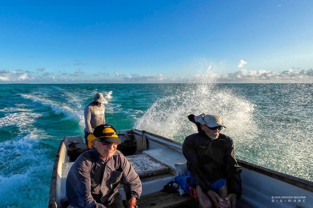
After half an hour, the rain stops and we set off again. The three and a half hour journey to Raphael Island seems endless. This time, we are constantly being drenched by the spray from the waves breaking against our boat.

When we arrive, we are soaked to the bone.
This time, we don’t stop at the island but head straight to the Fregate, which is anchored in deeper water. Our luggage is already on board; we just need to transfer our photography equipment.
On the frigate polished to a high shine, the crew is waiting for us with dinner …
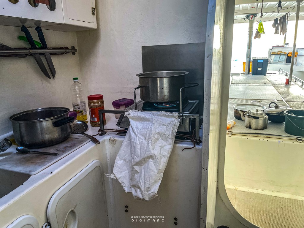
… being prepared in the galley.
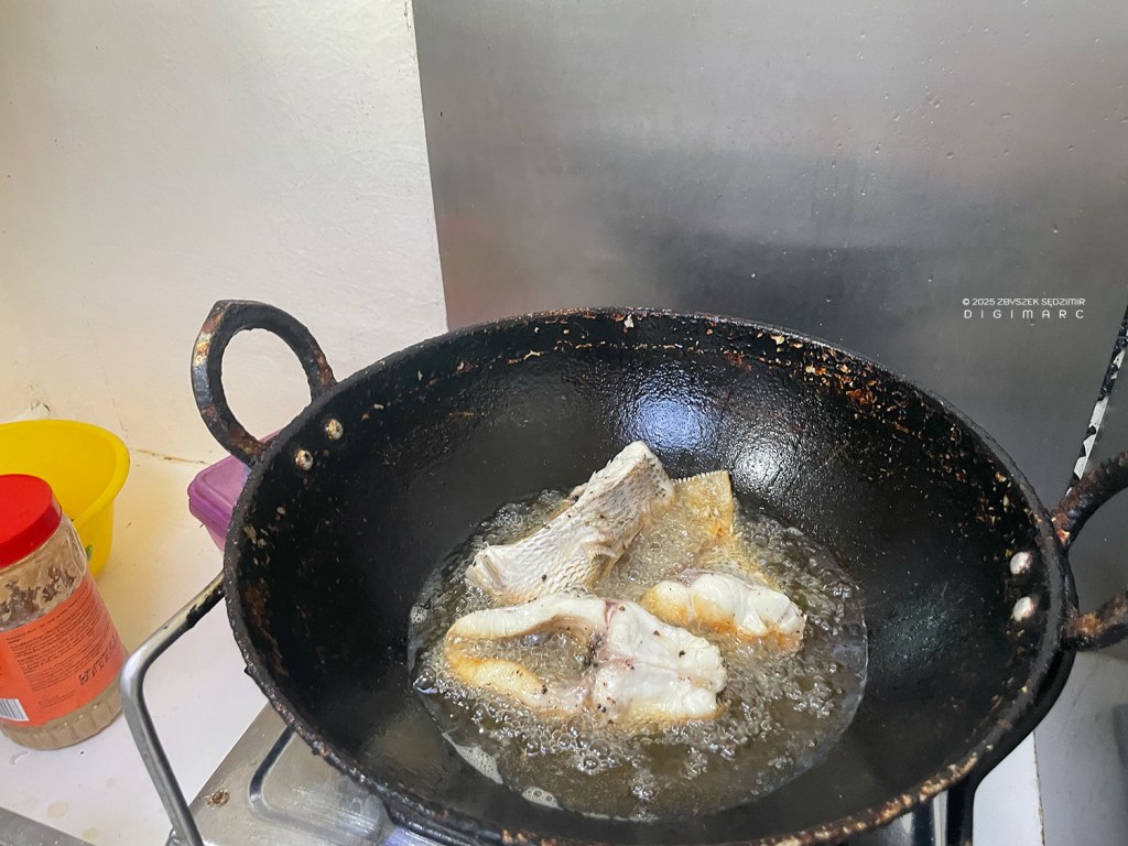
It will be a wonderful “curry poisson” made from freshly caught “capitaines.”
We spend the night on the Frigate, which will set sail back to Mauritius only tomorrow morning.
After sunset, our “twin” Albatros, which has just arrived from Port Louis, comes alongside us.
Day 10
18.04.2024 5:53 AM – After a peaceful night spent on the Fregate, we are savouring the moment before sunrise.
The crew of the Albatros is still sleeping.
The journey starts well; the ocean is calm, and the waves are small.
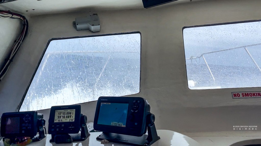
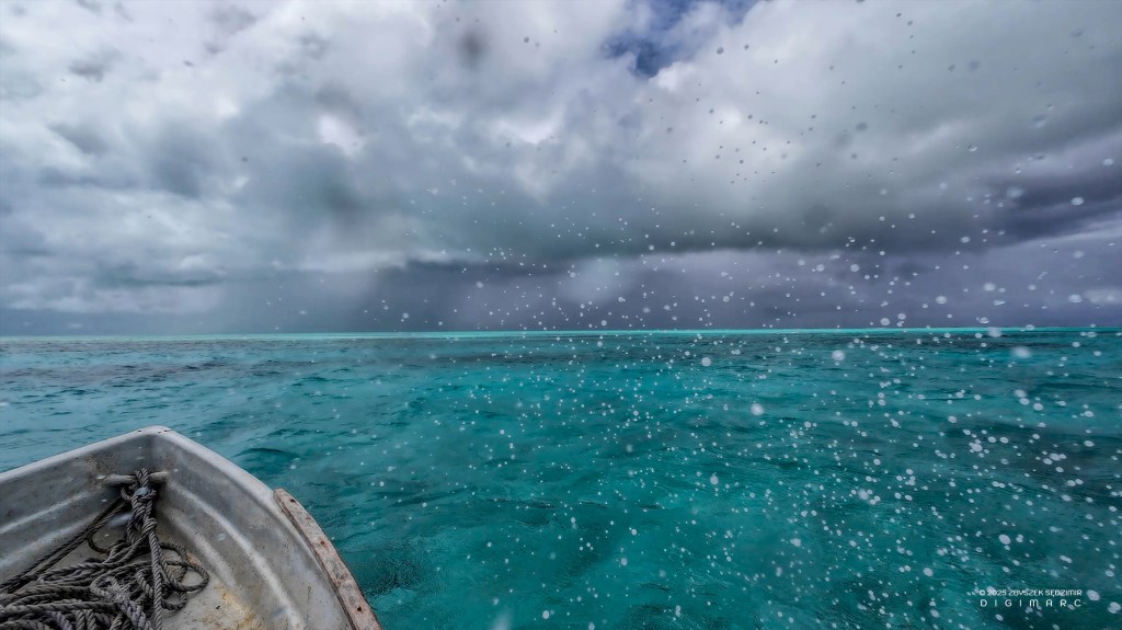
After two hours, the weather changes dramatically: a strong wind is blowing from the east, and the ship is battling high waves. Traversing the deck requires acrobatic skills.
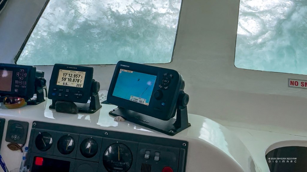
At times, the waves are so high that water completely covers the windows on the bridge.
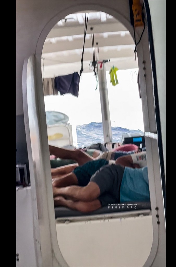
On the deck, most passengers are in a horizontal position.
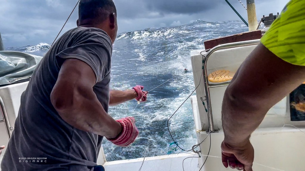
The crew tries their luck by trailing a lure behind the ship on a line. Suddenly, something big is caught. Now they have to pull the catch out of the water without breaking the line.
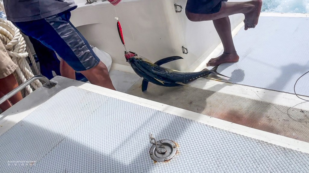
It worked out—it’s a 7-kilogram tuna.
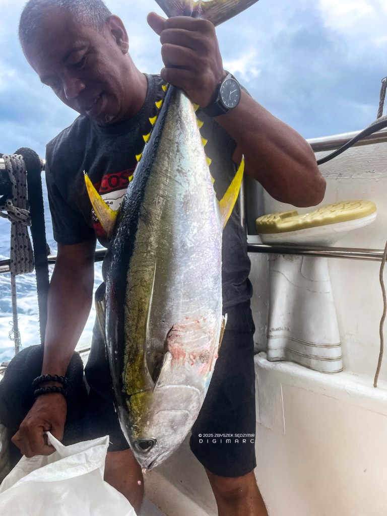
One hour later, another one got caught.
Day 11
19.04.2024 06:28 – After a restless night, the next and final day of our expedition arrives.
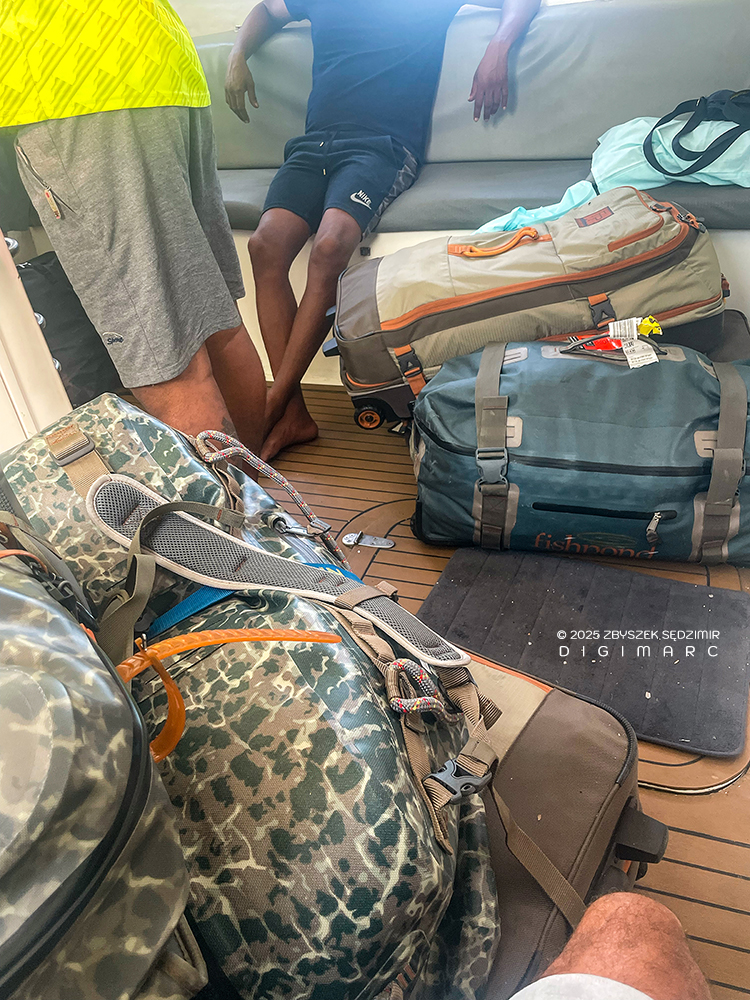
Three and a half hours later, the luggage is being pulled onto the deck as we approach Port Louis.
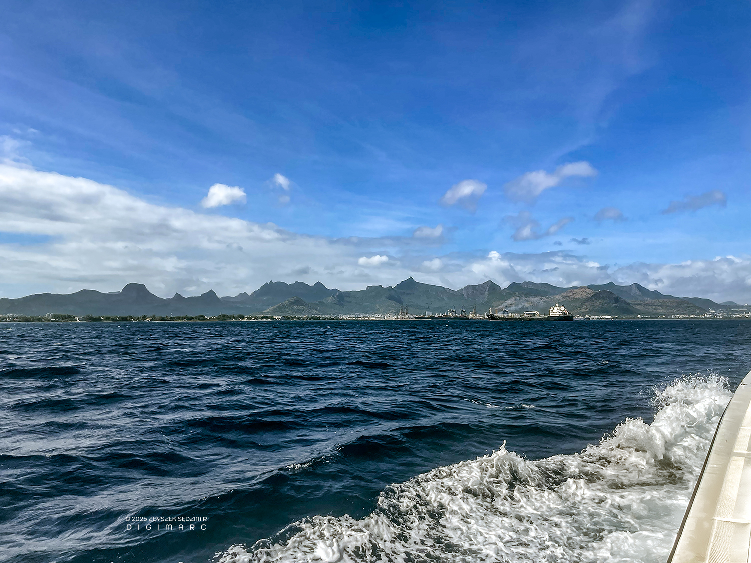
A familiar coastline appears on the horizon.
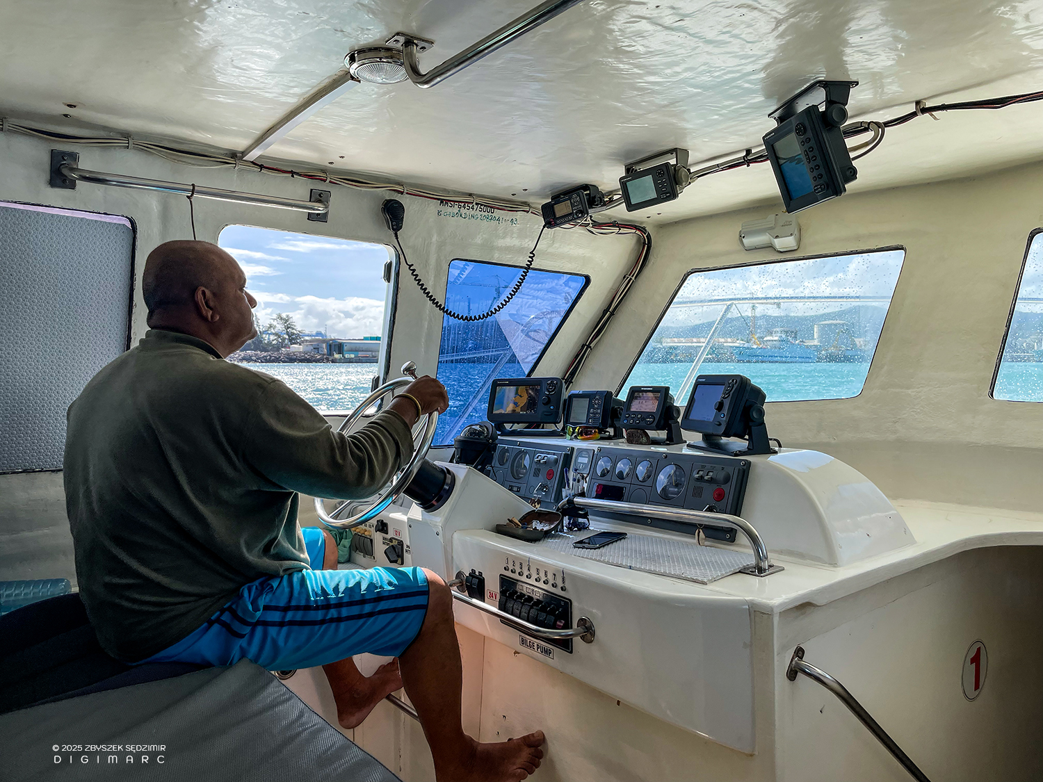
The autopilot is now off and the captain is focused as there is a lot of traffic in the port.
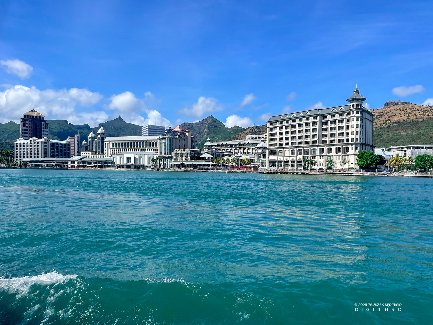
Port Louis welcomes us with beautiful weather. In front of us is the Caudan Waterfront, an old port that housed port warehouses, maritime workshops and trading companies, which was completely rebuilt in the 1980s and 1990s according to the plans of the Mauritian architect Maurice Giraud. Today, there are hotels, offices, restaurants, banks as well as a theater and a concert hall.
11:09 – Fregate docked in exactly the same place we left 11 days ago. All the camera gear is already loaded onto my car. Our expedition is over, but not the work associated with it. Pierre continues working on his album, and I on my website, where in addition to the “Saint Brandon” project, I would like to describe many others in which I have been and will be active as a photographer.
Copyright © 2026 Zbyszek SĘDZIMIR, All rights reserved.
