Rodriguan Adventures
As part of my project “Churches of Rodrigues,” I flew to Rodrigues on January 10. This time, I planned to meet there with my acquaintance Noreen and her friend Sophie. The two of them had arrived a few days earlier — it was their first time on the island — and intended to explore Rodrigues per pedes apostolorum — backpacks, tents, and a generous amount of optimism included.
They are quite experienced in this way of traveling. They have hiked and camped in many parts of the world — Madagascar, India, South America, and elsewhere. I quickly decided to join the two adventurers and, shortly before departing from Mauritius, picked up the necessary equipment.
Saturday, 10.01.2026
I got up early to take care of the final preparations and make sure I hadn’t forgotten anything. It can be extremely frustrating to realize later on that a battery, a memory card, a charger, or some other essential cable is missing.
The coastal road to the airport was empty at that hour. I left my car in the airport parking lot. At check-in, the first small reality check followed: both my hiking backpack and my camera bag together weighed well over the allowed 15 kg. In the end, I had to pay an extra 1,500 rupees for the excess baggage — a price I accepted without much hesitation at the time.
.
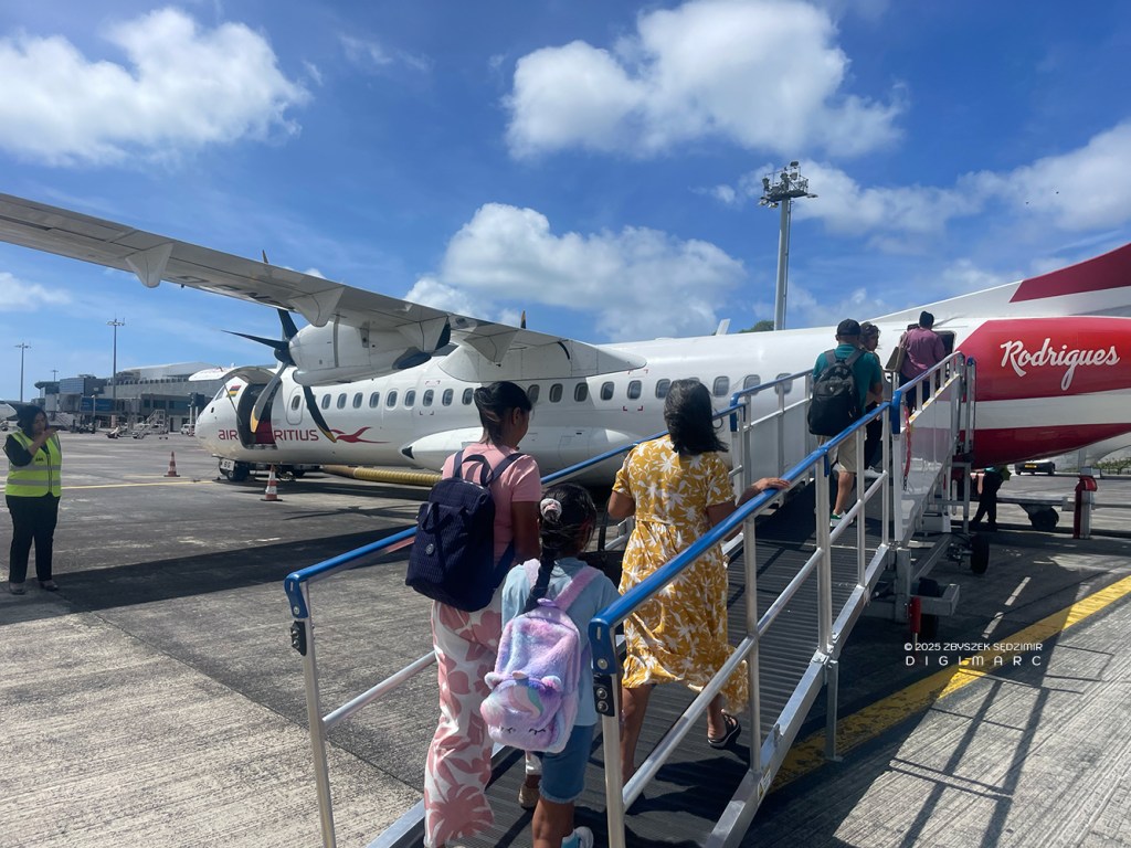
Flights to Rodrigues depart from a dedicated gate at Mauritius airport. The route is operated by small turboprop aircraft with around 70 seats (ATR 72-500 and ATR 72-600). The flight takes a little over an hour and a half. Snacks and drinks are served on board — just enough time to pause, breathe, and gather oneself before the real adventure begins.
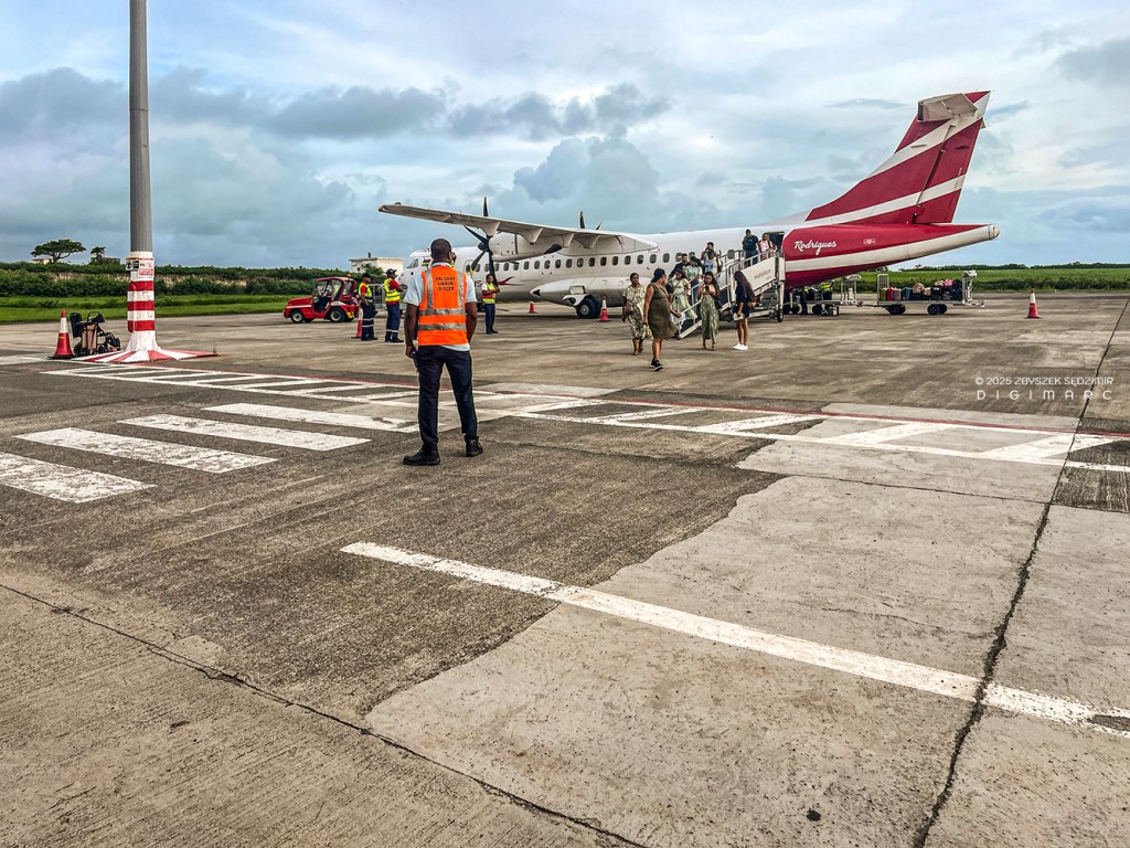
Rodrigues airport is so small that passengers walk from the aircraft straight to the terminal. Its location is no accident: Plaine Corail is flat and spacious enough to accommodate a runway — a rarity on an otherwise hilly island.
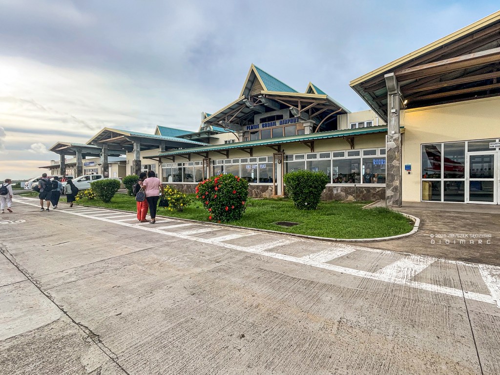
The small terminal building, designed by the Mauritian architect Gaëtan Siew, was completed in 2003. Yet aviation arrived on Rodrigues long before this modest structure existed: the first regular scheduled flight reached the island as early as September 1972, carried by a Piper Navajo PA-31
A small Kia was already waiting for me outside the airport, booked in advance through MFR, a local car rental company on Rodrigues. From there I drove along seemingly endless curves to Mangues, where my simple Airbnb room was located. I changed into hiking clothes and began packing my large backpack: tent, sleeping mat, sleeping bag, clothes, snorkeling gear, my Canon, food… in short, far too much — something I already sensed at that moment, and just as deliberately chose to ignore.
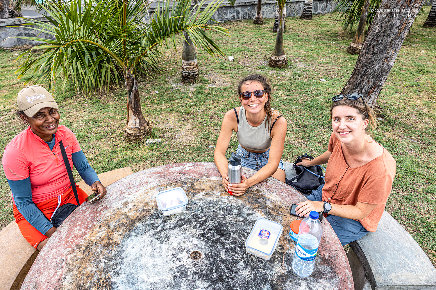
Afterwards, the journey took me on to Gravier, where I had arranged to meet Noreen and Sophie. They were already waiting for me at a small snack bar called “Kot Laurence.” I parked the car on the opposite side of the road. It was just before three o’clock in the afternoon when we finally set off together along the coastal path, filled with a sense of anticipation for what lay ahead.
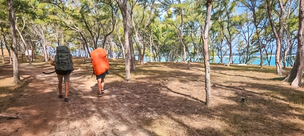
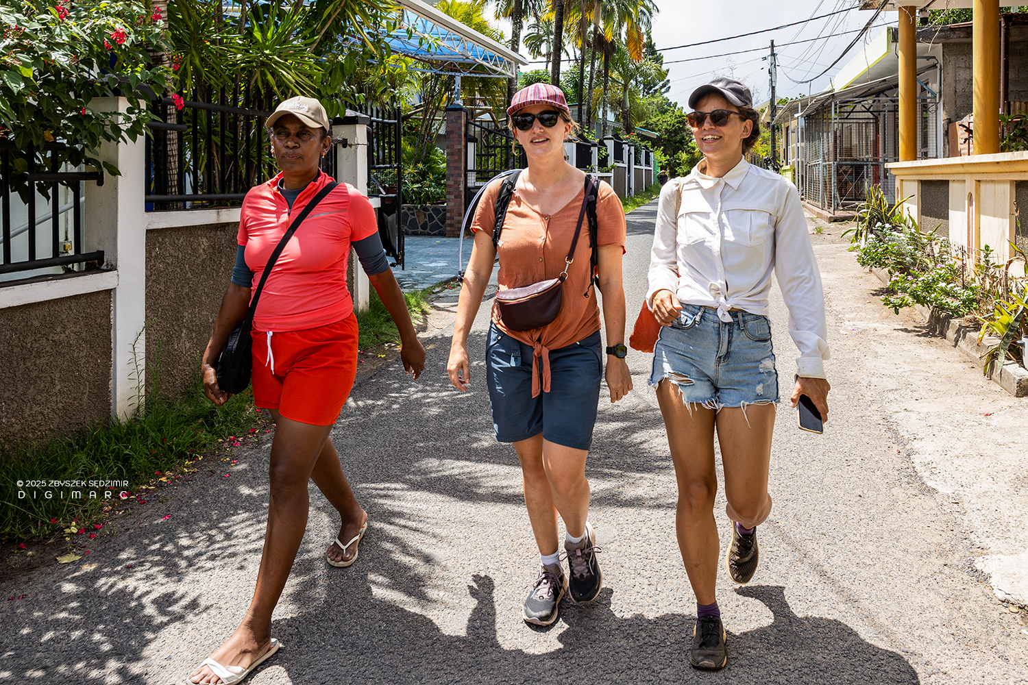
At the beginning, the path was straightforward: wide and flat, pleasantly shaded by filao trees, which—just as on Mauritius—grow along the coast (photo by Noreen).
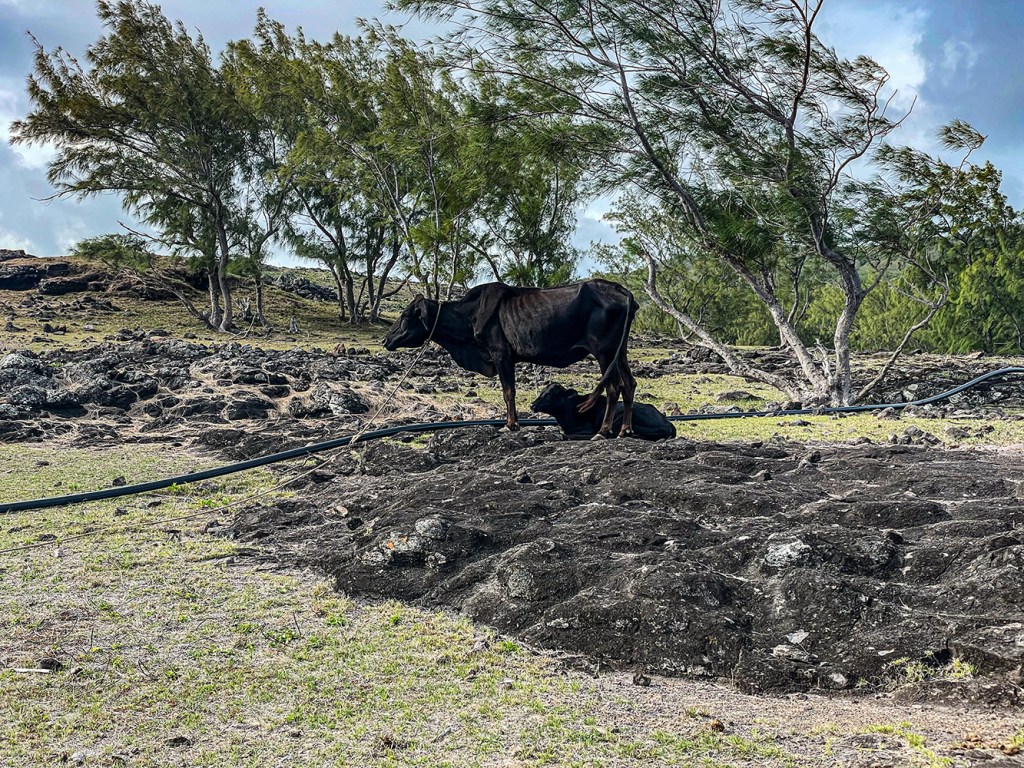
Along the path, grazing cows, goats, and sheep are everywhere, as well as chickens moving about with their chicks. This is typical of Rodrigues, whose population originally consisted largely of two groups: farmers and fishermen. The sight of freely roaming animals is not only beautiful, but also calming — industrial livestock farming does not (yet) exist on the island.

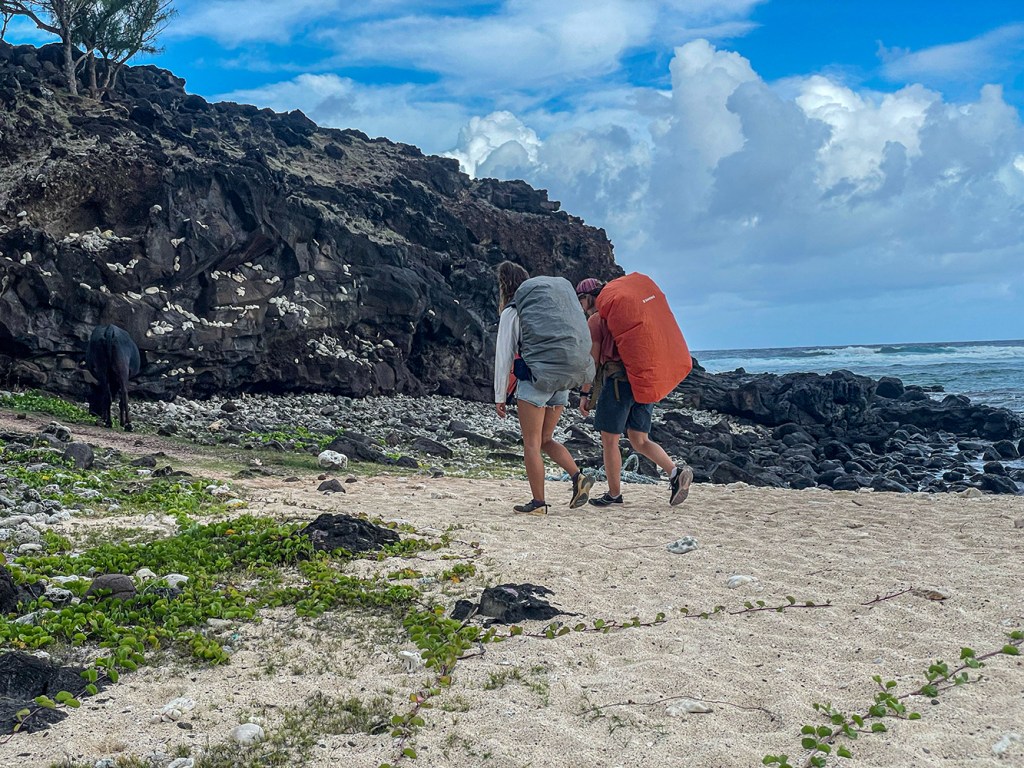
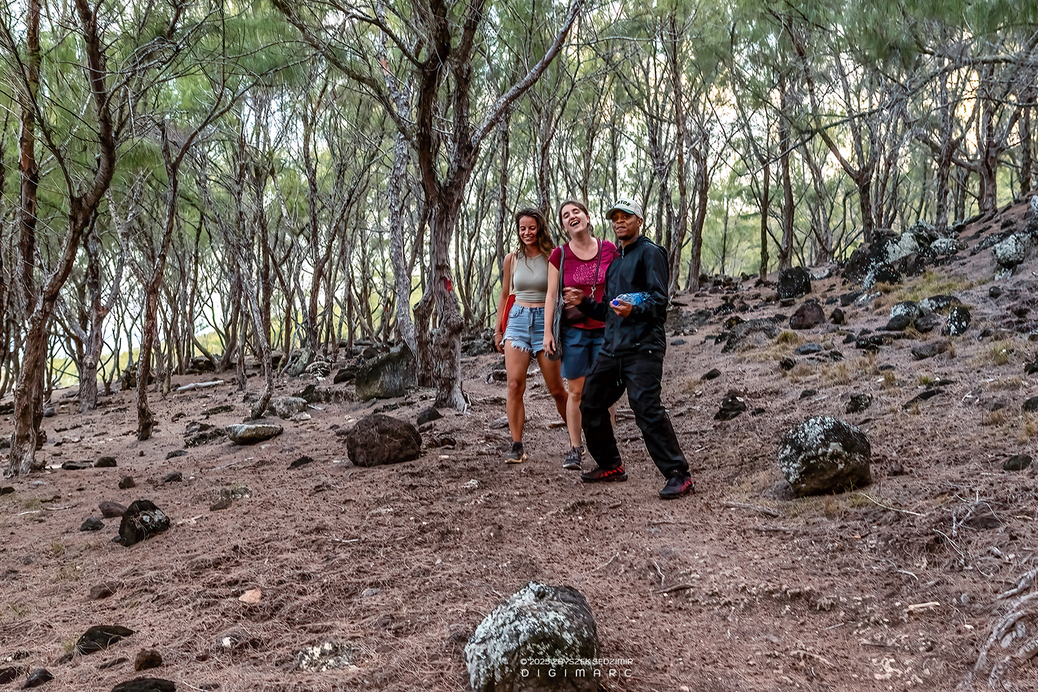
I’m on a narrow dirt path cutting through a slope of dark volcanic rocks. With little experience in multi-day hiking with a tent, I had seriously overestimated myself while packing and ended up carrying more than 20 kilos (photo by Noreen).
Noreen and Sophie, seasoned hikers, move ahead at an easy pace, chatting as they go. Every now and then they turn back to ask if I’m still okay. Their concerned looks say more than the question itself 😅
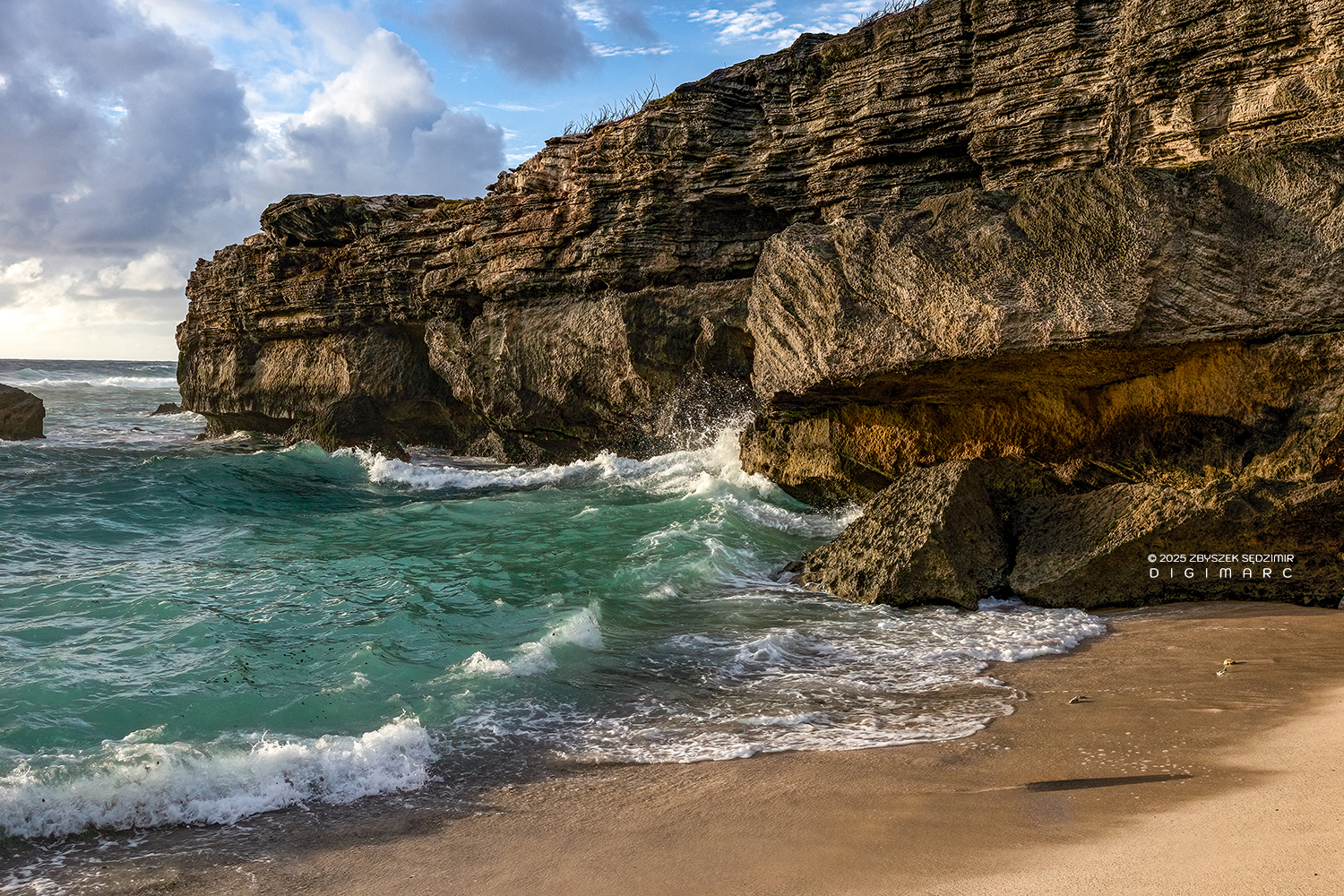
The path was very uneven, with gentle and less gentle climbs, but well marked. After just under three quarters of an hour, we reached the picturesque Anse Bouteille and stopped briefly to take photos.

First Sophie together with Noreen. I took the photo while they stood close together at the edge of the cliff, calm and completely at ease, their large backpacks still on their shoulders. The beach lay below them, some 30 meters down. Just looking made me feel slightly dizzy.
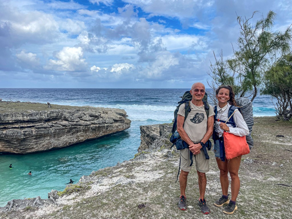
Then Noreen and I, keeping a respectful distance from the edge of the cliff — a decision I feel much more comfortable with (Photo by Sophie).
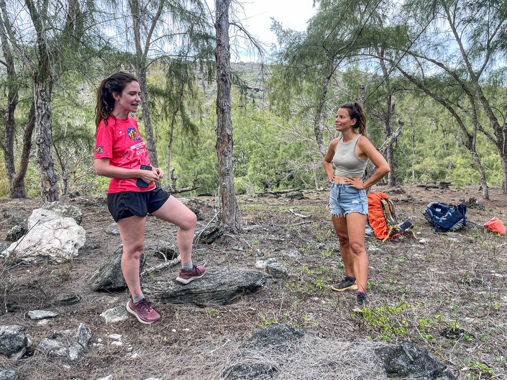
As we were about to continue, we were caught up by Blanche, also coming from Gravier. She is from La Réunion and had met Noreen and Sophie two days earlier during a diving trip. She is on Rodrigues to train for a trail race on La Réunion.

Blanche and Noreen look back once more in the direction we have come from.
In the upper part of the image, distinctive rock formations can be seen, typical of a so-called shield volcano. Rodrigues, like the other islands of the Mascarene archipelago, is of volcanic origin and was formed around 1.5 million years ago.
Shield volcanoes are characterized by their relatively gentle slopes and broad shape. Their lava is not expelled explosively like a fountain, but instead flows steadily out of the volcano — comparable to water seeping from a perforated pipe — spreading in thin layers over large areas. The slanted, layered rock formations visible today are remnants of these ancient lava flows.
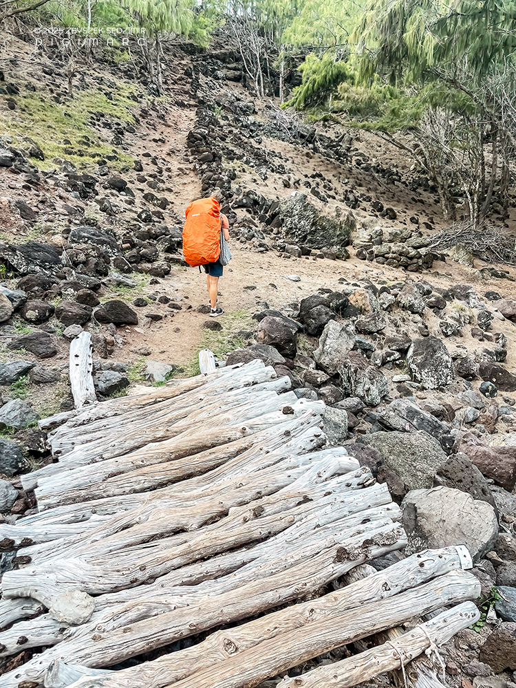
Sophie crosses the wooden footbridge and keeps going without stopping, determined not to lose her momentum. No sooner is the bridge behind us than the path climbs again — and my backpack makes it clear what starting out with it really means.
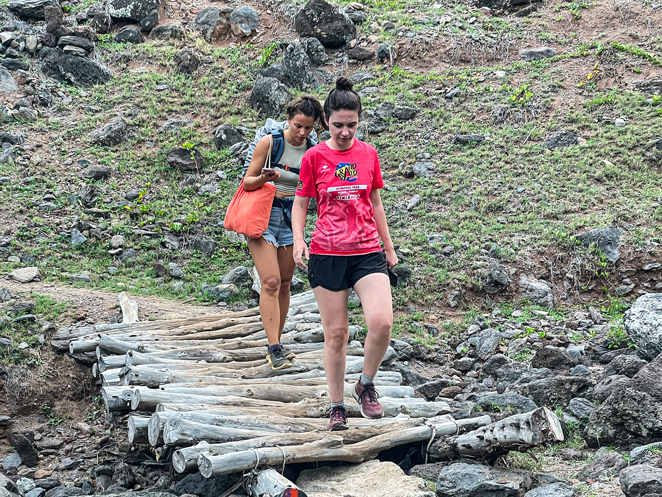
Noreen and Blanche follow us. With a large backpack on her shoulders, navigating rocky ground and chatting with Blanche, Noreen somehow still manages to stay in touch with the outside world via WhatsApp — a level of multitasking I admire from a safe distance 😅. She crosses the footbridge with particular focus: one wrong step, and the phone could disappear between the planks, never to be seen again.
In about an hour it will be dark, and we still need to reach Trou d’Argent to set up our tents while there is still daylight.
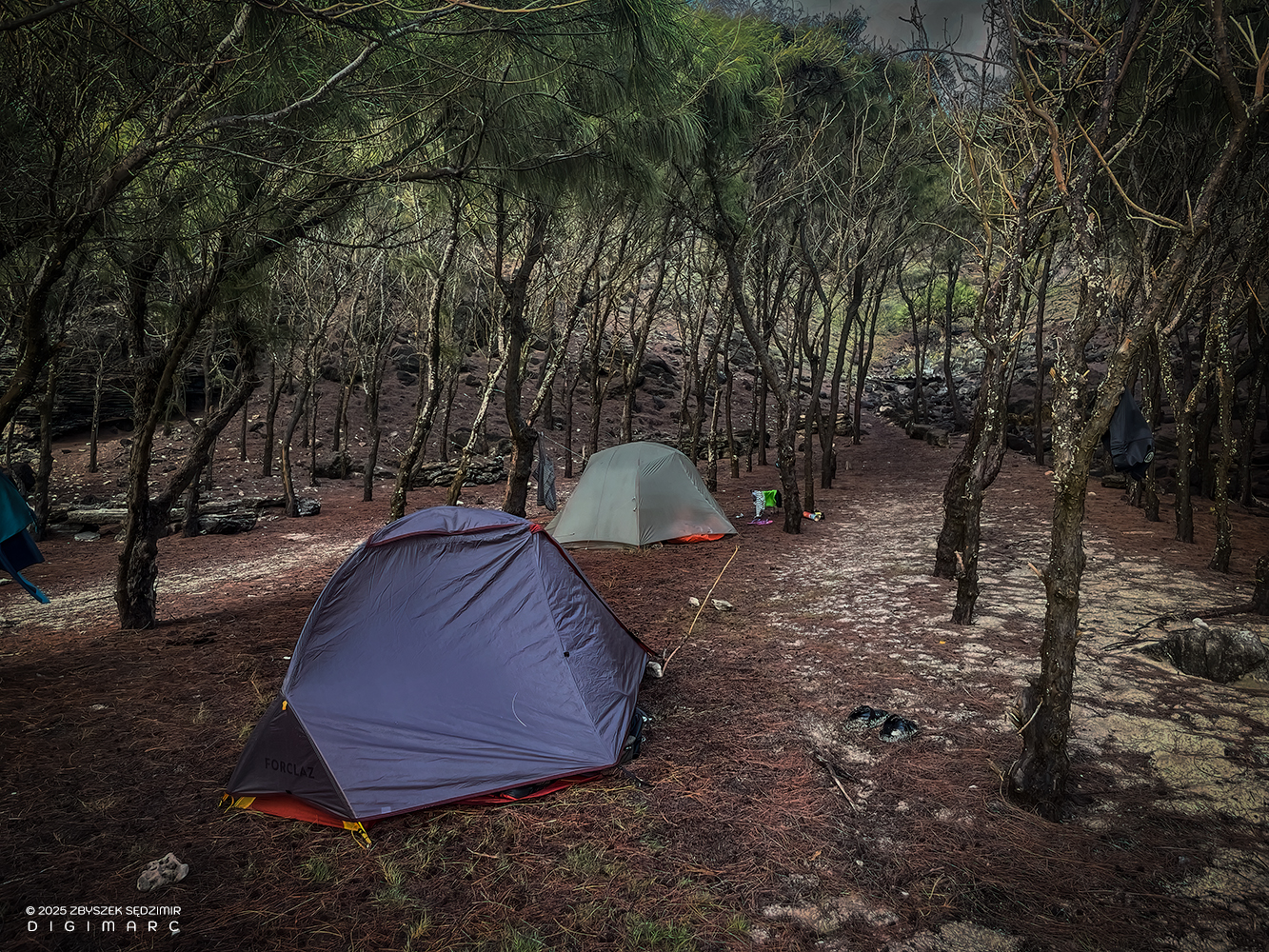
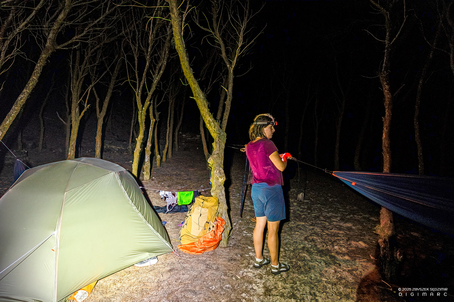
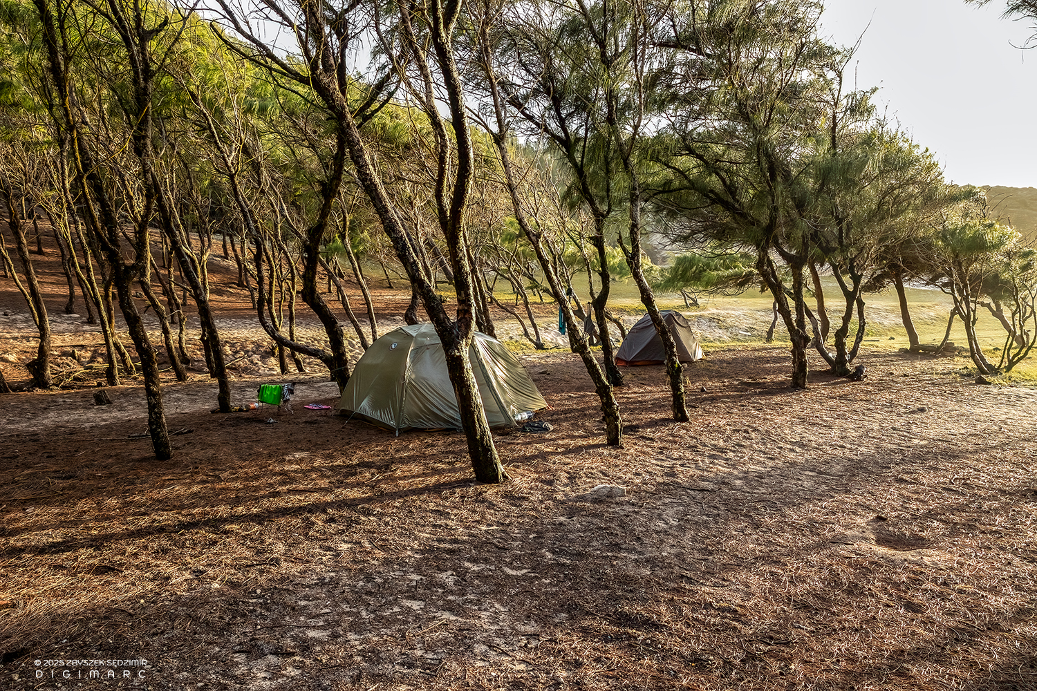
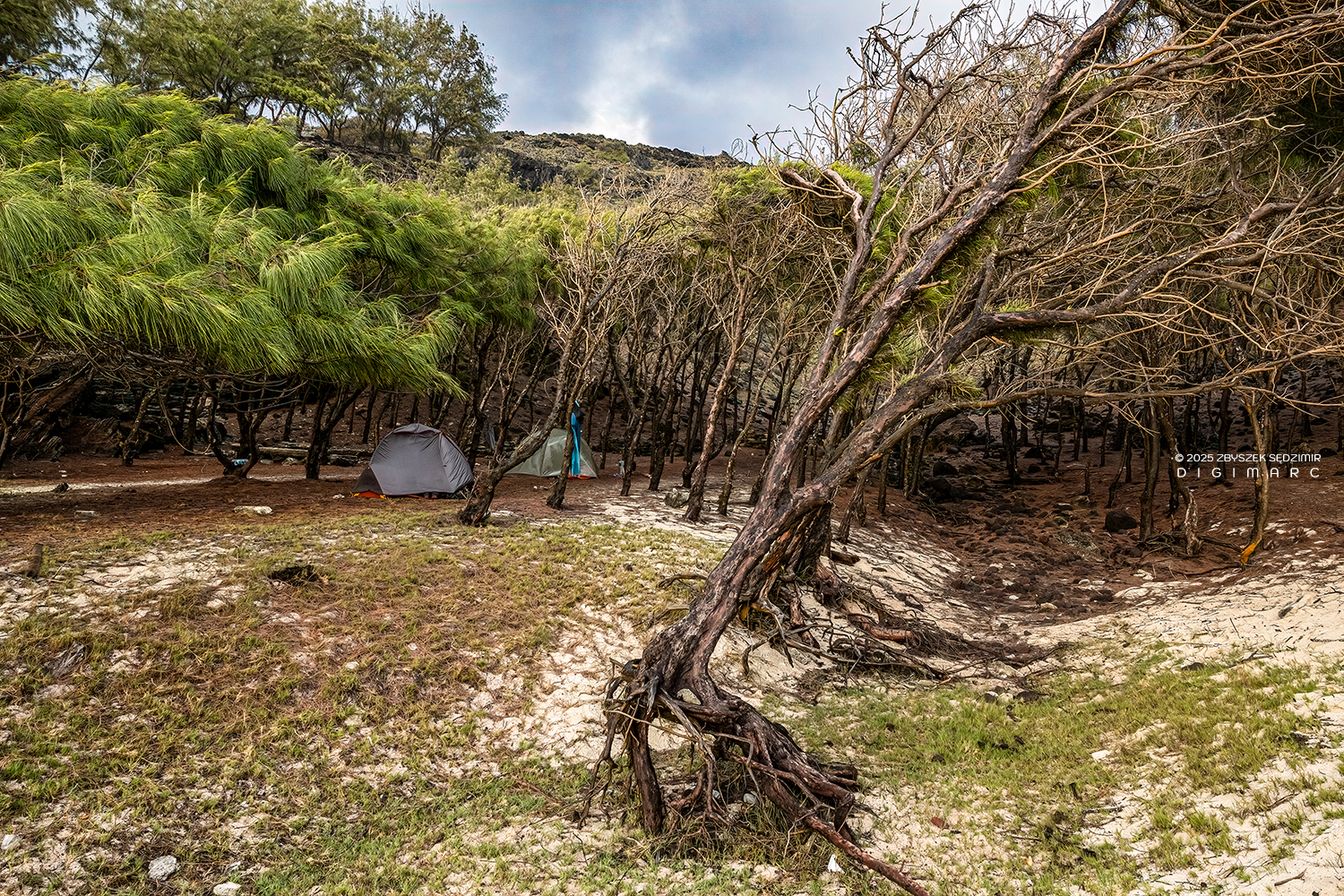
We make it to Trou d’Argent. Noreen and Sophie set up their tent with enviable ease — it is immediately clear that this is not their first time. For me, by contrast, the real exploration is only just beginning: which side is up, which is down? How does the flysheet attach? And why are the guy lines different colors? A true trial-and-error process.
The biggest challenge, however, is the ground on which I pitch my tent: pure sand. No grip at all for the tent pegs. To make the whole thing at least somewhat stable, I go looking for pieces of wood and heavy stones — with rather modest success.
Rest will have to wait. We continue on to Saint-François, where, according to what we had heard in Gravier, there should be a small snack bar offering food and beer — exactly what we need. The backpacks remain in the tents (nothing gets stolen on Rodrigues), and we move on unburdened. I savor the sudden lightness — my tormentor, the backpack, stays behind 😂. Along the way, Jeff, a friend of Noreen’s, joins us.
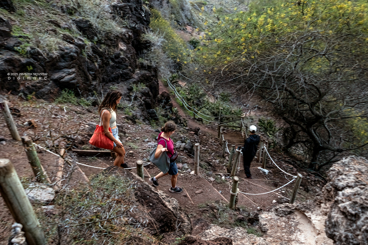
On some sections, like this one, the trail is well reinforced. This helps slow down erosion caused by foot traffic and at the same time makes the path more accessible for hikers with less experience or physical strength.
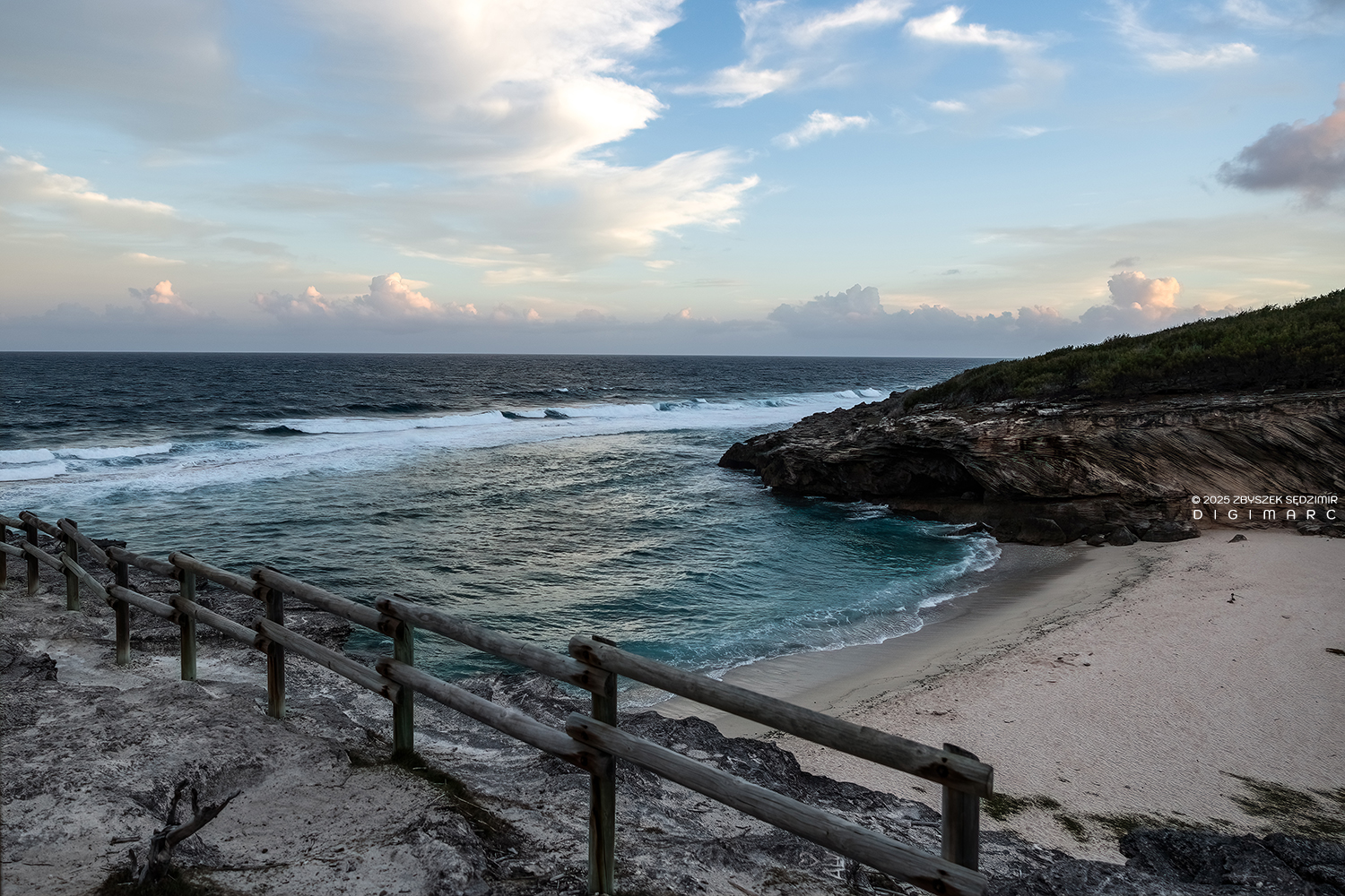
After the descent and the subsequent climb, we reach Anse Philibert. The beach here is broader than at Trou d’Argent, and there is a viewpoint from which the eye can wander across sea and rock — at a place that lies geographically at the easternmost edge of the Mascarene Islands
We are almost in Saint-François, and the relief is clearly visible on the faces of our small group.
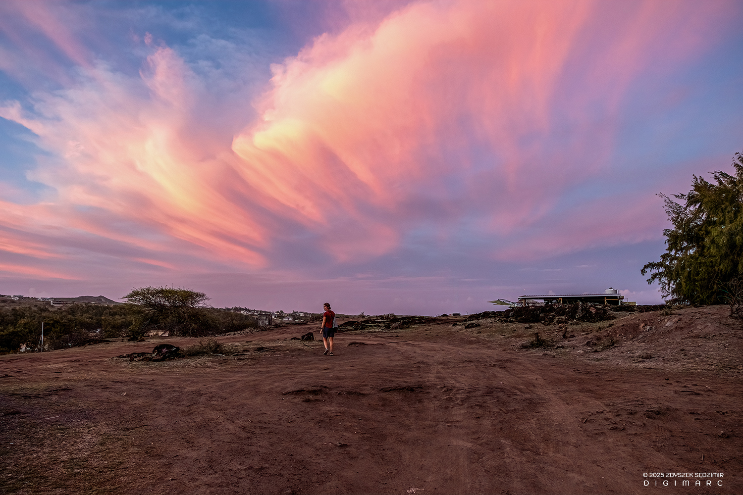
It is 7 p.m. We finally reach the summit at just the right moment to admire the sunset over Saint-François. Sophie looks out for a snack bar — only to discover that it lies in exactly the opposite direction and turns out to be a small restaurant, “Chez Dana”, with a beautiful, spacious terrace. Its roof and sunshades are visible to the right along the horizon..
The view holds us in place. The walk, the fatigue — everything else fades into the background. We stay seated longer than planned on the terrace, with fries and cold drinks, watching the sky change its colors as if it had all the time in the world.
When we set off again, carrying a few bottles of beer, bread rolls, and snacks, it is already pitch dark. With headlamps on, we make our way back toward Trou d’Argent, along the same path we had taken earlier. But the world has changed. The coast and the forest feel alive, restless.
It begins with the voices of the wedge-tailed shearwaters. Around Trou d’Argent, large breeding colonies of these birds nest in the ground. Their cries cut through the darkness — sounding like whimpering infants, cats in distress, distant howls. On many islands of the Indian and Pacific Oceans, such calls are traditionally believed to be the voices of spirits, or of the ancestors.
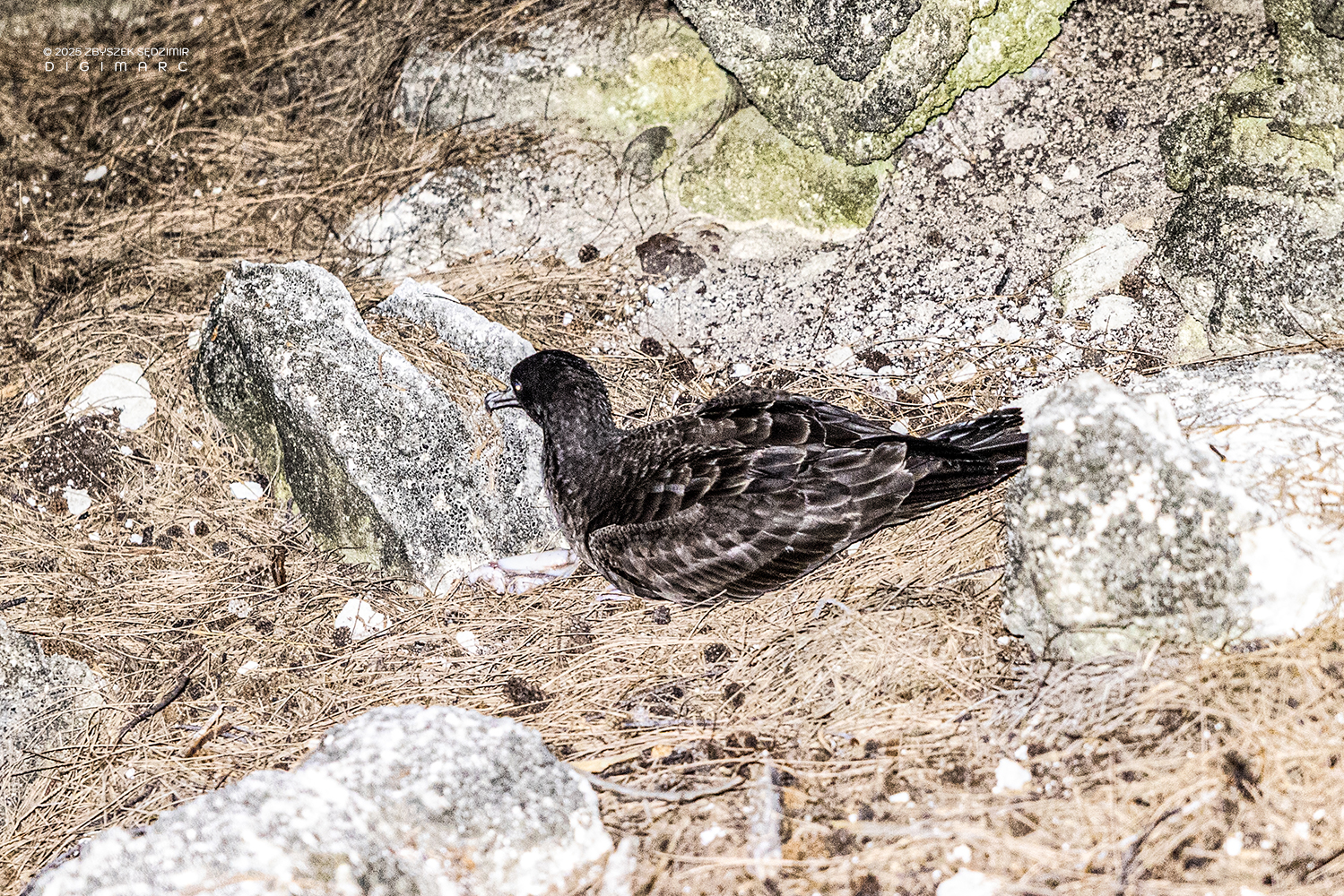
Suddenly, a wedge-tailed shearwater erupts from the darkness and collides with me. It now crouches motionless on the ground. The encounter is unexpected — and unwelcome — for both of us. I stay with it, watching for any sign of injury, waiting until it recovers enough to move again.
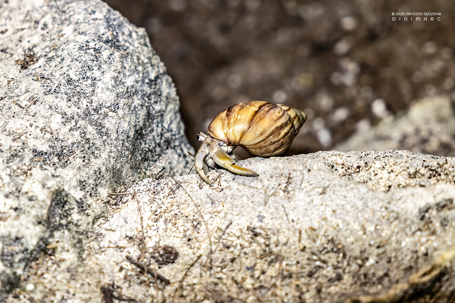
Less spectacular, but impressive in its own way, are the hermit crabs carrying their borrowed homes on their backs. I watched one of them for a long time as it hauled an oversized shell up a steep rock face — slow, strained, but persistent. It looked practiced, and oddly familiar: too much weight, no reason to hurry, and no option other than to keep moving. For the first time that day, I felt understood.
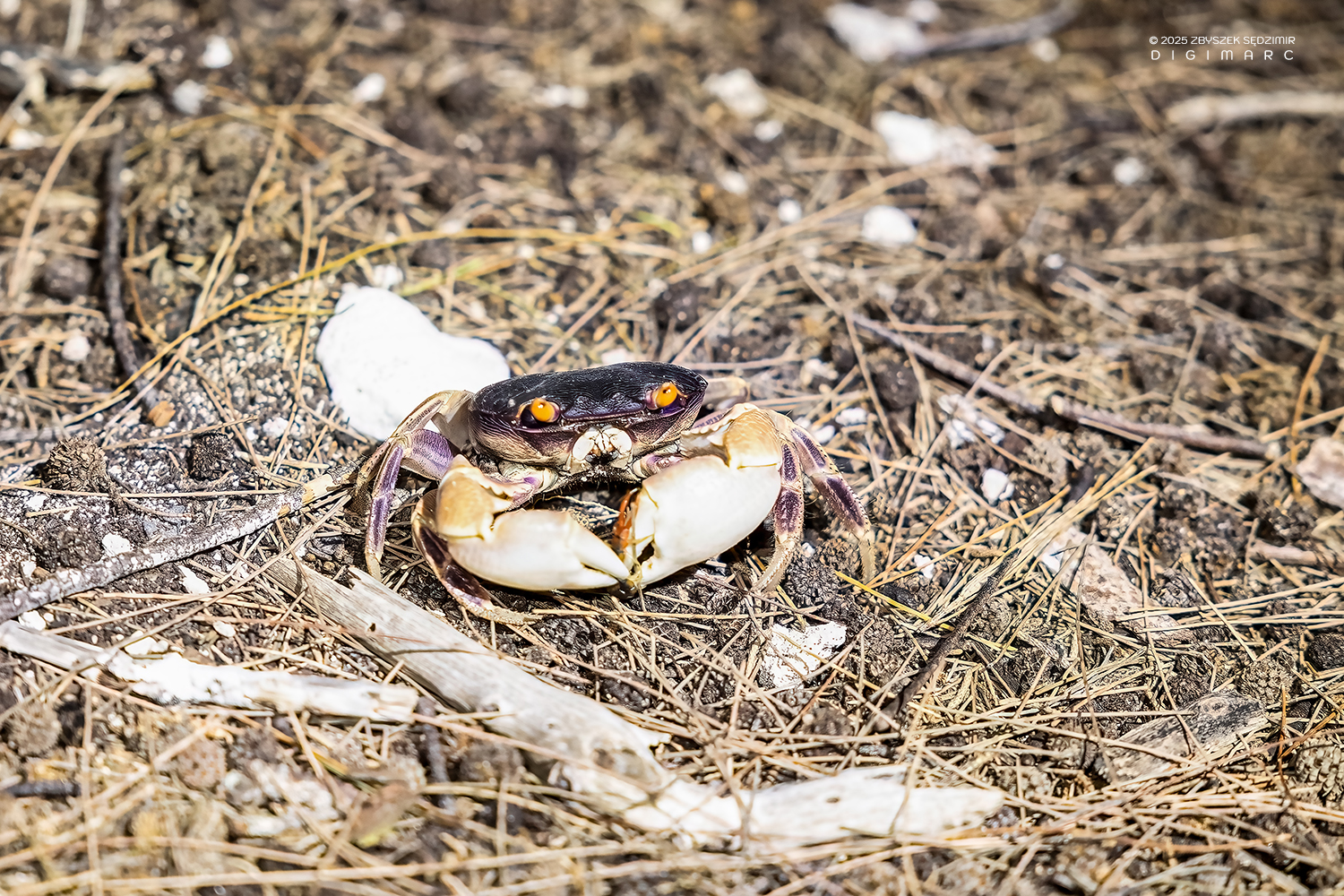
After that, I came across several more specimens of the fascinating purple land crab. Originally from the Caribbean, it lives far from the sea and can even be found at higher elevations. The crab is nocturnal and feeds as an omnivore on plant matter and carrion.
For reproduction, however, the females migrate back to the sea to lay their eggs. The larvae first pass through a planktonic stage in the water before the young crabs return to land. A considerable logistical effort, simply to ensure that there will continue to be purple land crabs in the future.
We are back at our campsite. Everyone checks that their anchors are still holding. I don’t, and I will regret that later.
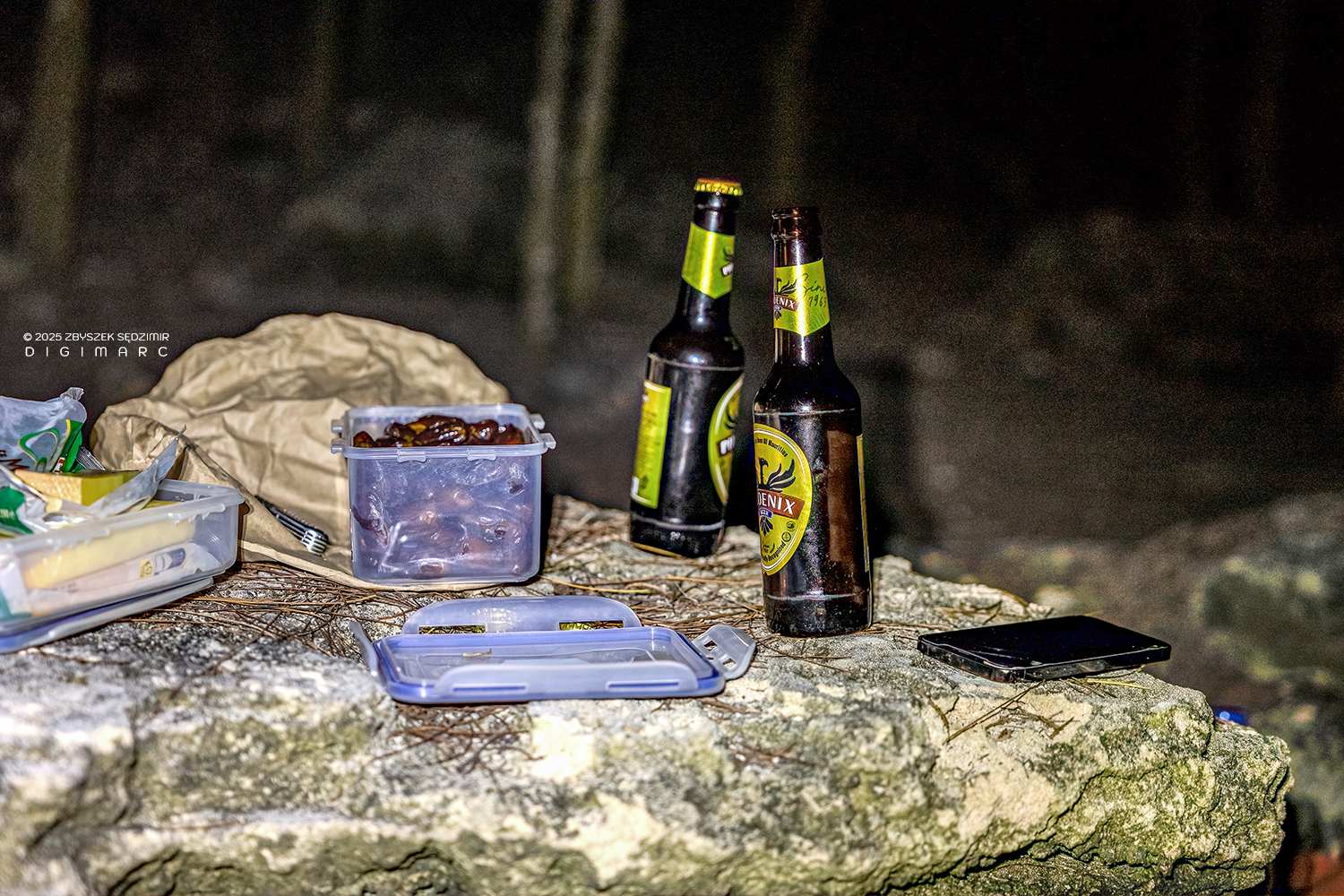
Afterwards, we settle in comfortably on a few rocks and have dinner. To my great delight, the provisions I had hauled along — French cheeses, boiled eggs, dates, and nuts — are met with genuine enthusiasm from my fellow hikers. Cold beer completes the picture.
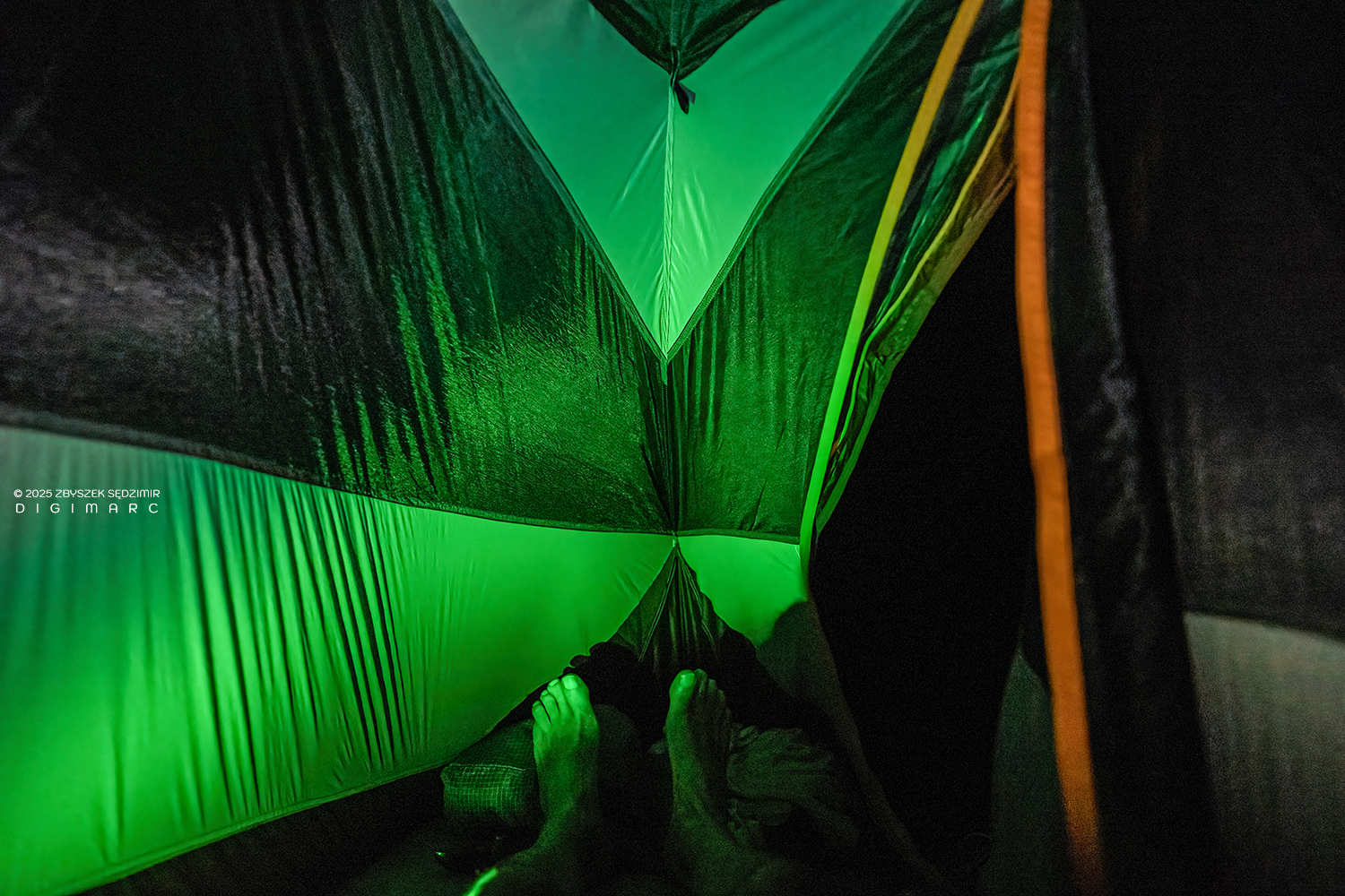
At some point we went to sleep. My small tent turned out to be surprisingly comfortable, and I fell asleep very quickly. If only the inadequate anchoring hadn’t been there…
It was shortly after midnight. I dreamed I was standing under a shower when I woke up abruptly. The dream merged seamlessly into reality: tropical rain. Two tent pegs had come loose. The wind tore the rainfly aside. Water forced its way in, lukewarm and relentless. After a brief, wordless struggle with wind, rain, and the tent, I brought the situation somewhat under control — and went back to sleep.
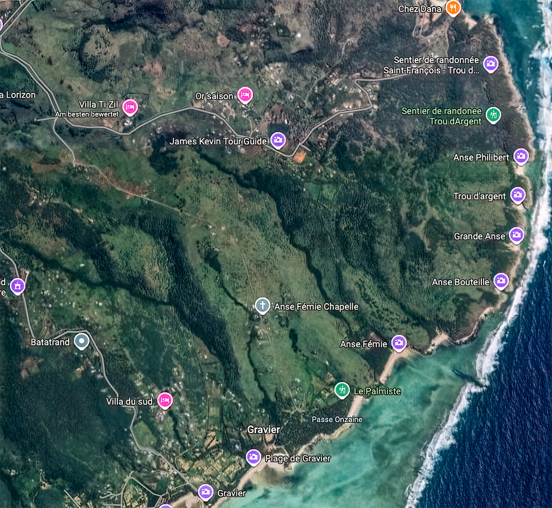
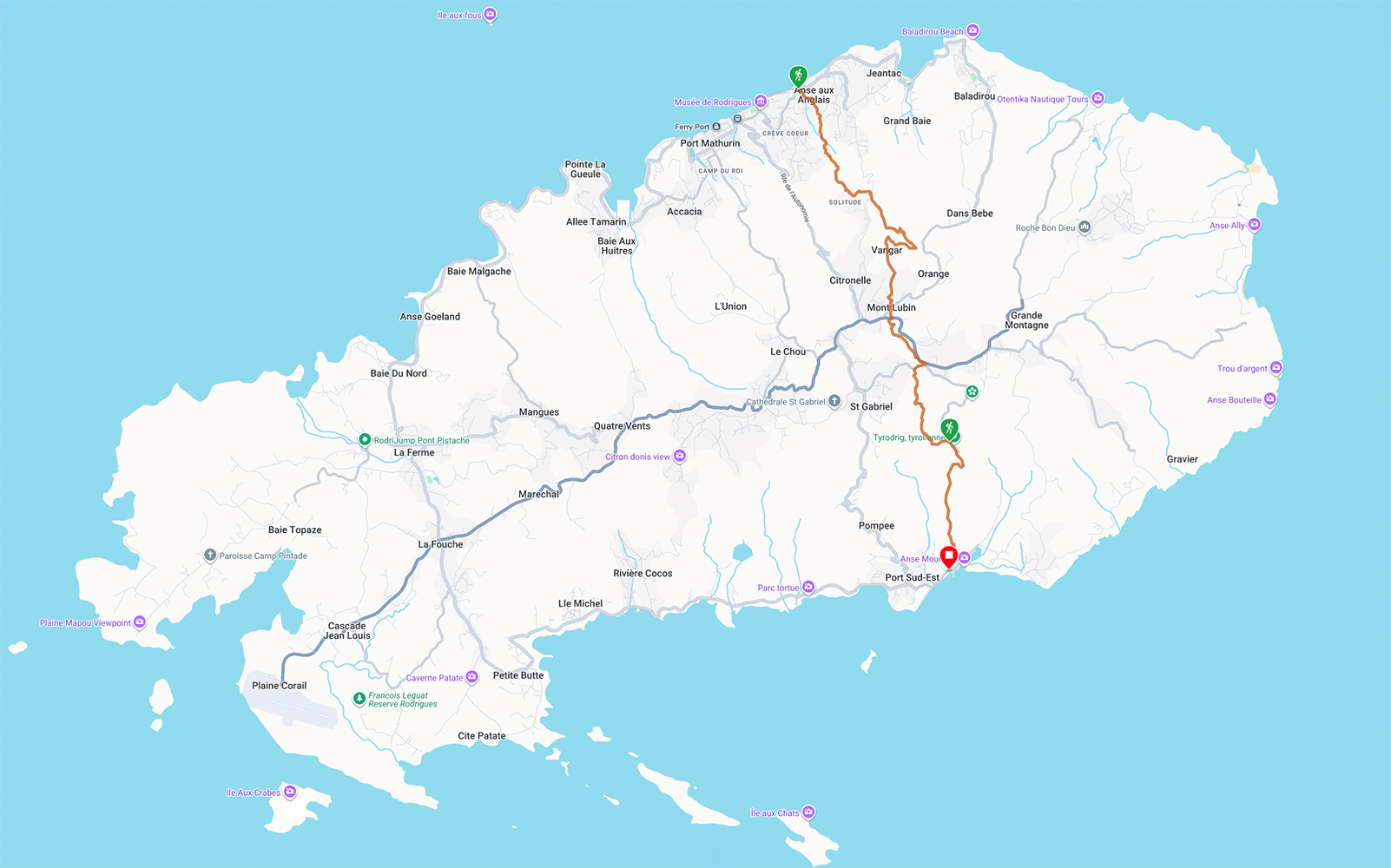
The map traces the line of our first day. It shows the coastal places we passed through — sometimes more than once 😅 — from Gravier via Anse Bouteille and Trou d’Argent all the way up to Saint-François.
Sunday, 11.01.2026
The night was rather short. By 5:30 a.m., I was already awake and, surprisingly, felt quite rested. I could hear the sound of wind and waves, along with birdsong. I needed to step outside into the fresh air.
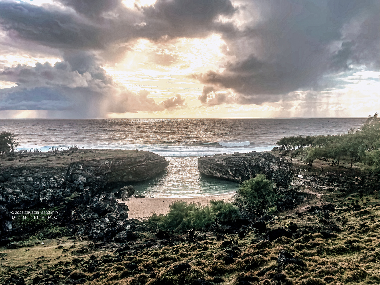
The sun had already risen, and everything was bathed in pure gold. The spectacle did not last long, however, as the sky was quite overcast and the wind was still strong.
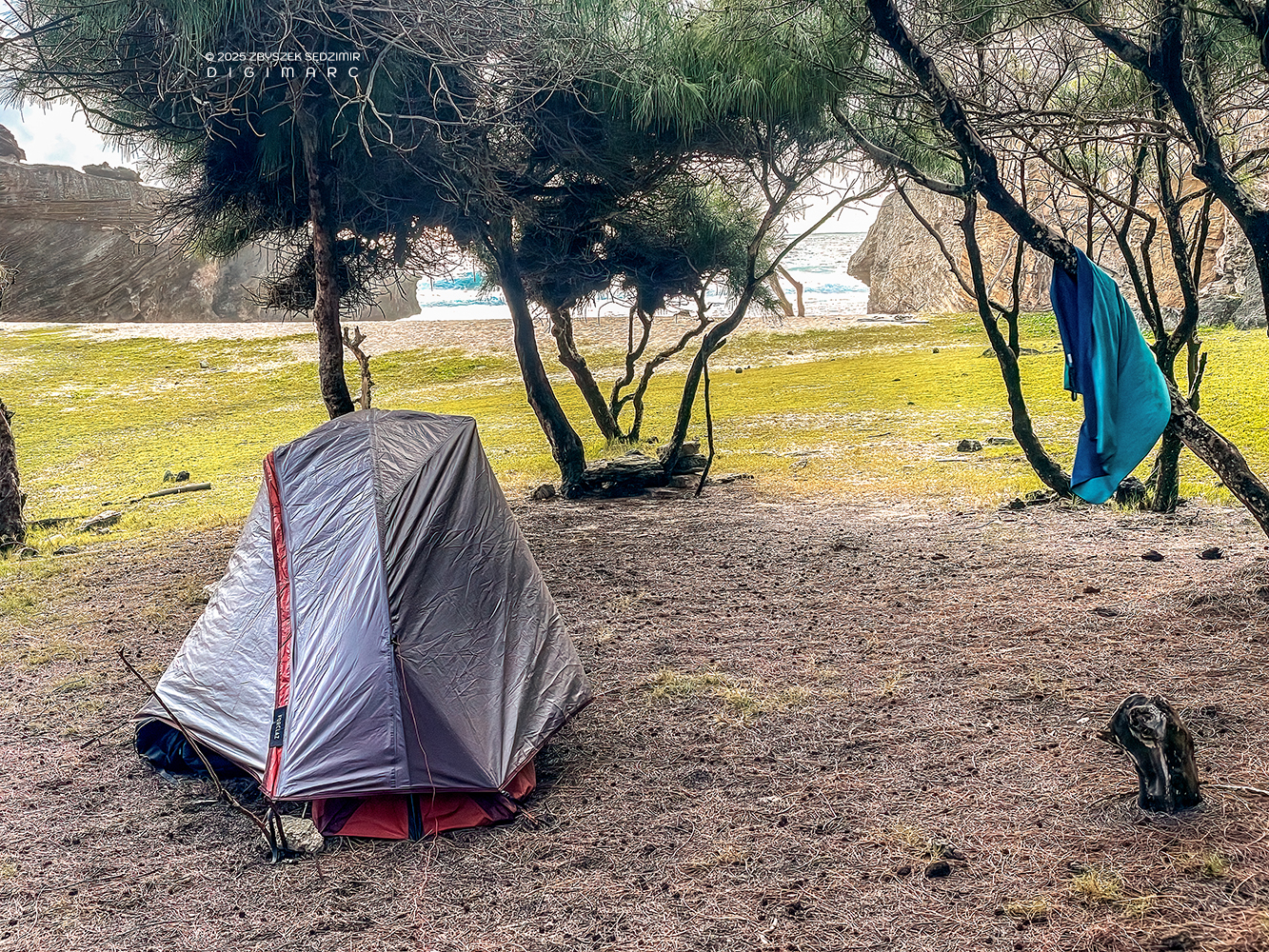
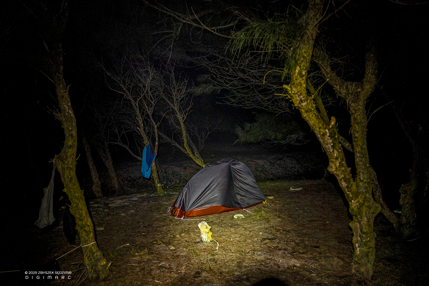
In daylight, I could now take a critical look at my nocturnal attempts to reinforce the tent’s anchoring (sticks, stones). It did not inspire much confidence. The small tent stood between wind-bent trees on sand and needles. The guy lines seemed more decorative than functional. That the tent had survived the night was pure luck.
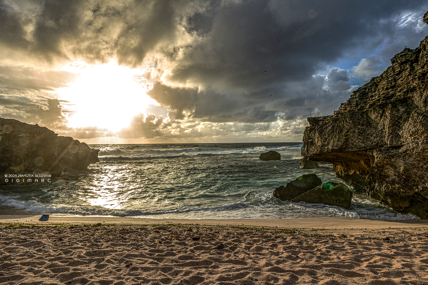
I walked down to the sea with the intention of going for a short swim. The water could not possibly be cold. The view was intoxicating. I almost felt like Robinson on a deserted island. My fellow travelers were still in a deep sleep phase, and I could be sure of having the beach and the waves entirely to myself for at least another hour.
Hardly in the water, it quickly became clear that this was not an ideal day for swimming. The sea was raging. The waves — and especially the backwash — were extremely strong. Only with considerable effort did I manage to avoid being dragged into the depths between the rocks. In short: an involuntary water park. 😅
I returned to our camp and realized that I was still the only one awake. Shortly after 6 a.m., I felt the urge to do something.
That’s when an idea came to me: the car was parked in Gravier, and we planned to hike with our backpacks (and tents) all the way to Saint-François. From there, we would continue by car toward Port Mathurin, as the island crossing on foot was scheduled for the afternoon — from Port Mathurin to Port Sud-Est.
It therefore made sense to walk to Gravier now without any luggage, drive the car to Saint-François, and then return from there to our camp. That would solve the problem of not having a car in Saint-François. I estimated the whole operation would take one and a half to two hours.
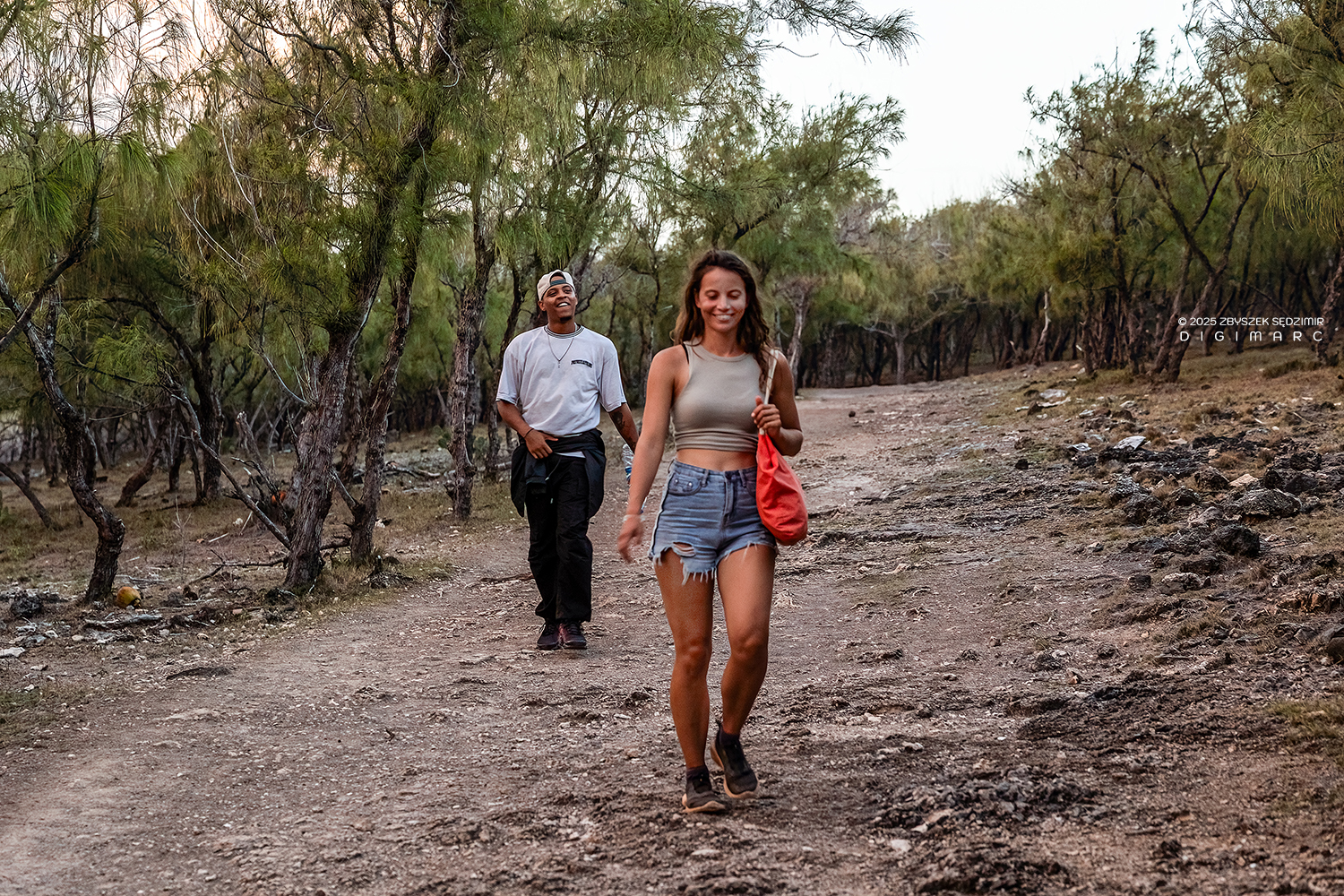
I set off, passing the same places as the day before, this time in the opposite direction and without any luggage. Anse Bouteille lay there, changed by the morning light, and the path suddenly felt familiar and strange at the same time…
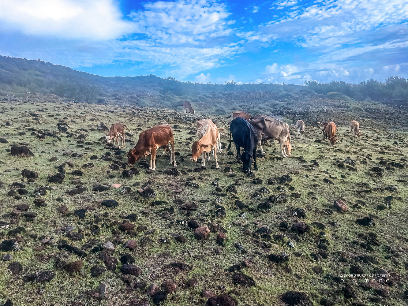
…past the grazing cows that were already there, and I wondered whether they, too, had spent the night on the beach.
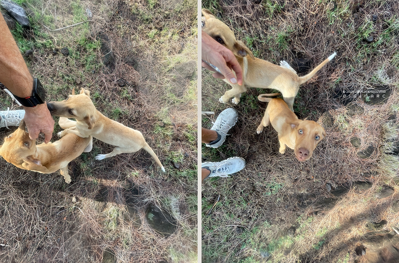
Then, out of nowhere, two puppies appeared and began circling around me, as if they wanted to play tag. For a while they accompanied me, keeping their distance, coming closer, drifting away again. I wondered whether they had wandered too far from home — wherever that might be. After about ten minutes, they stopped. Shortly afterward, they were gone, without me noticing which direction they had taken.
On the remaining stretch to Gravier, I only went the wrong way once, turning too far inland. It cost me about fifteen minutes. The car was still standing exactly where I had left it.
The drive to Saint-François took around twenty minutes. I parked there, then walked back toward Trou d’Argent and returned to our camp. Nothing dramatic — all in all, I was on the move for about two hours.
When I got back to the camp shortly after eight o’clock, there was still no sign of life. Only around half past eight did Sophie crawl out of the tent. Finally, at a quarter to ten, we set off toward Saint-François, backpacks on our shoulders.
At Anse Philibert, we made a brief stop. According to historical accounts, the explosion of the Indonesian volcano Krakatau was reportedly perceived here on 27 August 1883 despite a distance of around 4,800 kilometres, and was interpreted as a cannon shot from a ship. The pressure wave released by the eruption was exceptionally powerful and is known to have circled the globe approximately 3.5 times. Before continuing on our way, we took a few photographs from the viewpoint to capture the scenery.
When we arrived once again in Saint-François, we decided after a brief consideration to stop at “Chez Dana” — where we had already eaten the day before — to have a proper meal. The day ahead was ambitious: a crossing of the island from north to south, and we did not want to interrupt the hike with food breaks.
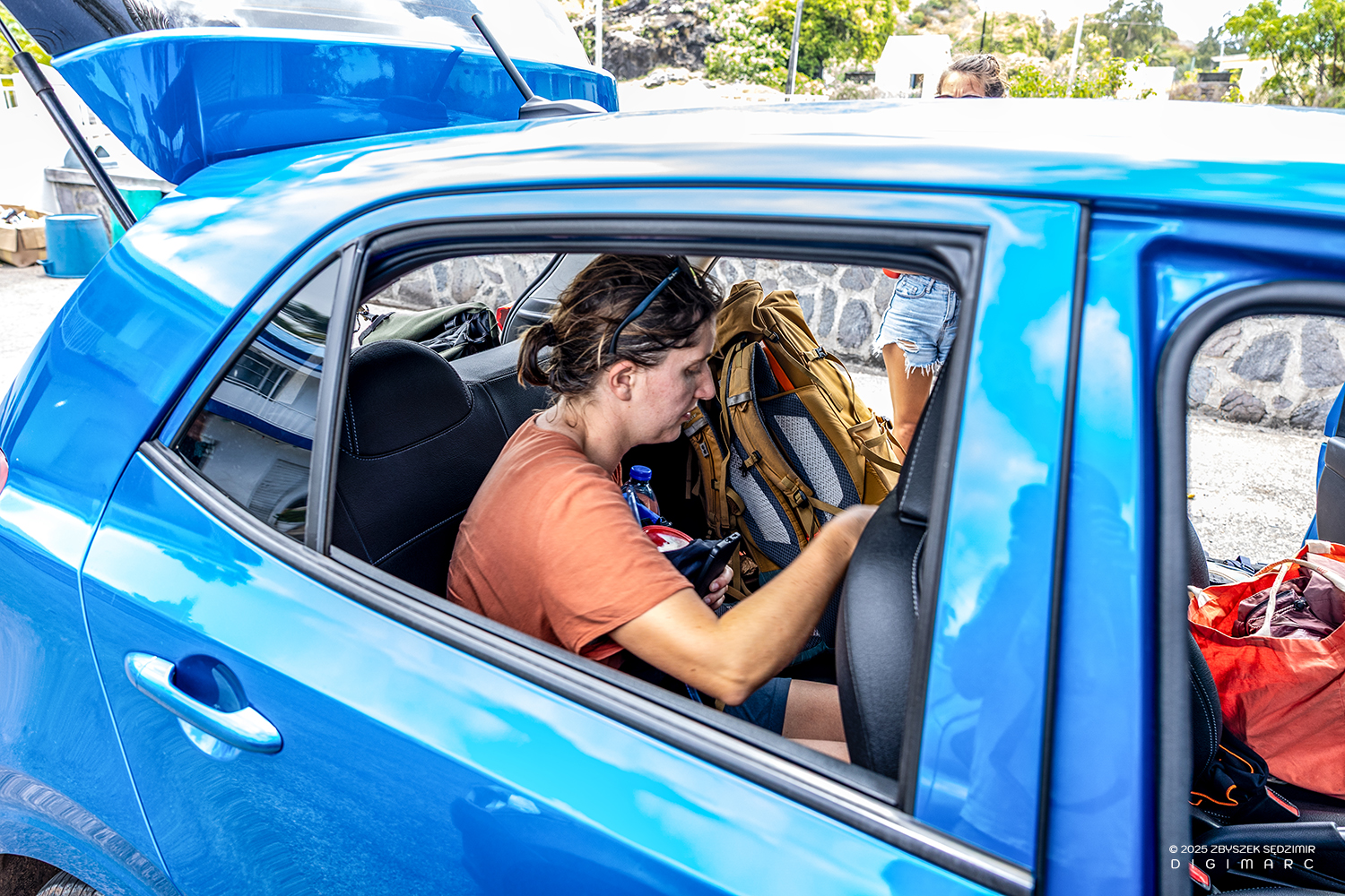
After the substantial meal, we climbed into the car with our mountain of gear and drove north. But not far
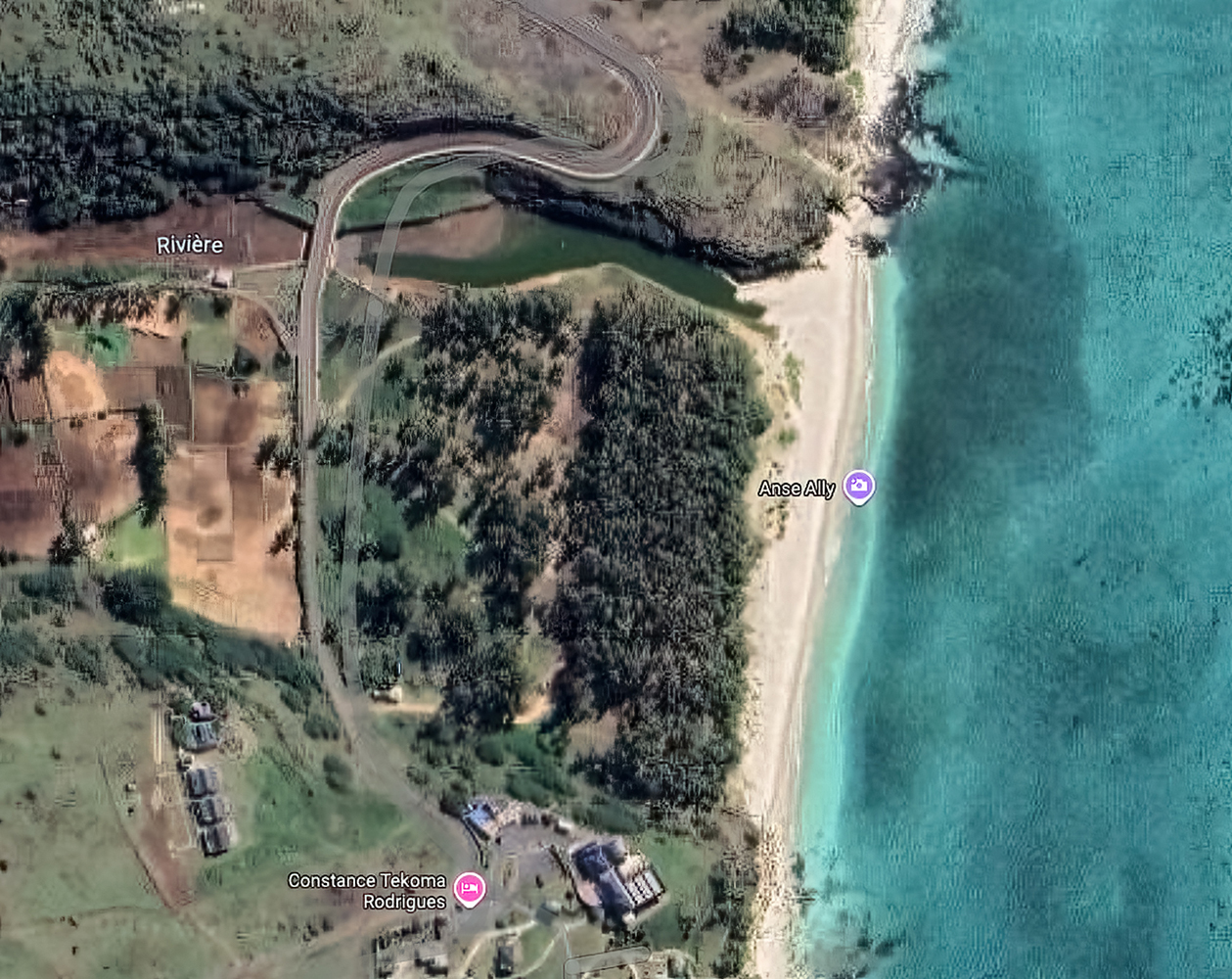
Just beyond Saint-François and the Tekoma Hotel, Noreen and Sophie expressed the wish to go for a short snorkeling session. The water in Anse Ally was crystal clear, and we saw many different types of coral. Unfortunately, I didn’t have any fins with me, and since I’m not a particularly strong swimmer, my range of movement was quite limited.
After the refreshing break, we continued our drive toward Port Mathurin. The meeting point with Danie, our guide, was at Anse aux Anglais; from there, she would lead us across the island all the way to the far south.
That’s where we met her as well, and we sat down at a table on the beach to introduce ourselves and sort out the details of the hike. The catch was that we would have to leave the car, with all our gear, at Anse aux Anglais, and then somehow get back from Port Sud-Est, on the other end of the island, to Port Mathurin — and preferably not on foot! 😂
The current road network on Rodrigues is relatively recent. The first road that truly deserves this name was built toward the end of the first half of the 20th century, on the initiative of Governor Wallace Hanning, and complied with the “16 pieds” standard in force at the time—that is, a width of 16 feet. This was the width that allowed two carts (drawn by horses or donkeys) to pass each other without having to give way. The road ran from Port Mathurin towards Mont Lubin. Construction took several years, and for the following 40 years it remained the only road of this width on the island.
Our journey begins in Anse aux Anglais. Danie, who works at the Grande Montagne Nature Reserve, knows the island like few others and speaks with passion about nature, conservation, and history. Over the next four and a half hours, she leads us along the old paths of Rodrigues—routes that tell stories of earlier times and are now almost forgotten.
As recently as the 1970s, there was only a single paved road in Port Mathurin and a total of about 60 cars on the island, most of them owned by government officials.
In earlier times, people and goods were transported on foot, on the backs of donkeys or horses…
… or in sedan chairs (e.g. for an ill person) — along narrow paths and sentiers. These old routes, which crisscross the island, still exist today, but hardly anyone knows them anymore (except Danie 😉).
The first modern road planned and built according to today’s standards is the “Route de l’Autonomie”. It connects Port Mathurin with the airport in Plaine de Corail. Construction began in the late 1990s, and after several phases, the road was officially opened on 18 January 2004. It represents an important milestone in the development of Rodrigues’ transport infrastructure.
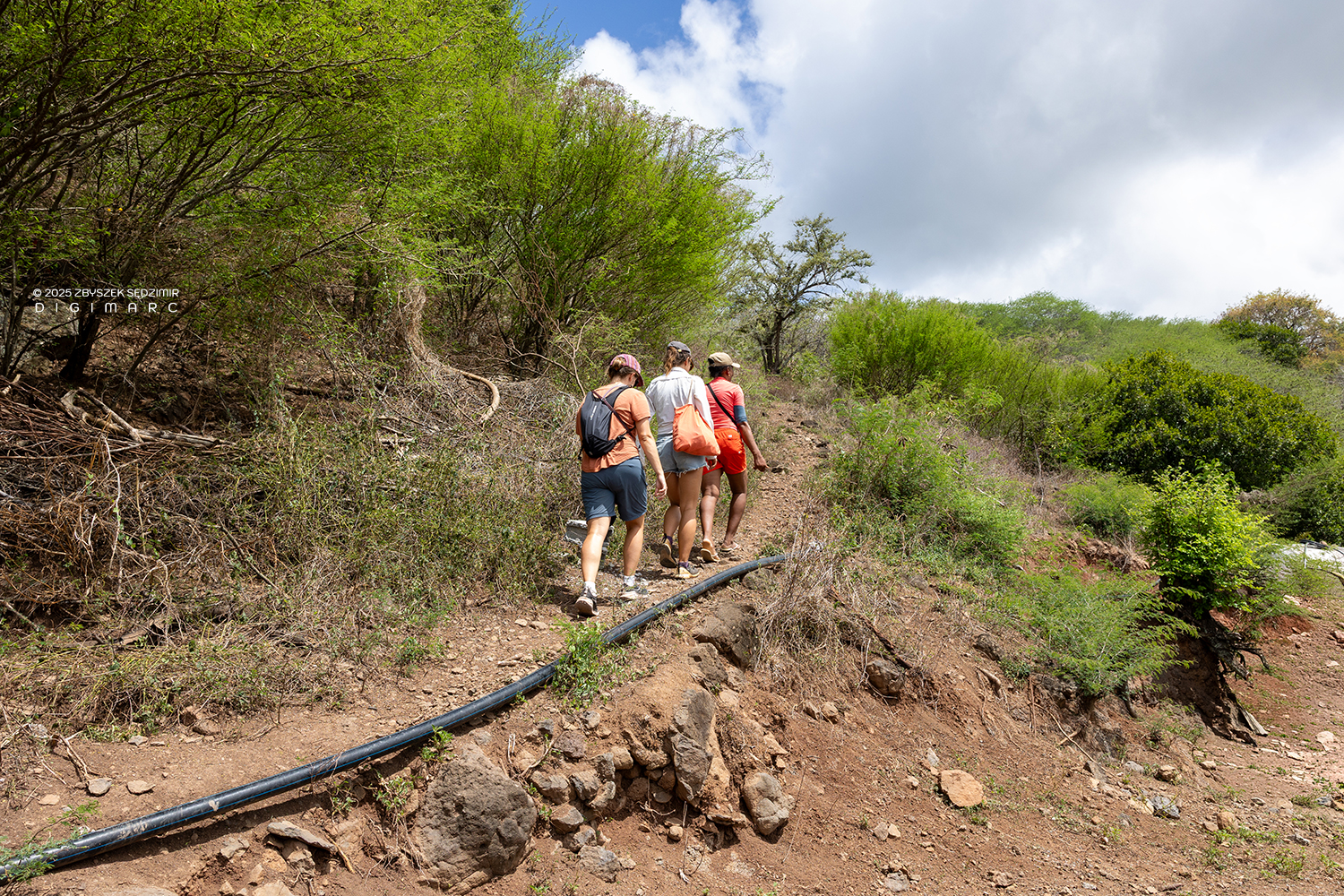
As we left the streets of Anse aux Anglais behind us, the path was clearly visible, indicating that it is still used regularly.
After about twenty minutes, we would probably have come to a halt without Danie and struggled to continue following the trail.
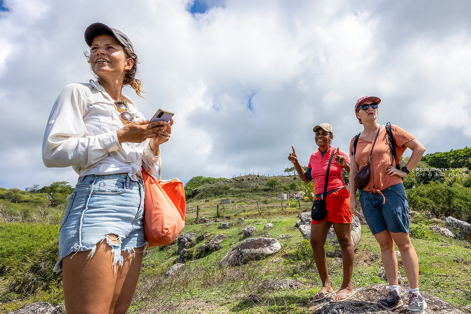
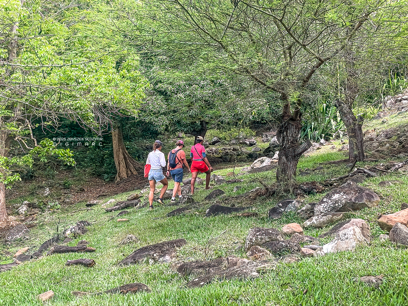
Again and again, we reached small viewpoints where the landscape opened up—sometimes looking back over the ground we had already covered, sometimes out towards the coast and the shimmering lagoon.
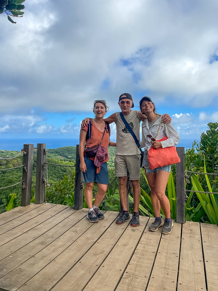
After two and a half hours, we reached the highest point of our route—and the highest point on Rodrigues: Mont Limon, at an elevation of 398 metres. The French word limon refers to a fine, fertile soil and points to the favourable soil conditions of Rodrigues’ central ridge. Such descriptive place names were common during the French colonial period. From the viewing platform, the landscape opens up in all directions, revealing Rodrigues in its full breadth. It is also a place that naturally invites you to capture memories in photographs of every kind.
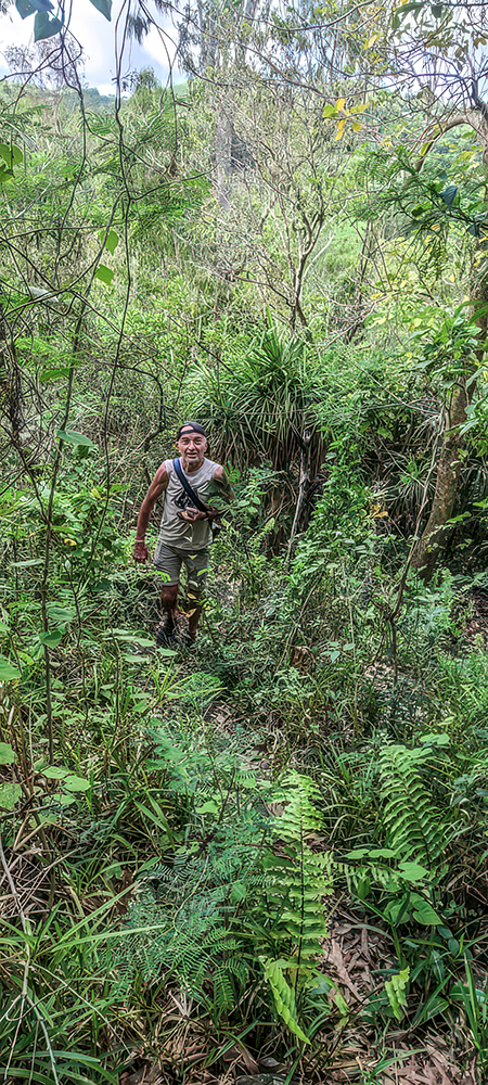
After that, the trail led us through densely overgrown sections where hungry mosquitoes were already waiting for us, alternating with patches of Pikan-loulou bushes. The latter — Acacia nilotica — is an invasive species with long thorns and a strong sense of territorial dominance: wherever it grows, nothing else does. No wonder that every effort is made to get rid of it (photo by Noreen).
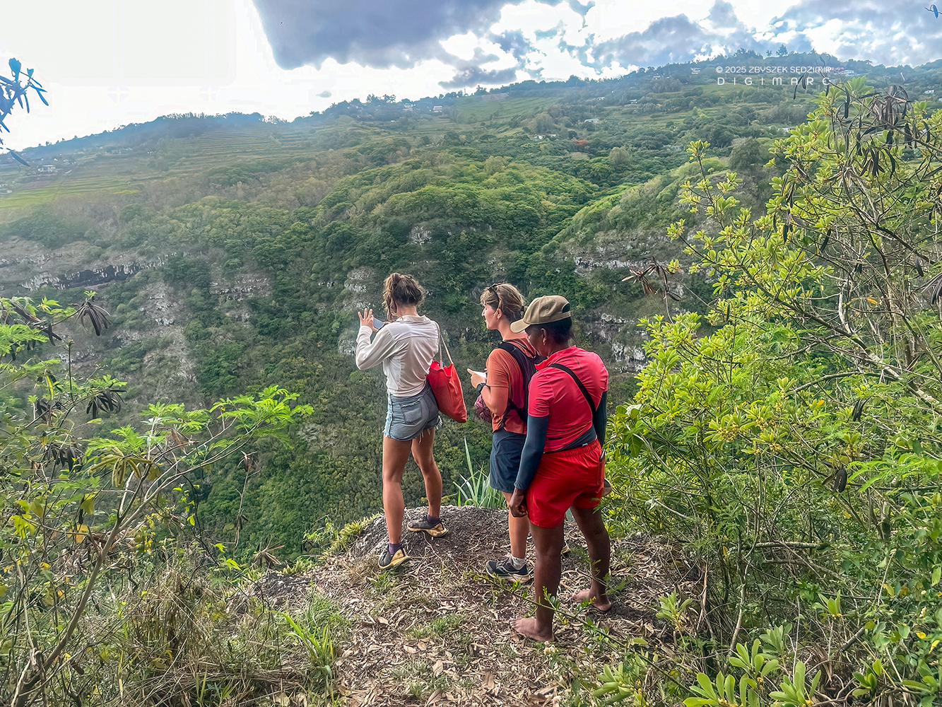
Forty-five minutes later, we stood at the viewpoint above the Victoire Waterfall. The path leading there had taken us through open countryside and lovingly maintained private gardens, for which Danie had obtained the owners’ permission in advance.
As usual, Noreen was standing so close to the edge that I didn’t even dare to call out and ask the ladies to turn towards me for a photo.
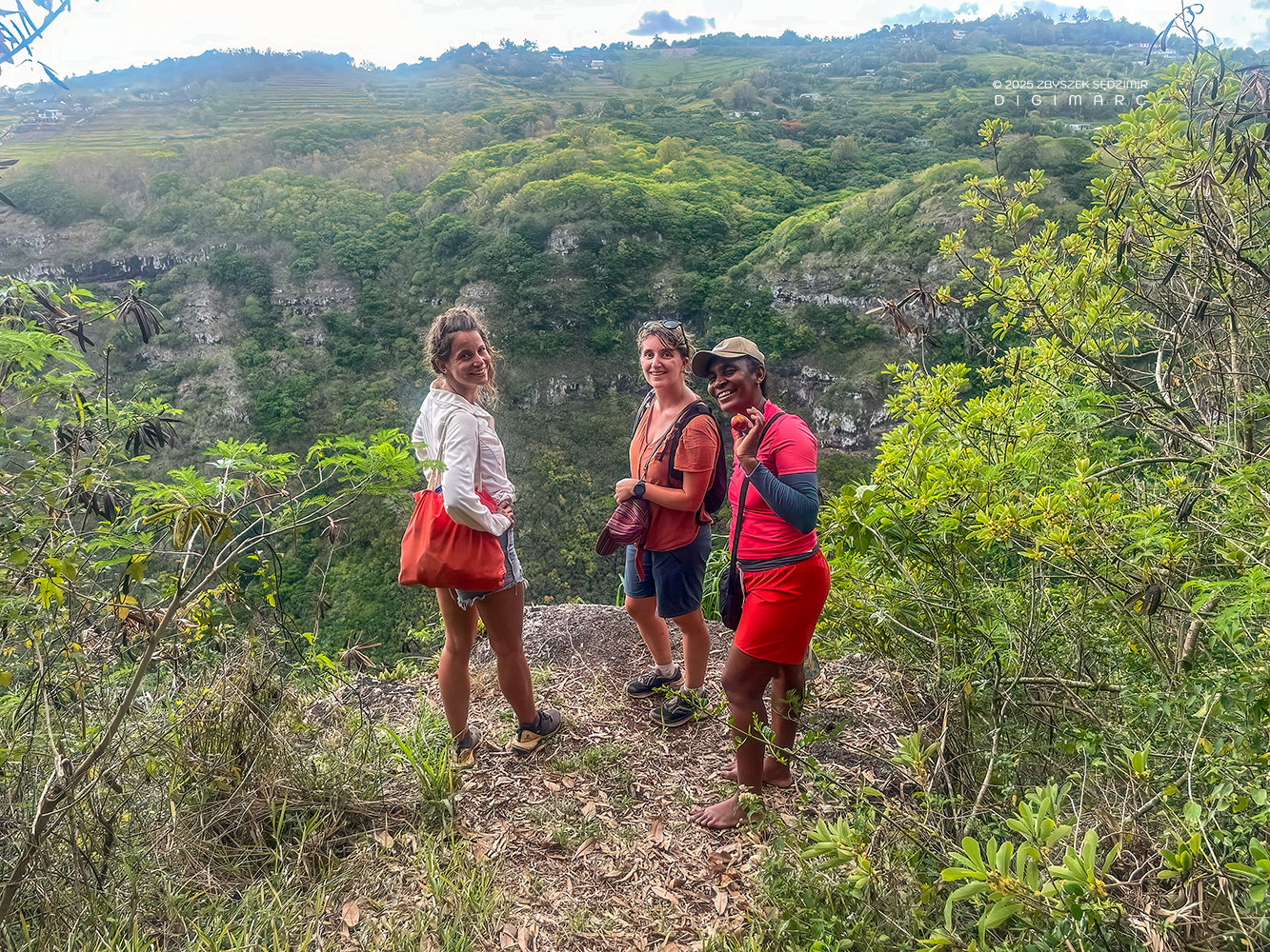
Fortunately, Danie understood my intention without a word being spoken; everyone turned around, and I was finally able to take a group photo.
Another hour later, we reached Port Sud-Est. The “Traversée de l’île” had taken four and a half hours in total—covering 11.5 kilometres and 640 metres of elevation gain.
Danie then invited us to her home, where we could finally take a shower. She even had fresh clothes ready for Noreen and Sophie: two pretty skirts. Since I don’t exactly cut a good figure in skirts, I decided to skip the shower altogether.
After that, Danie drove us back to Anse aux Anglais, where our car was parked. By then, it was already after 8 p.m. In Port Mathurin, we found a snack bar that was still open and treated ourselves to a well-earned pizza.
Around 9 p.m., I dropped my two companions back at the beach in Anse aux Anglais, as they absolutely insisted on spending the night in their tent once again. No arguing with that 😅. The next morning, I was to pick them up there around 8:15, since the next item on the agenda—diving—was scheduled for 9 o’clock.
To be continued.
Copyright © 2026 Zbyszek SĘDZIMIR, All rights reserved.
